Round the World – Australia 3, Part 4
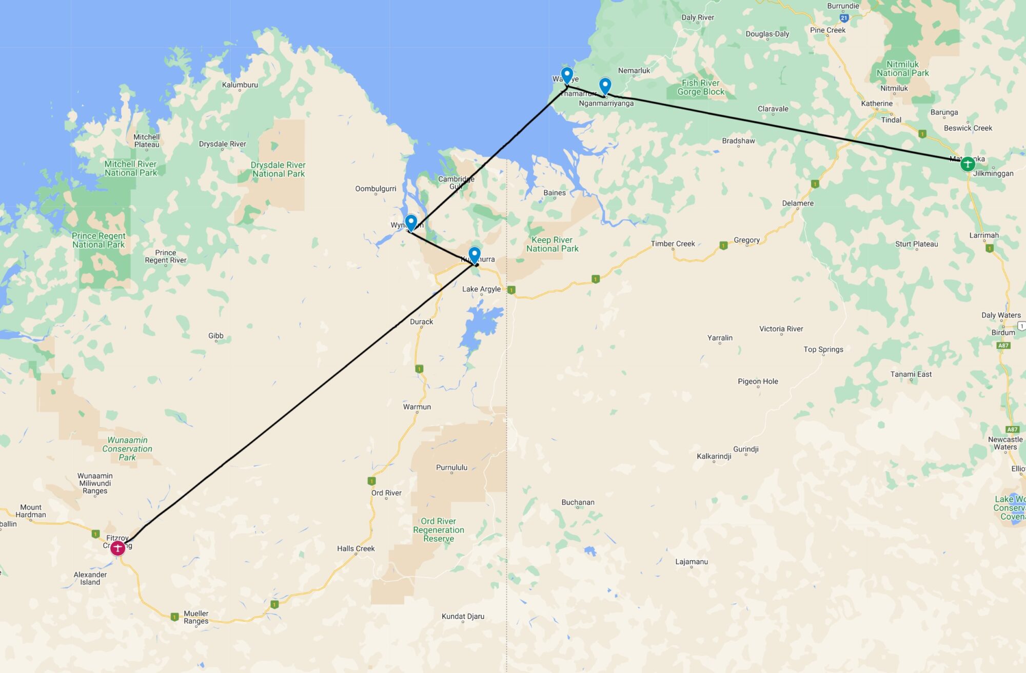
The various Darwin “Big Things” are quite widely scattered around the city and its surroundings; a rental car is really the only practical way to get around them. After breakfast in a coffeeshop, the “Budget” location around the corner provided a little white SUV for the day. I planned a route around the big things, starting with the furthest away, then working back towards the city. First stop; the “Big Jumping Crocodile”. This is located an hour’s drive outside Darwin at the site of the Adelaide River Queen tourist company. Unfortunately, after said hour’s driving I pulled up at a locked gate; the crocodile was still 5km down a private road, and it seemed that the site must be closed; if not for the season, at least for the day! Disappointed, I turned the car around and headed back the same way.
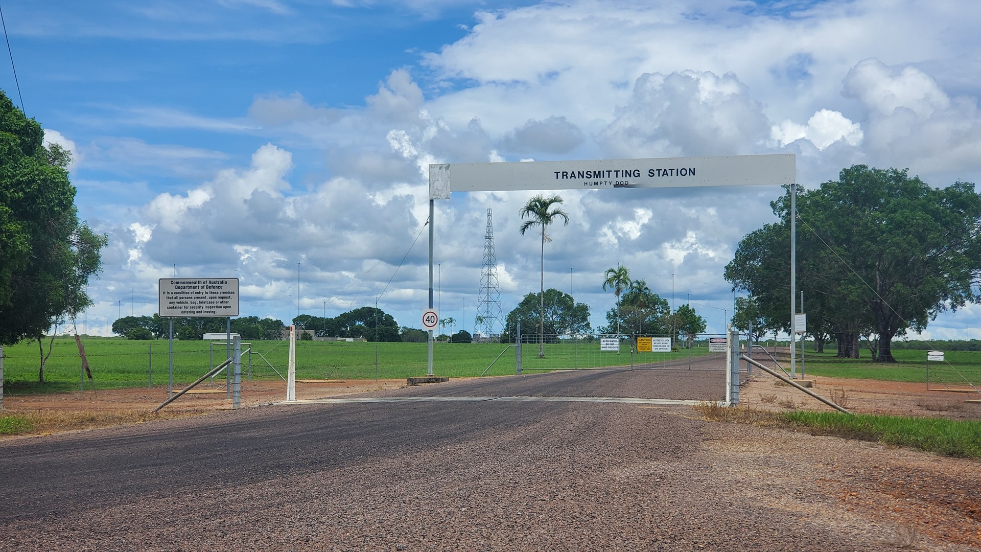
Before arriving back at the next “big thing” I passed the Humpty Doo transmitting station. This location operates approximately 30 high powered, High Frequency (HF) radio transmitters and over 40 HF aerials. According to online sources it has two primary roles: the interception of satellite communications and the interception of high frequency signals. I wondered if it played any role in communicating to aircraft such as me when on oceanic routes.

Shortly beyond Humpty Doo was the first “Big Thing” of the day that was actually accessible; the Big Boxing Crocodile. This 8m (26ft) sculpture of a fierce crocodile in boxing gloves was constructed to commemorate Australia’s victory in the 1983 America’s Cup, the world’s most well known sailing contest. Australia’s victory in 1983 was the first time in the then-132 year old competition that the cup was won by a yacht club outside of the USA, so it was quite a national triumph. It was unclear exactly why a large boxing crocodile in a remote Northern Territory town had been selected to celebrate the occasion.
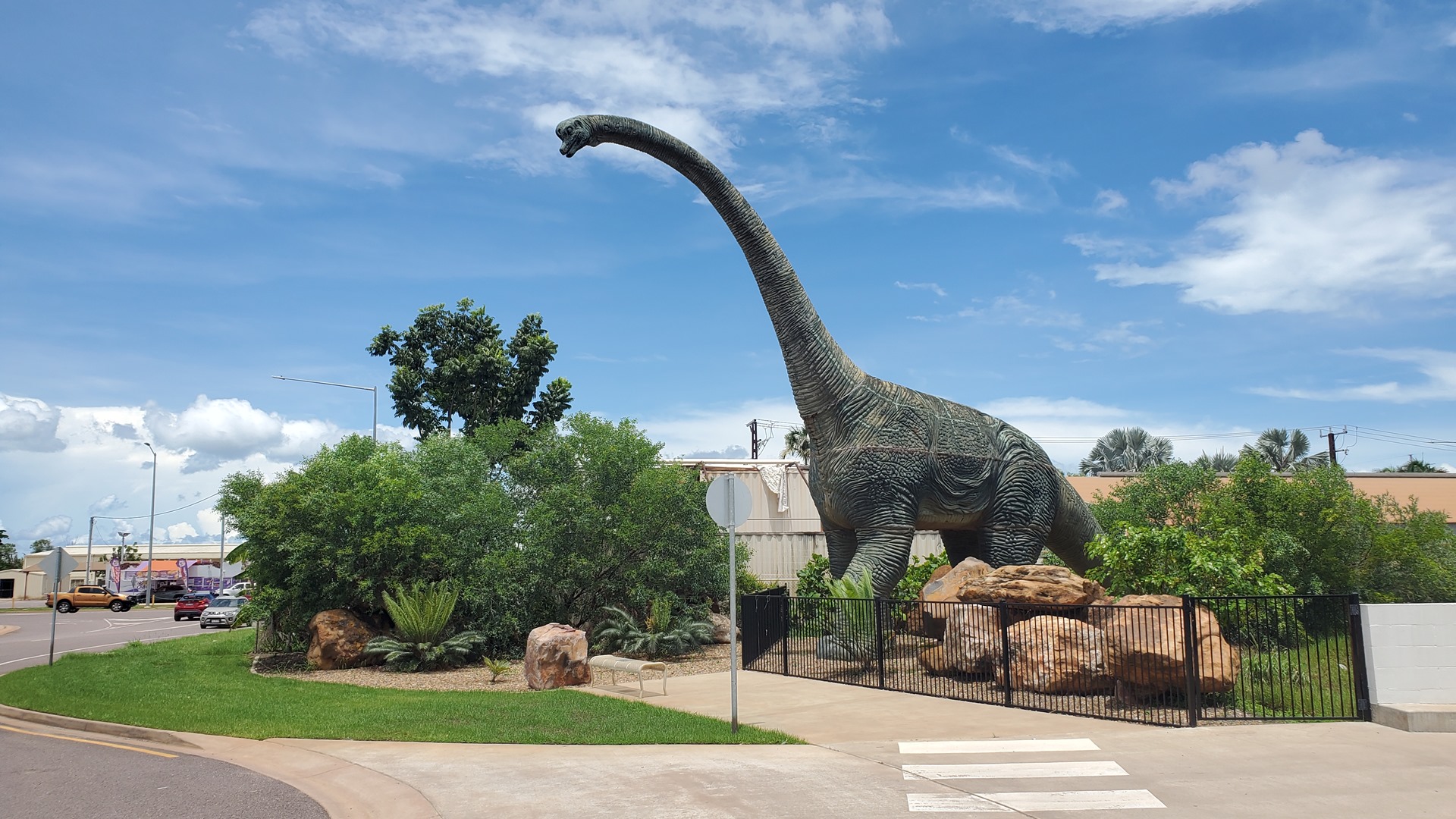
The next stop was a “Bunnings” home improvement store, in Palmerston. This is the site of “Big Kev”, the big dinosaur (standing over 18m tall); although I suspect he may be rather smaller than life-size. Kev was built in 2007 and used to sit outside a local independent hardware store and when Bunnings took over there was quite some concern that he might be destroyed. Although he was indeed dismantled and stored for a while, Bunnings eventually re-assembled him and he now stands proudly at the entrance to the carpark.

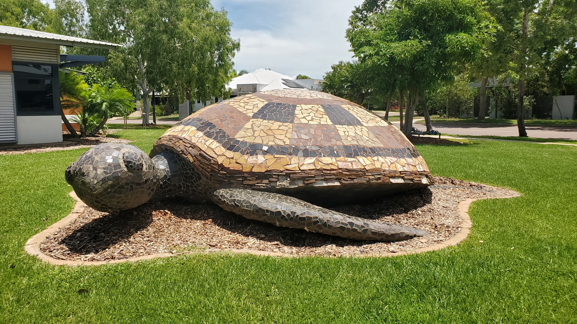
After Big Kev, the next two items on the list were the Big Turtle, and the Big Fish. These were located very close to each other, and were both much more professional-looking than a typical Big Thing; they had clearly been produced by talented sculptors rather than enthusiastic but unskilled amateurs. The sea turtle goes by the unofficial name of Colin, and was installed to celebrate the official establishment of the suburb of Lyons in 2004. Colin the Turtle was created by artist Techy Merero with the assistance of a handful of Larrakia Nation artists; he now sits outside the community center.
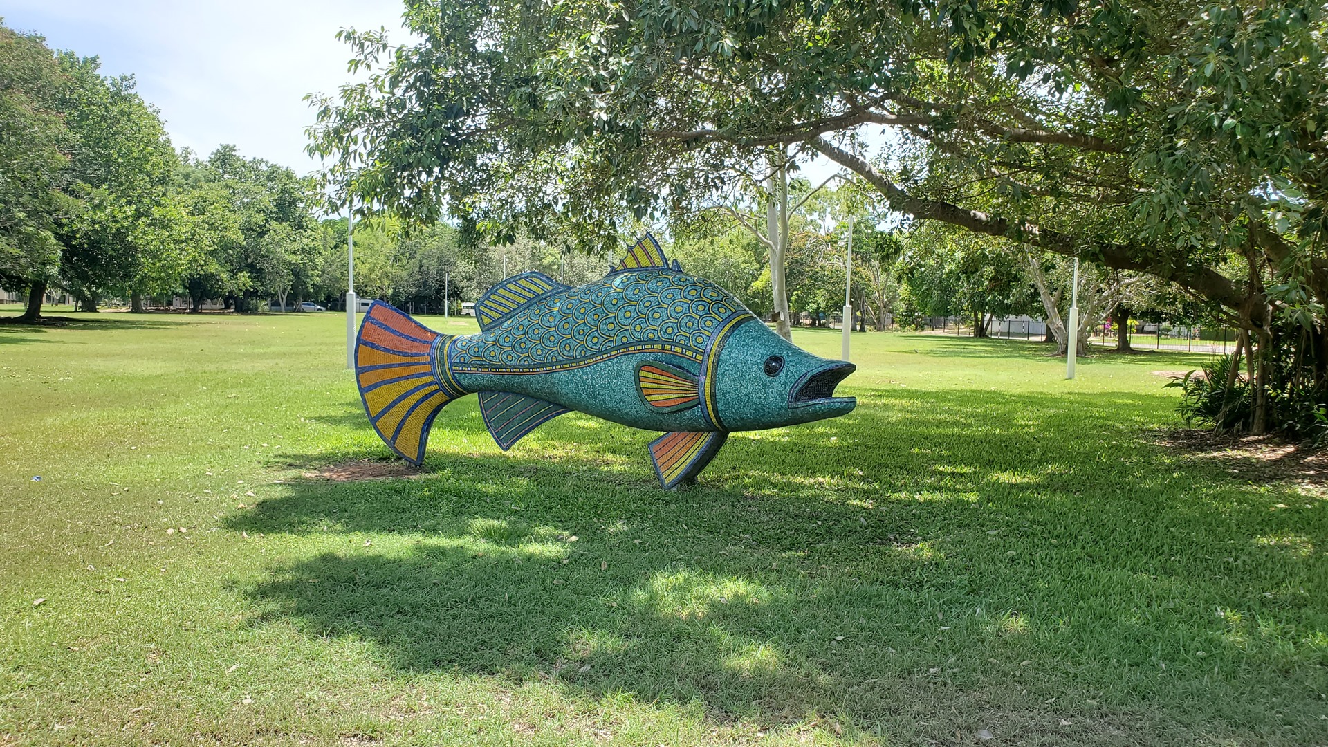
Darwin’s Big Fish, a few minutes drive from the turtle, is another Barramundi. This particular species is by far the most popular for sculpture in Australia it seems. The fish was sculpted in 2009, again by Techy Masero. It is located on the grounds of Wanguri Primary School and I was glad that school was not in session; I didn’t want to be asked why I was standing by the playground taking pictures through the fence.
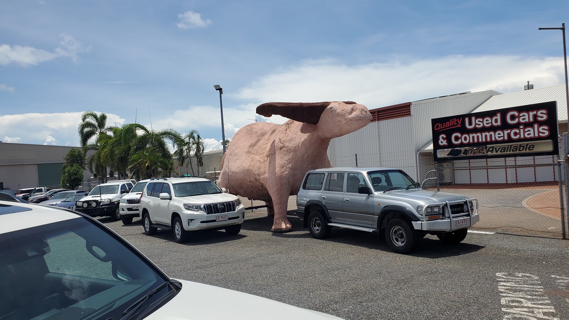
There were two further Big Things to see, and the next of these was the Big Pink Buffalo, Lefty. He is known as Lefty due to an asymmetry in those particular anatomical features that make him a bull and not a steer; he is fully anatomically correct and intact for some reason. Lefty began his life as a big grey parade float before ultimately ending up in the front yard of a second-hand car dealership, painted pink after the buffalo trading company he started off with went bankrupt. The car dealership was closed, so it was only possible to admire him through the fence.
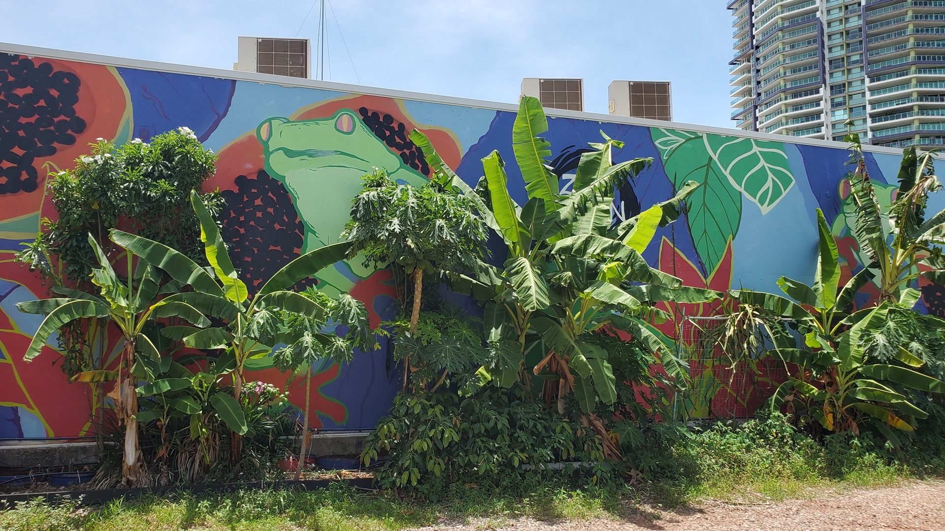
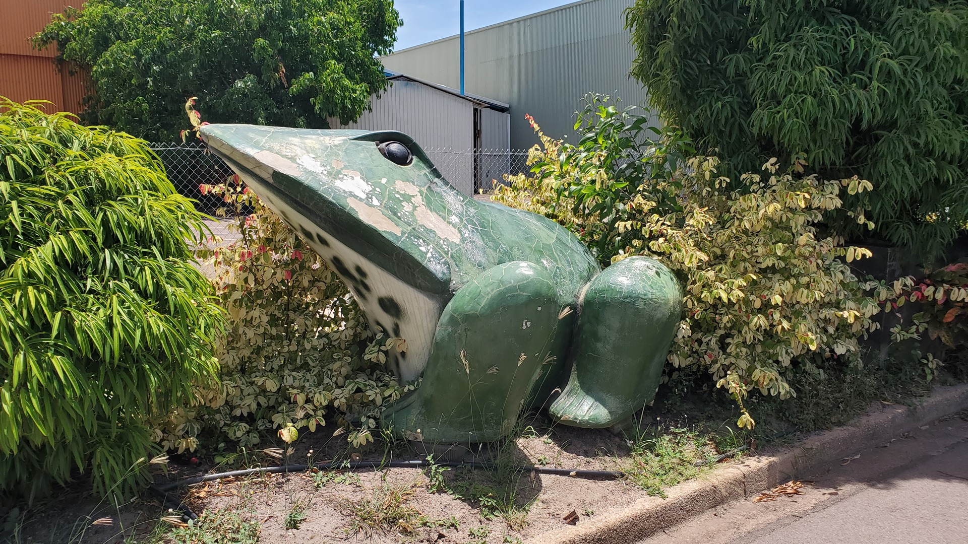
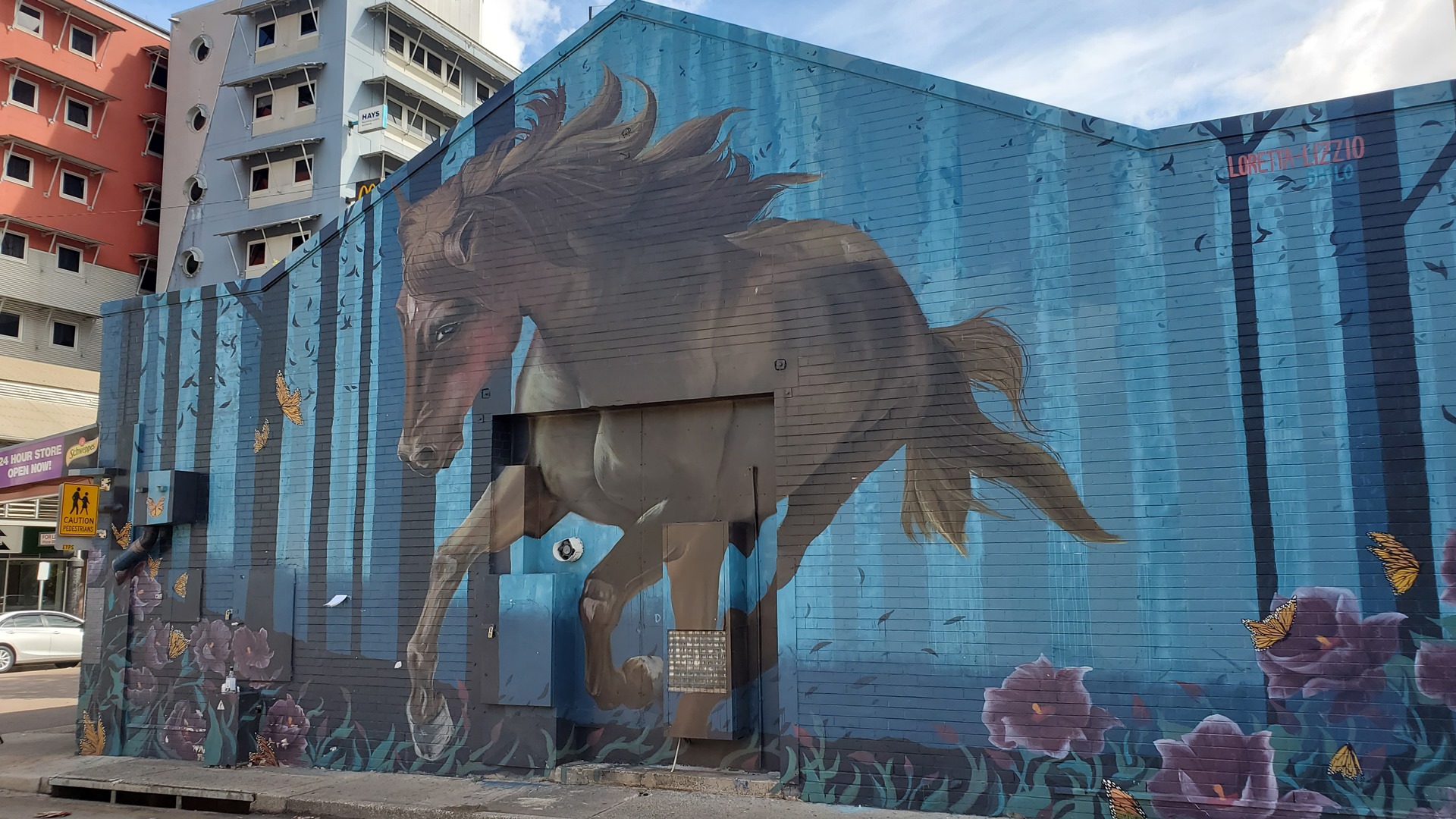
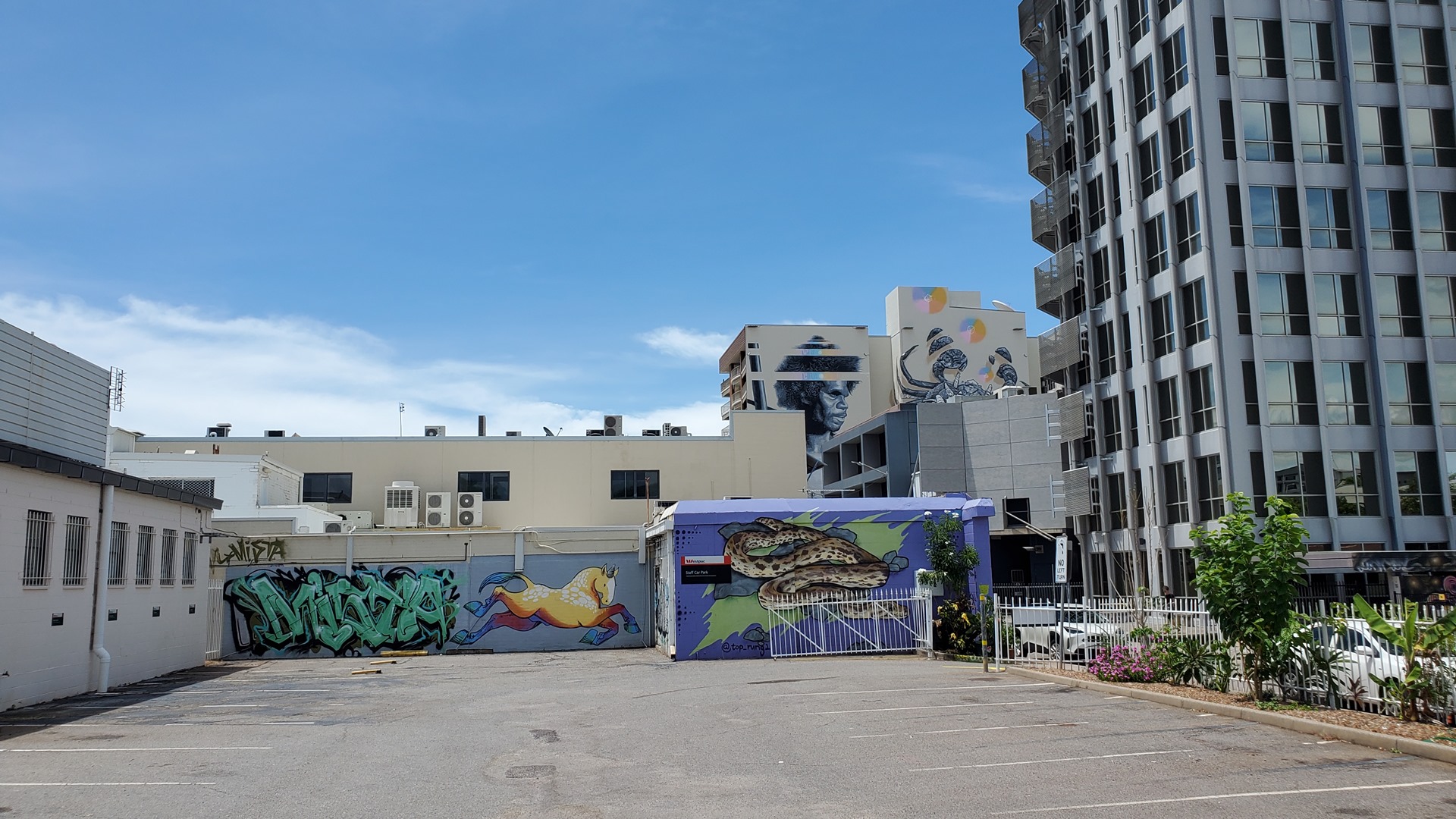
The final Big Thing was Darwin’s Big Frog, back pretty close to the hotel. There was brief concern when the Big Frog could not be located; all that was evident was a large mural of a frog, which clearly doesn’t count. Thankfully he was eventually located over the other side of the road. The frog was initially located at the Get Stoned Masonry business; for some reason, the Ramada Suites hotel decided to buy it after the masonry business closed. Whatever their motivations, it’s great that it was preserved.
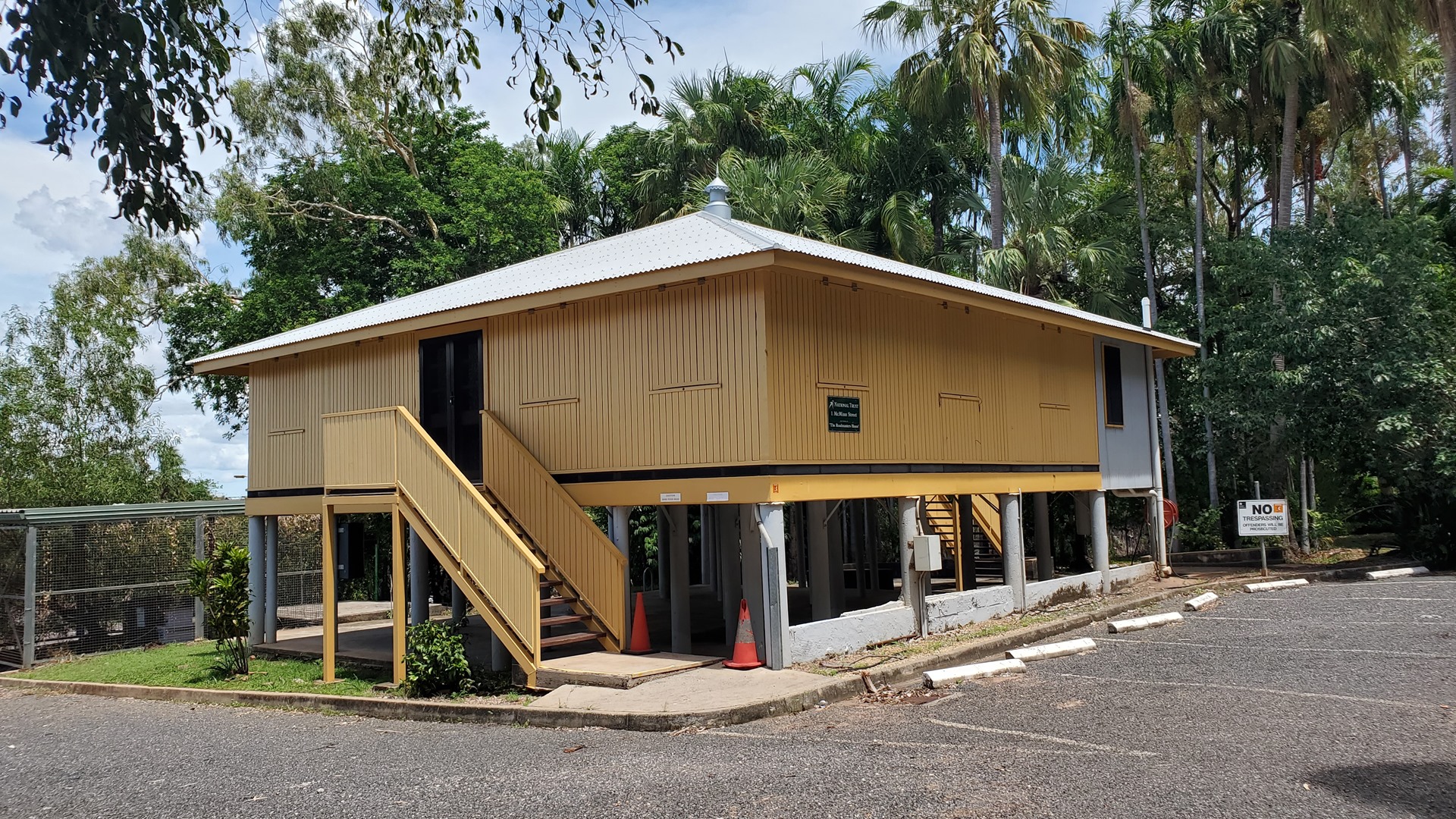
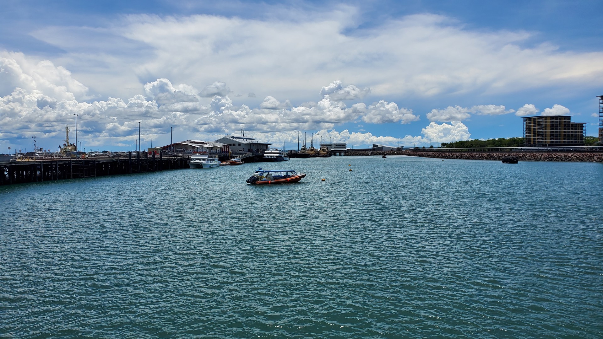
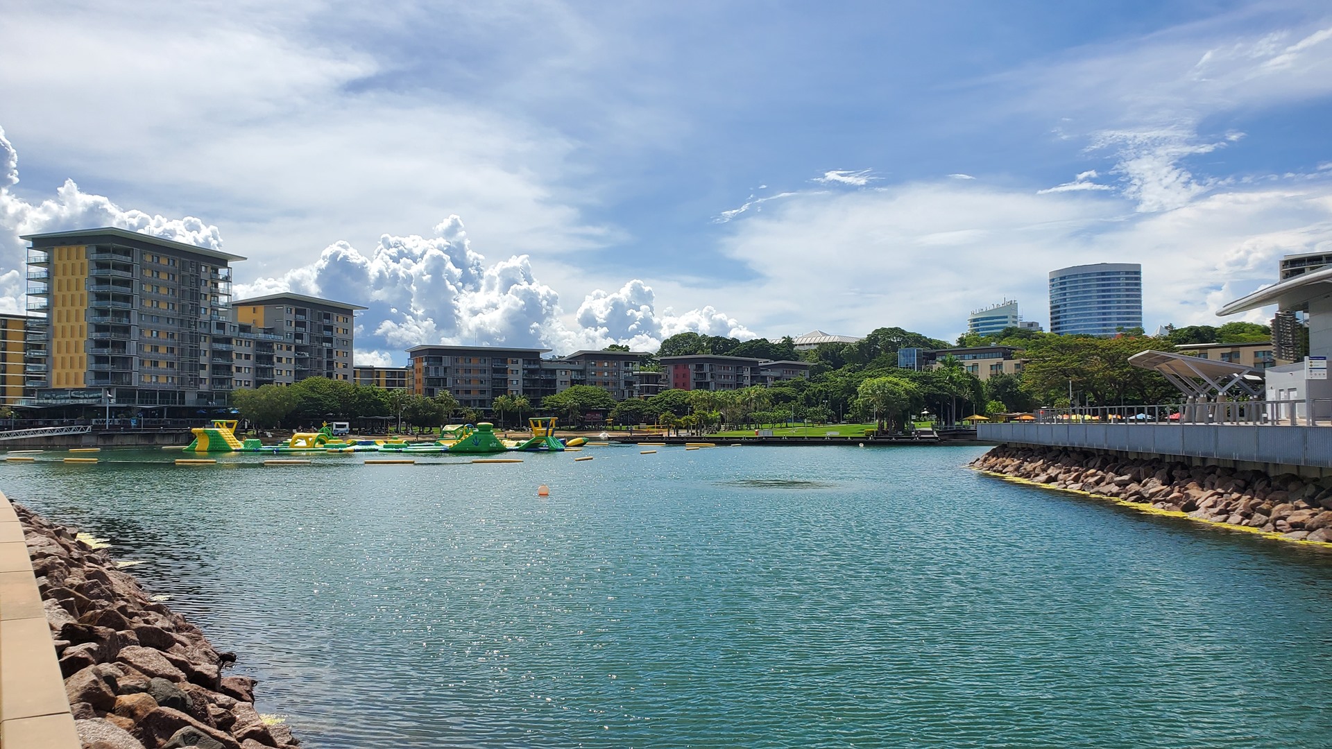
There was just enough time left that afternoon to walk down to the waterfront and visit the Royal Flying Doctor Service tourist facility. It was a little less than thirty minutes walk from the hotel, but the mid-afternoon sun was harsh and I regretted leaving the car behind. The walking route ran past the Roadmasters House. The Roadmaster was the officer responsible for track maintenance on the North Australia Railway, and this house was built to accommodate staff of said railway. The date of construction of the building is not known but was most likely in the 1920s or 1930s. It was occupied by staff until damaged by Cyclone Tracy in 1974 and is now open as a historic attraction.
It wasn’t much further to the RFDS facility, out at the end of the wharf. This location also houses an exhibit about Japan’s first air attack on Darwin during the Second World War. The bombing of Darwin on 19th February 1942 was the largest single attack ever mounted by a foreign power on Australia. On that day, 242 Japanese aircraft in two separate raids attacked the town, ships in Darwin’s harbour and the town’s two airfields. Their aim was to prevent the Allies from using them as bases to contest the invasion of Timor and Java. Darwin was lightly defended relative to the size of the attack, and the Japanese inflicted heavy losses upon Allied forces at little cost to themselves. The urban areas of Darwin also suffered damage from the raids and there were a number of civilian casualties. More than half of Darwin’s civilian population left the area permanently, before or immediately after the attack.
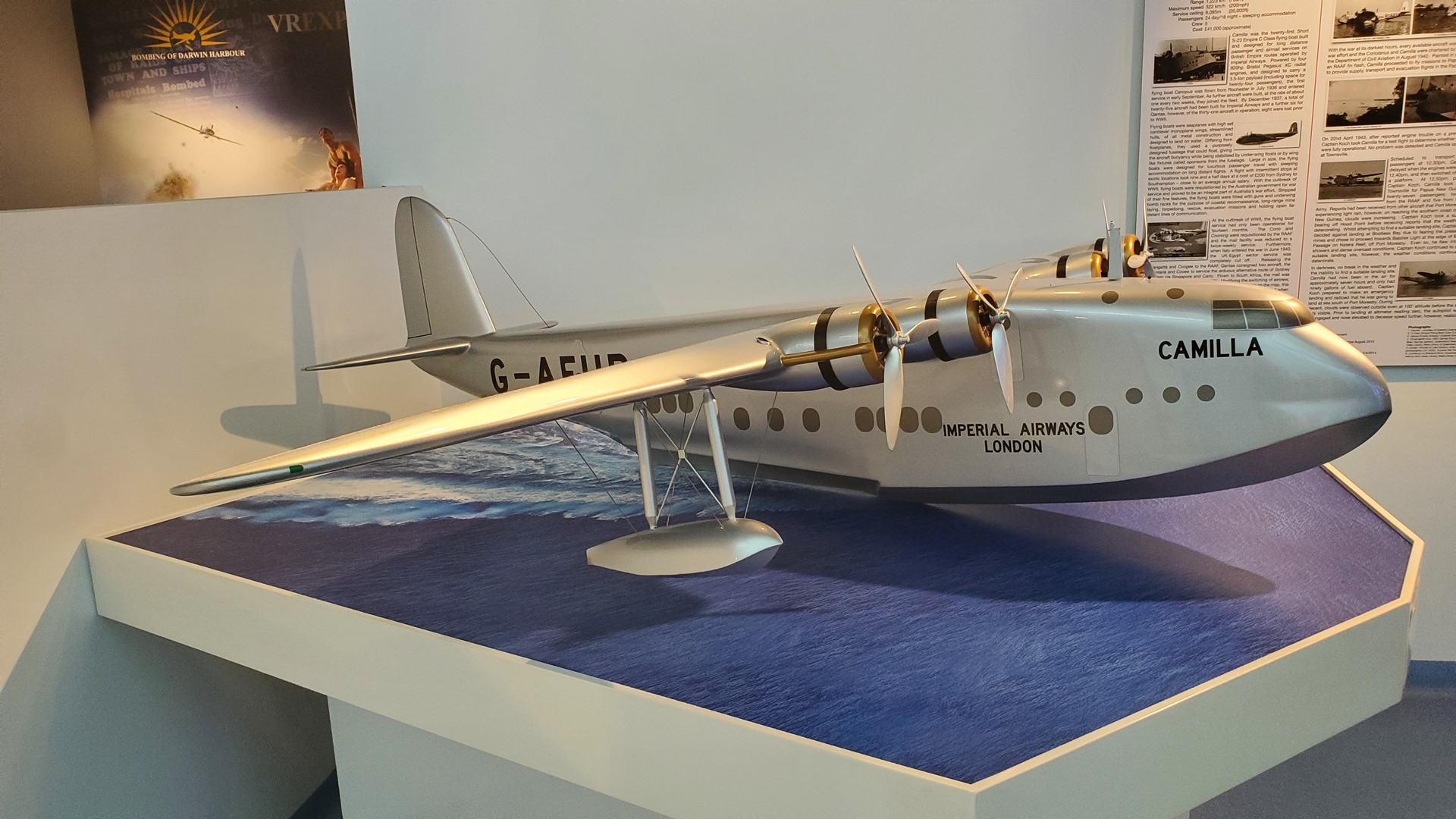
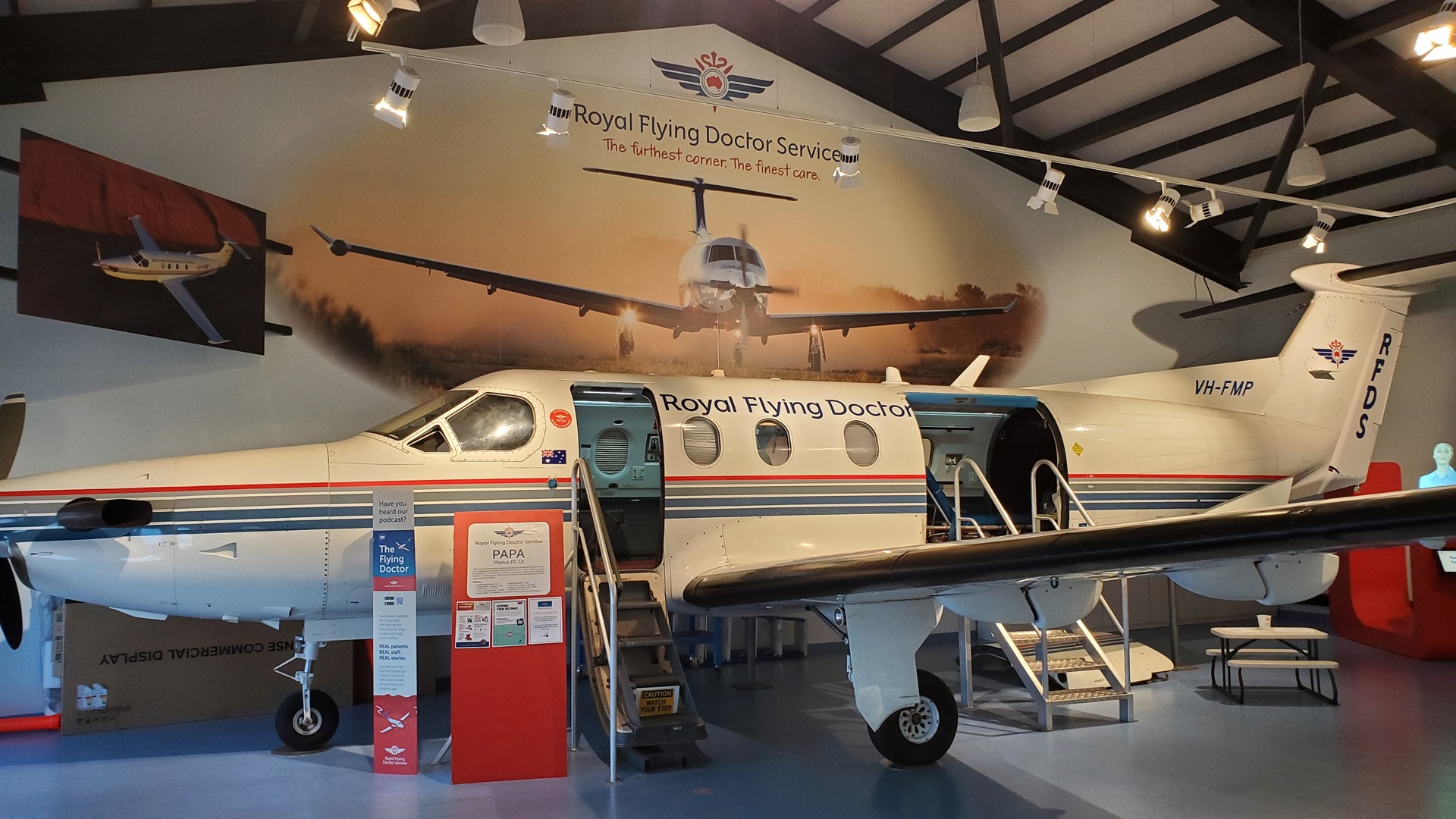
The other half of the exhibit was all about the Royal Flying Doctor Service, including a fifteen minute presentation all about the service’s origins, as well as one of their old turboprop aircraft on static display. The service is almost 100 years old, having its origins in the 1928 formation of the Australian Inland Mission Aerial Medical Service by Reverend John Flynn. They started off their activities with a single De Havilland DH.50 leased from Qantas; today they operate almost 80 advanced turbojet and turboprop aircraft, providing multiple types of medical care throughout Australia’s remote interior.
The next morning did not start auspiciously. A pilot from Hardy Aviation assisted with access airside, and provided an escort back to the airplane. When removing the passenger-side chocks, they didn’t come free with the usual tug. A closer look revealed the bad news; the tire had fully deflated, and the wheel fairing was now resting on the chocks and pinning them in place.
The good news was that this had happened in Darwin, and not on a dirt strip in the outback. I headed back to Hardy Aviation and asked for their advice. They were fantastic, and sent out Gordo and Cass (a senior mechanic and apprentice) with a jack to help out. We soon had the wheel off, and made our way back to Gordo’s workshop.
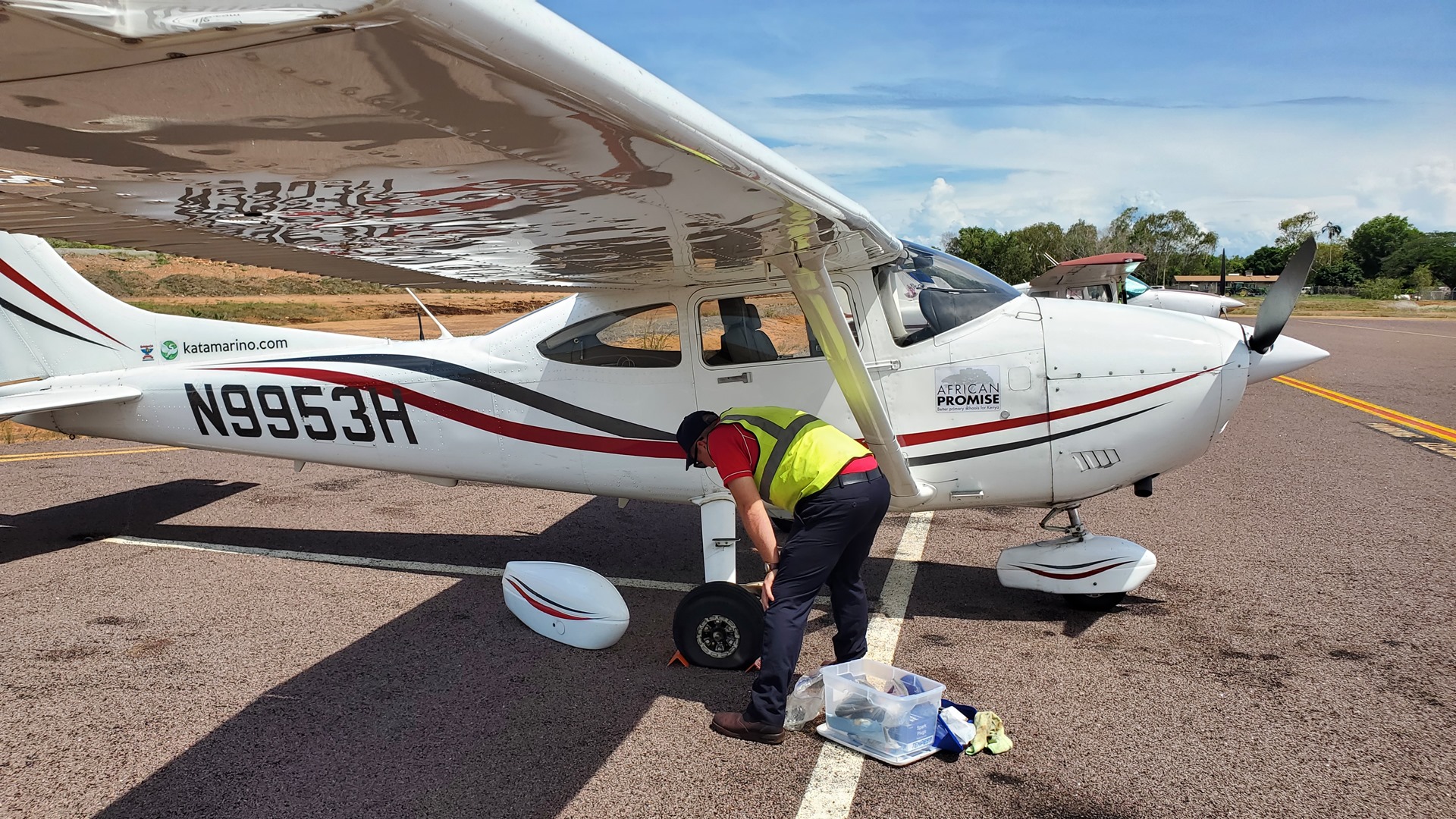
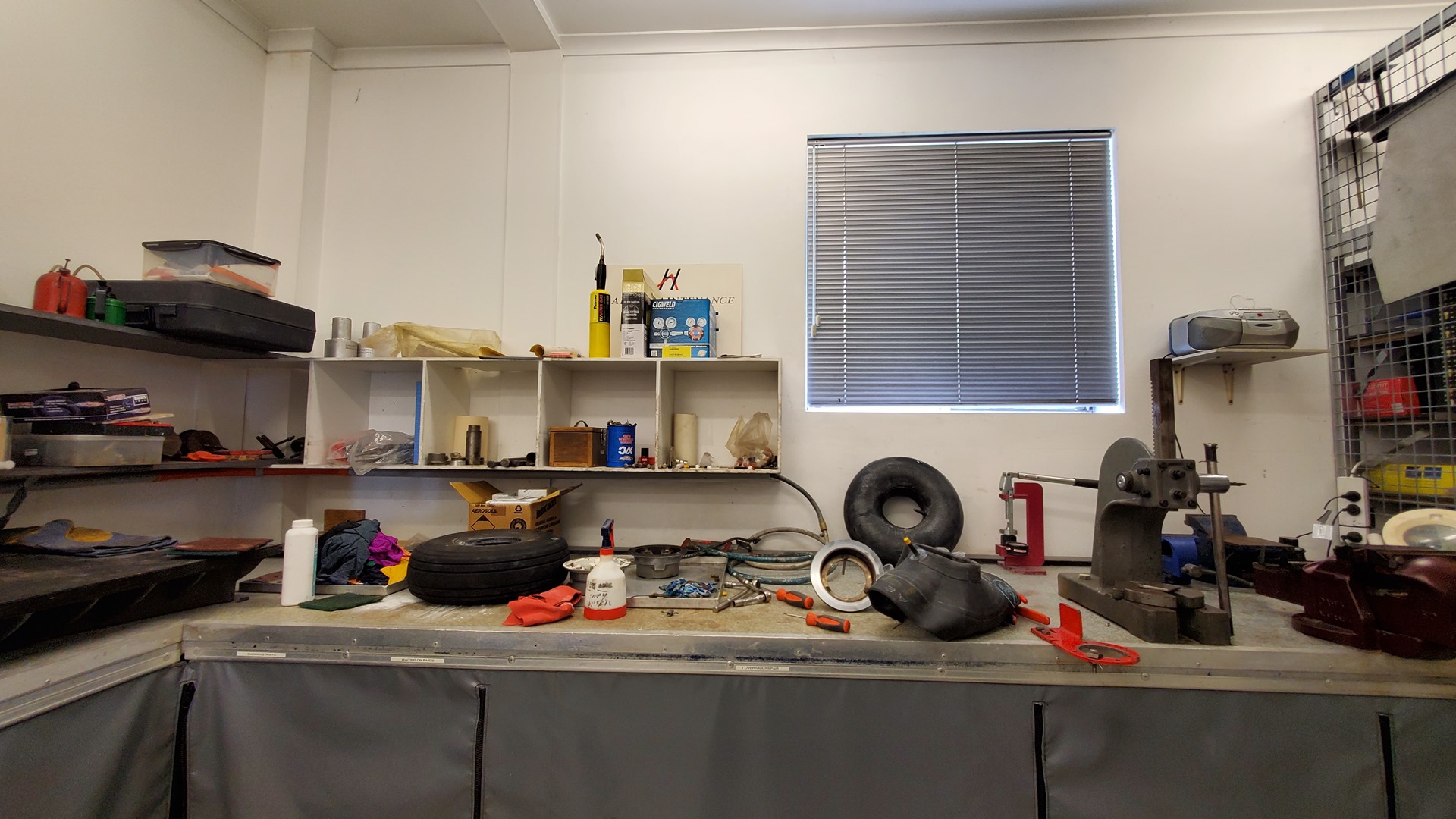
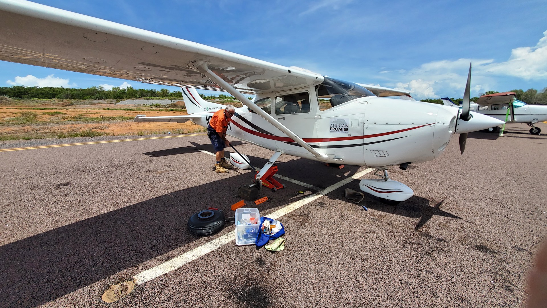
The culprit turned out to be a tiny hole which had worn in the inner tube, seemingly from rubbing on the tire. This can happen if the inner tube isn’t properly inflated when being fitted into the tire, and a small fold or similar forms. My small kit of spare parts included a new inner tube and it didn’t take too long to swap it in place of the damaged one. Gordo worked meticulously, ensuring that the wheel and bearings were all checked and serviced while we had it in pieces. Overall, it was just a couple of hours delay before Planey was back in action.
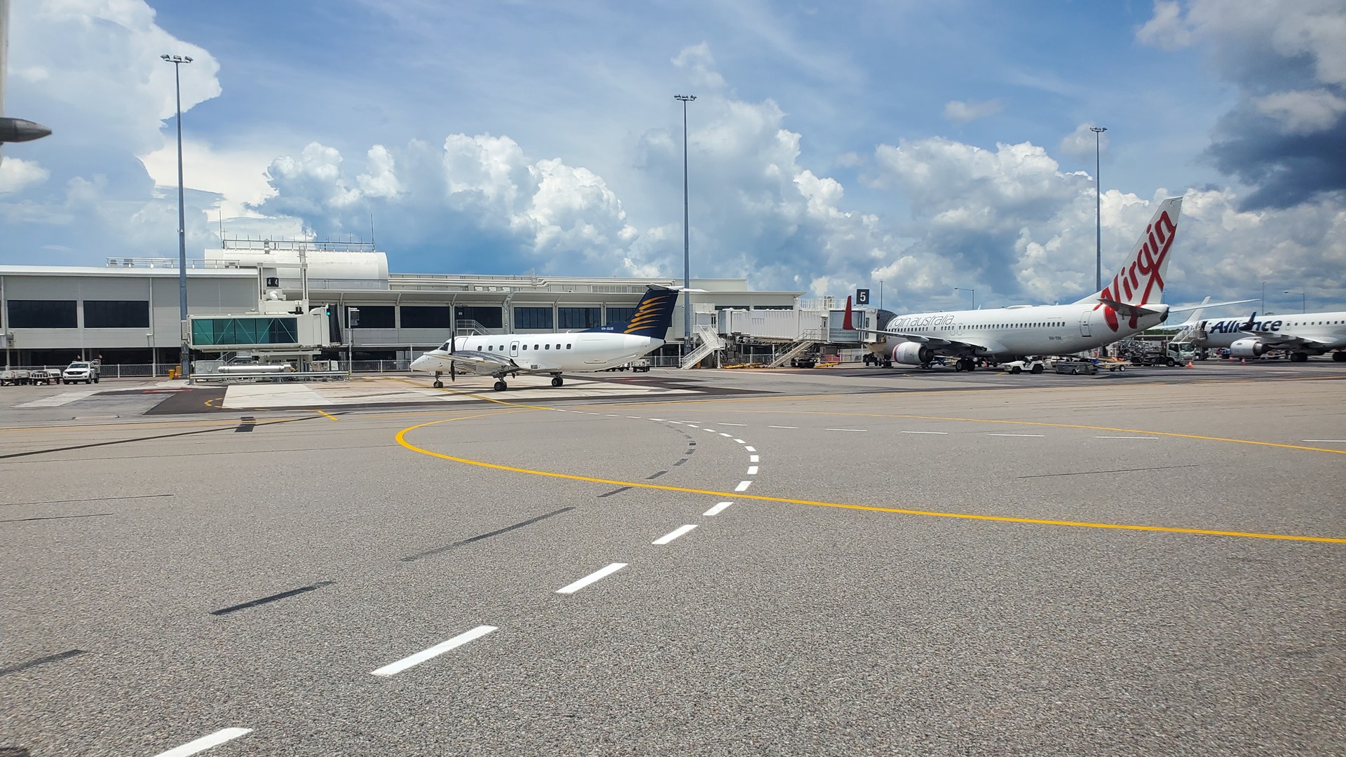
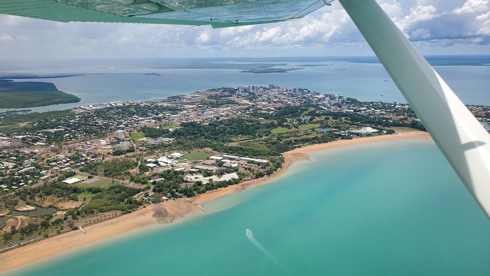
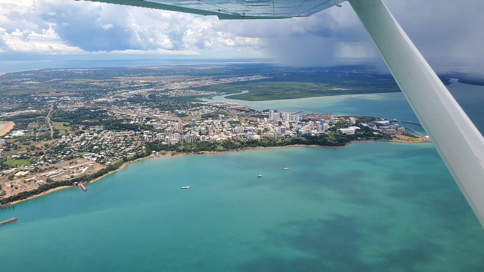
Air traffic control gave taxi instructions past the commercial apron, where a variety of Qantas, Rex, Virgin Australia and Alliance aircraft were parked up. The tower controller issued a clearance for an intersection departure from the center of the 3,350m (11,000ft) runway, departing to the northwest. The departure route gave great views of Darwin downtown, as it looped around the shore before heading south.

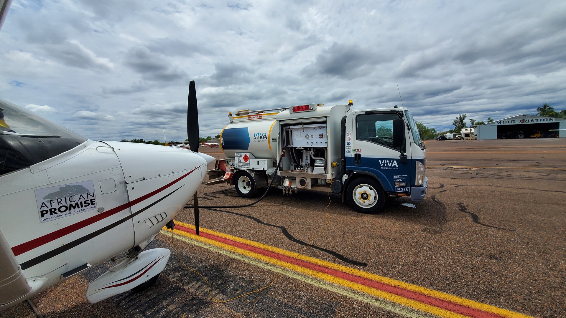
Darwin has AVGAS available, but I had decided to fly a few miles south to the small strip at “Emkaytee” and fuel up there instead. This strip comes across as small and sleepy but is in fact the second busiest in the Northern Territory, after Darwin. It is primarily used for recreational flying, but also provides flight training, recreational charters, and aircraft maintenance.
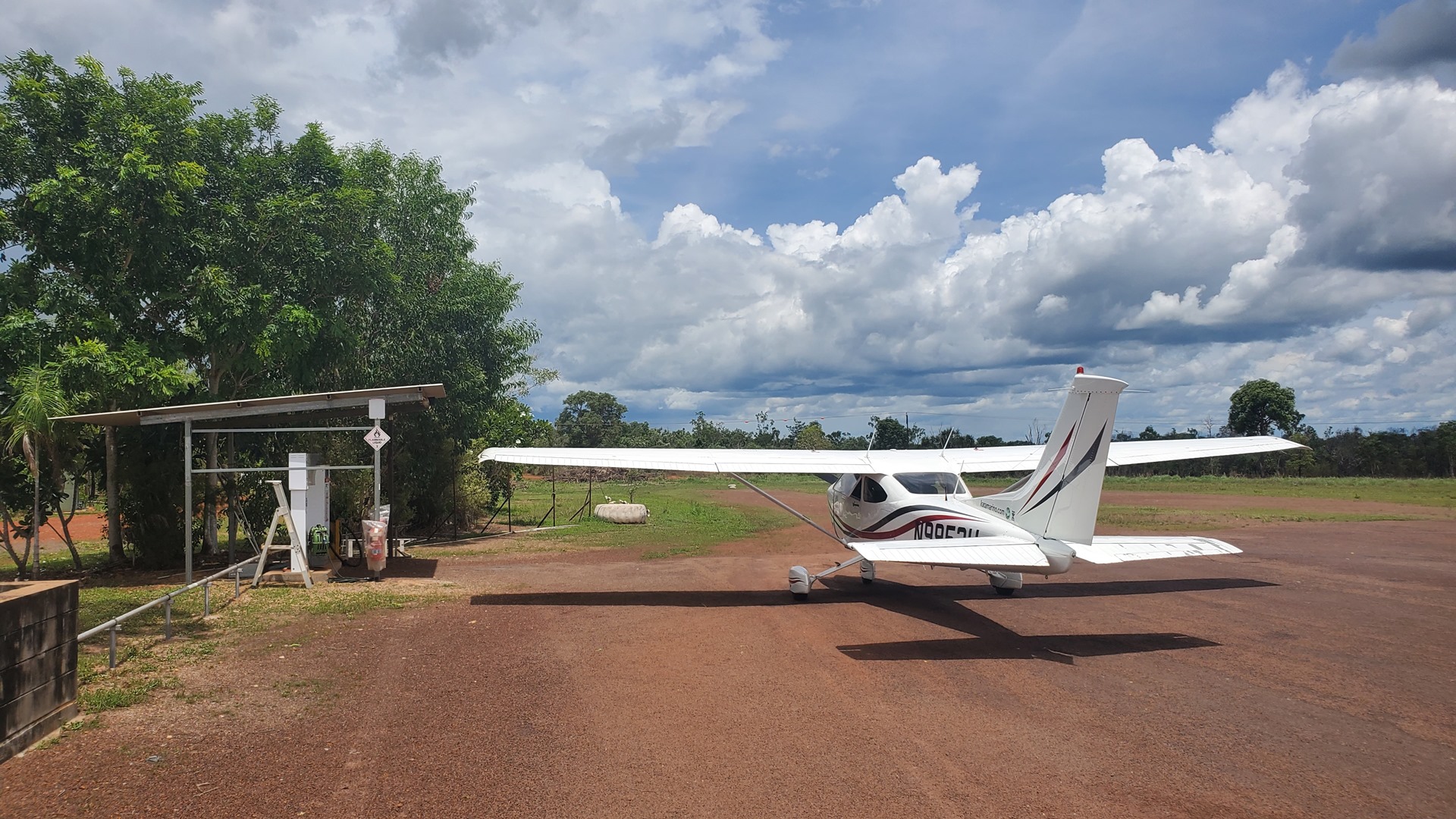
One other aircraft was in the circuit as I approached for landing, practicing engine-out approaches. We coordinated between ourselves over the radio so as to avoid any conflict. The wind was from the east, so I landed out of the west and rolled to the fuel pumps which are located right at the eastern end of the runway. After refueling I stopped by the flight school lounge to say hello and see if any cold drinks were forthcoming. A couple of students were hanging around preparing for their lessons, and we chatted for a while in the air-conditioning before it was time to head back out into the heat and depart. The wind was calm, so I entered the runway directly from the fuel pumps and took off to the west before turning on course and continuing on my way.
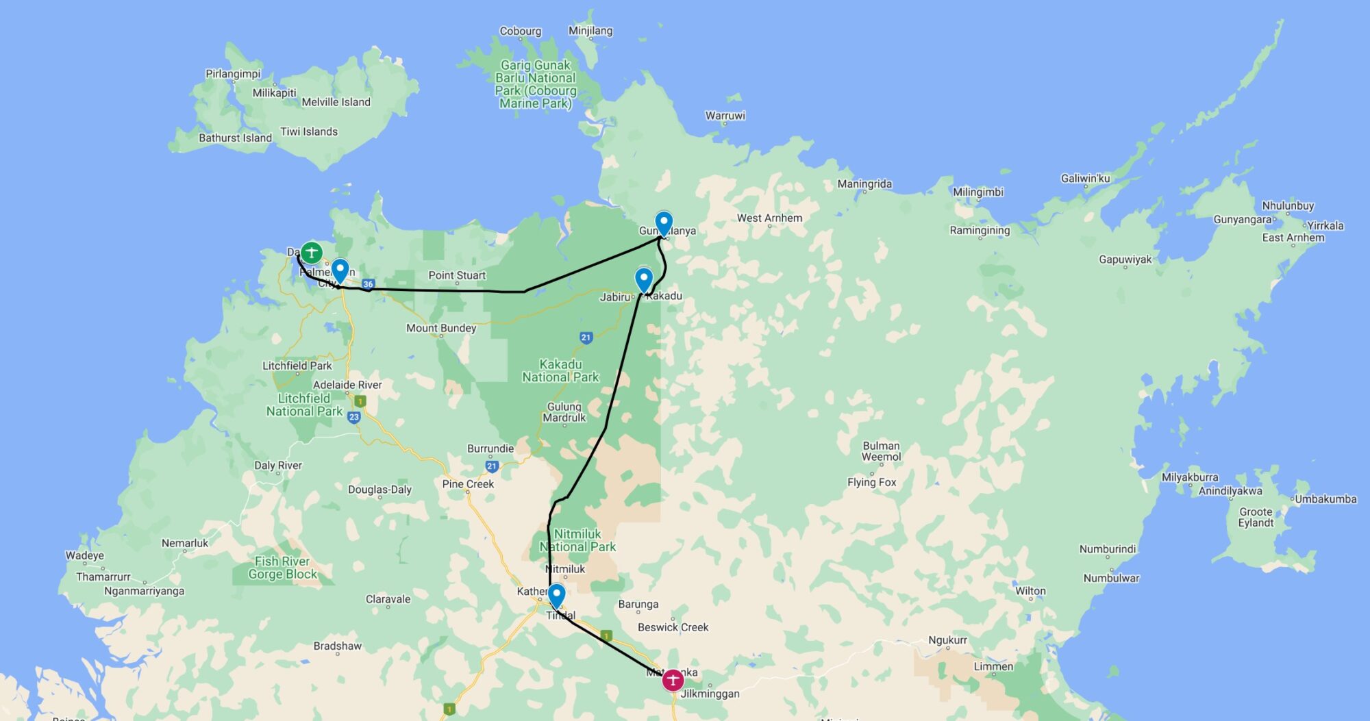
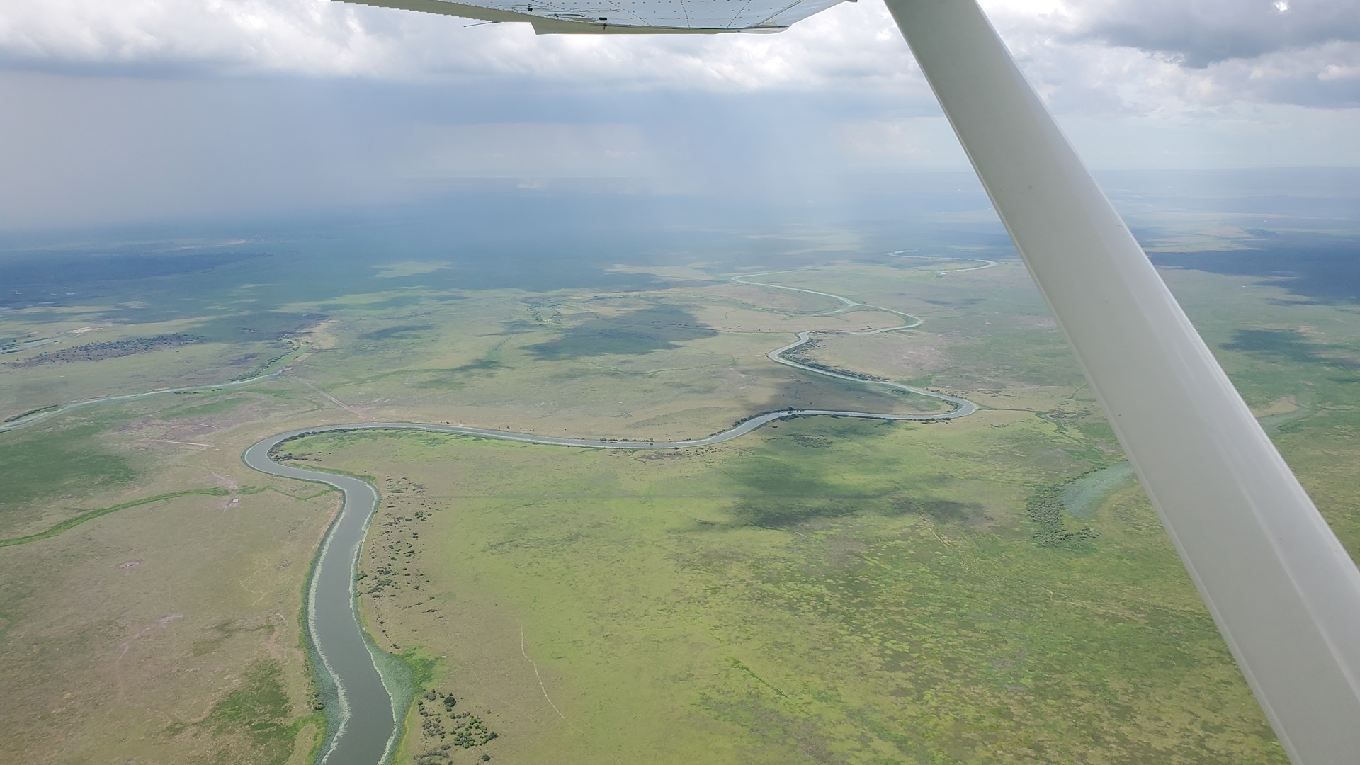
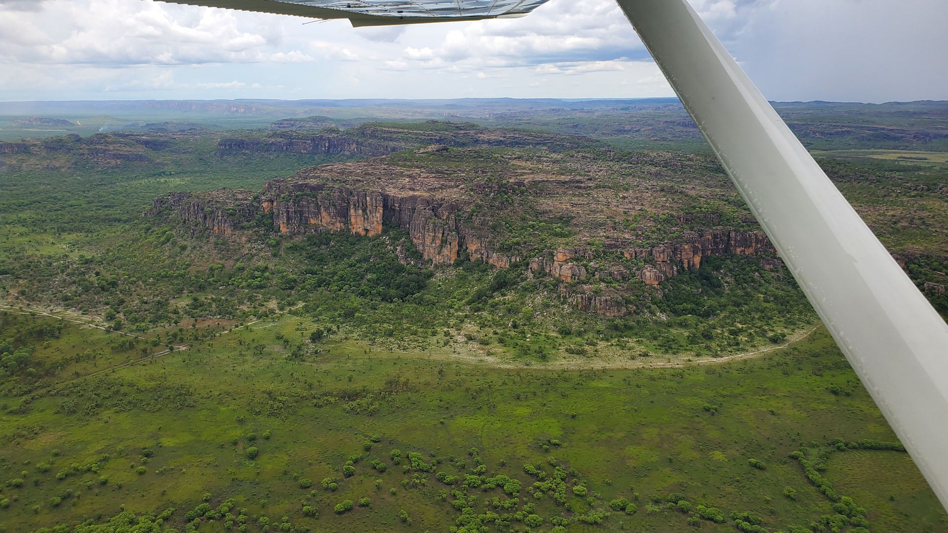
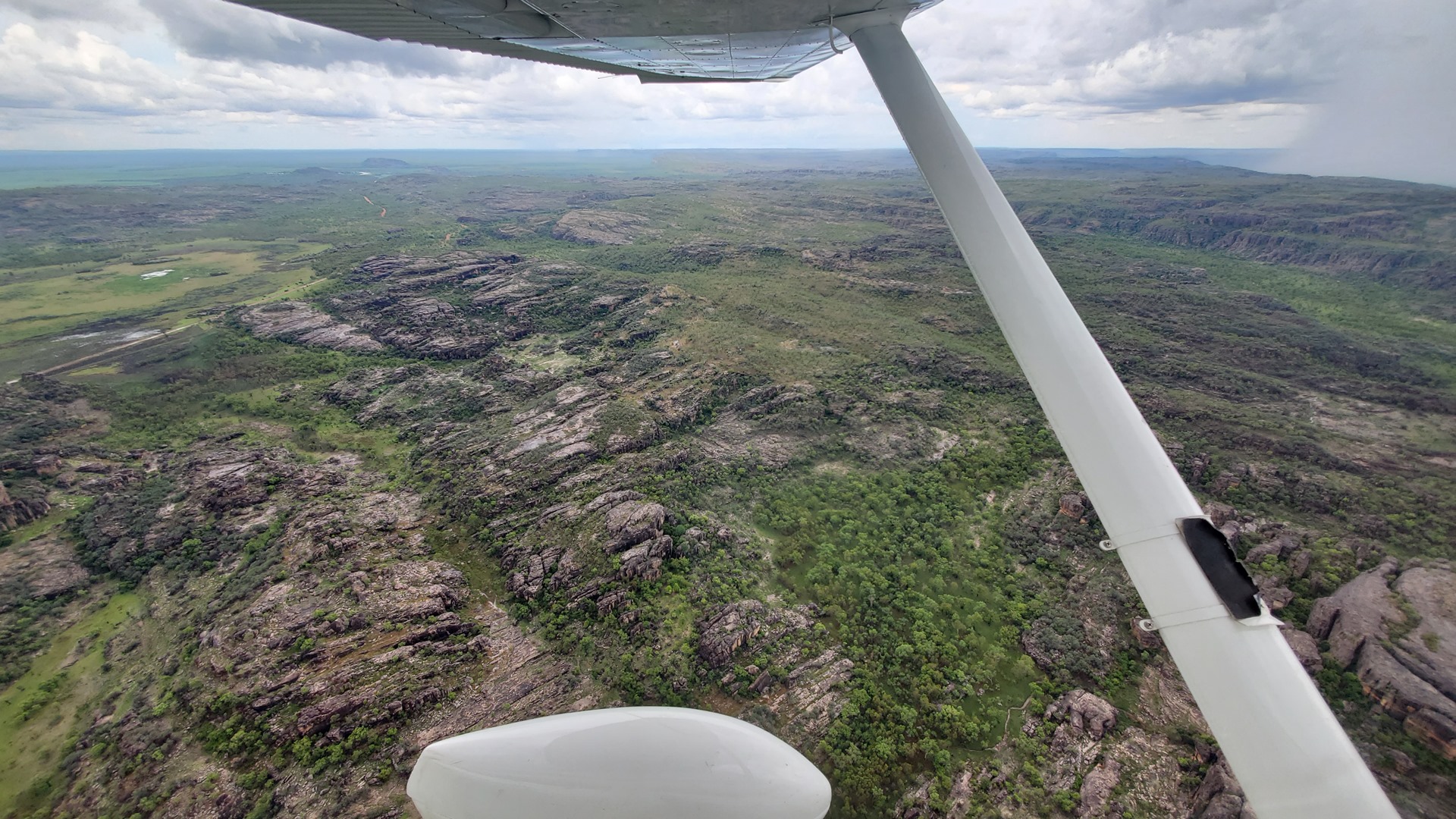
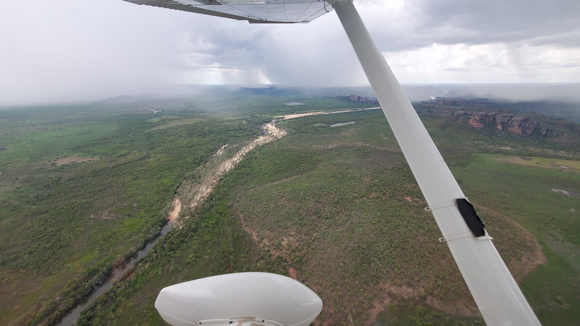
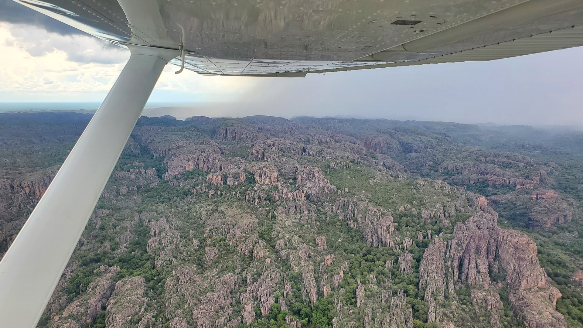
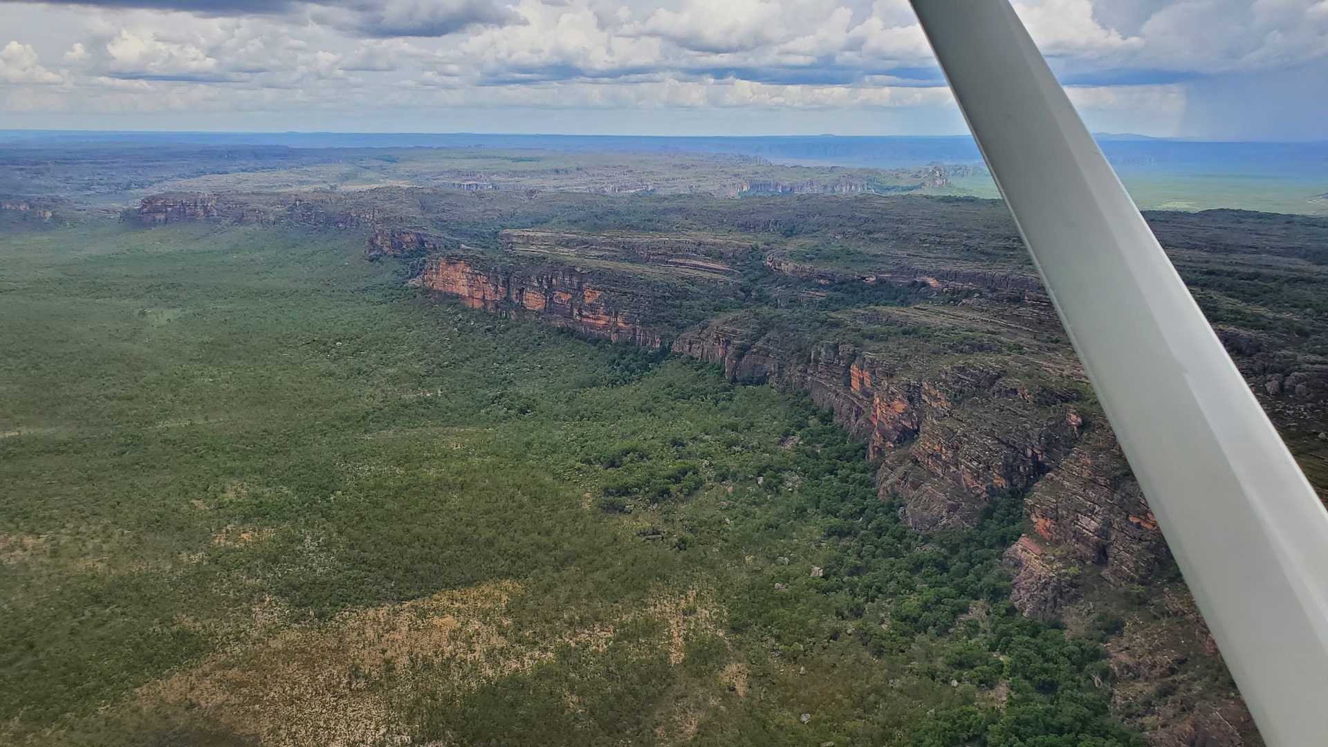
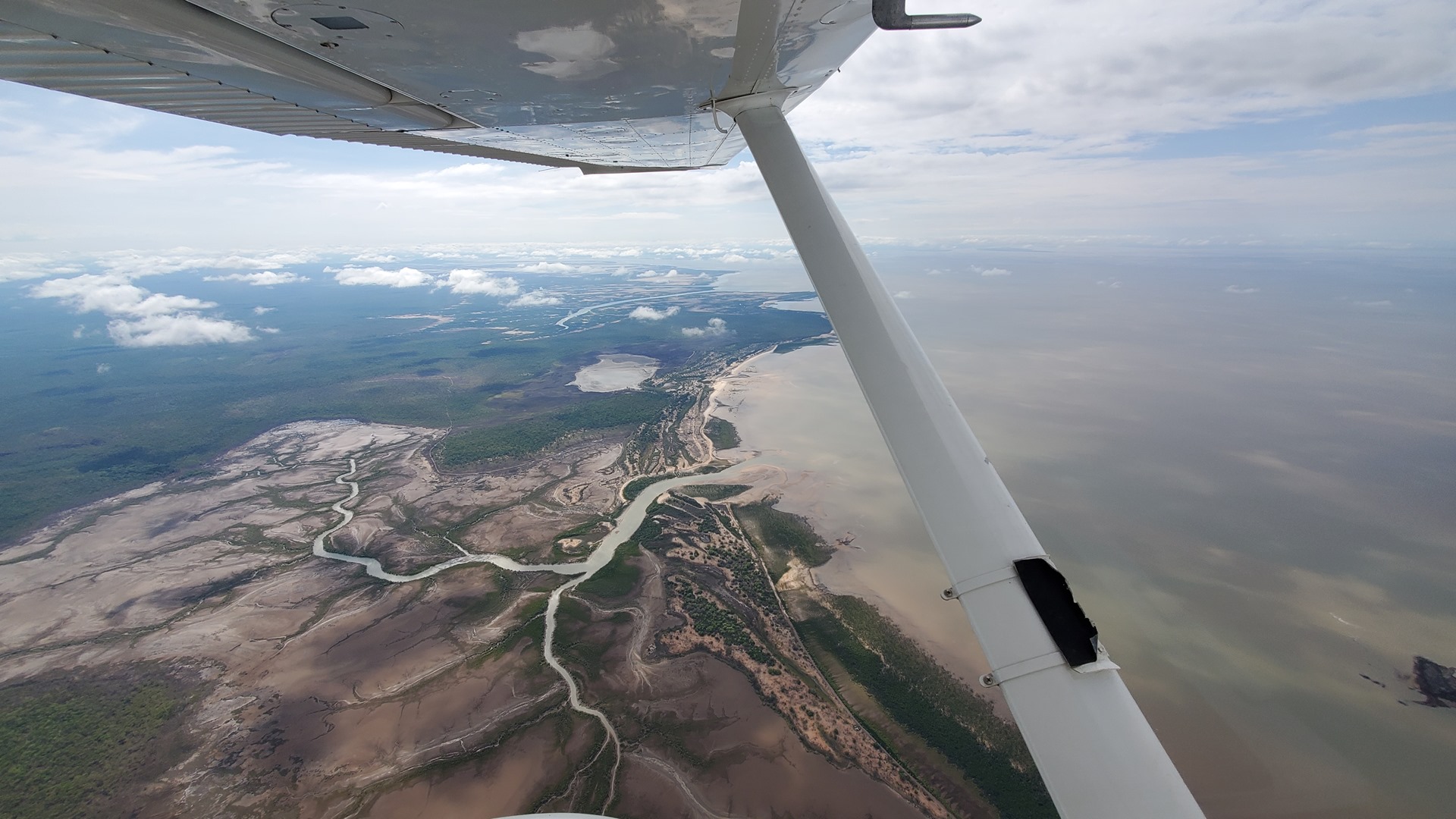
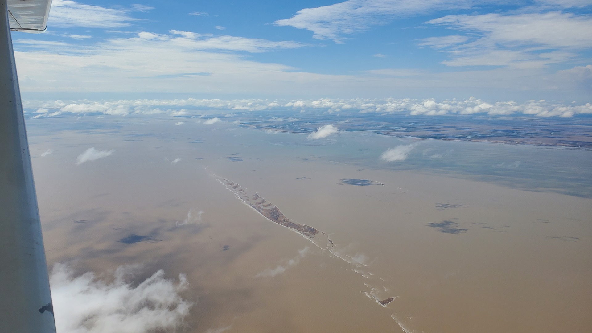
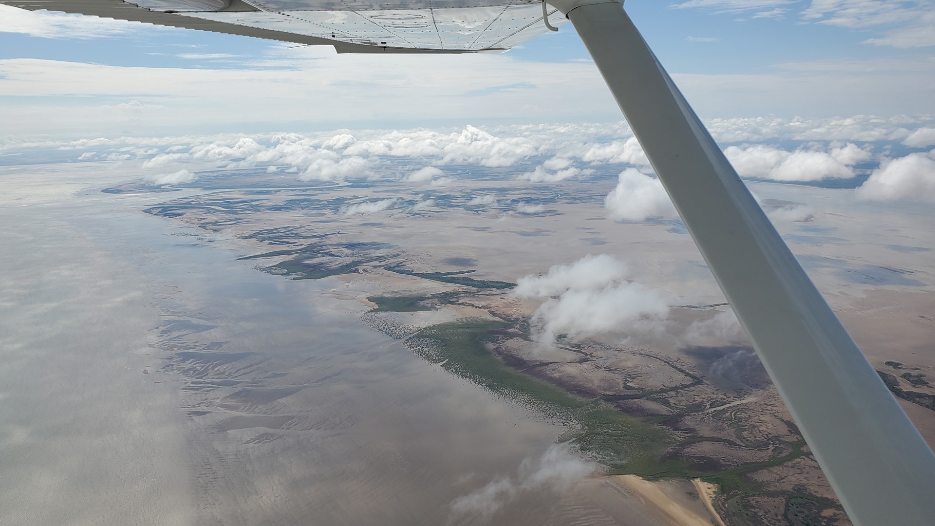
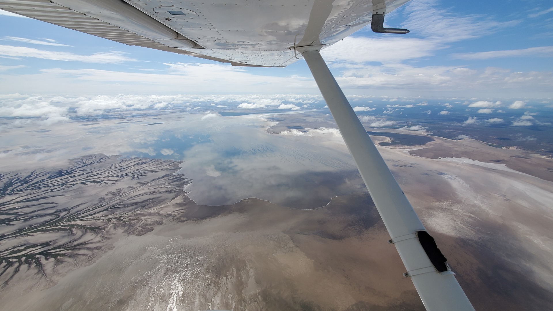
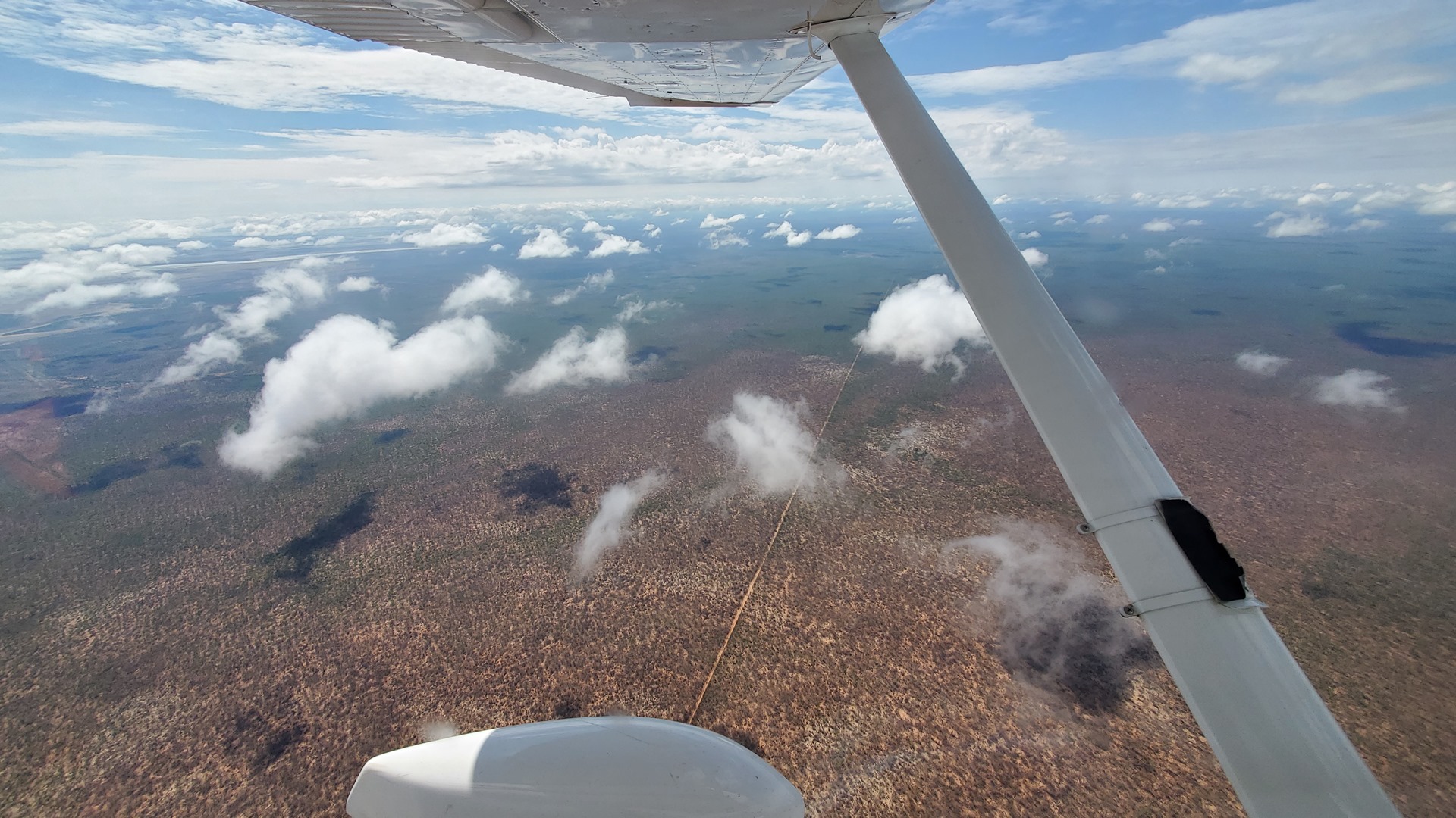
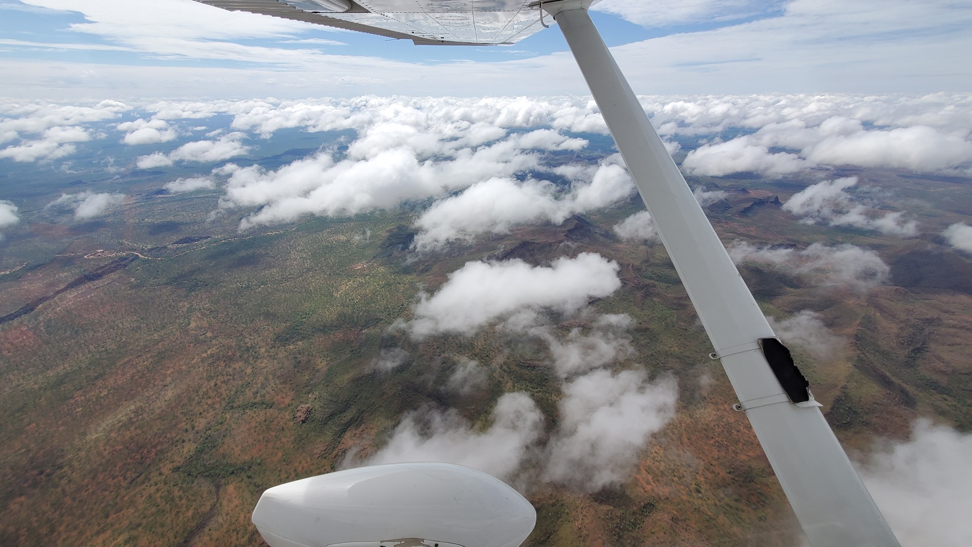
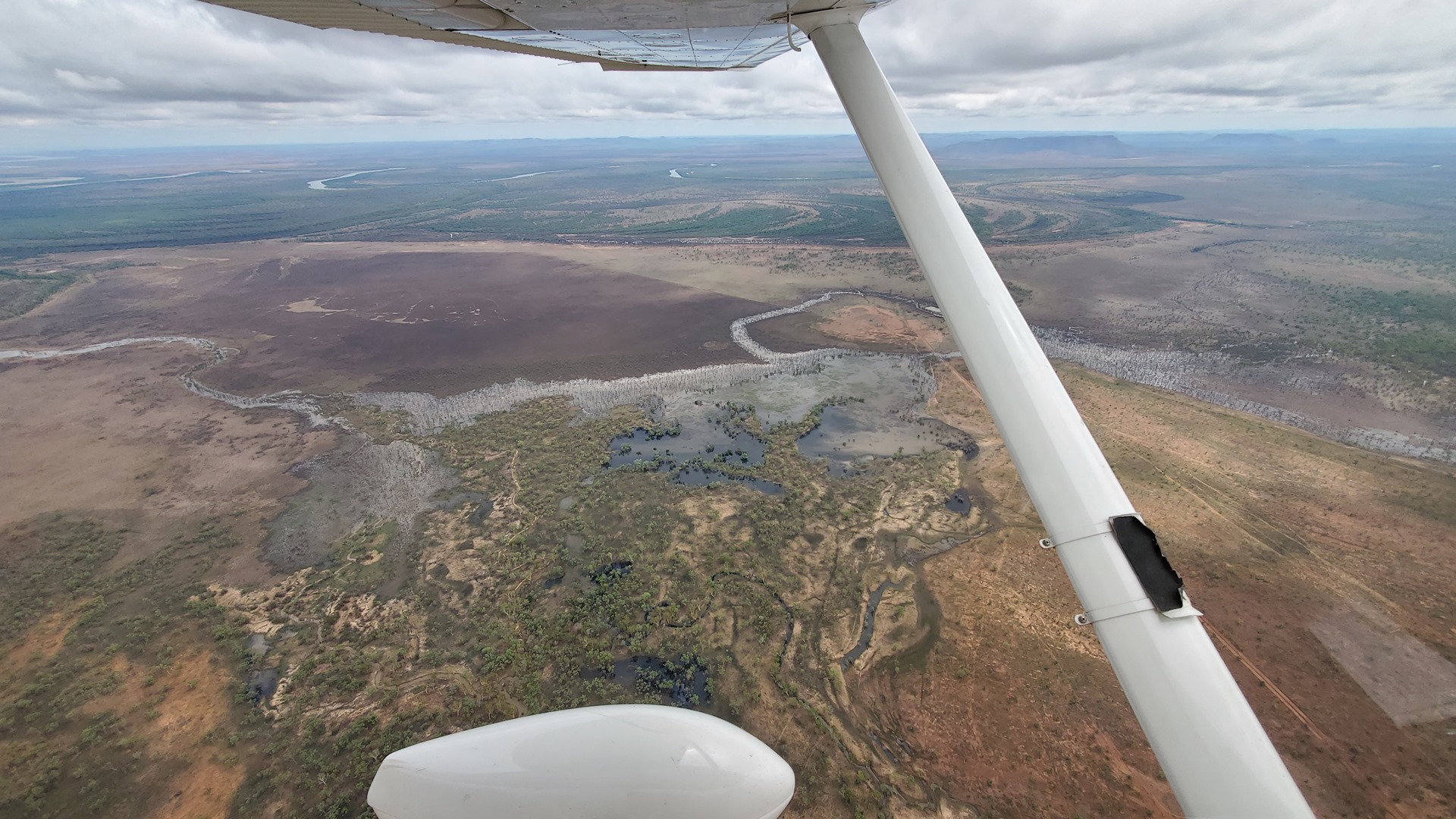
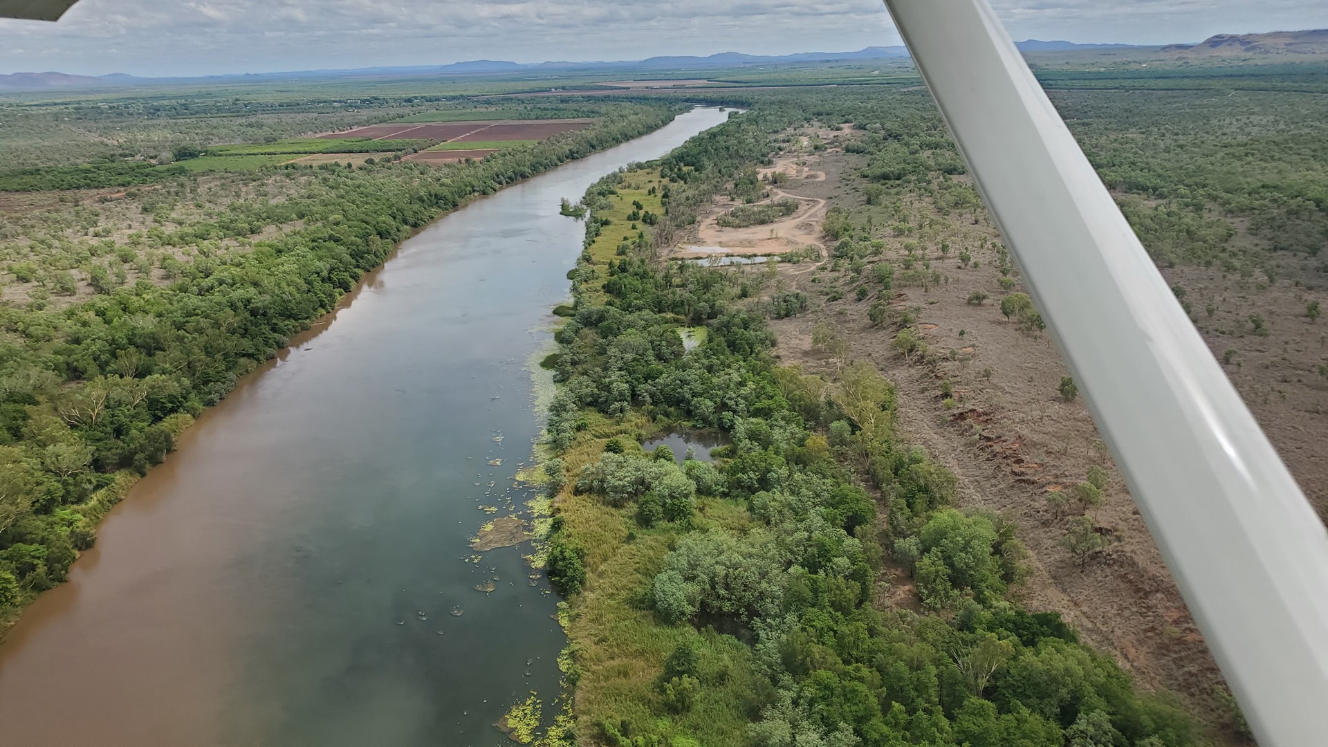
The first section of the days flying led east from Darwin over Kakadu National Park. The terrain in the area started off flat and swampy, but approaching the eastern side of the park rocky hills and outcrops started to sprout from the terrain. The park is enormous, measuring 200km north to south and 100km west to east. Native people have occupied the area for as much as 60,000 years; there are more than 5,000 recorded art sites in the park illustrating Aboriginal culture, that have been dated over thousands of years. Large saltwater crocodiles are present throughout the park (the movie Crocodile Dundee was filmed in the area) so I was glad that the engine purred smoothly throughout.
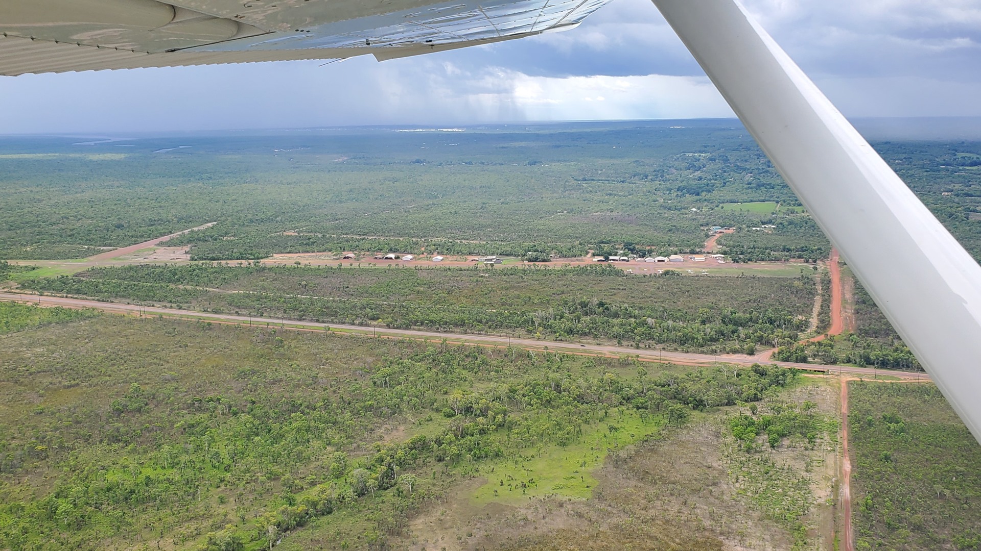
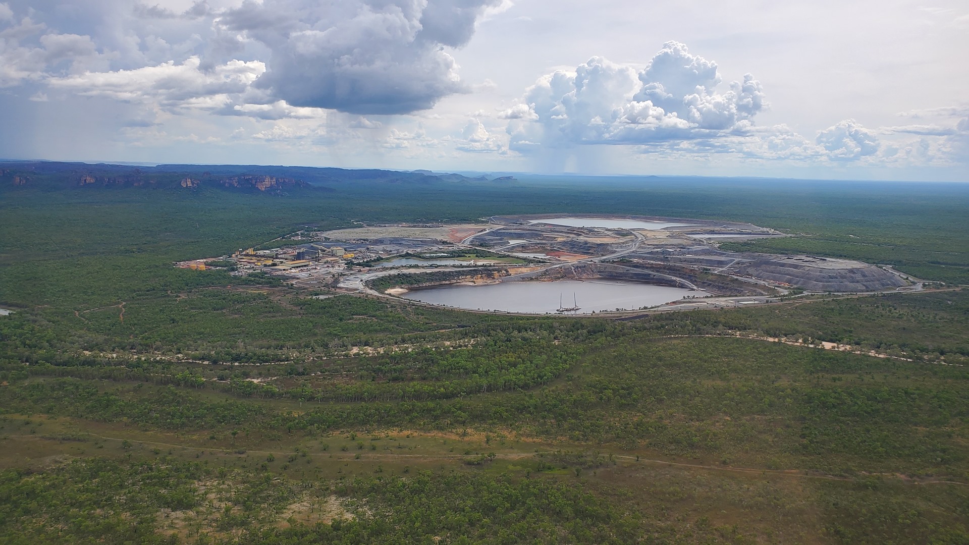
After a brief stop at Oenpelli airport, just for the fun of it, I arrived at Jabiru airport. The town of Jabiru was built for the Ranger uranium mine that was established prior to the founding of Kakadu National Park and provides infrastructure for the mine’s workforce as well as the national park activities and tourism. “Jabiru” is also the name of a well known Australian ultralight aircraft manufacturer which for some reason is based not at Jabiru the town, but in Queensland.
While standing on the apron at Jabiru, a commercial Cessna 210 taxied in and shut down. Out hopped the pilot, a passenger, and a big dog in a crate. One benefit of flying on small planes is that taking an animal is much more straightforward!

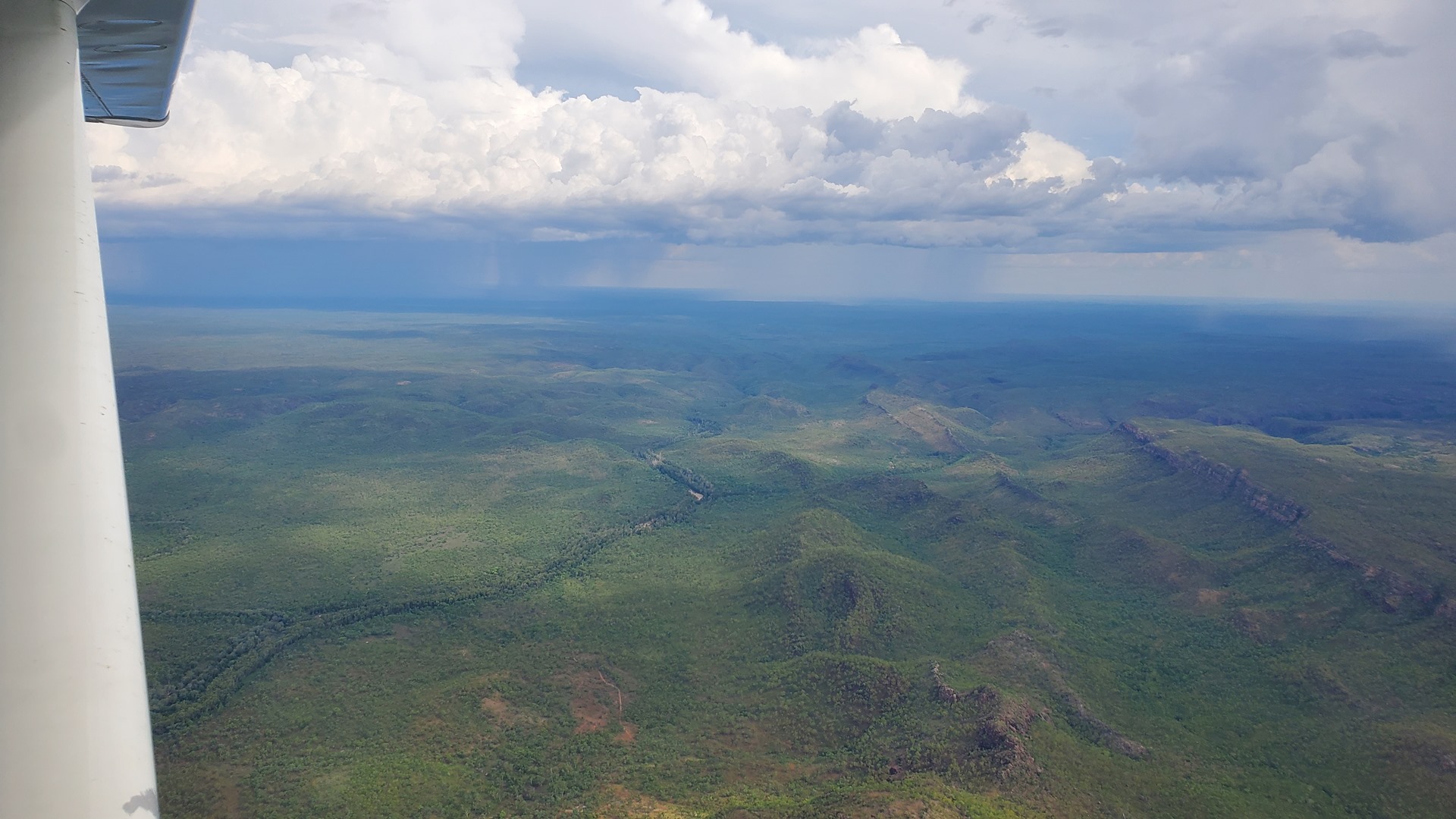
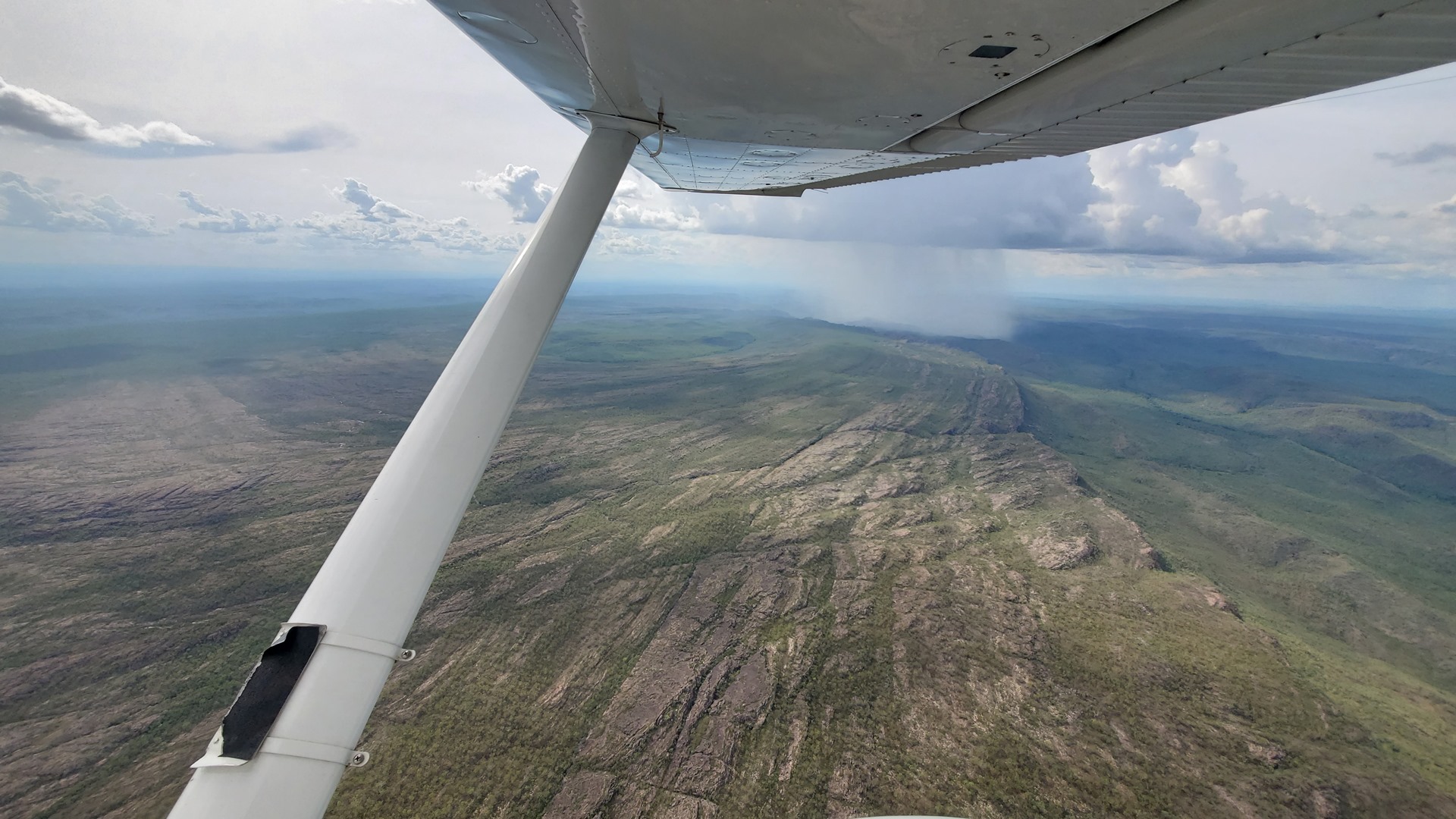
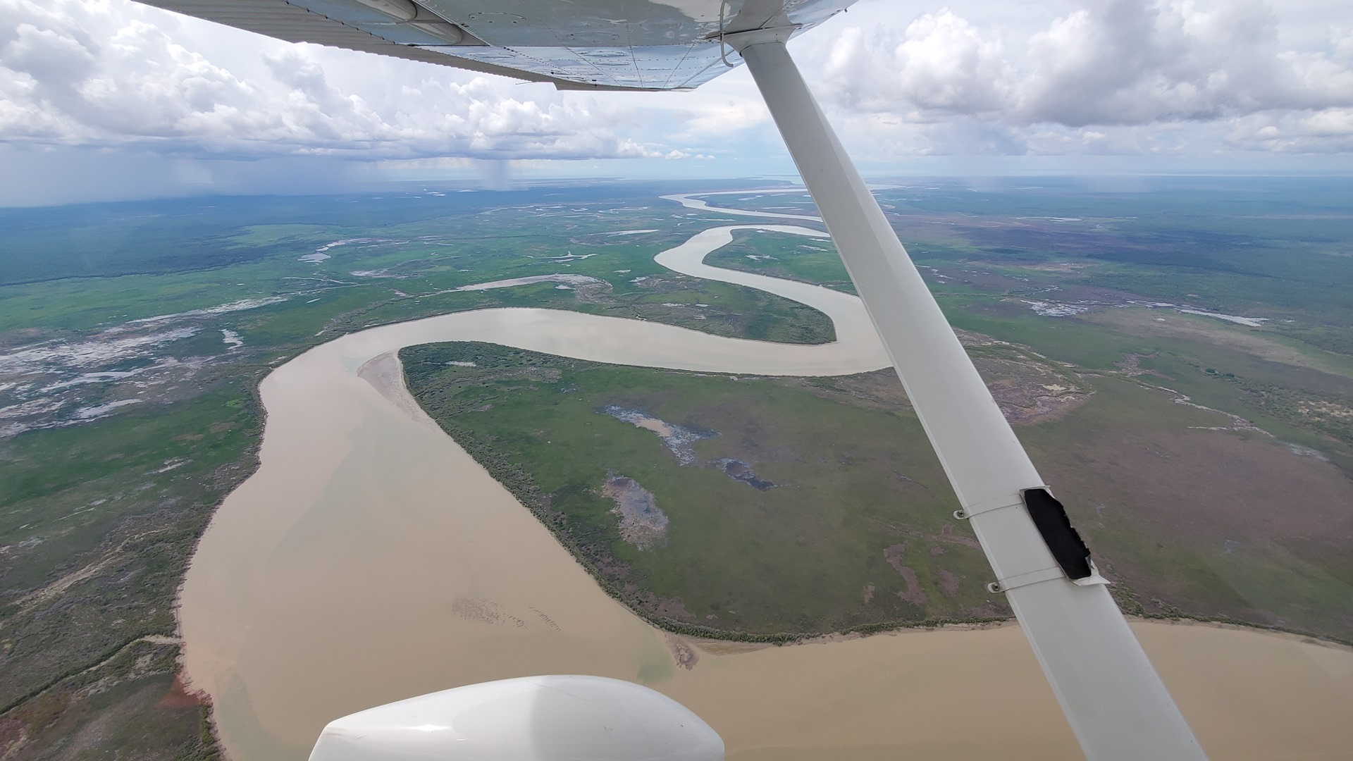
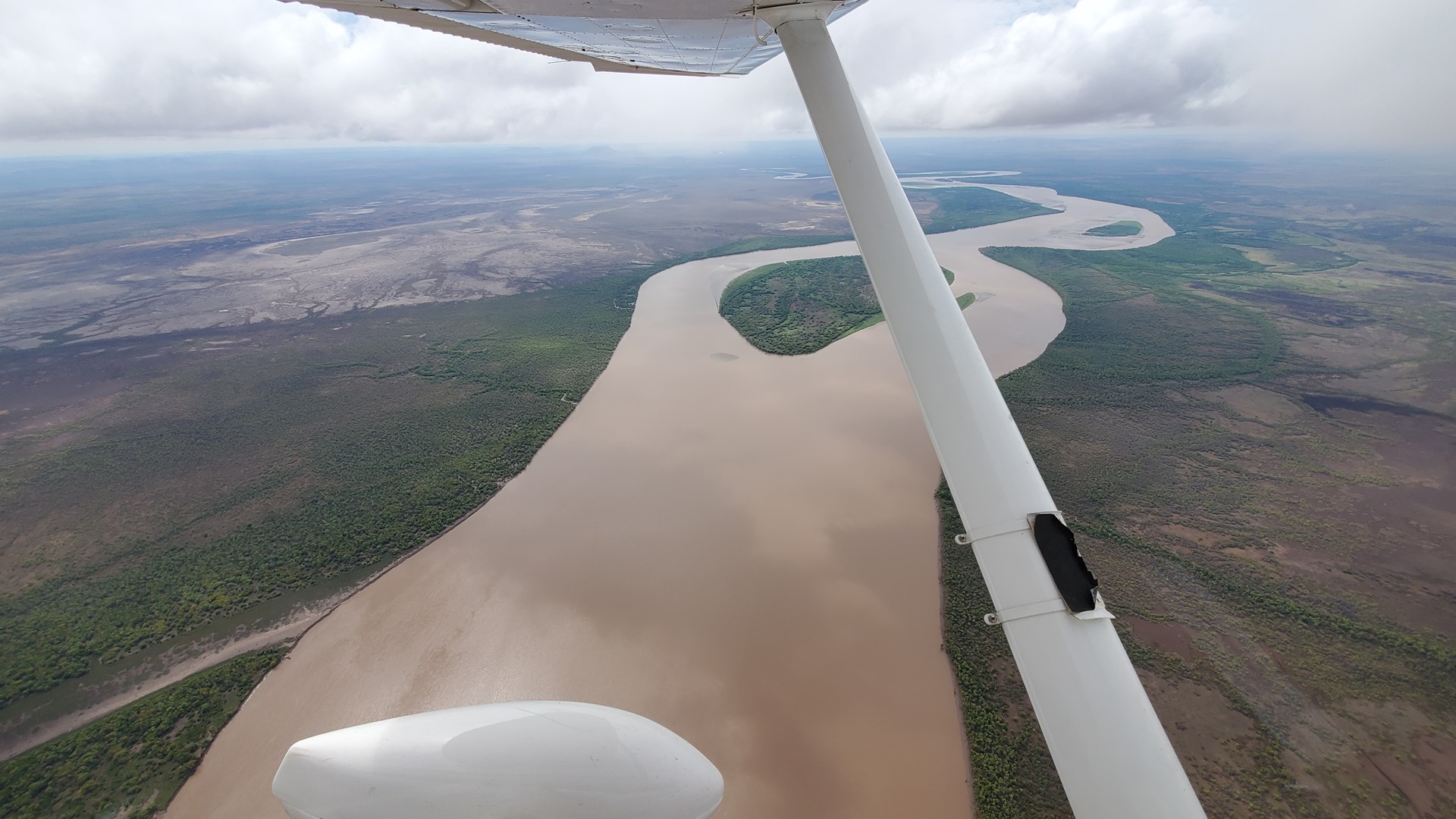
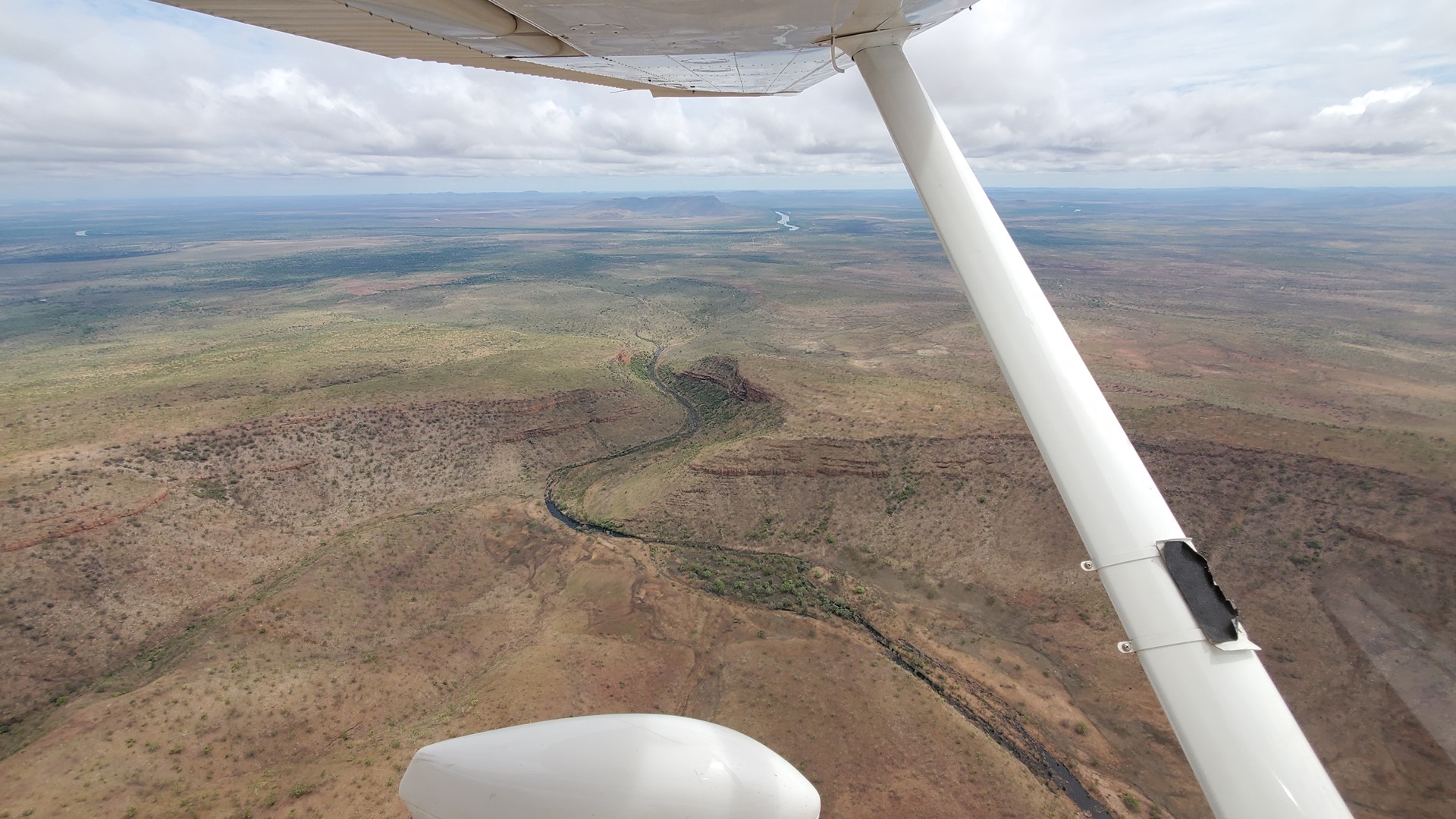
The next leg of the flight, from Jabiru down to Katherine (also known as Tindal) took us over the length of Kakadu National park. As we approached Katherine rain showers became visible, gradually increasing in size and extent as we got closer to the airport. They didn’t force too much in the way of detours, although lightning could be seen from time to time, striking from near the rain clouds; at times the lightning seemed to come from clear air, rather than the cloud itself. The lightning was striking dry ground, well outside of the rain’s extent, so it was easy to see how wild fires could start in these regions.
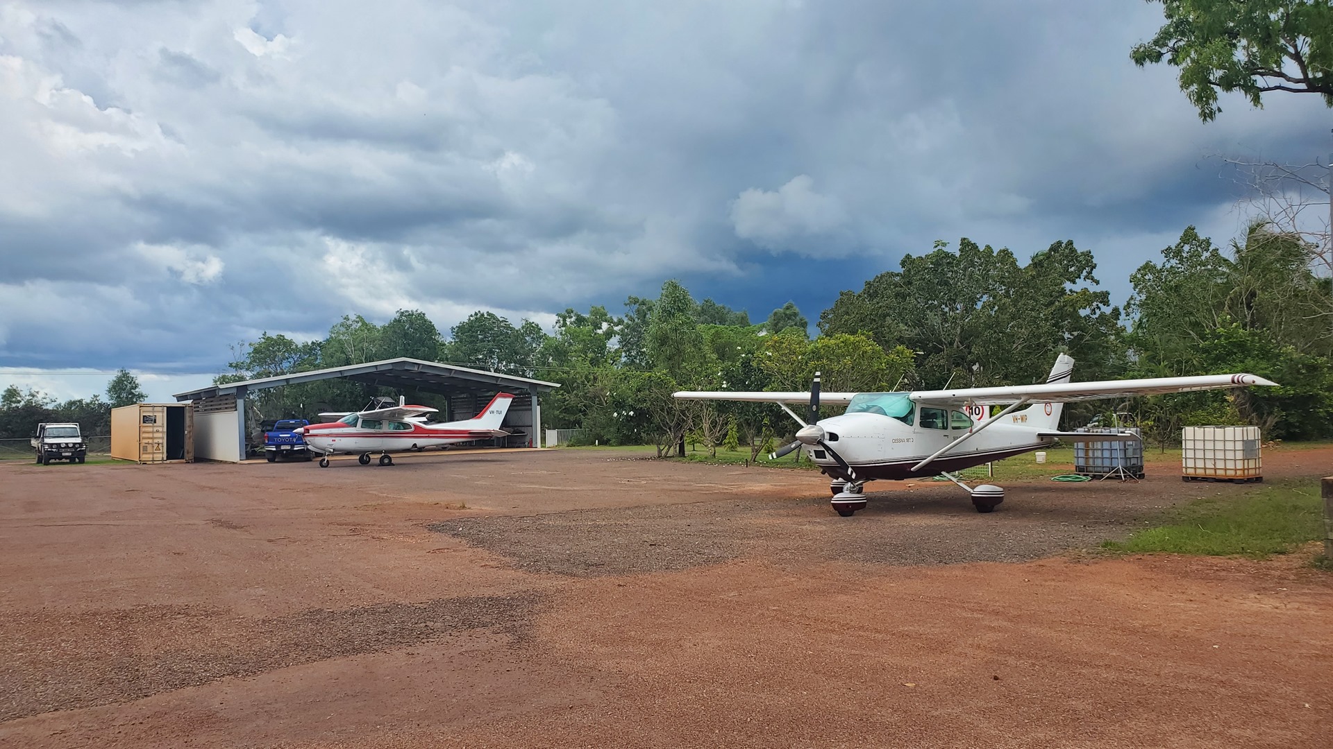
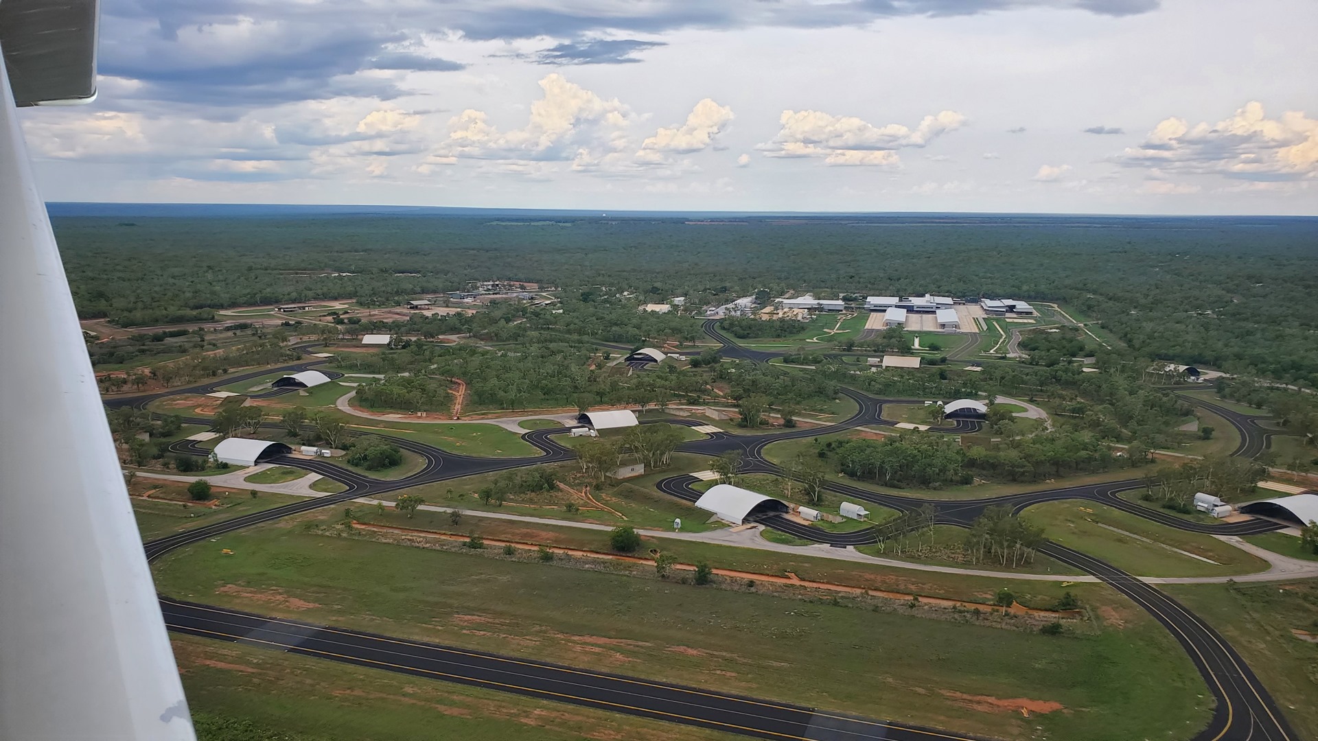
I lined Planey up and we touched down to the southeast, turning 180 degrees on the runway and taxiing back. Katherine/Tindal is a joint civil and military airport. A left turn took me to the civilian apron, a right turn would have placed me on the military part of the field, and probably caused some issues. A commercial Cessna 206 was sitting at the fuel pump with his engine running, apparently going through his pre-flight checks, but as soon as he saw me he gave a little wave and pulled out of the way to let me park up.
The planned night stop was the Mataranka Homestead, near the community of Mataranka. They have their own airstrip, but at the time of my visit in was in disrepair, so we had arranged that they would provide a pick-up from the nearby community airstrip. It had been difficult to get hold of the homestead by phone but luckily they picked up, and confirmed that Steve would be there for the pick-up at the my expected ETA.
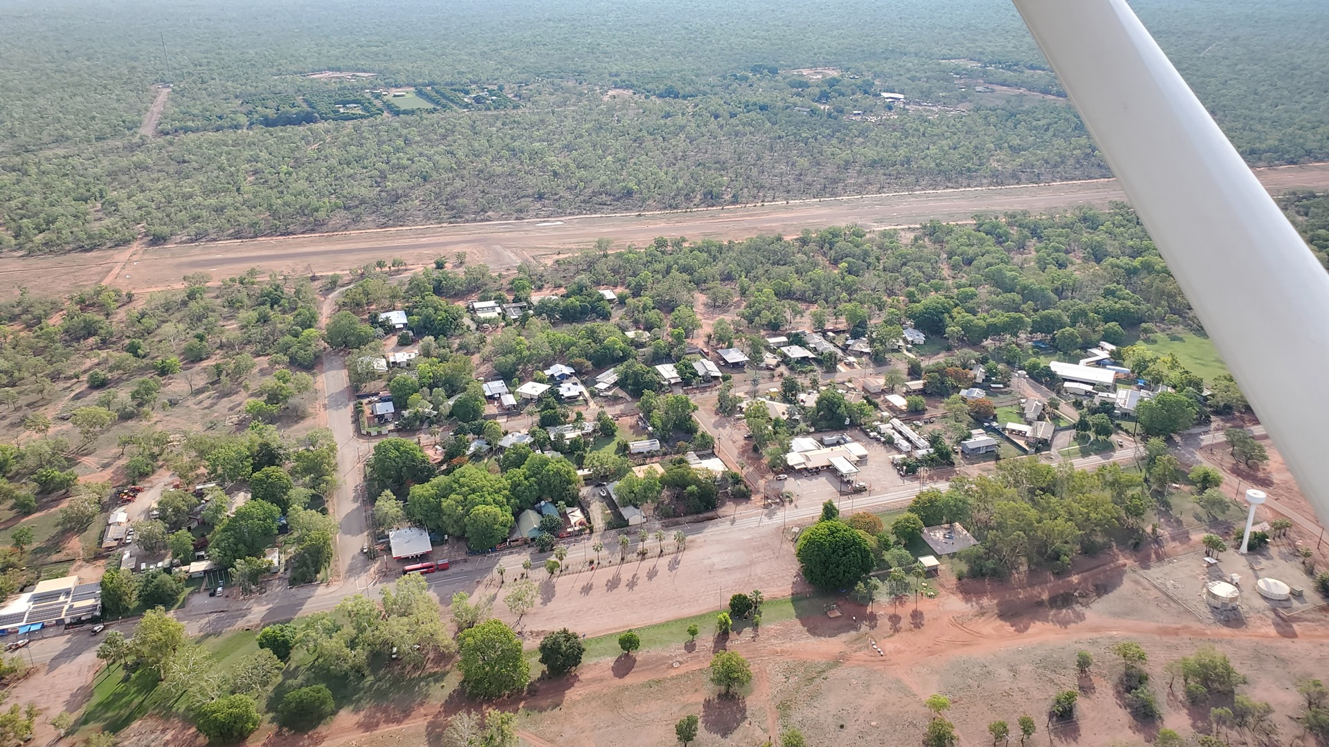
Refueling took a little longer than planned, and I was worried about keeping Steve waiting, so I kept the speed high on the flight to Mataranka. I needn’t have worried; he didn’t pull up until I was already on the ground and had finished securing the aircraft for its overnight stay. After saying our hellos and taking a quick look at the aircraft we jumped into the 4×4 and headed back to the homestead. As we drove, Steve pointed out the low points in the road that can flood in the wet season, sometimes for weeks at a time, cutting off the homestead from the community. The flood water is not fast flowing, and they keep a small boat to hand to keep communications open during these times.
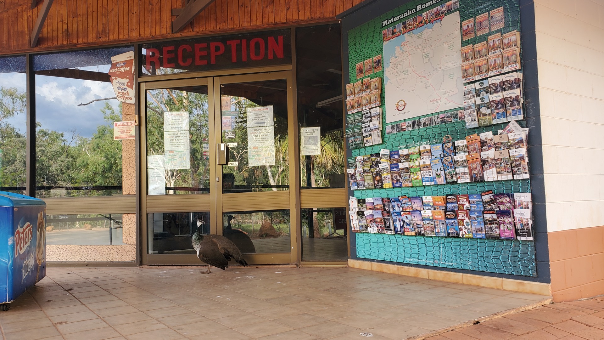
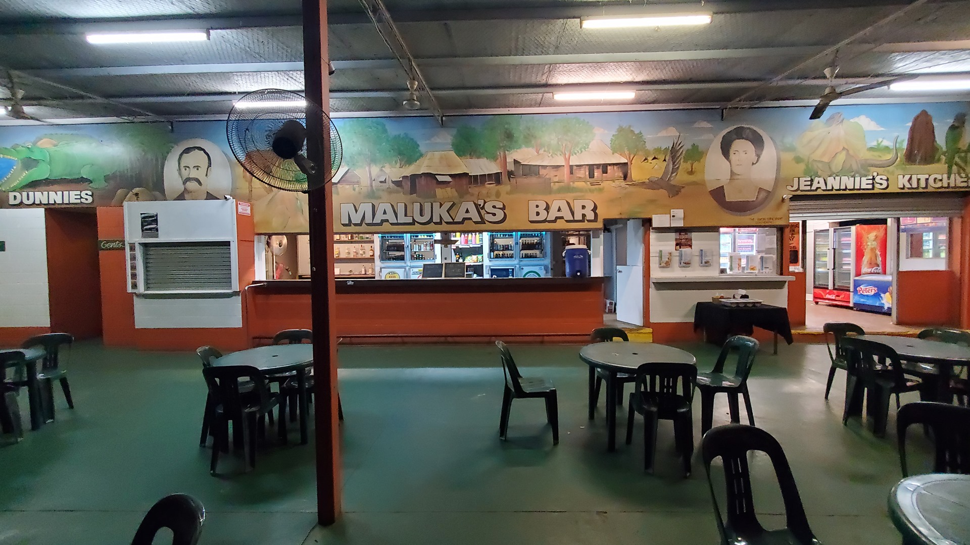
It was the start of the off-season, and there were only a few other guests staying. Reception was closed, with only a large peacock on duty, so check-in was at the bar. Keys to two rooms reserved by someone called “Russ” were initially offered up, but eventually we figured out that I wasn’t him, and the correct key was provided. After a quick stop in the room, which was rather musty and smelly and clearly hadn’t been used in a while, it was time to visit Mataranka’s main attraction; the thermal pools.
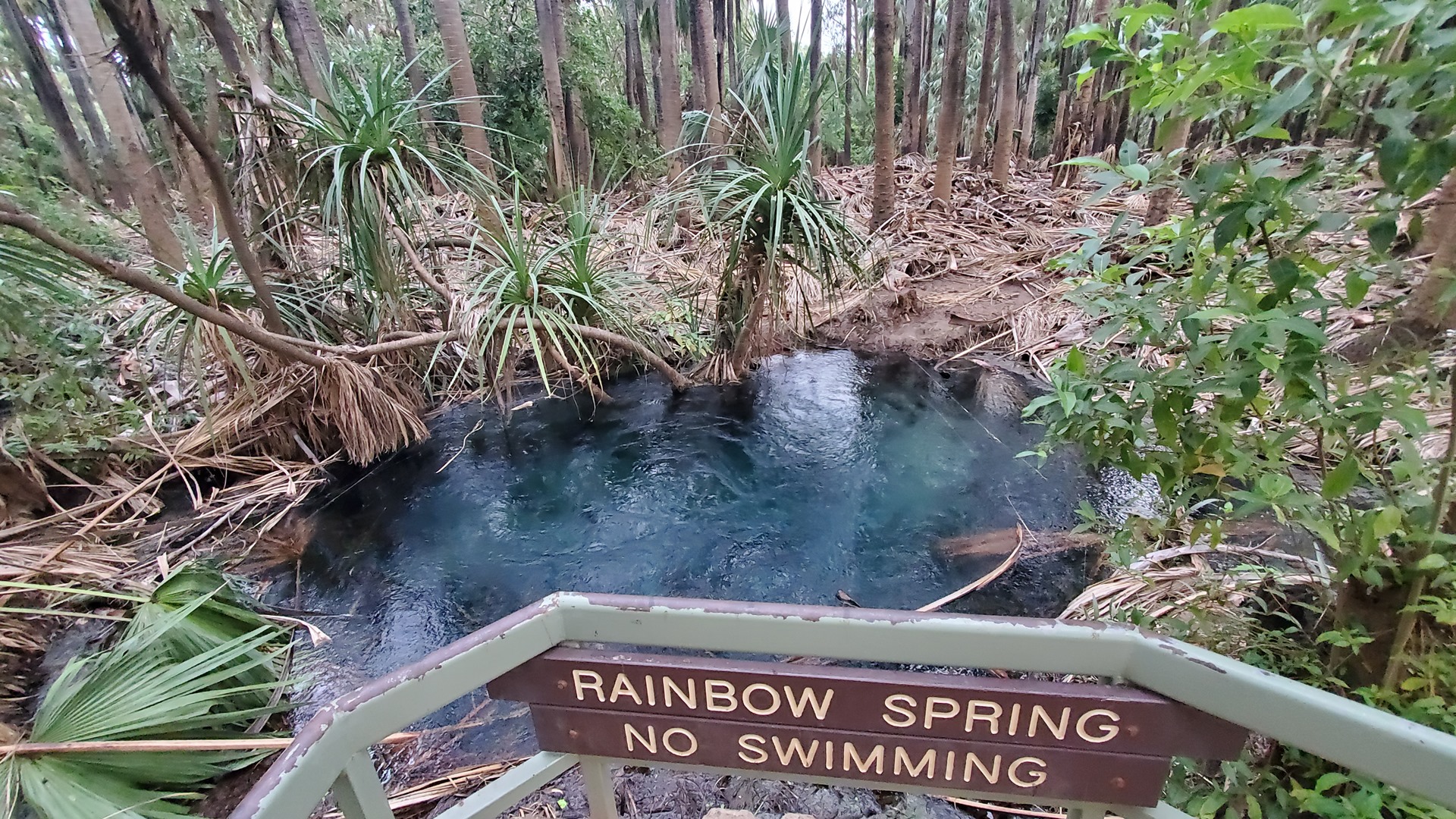
The pools at Mataranka are fed by groundwater heated to the temperature of the underground rocks, 30 to 100 metres below the surface, in the area (about 34c). In this regard they are not considered true “hot springs” as there is no specific hot spot heating the water. This water flows out of the ground in low spots, such as that found at Mataranka. More than 30 millions litres of water flow out of the Rainbow Springs, which feed Mataranka, every day; the water ultimately ends up in the Roper River.
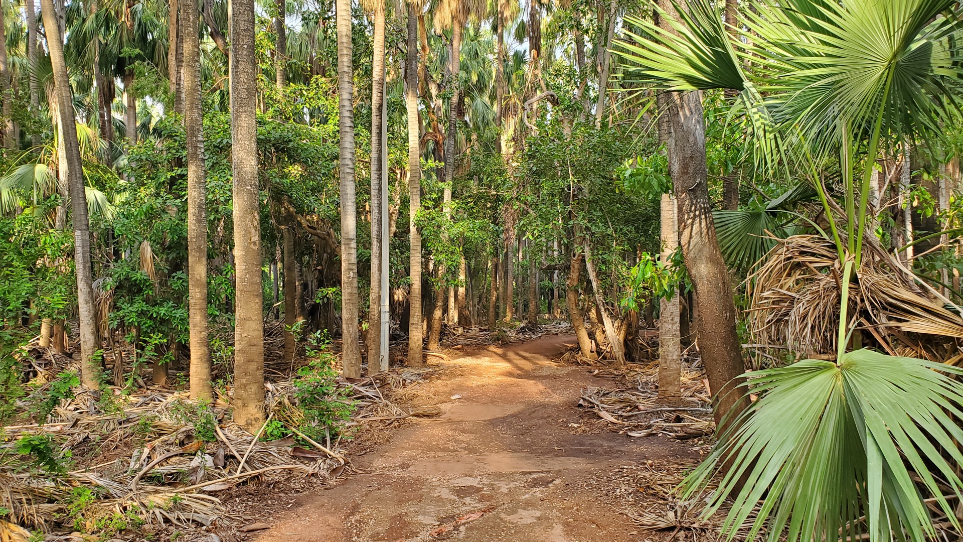
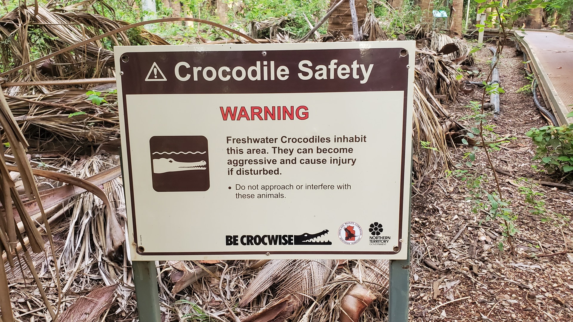
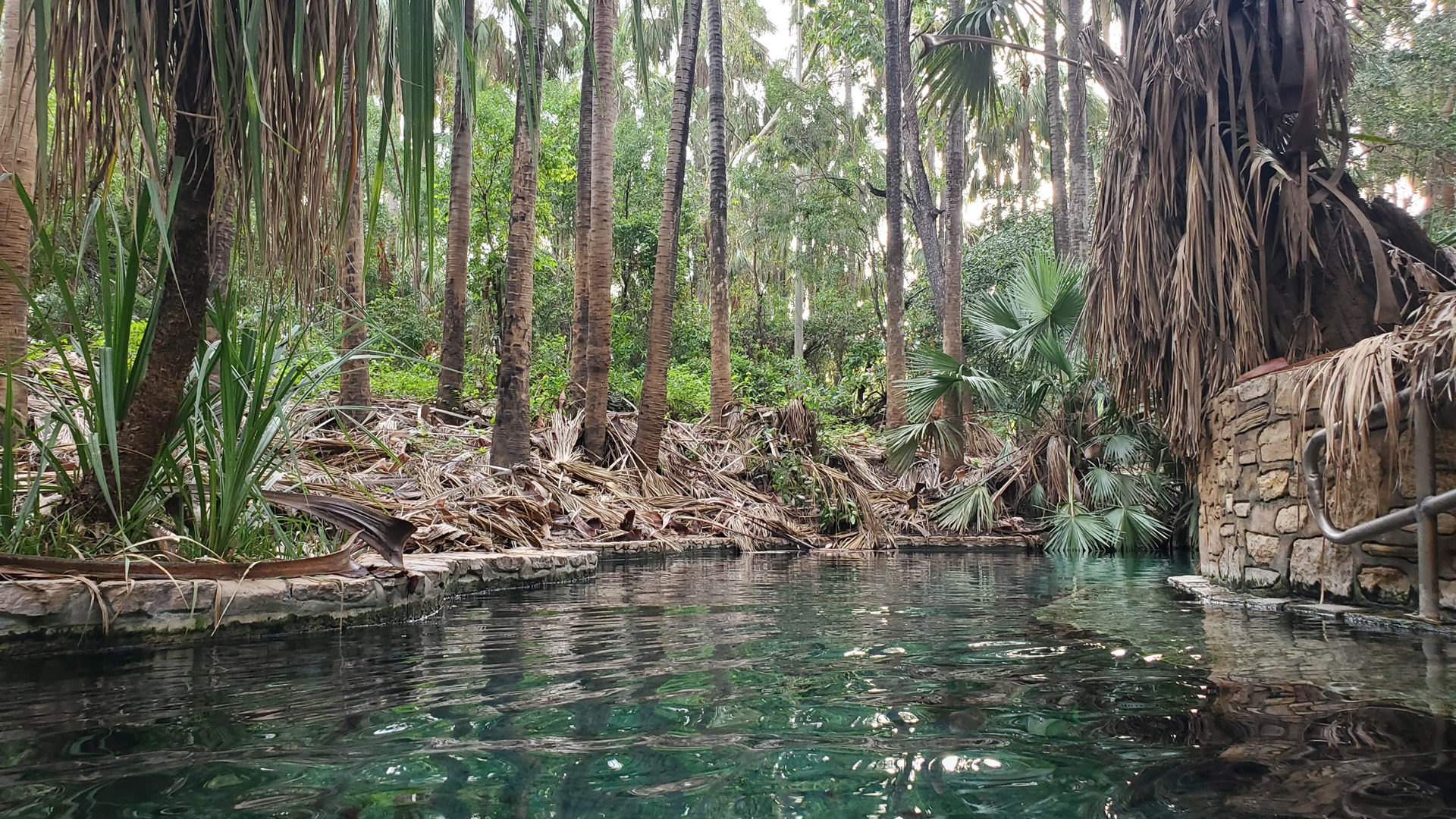
The springs are usually very popular, but with this being the start of the low season, they were completely deserted. It was a real treat to have a private visit! The springs have been developed rather more than many hot springs; the banks are lined with stone walls, and steps have been built at a few points along the edge. This helps to minimise sediment and keeps the water clear and clean.
After a little while floating around and relaxing, with no other company other than a man who spent 2 or 3 minutes down the other end of the pool, it was time to head back for dinner at the homestead before the kitchen closed.
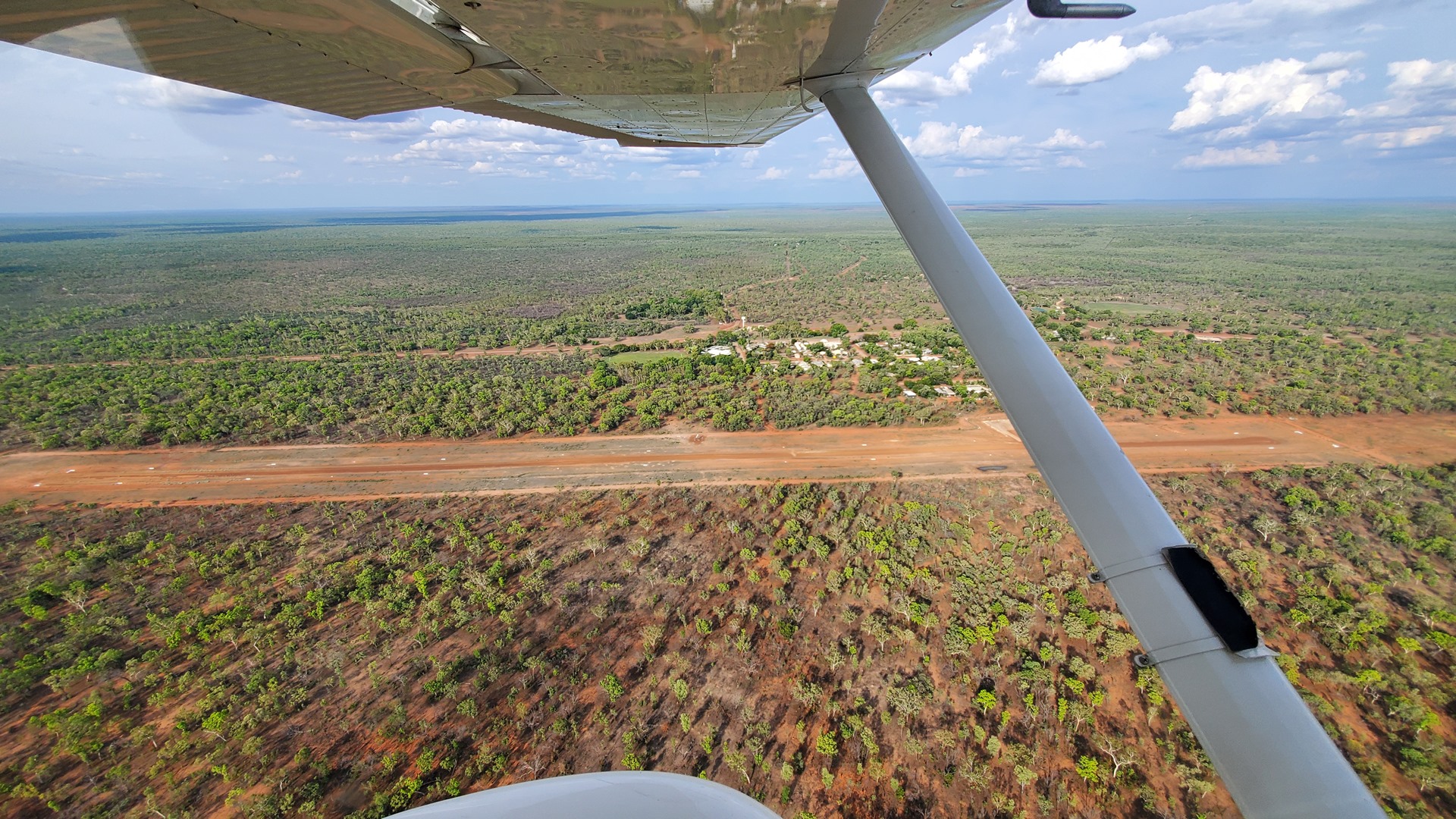
Steve provided a lift back to the community airstrip the following morning. As I pulled the cabin cover off I noticed a lady and her dog jogging along the runway and made a mental note to look out for them when the time came for take-off. With preflight checks completed, I guided Planey down to the other end of the runway for take-off. The lady had disappeared, so I pushed the throttle in and roared back down the strip, departing from the left downwind with good views of the community along the way.
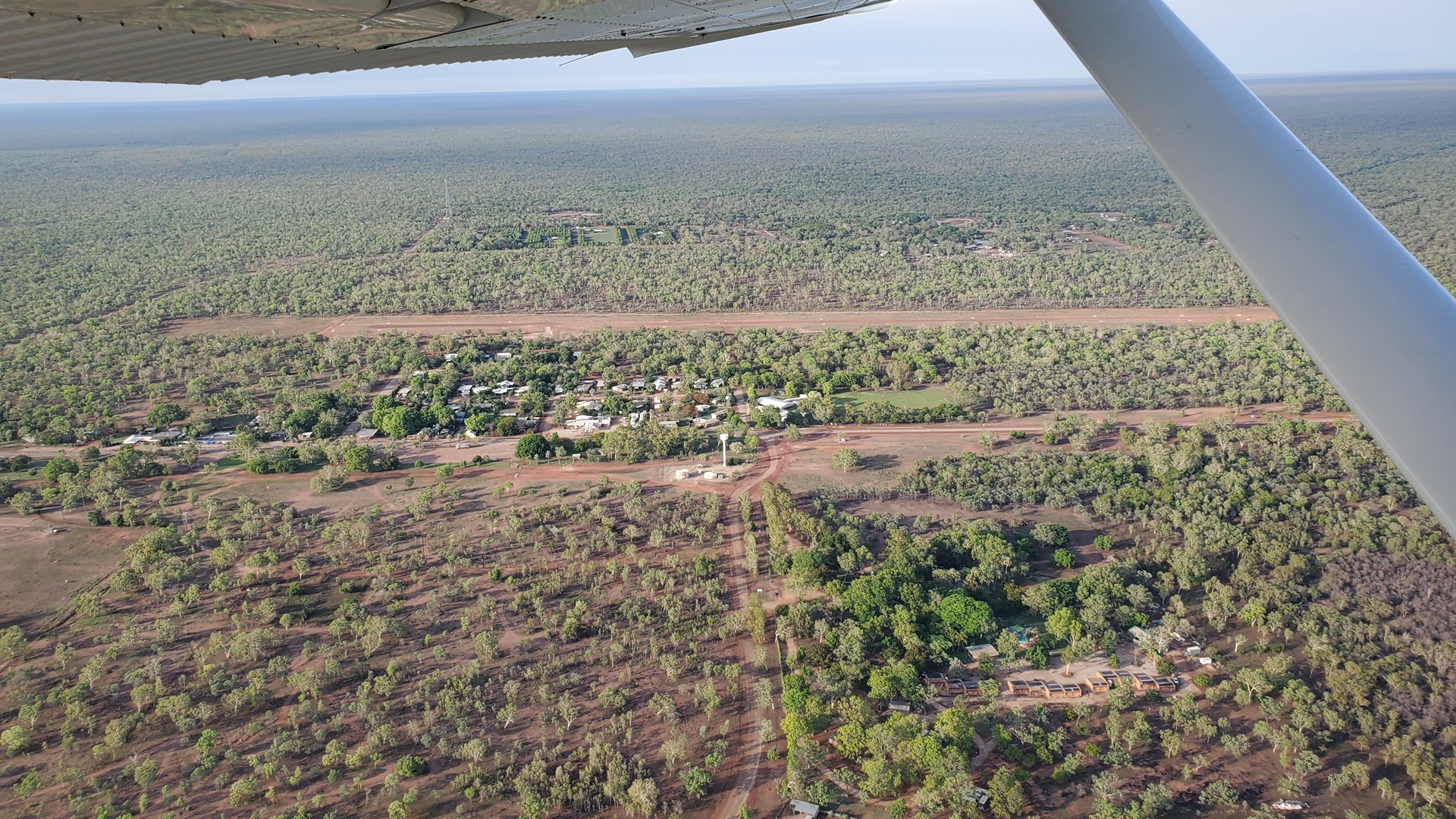
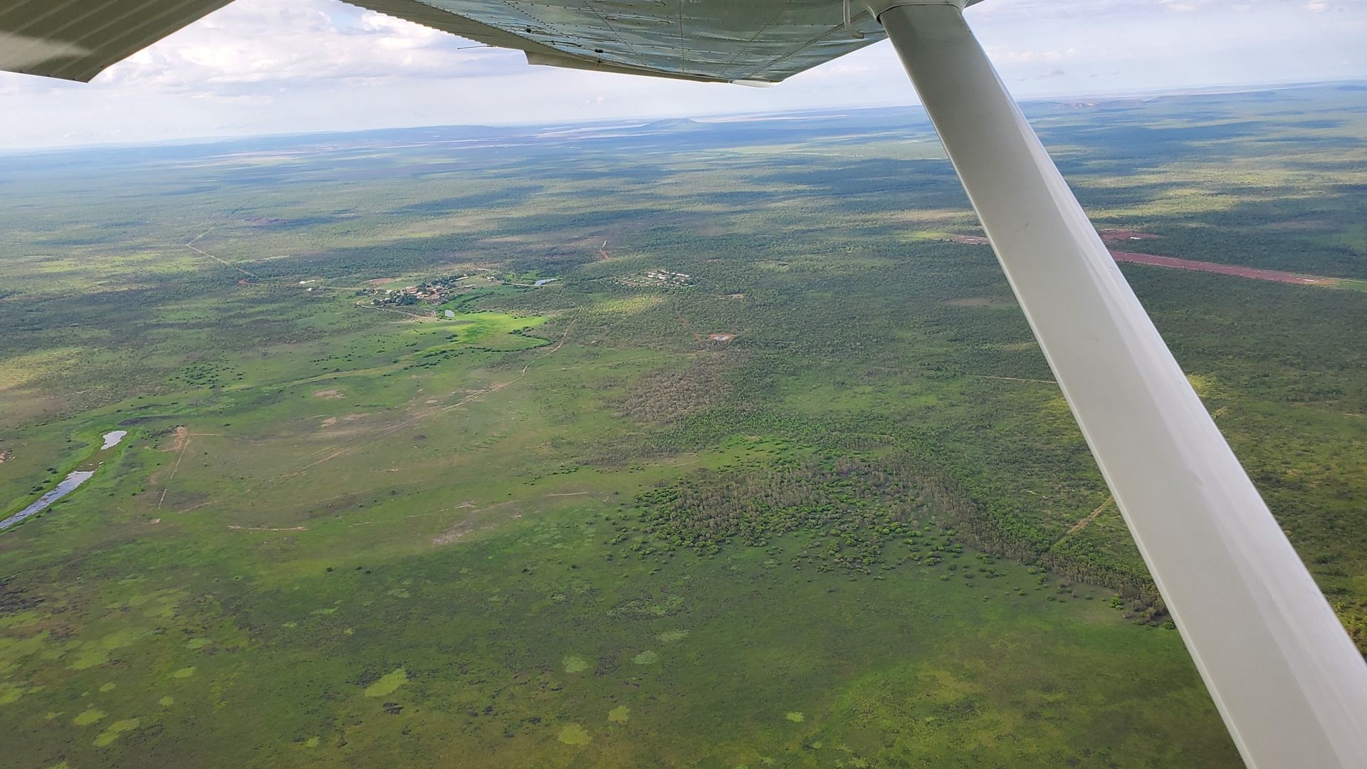
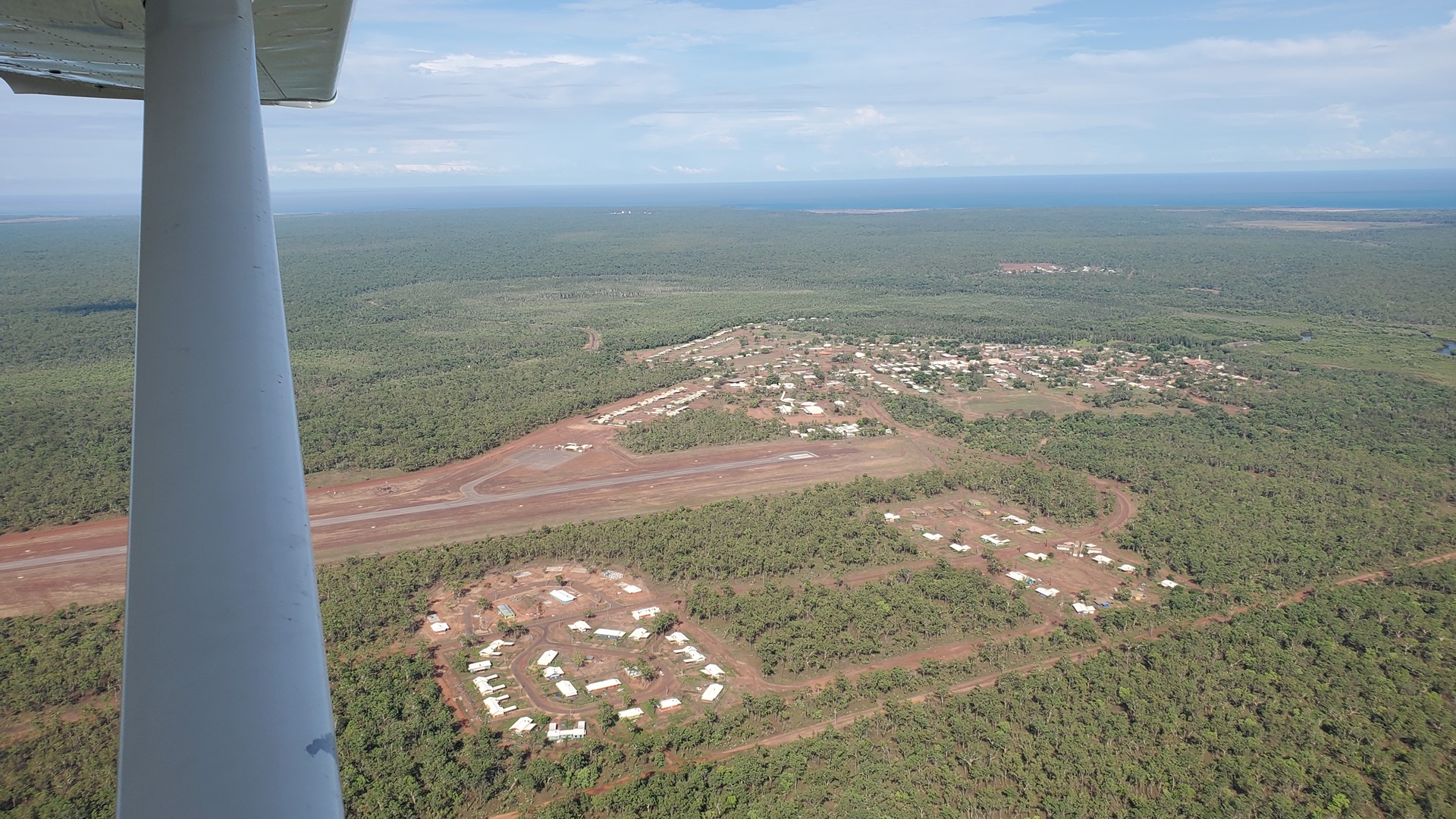
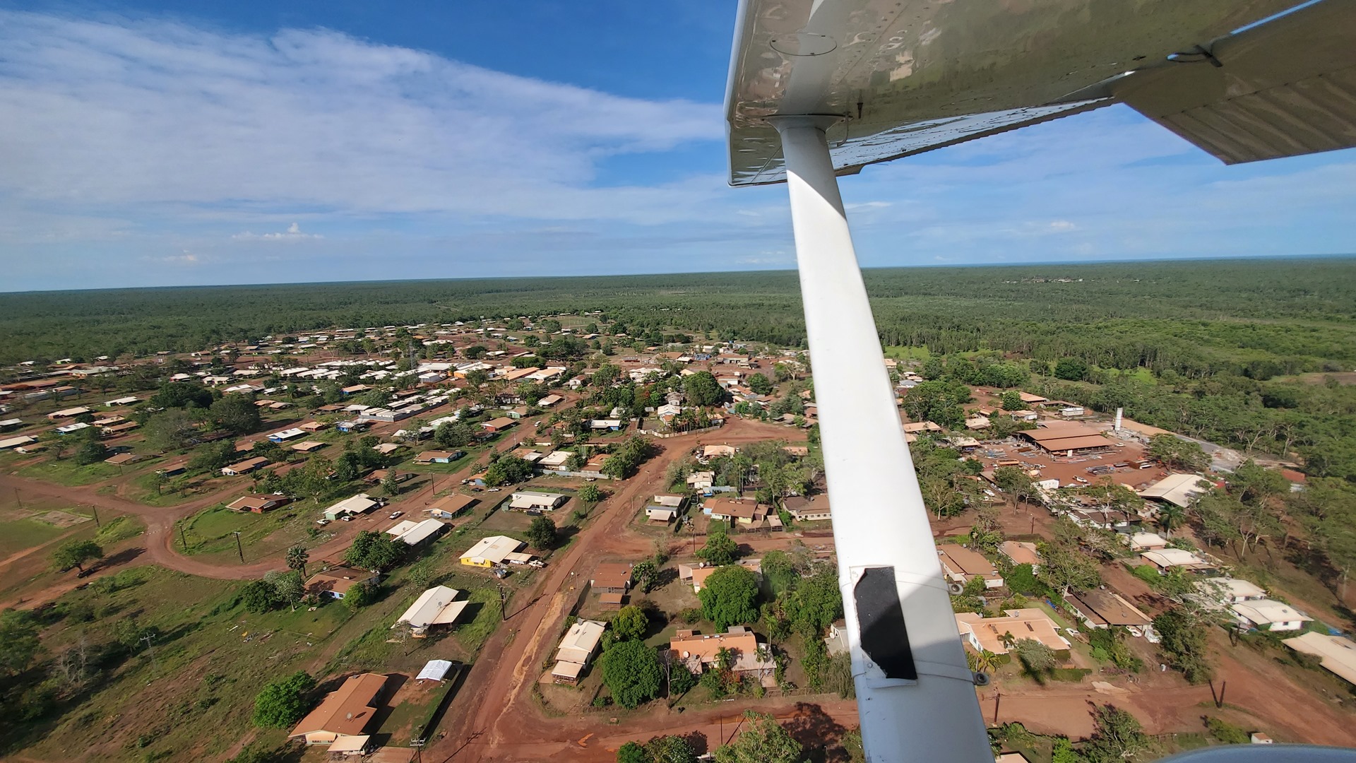
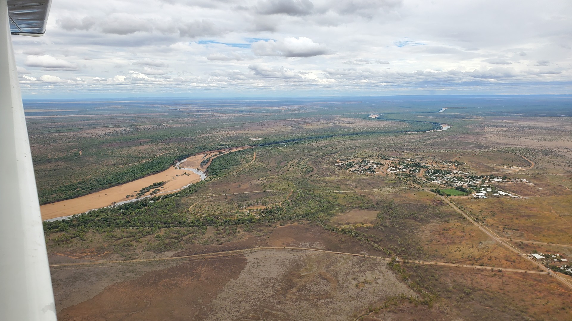
The day’s flying would take us in a westerly direction, entering into the state of Western Australia. Cloudy layers came and went along the way to the first pair of destination; these were the small community of Palumpa followed by the larger town of Port Keats, also known as Wadeye. The town was originally founded as recently as 1935, as a Roman Catholic mission which brought together more than 20 clans and seven different language groups; it seems that contrary to many missions, a lot of people moved to this one through choice due to the opportunities available there. The town is now the largest Aboriginal settlement in the Northern Territory with a population of more than 2,000.
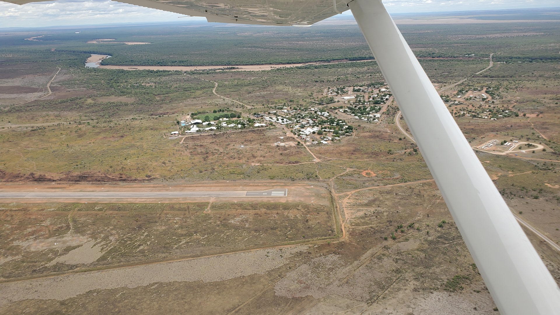
I parked Planey up off to one side of the little terminal, making sure I was well out of the way for the gaggle of commercial aircraft that would be on their way in a little later. An Irish gentleman was opening up the terminal building and getting ready for the arrival of these aircraft, and vehicles were starting to trickle in to drop off or pick up passengers. Port Keats was clearly something of a “fly-in, fly-out” destination for workers.
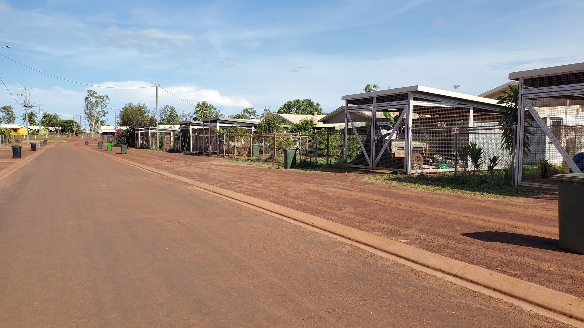
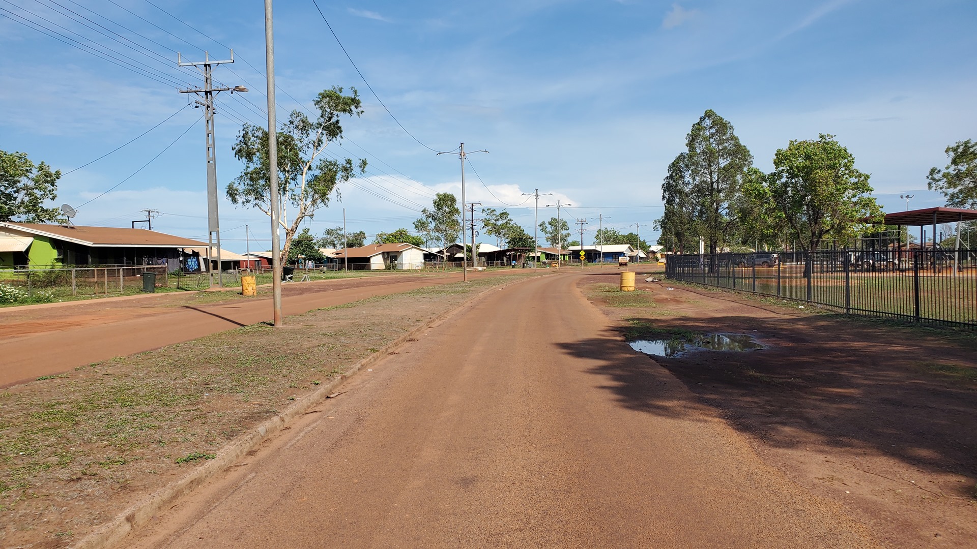
Google suggested that there was a store and café in town, which was just a short walk from the airport. The Irish chap suggested walking down the residential street which paralleled the main road, to avoid the dust thrown up by the vehicles heading for the airport. This was a good call, and as well as avoiding the dust it was an interesting walk; every home was fortified, each with a parking space completely enclosed with thick steel mesh. This was the first obvious sign of the trouble and criminality affecting the town and certainly made it a slightly nervous walk. Neither the store nor café were apparent, just a whole lot of people hanging around in the street, and a police car cruising up and down.
Upon arrival back at the airport, things had become busier. An air-ambulance King Air was parked in front of the terminal loading a patient, and a little commercial Cessna was parked up to the right of Planey. Another Cessna was taking off, and a third taxiing out to the runway. I steered Planey out behind them, back-tracked, and departed heading west. The flight led over the Joseph Bonaparte Gulf, named by French explorer and naturalist Nicolas Baudin in 1803, after the brother of Napoleon. It was a short crossing, and before long we coasted in over Western Australia. Unlike in 2020, there were no COVID permits or reports to the police to worry about this time!
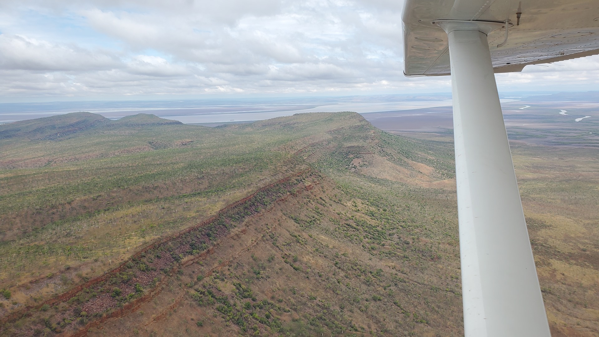
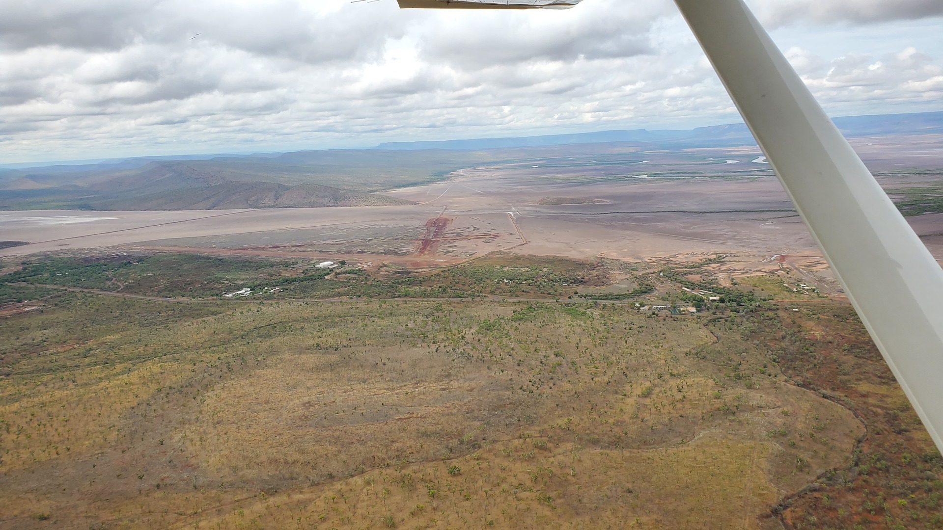
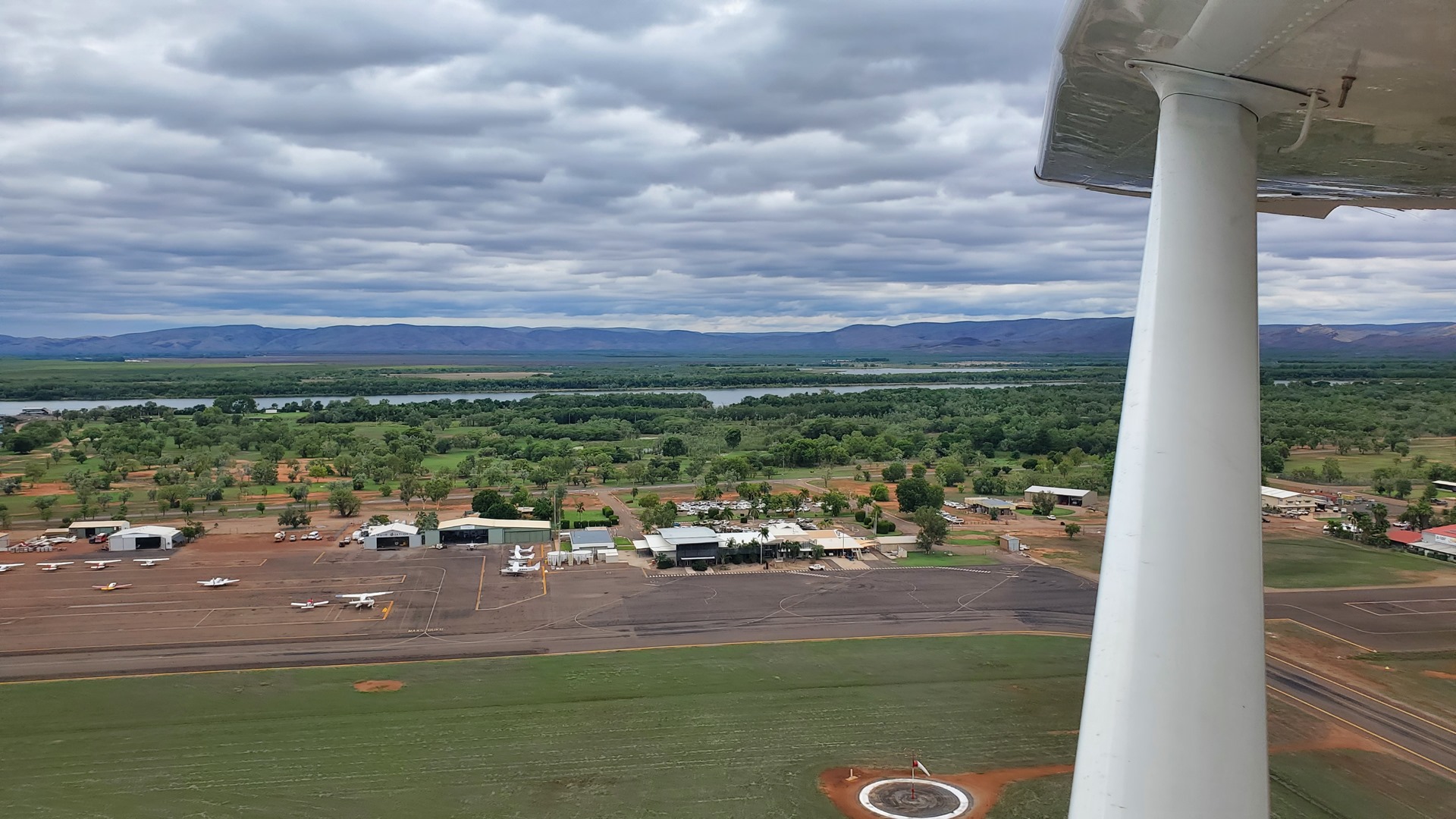
Compared to the first half of the day, the terrain below was now significantly more varied and rugged. The route led across the swampy shores, and then the east arm, of the Scambridge Gulf. A quick landing at Wyndham, just for the fun of it, was followed by a return to Kununurra which I had last visited on the 2020 flights. Fuel in this part of the country is scarce, and Kununurra was the only option along this section of the route. Despite still being listed in the official “ERSA” airport information pack, the self-serve AVGAS pumps had been removed in 2007; fuel was still available from the truck though and it didn’t take long to refuel and continue.
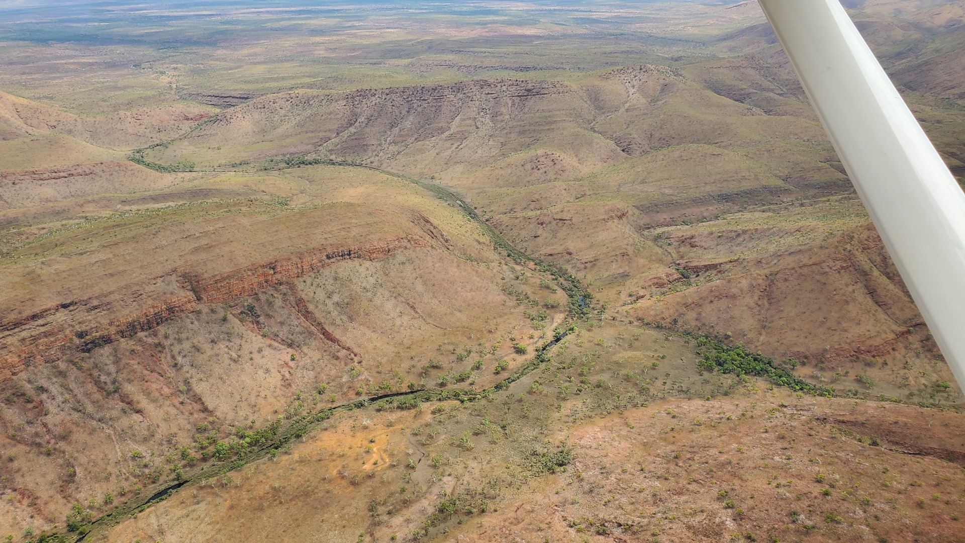
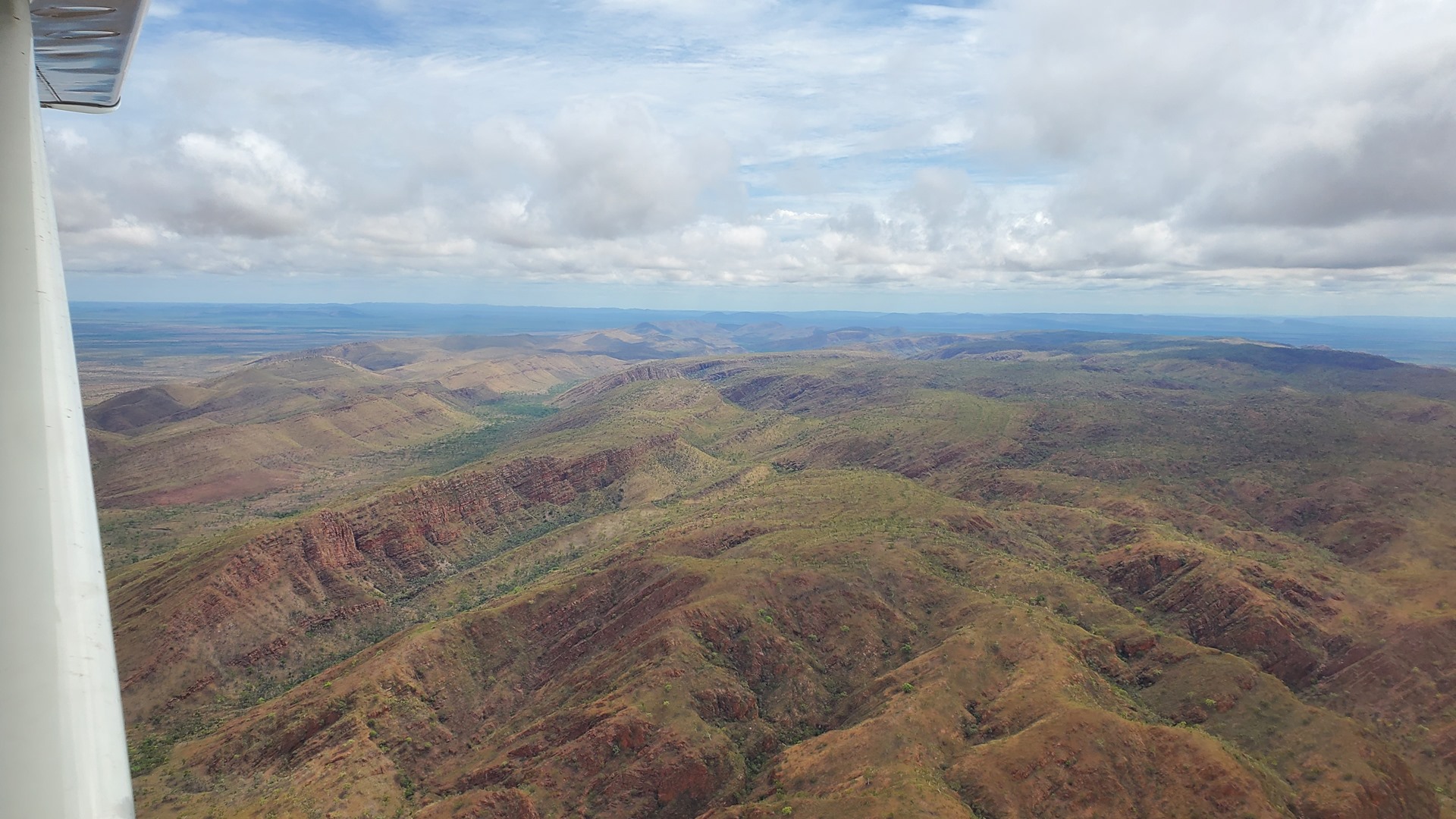
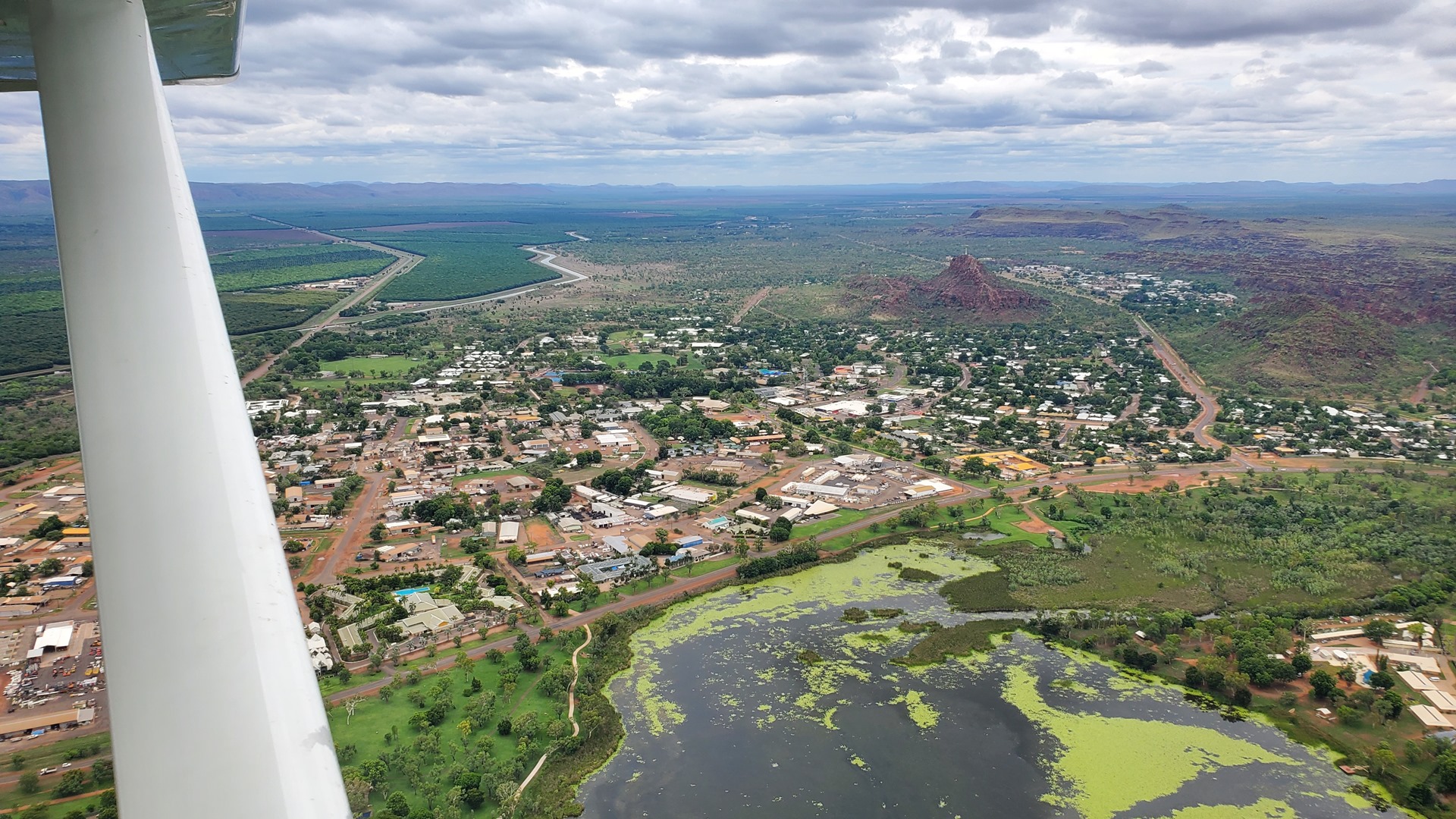
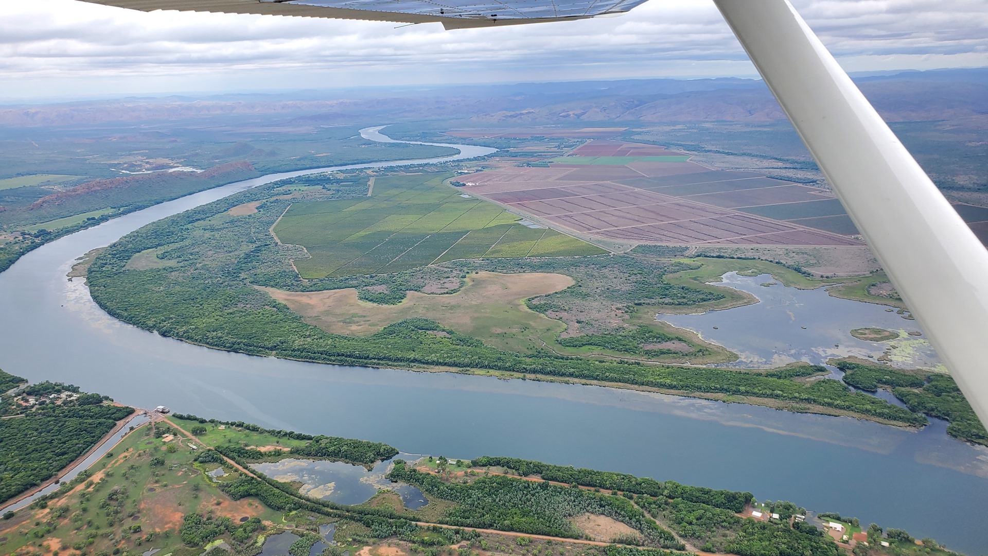
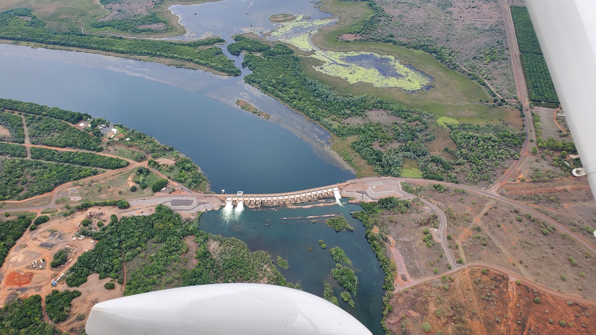
The area around Kununurra is wet and tropical, and cyclones are a constant threat. The land around the town is mostly covered by agriculture, mostly of which seemed to be fruit orchards. The route south led over a large reservoir, and back out into the deserts of Western Australia.

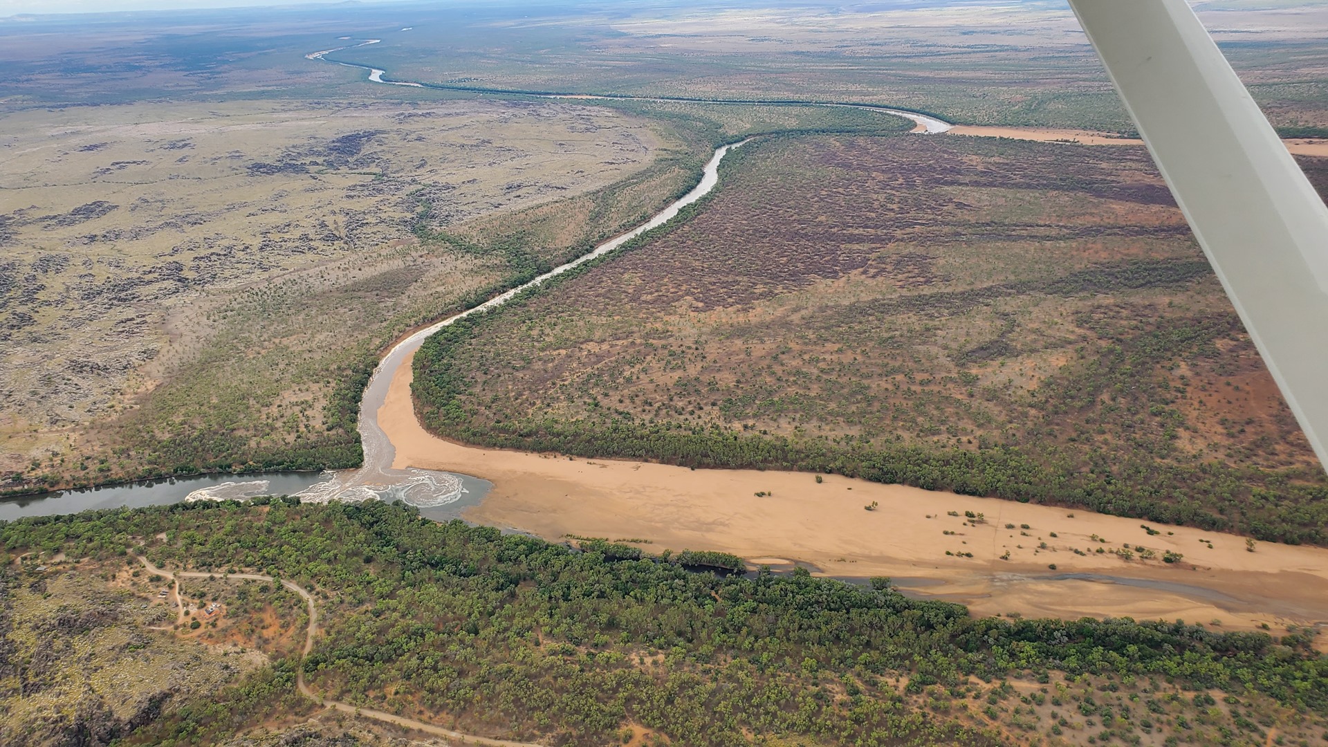
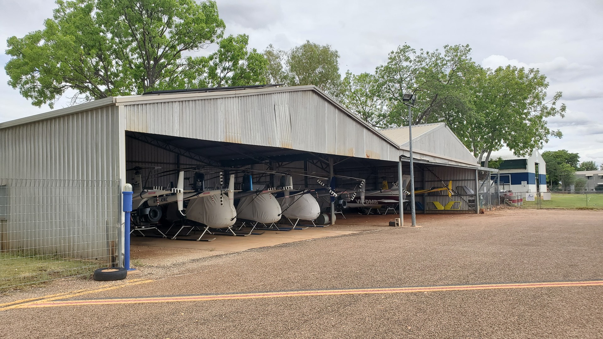
The weather south of Kununurra was cloudy, and this continued across much of the route. Things eventually cleared up close to Fitzroy Crossing, the day’s planned overnight stop. During the descent towards the town the junction of the Margaret and Fitzroy rivers was clearly visible, with a torrent of water from the Margaret just arriving at the Fitzroy in the form of a flash flood. I eased Planey down onto the runway and we taxied to parking, finding a space at one end of the apron with some tie-down rings available. There wasn’t much at this airport; the fuel pumps had been ripped out long ago, and there was only one hangar. This was full of little Robinson helicopters, used for mustering cattle in the vast open spaces of the outback.

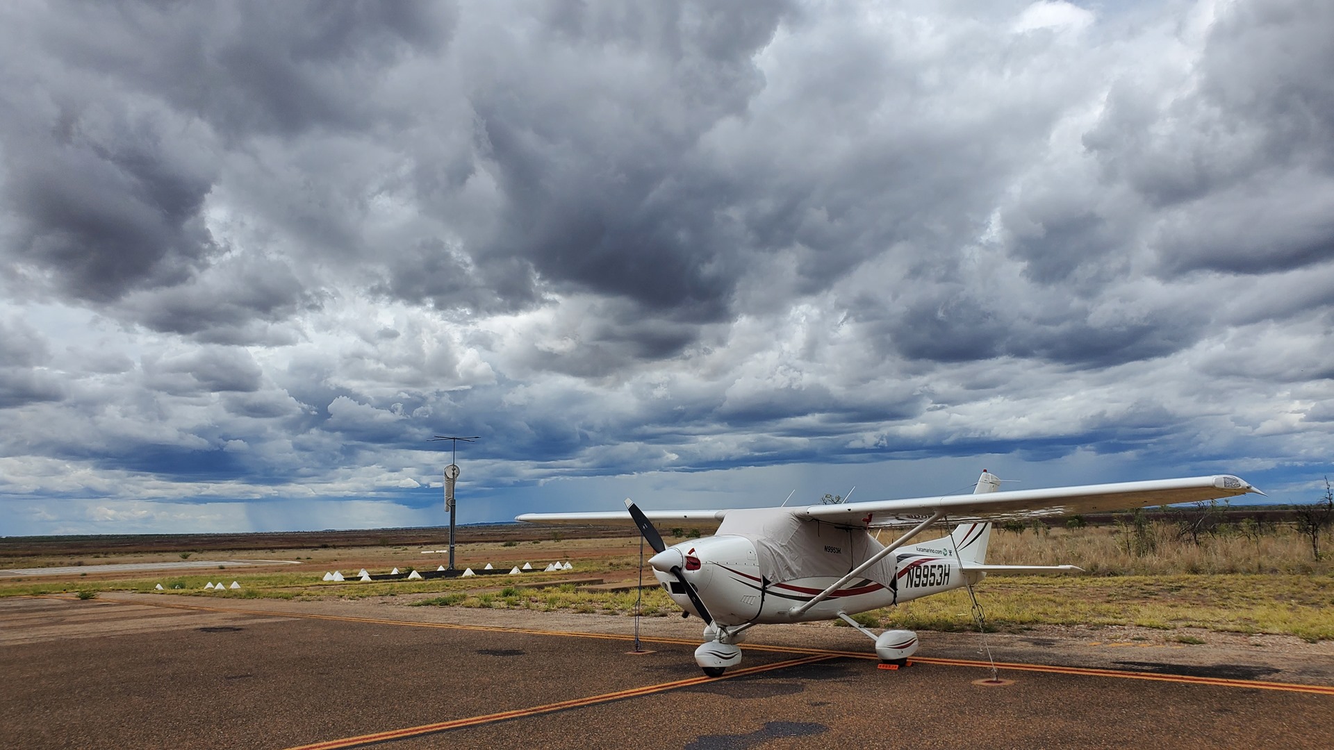
The sky looked ominous, and rain showers were visible in the distance, so I took the time to fit the cabin cover before exiting the airport and waiting for the shuttle van from the Fitzroy River Lodge.
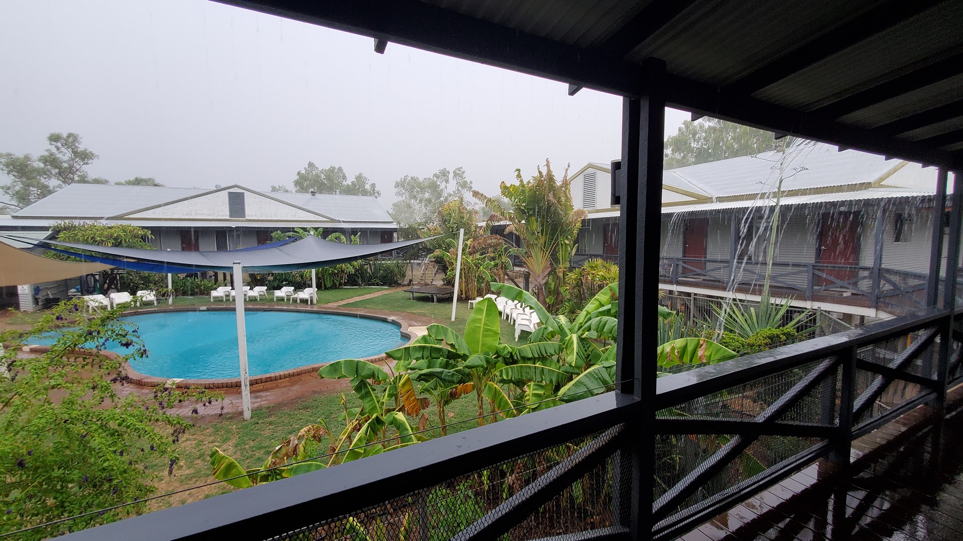
As the name suggests, the lodge is nestled right by the river. The flood risk is clear, given how the rooms are all constructed up high on stilts. Although rainfall is generally low here, the start of the wet season was approaching. I was happy that I had left the cover on Planey, as strong rain set in through the afternoon; the first real rain of the season, according to the staff. Many dry years end with a monsoon cloud mass or a tropical cyclone and this year was not an exception; just weeks after flying through, the region was hammered by Cyclone Ellie. The Fitzroy River rose to a record height of 15.81m (more than 50ft), and the town was hard hit, with the bridge entirely destroyed. The expectation was that it would be months before any kind of crossing was restored, and years to have a permanent bridge back in place. This was the only crossing of the Fitzroy in the region, so travel between west and north would now take at least a day longer.
All that, however, was still in the future. For now, I watched the rain fall before enjoying a BBQ chicken pizza in the lodge’s attached pub, with the football world cup playing in the background. Argentina lost, much to the dismay of the few Argentinians who had gathered to watch the match.
Click here to read the next part of the story.