Round the World – The Pacific, Part 11
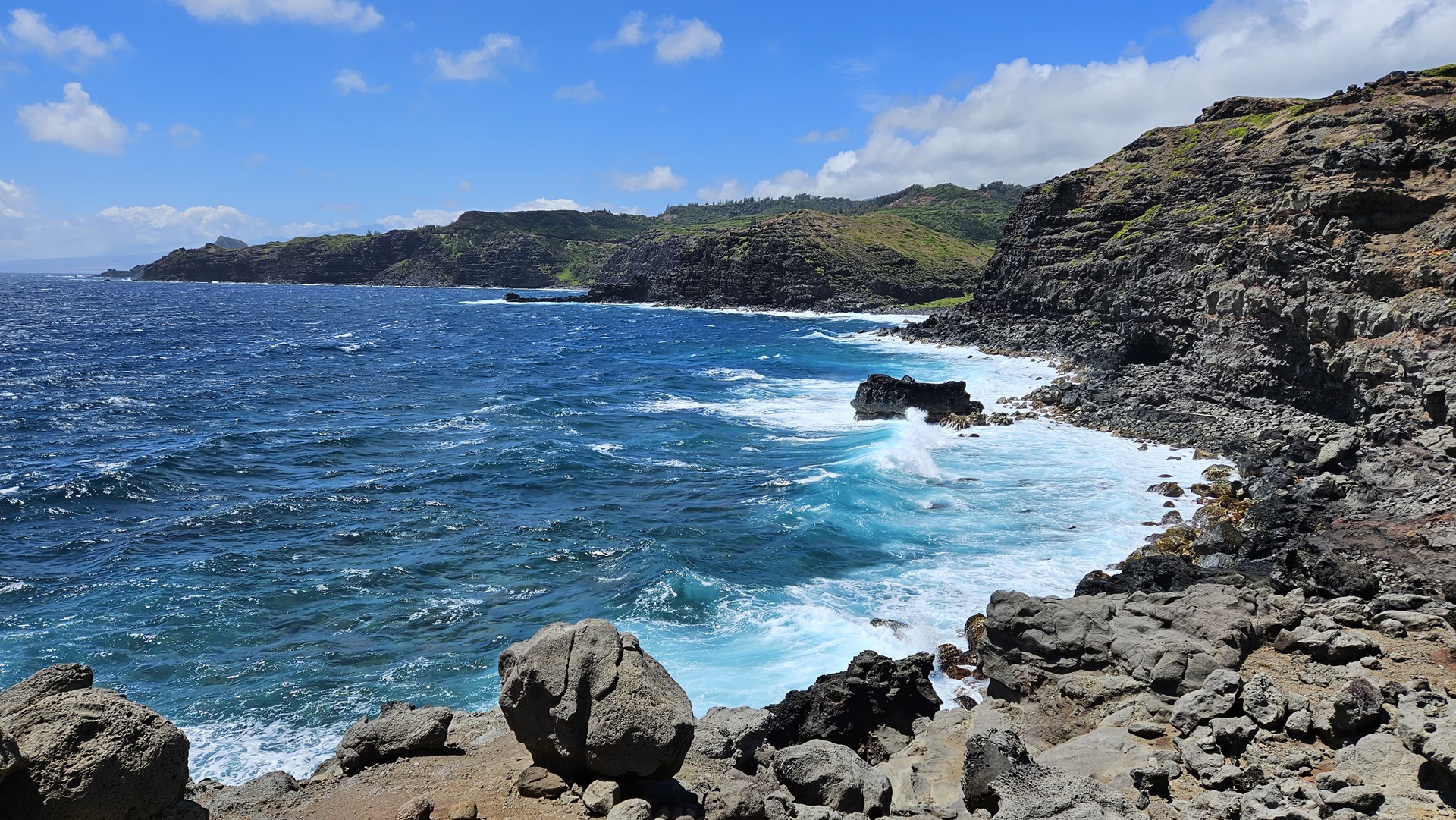
The next morning we breakfasted near the hotel before setting out again in the Tesla to make our way back to the airport. Instead of following the same route as we’d taken over the last couple of days we headed north, around the coast in the opposite direction. It was a longer drive but significantly more scenic – and significantly more winding! The road was single track in many places and speed was rarely over 25 mph.


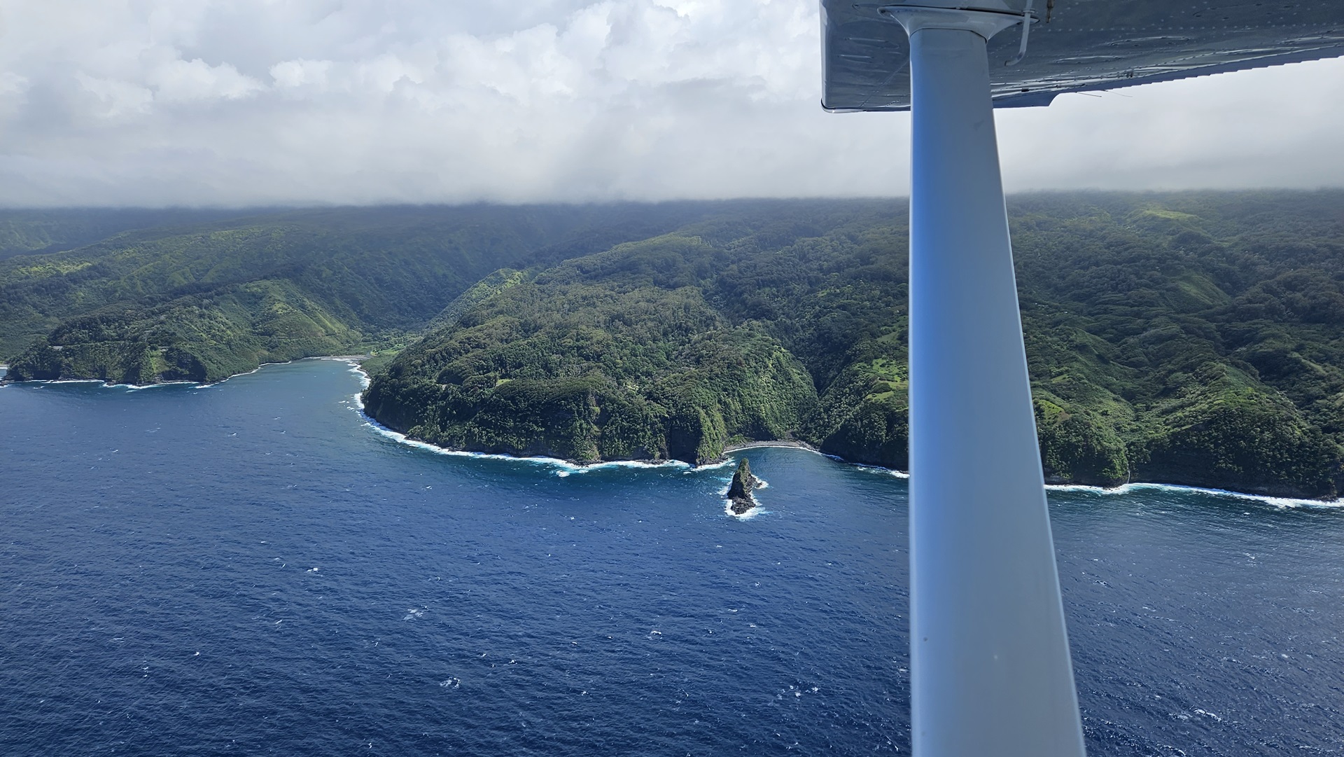
We returned the car with a little under 10% charge, and caught another Uber back to the General Aviation side of the airfield. Once again we had to call airport security and wait for them to come and unchain the access gate. They turned up quickly though, so we were soon fully loaded (including our Maui pineapples) and taxiing for departure. We took off and followed the northern coastline of Maui along to the east, paralleling the Hana Highway which we had driven the day before.
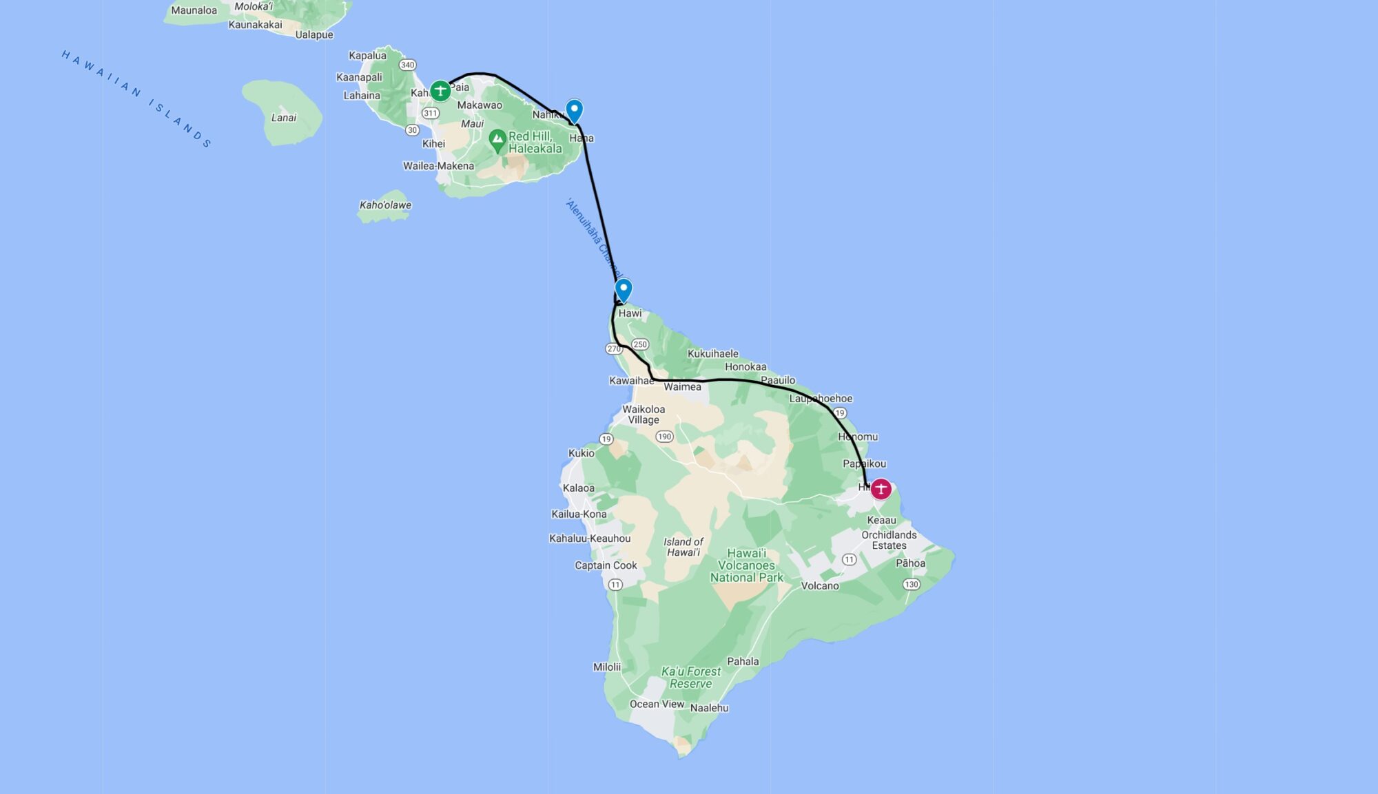
We took the opportunity to briefly land at the Hana airport before striking out across the Alenuihaha Channel towards the Big Island. While we were on the ground a Medevac helicopter dropped in to pick up a patient; a ten minute flight was much better for a critical case than a winding two hour drive.

A stiff wind was blowing once again as we crossed the channel south. The imposing volcanic peaks of the Big Island were clearly visible before we even left gliding distance of Maui. Our first stop on this largest of Hawaii’s islands was the small Upolu airport on the northern tip, before we took off once again and tracked the northern side of the island towards Hilo.
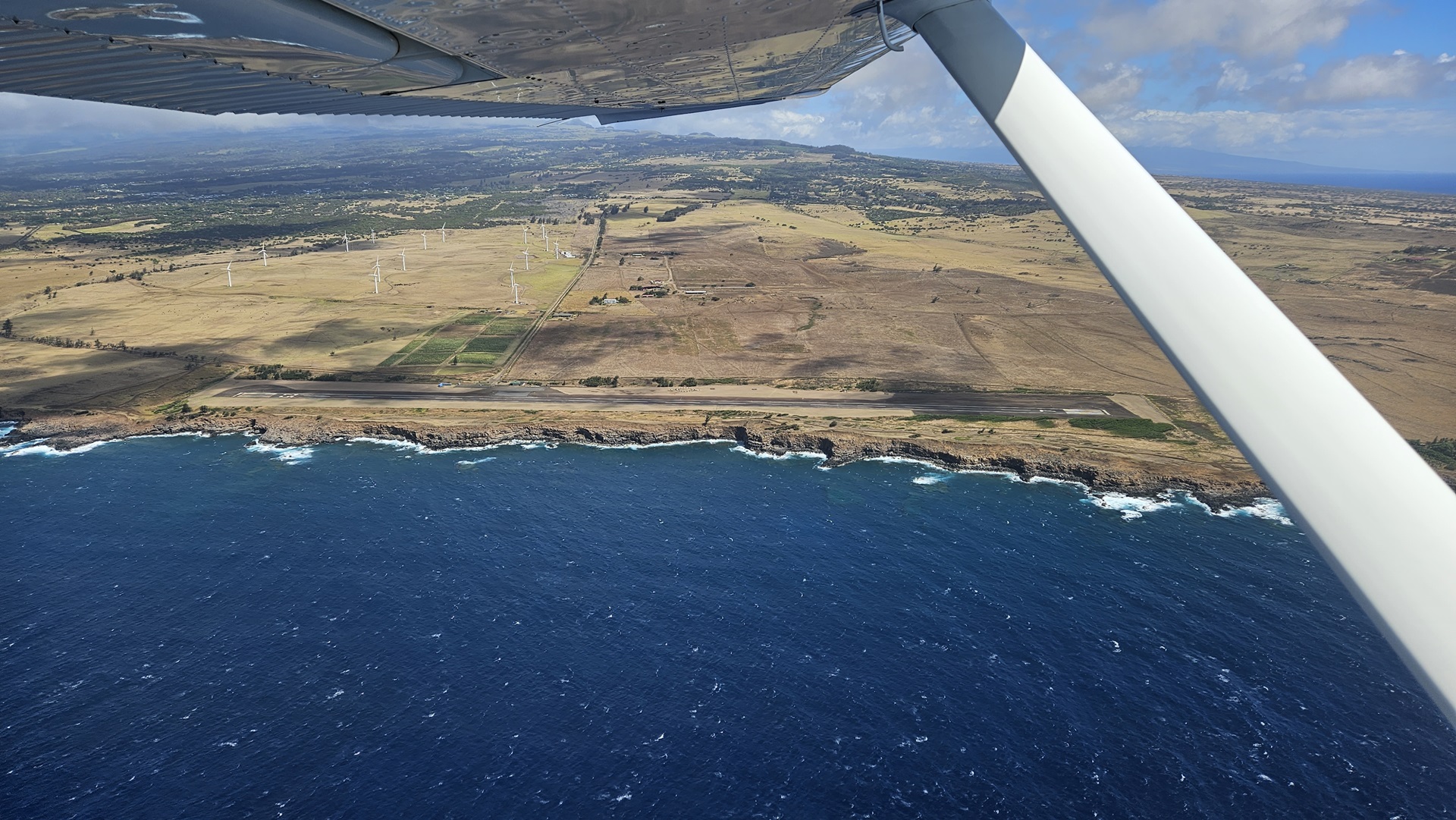

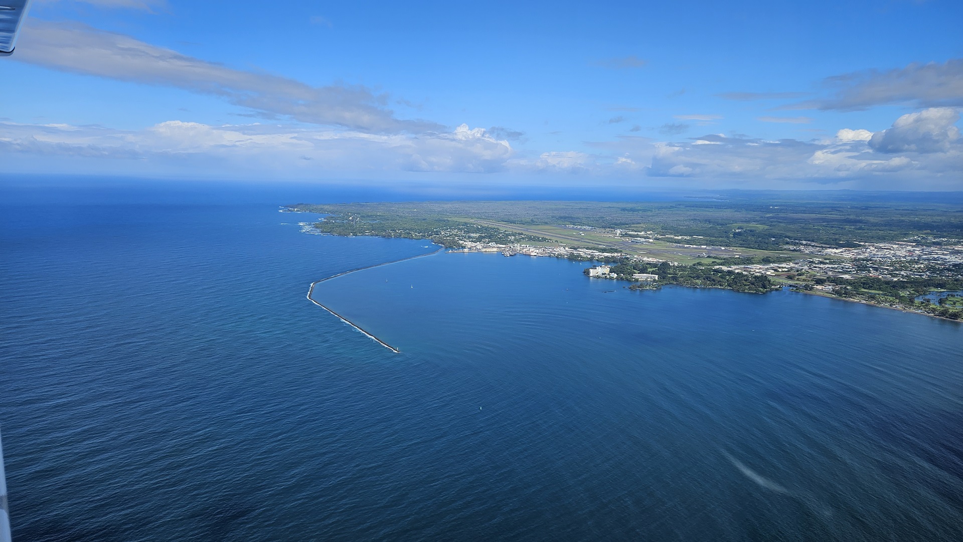
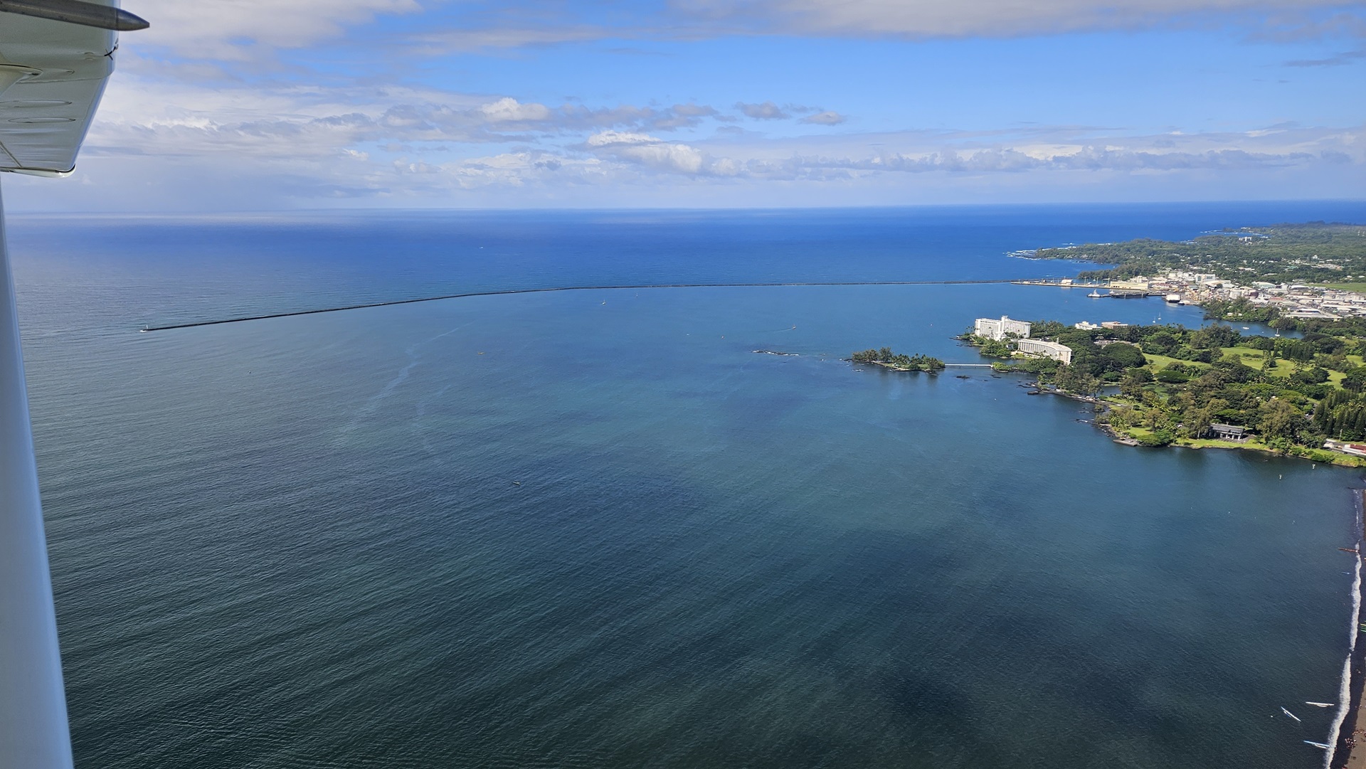
Hilo is the most easterly airport in Hawaii, and boasts all the features that I would need to enable my flight to the mainland: a mechanic who works on small aircraft, fuel availability, and a nice long runway. The first of these was needed to fulfil the requirement for the overweight flight permit that the aircraft be inspected before the flight in question. I also wanted to have a thorough check of the ignition system, given the transient failure of one spark plug on the arrival to Hawaii. I’d been in contact with local pilot and flight instructor Scott before arriving in the islands and he had given me a lot of very useful local information, including the details of the mechanic at Hilo. As arranged, we taxied straight to his hangar on arrival.


Richard the mechanic was waiting for us along with his son and a friend. We got straight to work, removing the cowls and spark plugs and draining the oil for replacement. Richard’s son serviced the plugs as Richard and I gave the engine a good going over, pausing only to go and collect my rental car from the terminal before they closed. We pushed on through a few rain showers, emptying the aircraft entirely and sorting the equipment into piles of what would stay with me, and what would go home in checked baggage on a commercial flight; I would be making the flight to the mainland solo, and with as little unnecessary weight on board as possible.
By the time we had finished the work on the aircraft it was after dark. We bought snacks from a local supermarket and enjoyed a peaceful night in the Inn at Kulaniapia Falls.
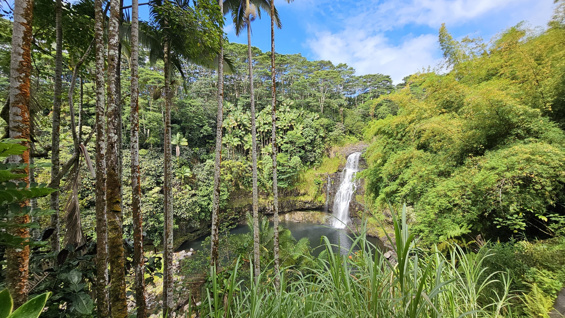
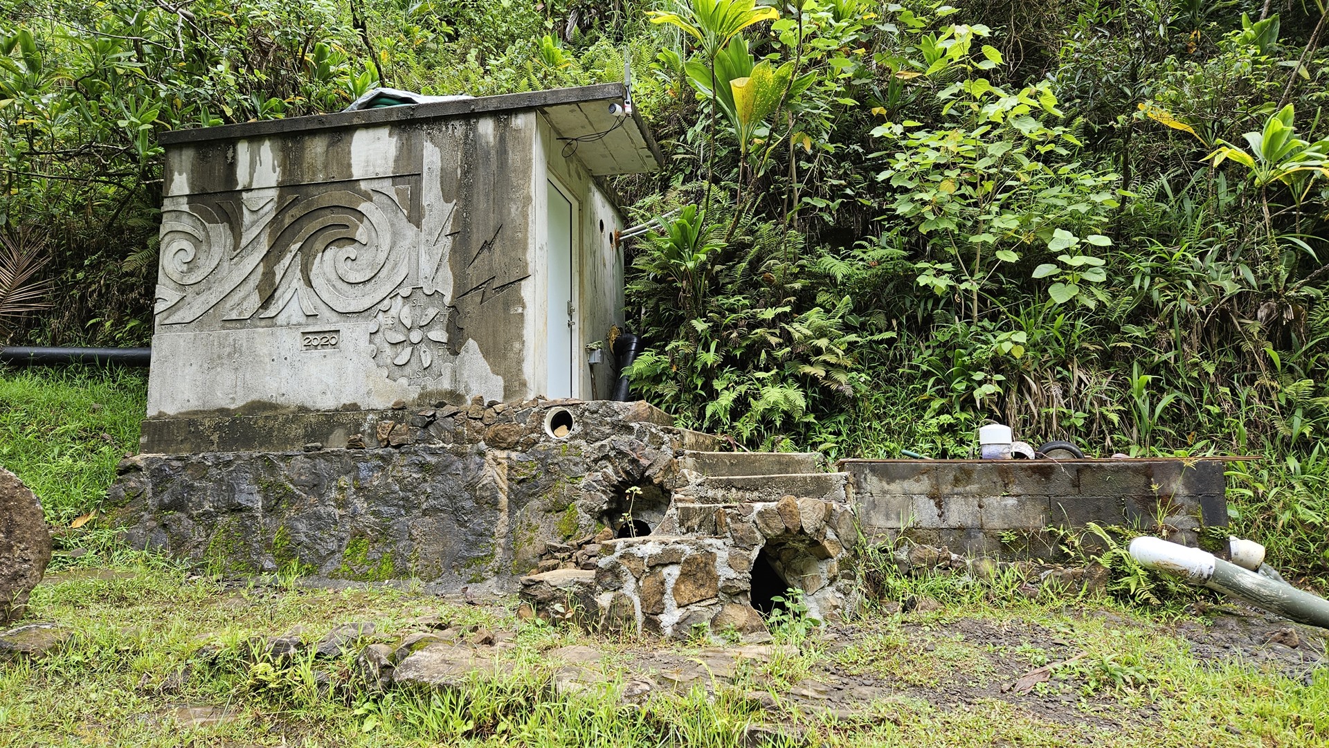
After a lovely B&B breakfast we walked down to the falls, where we came across a small pump house which seemed to be supplying water to the Inn. Returning to the Inn, we loaded up our rental Jeep and headed out to explore some of the Big Island.
Our first destination was Hawaii Volcanoes National Park. This park and UNESCO World Heritage Site is enormous, with an area of more than 1,300 square kilometers. Such is the huge size of the US however that this only places it at a rank of 24th in terms of size among the national park system. The park encompasses two active volcanoes: Kilauea (one of the world’s most active volcanoes) and Mauna Loa, the world’s largest shield volcano.

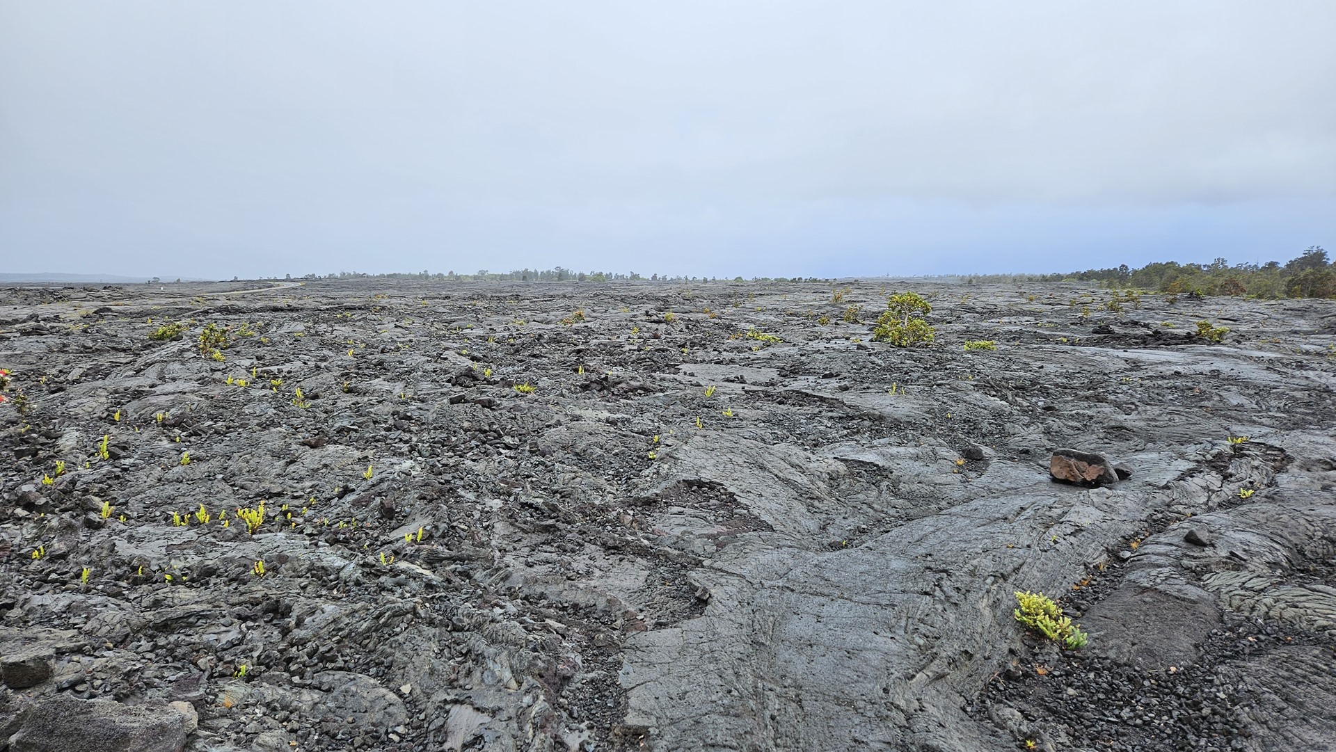
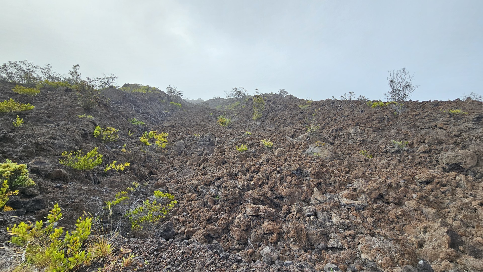
We started our visit on Chain of Craters Road. This road leads south from the entrance and winds past multiple fascinating volcanic features. The first which we visited was the “Devastation Trail”, a short walking path through a cinder field which very clearly demonstrates the destructive nature of volcanoes. This particular cinder field fell from an eruption in 1959 and is only now starting to show obvious signs of natural restoration.
We continued driving through the scrub forest that populates this part of the park, regularly broken by lava flows of various ages and the occasional small volcanic caldera, now dormant or extinct. Soon we came to the top of a steep escarpment, with views of lava flows of various vintages stretching down to the coastline. The road wound its way down the slopes to parallel the coast.

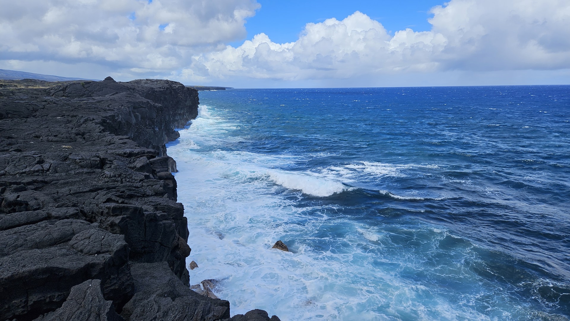
This road used to continue along the shore and exit the park to the east, but has been cut multiple times by lava flows through the years. These days the road is kept open as far as the Holei Sea Arch, but beyond that is maintained as a single lane dirt road at most, mainly for emergency access to Lower Puna. This residential area sits outside of the park to the east, and is at risk of being cut off by lava flows on the other side of the settlement, resulting in the need for this secondary route.
We backtracked up the slopes and along Chain of Craters Road almost to the park entrance, stopping to visit Nahuka, also known as Thurston Lava Tube. Five hundred years old, this tube was formed by the flow of lava at temperatures of 1,100 C, or 2,000 F. It was discovered in 1913. The outer layers of a lava flow cool quicker than the center, forming a solid crust through which molten rock continues to flow. When the molten core flows away once an eruption ceases, a lava tube is left behind.

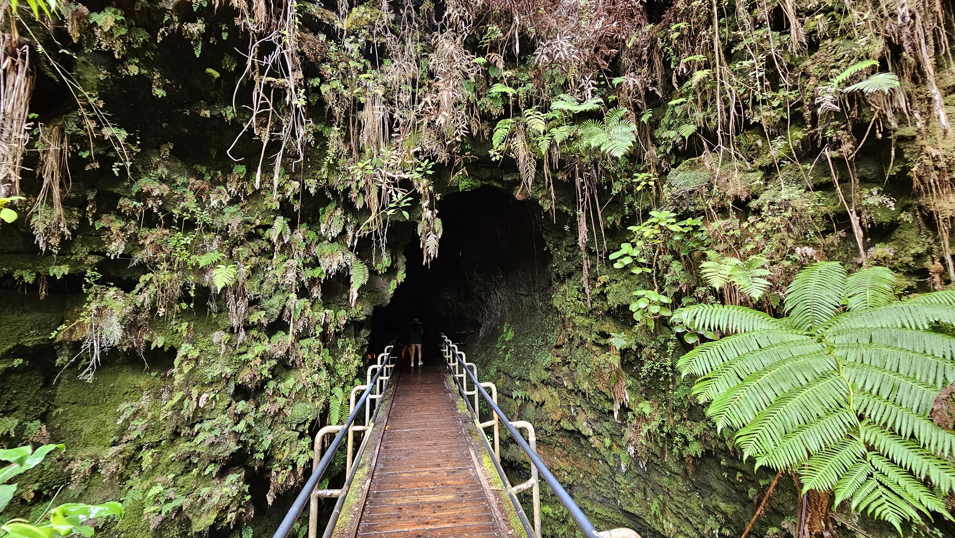

The Thurston lava tube is accessed along a walking path through lush rainforest. One can walk through a section of the tube 600 feet in length, although the tube itself extends much further. The inside is lit from 8am to 8pm but if you want a more “authentic” experience you can go outside of these hours and enjoy the darkness!
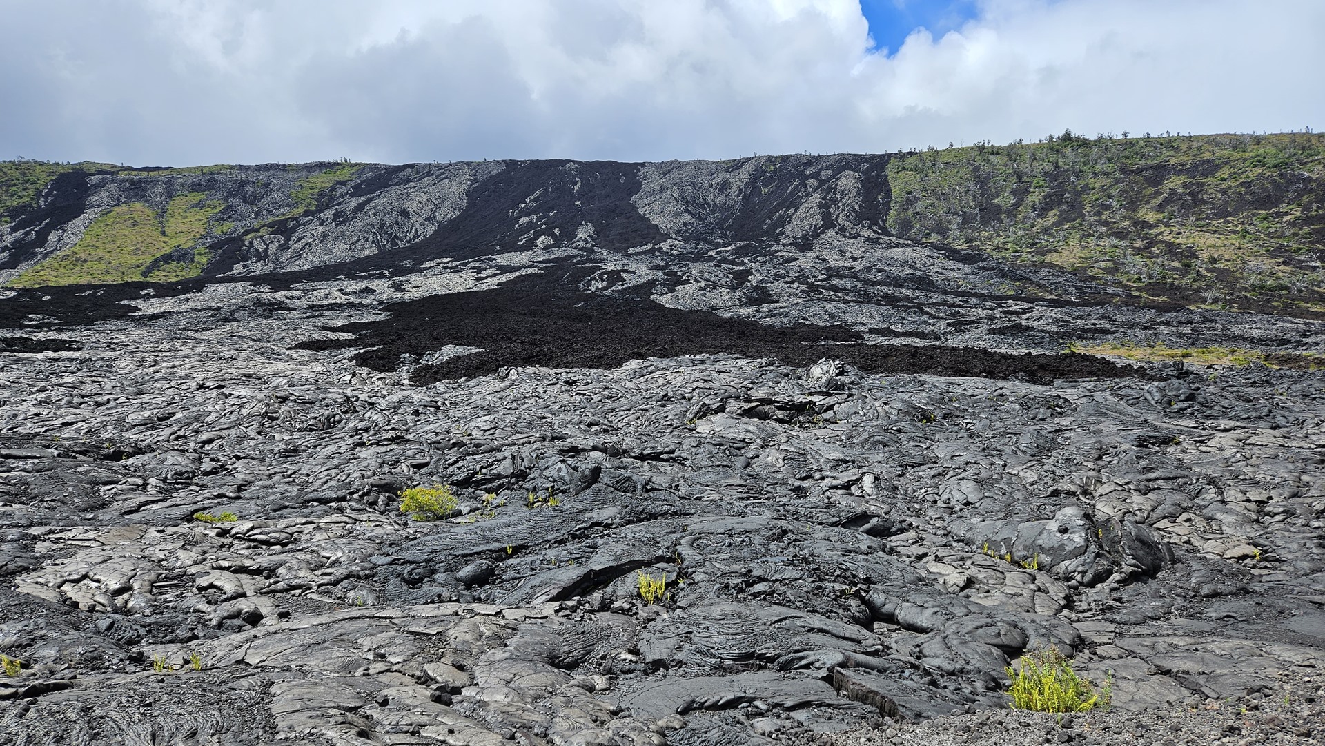
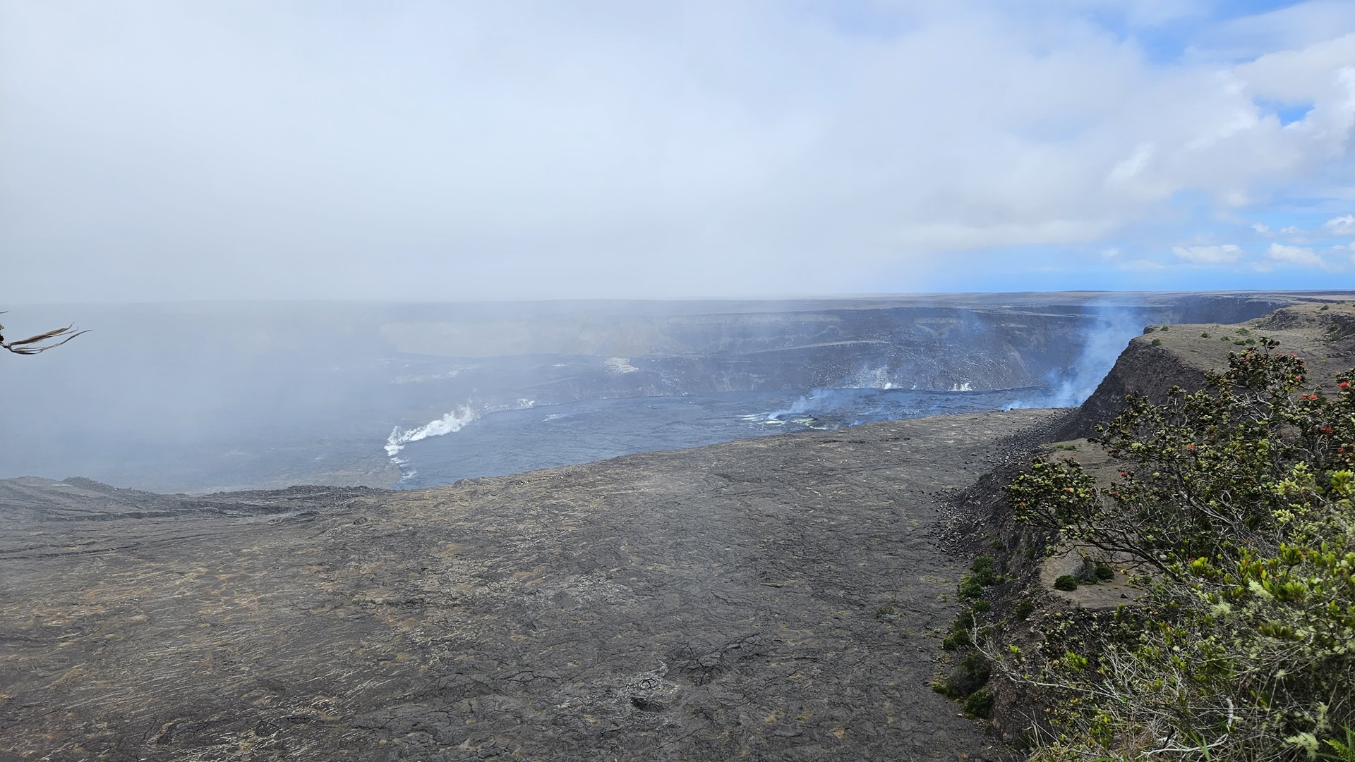
From the lava tube we made our way to Kilauea crater. A shield volcano of about 250,000 years in age, it emerged above the ocean about 100,000 years ago and is the most active of the five volcanoes which form the island of Hawaii. Regular eruptions of various intensities, the most recent being just a week before our visit, have caused significant destruction to the area over the years including the famous destruction of large parts of the nearby Leilani Estates in 2018. Although no lava was visible at this time, a multitude of steam vents gave evidence to the volcano’s active status.
Rain showers were sweeping through and it was surprisingly cold; although close to the equator, we were up at an elevation of 4,000 feet. We returned to the car and headed further into the park, climbing the slopes of the famous Mauna Loa volcano to reach the Mauna Loa lookout at an elevation of 6,662 feet. On clear days this point offers beautiful views over the slopes of Mauna Loa and historic lava flows to the sea; today was not a clear day, and we mainly saw thick cloud flowing around us!
The following morning we set out to drive the road to the summit of Mauna Kea. This is not a straightforward drive, featuring large portions of unpaved road on the way up to 13,803 feet above sea level. There is a visitor center at an elevation of 9,300 feet where there is a mandatory minimum wait time of thirty minutes enforced by the national park rangers. This is to stated as being to allow visitors to partially acclimatize to the elevation although the length of time seems rather short for this; I suspect it’s more useful as a way of weeding out anyone who starts to show symptoms of elevation sickness before they go higher.
Whatever the reason, the rangers would not allow us to go up further. Despite having four wheel drive, which is mandatory, we had just under half a tank of fuel! They are very conservative in their requirements so we headed back down with plans to return the following day, and turned west to visit the other coast of the Big Island instead.
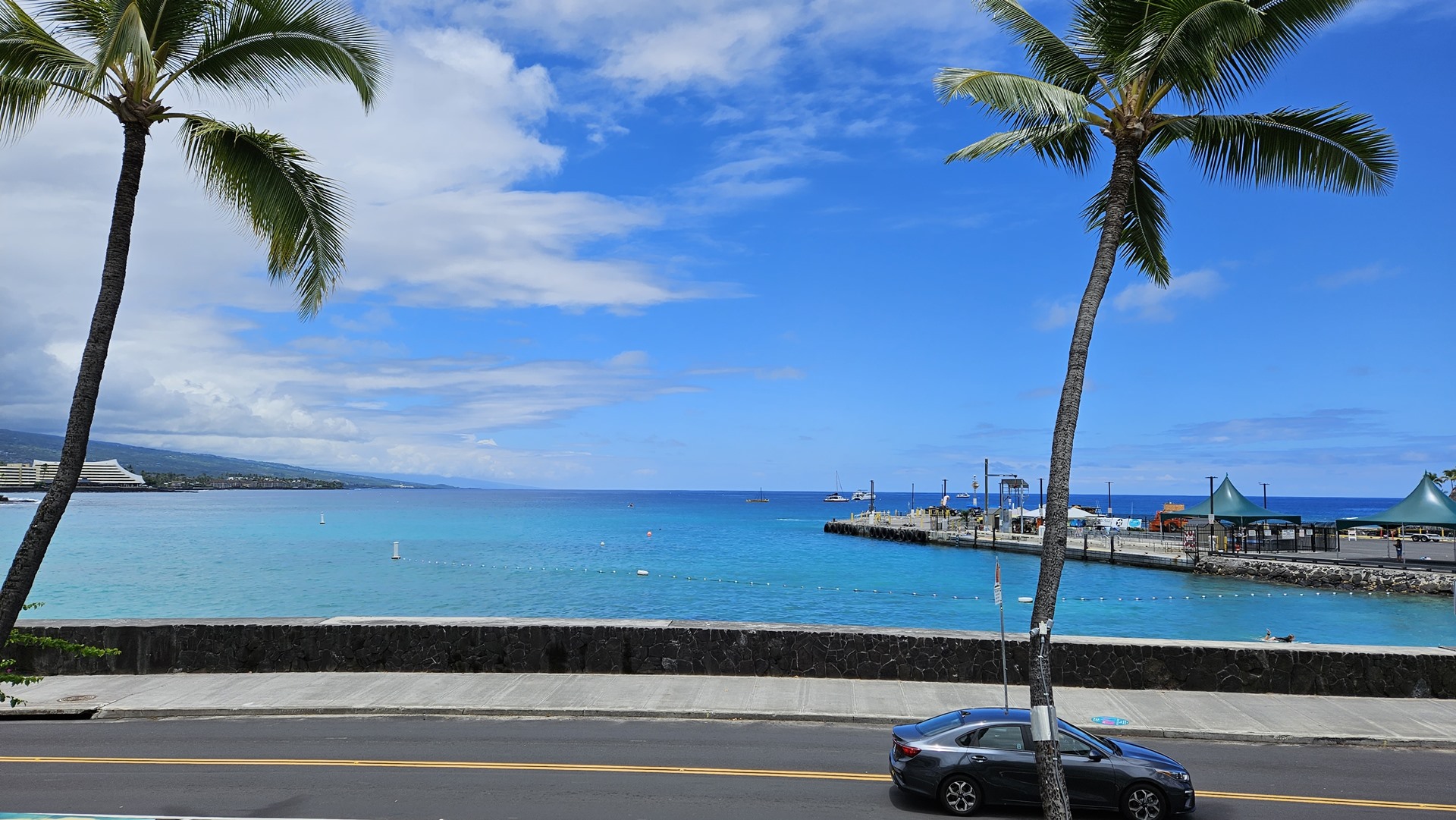
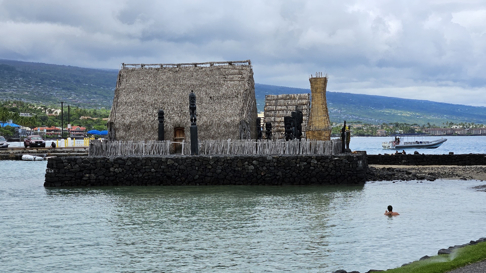
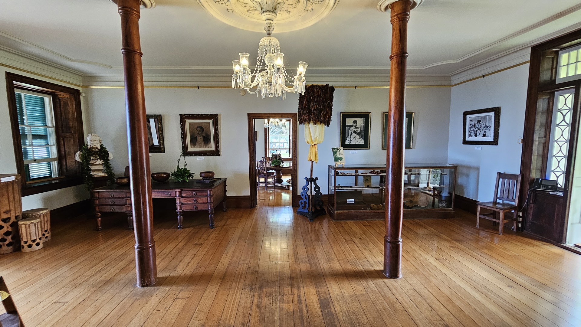
We drove into the town of Kona and had lunch on a restaurant balcony overlooking the waterfront, Pina Coladas included. From there we walked along the shorefront and dropped in to visit the Huliheʻe Palace. The palace was originally built out of lava rock by John Kuakini, the governor of the island of Hawaiʻi, during the Hawaiian Kingdom. After he died in 1844 the palace eventually made its way into the hands of Hawaiian royalty, serving as a vacation home. The palace was turned into a museum in 1927, and it remains one to this day.


This week happened to be the week during which the OceanGate Titan submersible had disappeared, lost on the wreck of the Titanic. One silver lining to this tragedy was that the Atlantis Submarine tours running from Kona were not very heavily booked, and we were able to secure last minute bookings on a half-empty vessel. We killed a bit more time walking around Kona, including a visit to the Gupton art gallery, before returning to the shuttle boat out to the Atlantis submarine.

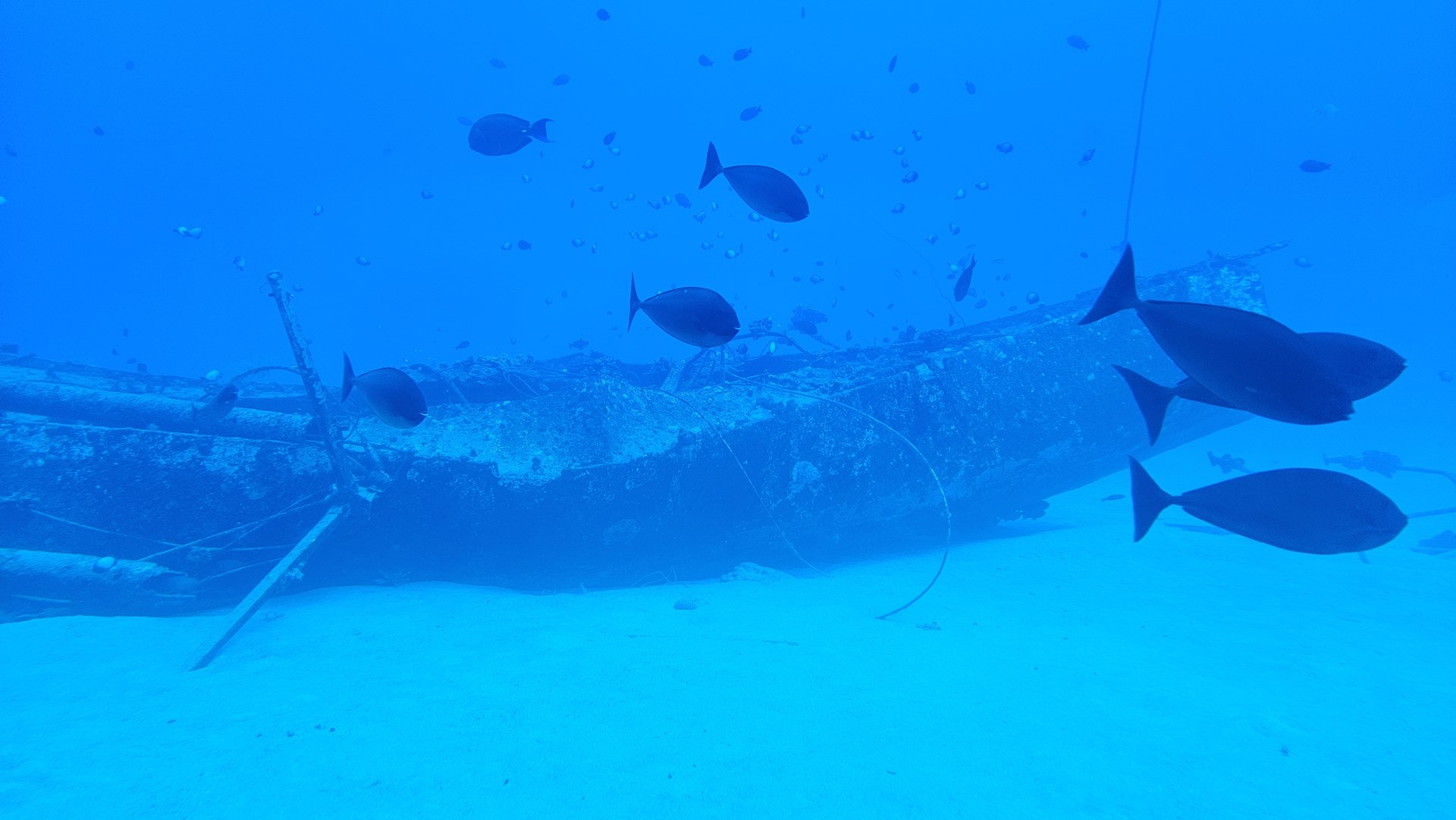

The low passenger load meant we had our pick of windows. The tour took us through waters of gradually increasing depth, down to about 140 feet. Unsurprisingly for a submarine tour, it focused on coral, fish, and boat wrecks. The stories of each wreck were told to us by the guide and included a yacht which was accidentally set on fire by the skipper’s wife, and a tour boat which was sunk in a case of insurance fraud.
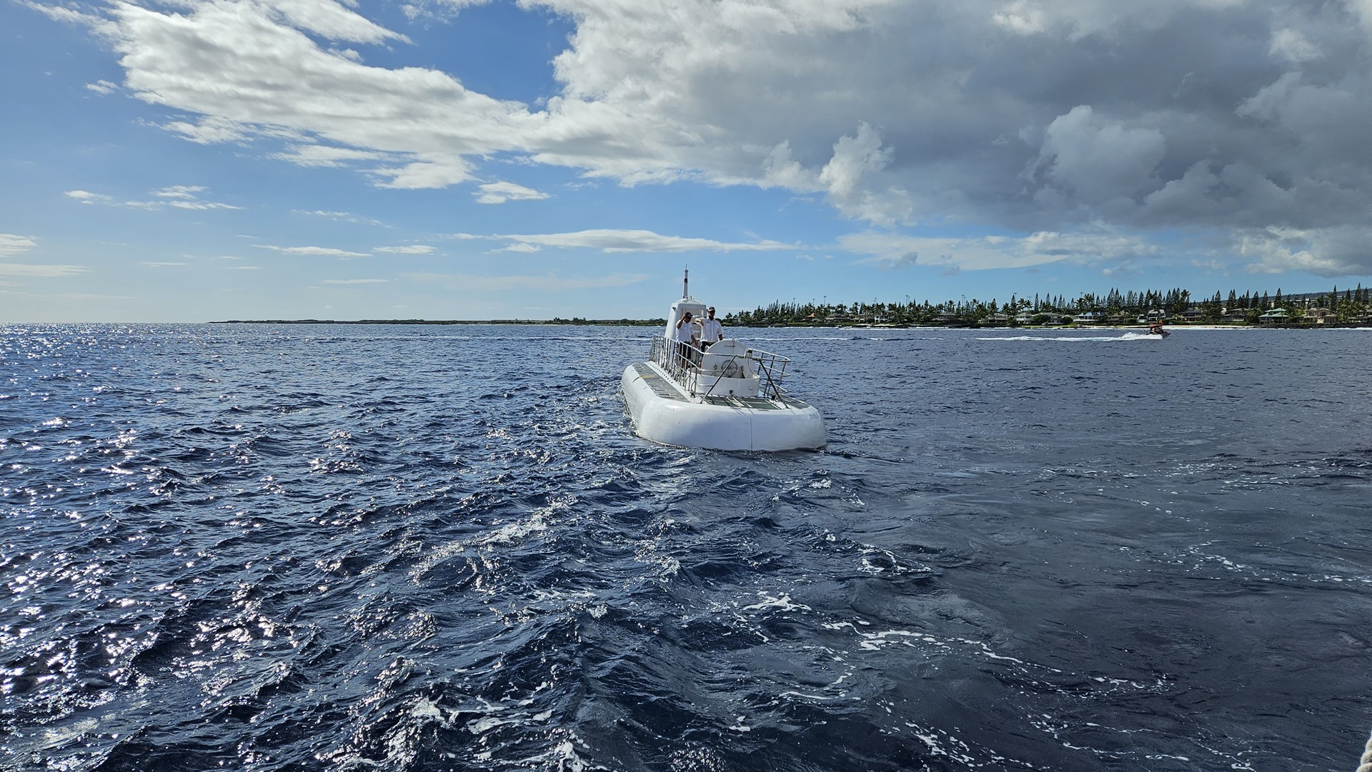

The submarine’s crew waved us off and we took the short ride back to shore before starting the drive back to Hilo. The road wound north along the lower slopes of Mauna Kea, and the lava flows from previous eruptions stood out starkly as black scars across an otherwise green landscape.
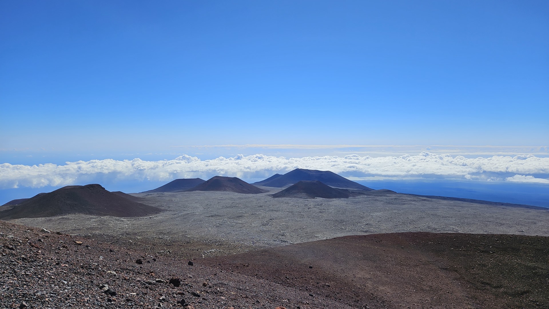
I started the next day solo with a trip back to Mauna Kea, and this time I had a full fuel tank. After the mandatory thirty minute wait I was permitted to go on my way and I carefully climbed along the gravel road towards the 13,803 foot summit. Despite the many warnings the road was not at all bad; this made sense as the multitude of telescopes on the summit would need reasonable access for operation and maintenance. Taking into account the brief foray up to 14,500 feet over Greenland, this was the second highest elevation I had reached on the entire trip, and I wasn’t even in Planey.


The summit of Mauna Kea is dotted with telescopes. The conditions here are ideal for observation; cool, dry air which is above the vast majority of pollutants or other haze. There is no significant light pollution nearby. Local government have introduced various incentives for observatories to locate themselves here, resulting in a present day count of thirteen observatories, each funded by as many as eleven different countries.


I made my way back down the mountain, following the instructions from the rangers to use low gears in order to save the brakes from overheating. Heading back to the bed and breakfast I grabbed my iPad and drove out to the airport. It was time for one last check flight, post-maintenance, before setting out on the long haul to the mainland.
Click here to read the next part of the story.