Round the World – Australia 2, Part 9
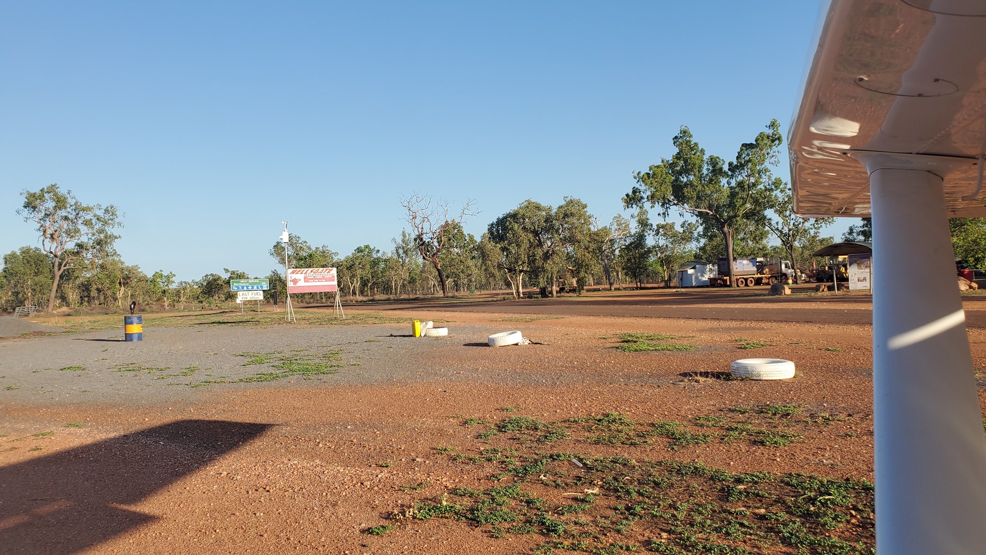
It was a peaceful night at Hell’s Gate and the temperature early the next morning was much more agreeable as I prepared Planey for departure. I taxied back across the road and set off down the runway, turning right away from the rocky escarpment and made my way east.
I tracked east towards the small settlement at Doomadgee, a mostly indigenous community with a population of about 1,400. A mission was established here in 1933 with the intention of providing education to the local children and featured a hospital, a school, a cattle run which included horses, and a 26-hectare (65-acre) garden. The one thing that it apparently didn’t include was a school, with lessons taking place in the dormitories. The mission remained until as late as 1983.


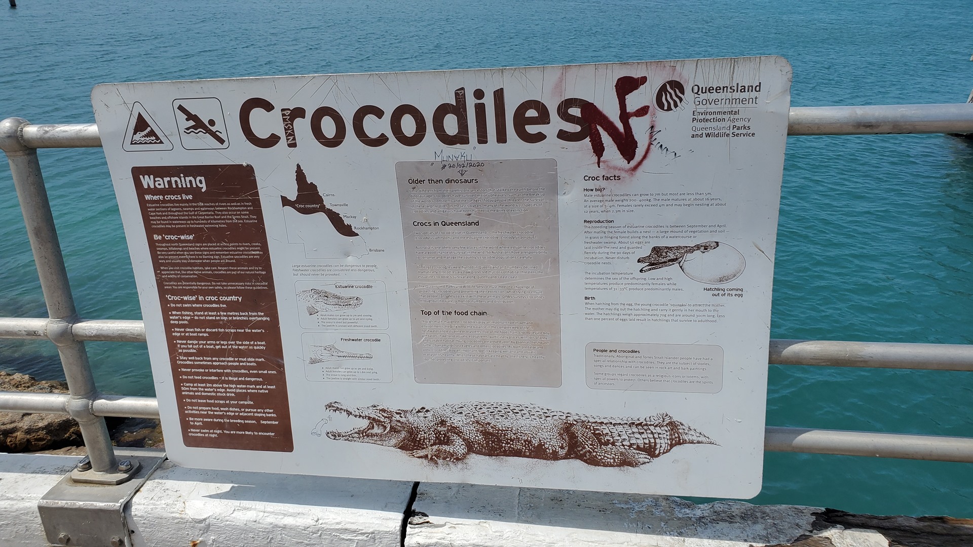
I performed a quick landing at Doomadgee, and then took off and headed east to Burketown. I stopped at Burketown to refuel from their self-service fuel bowser, a rare one which took credit cards instead of needing a specific card from the fuel supplier. This done, I flew north out towards the Gulf of Carpentaria, coasting out over the crocodile-filled waters and making my way towards Sweers Island. This 8km long island is part of the South Wellesley group in the gulf, and today supports a recreational fishing camp.


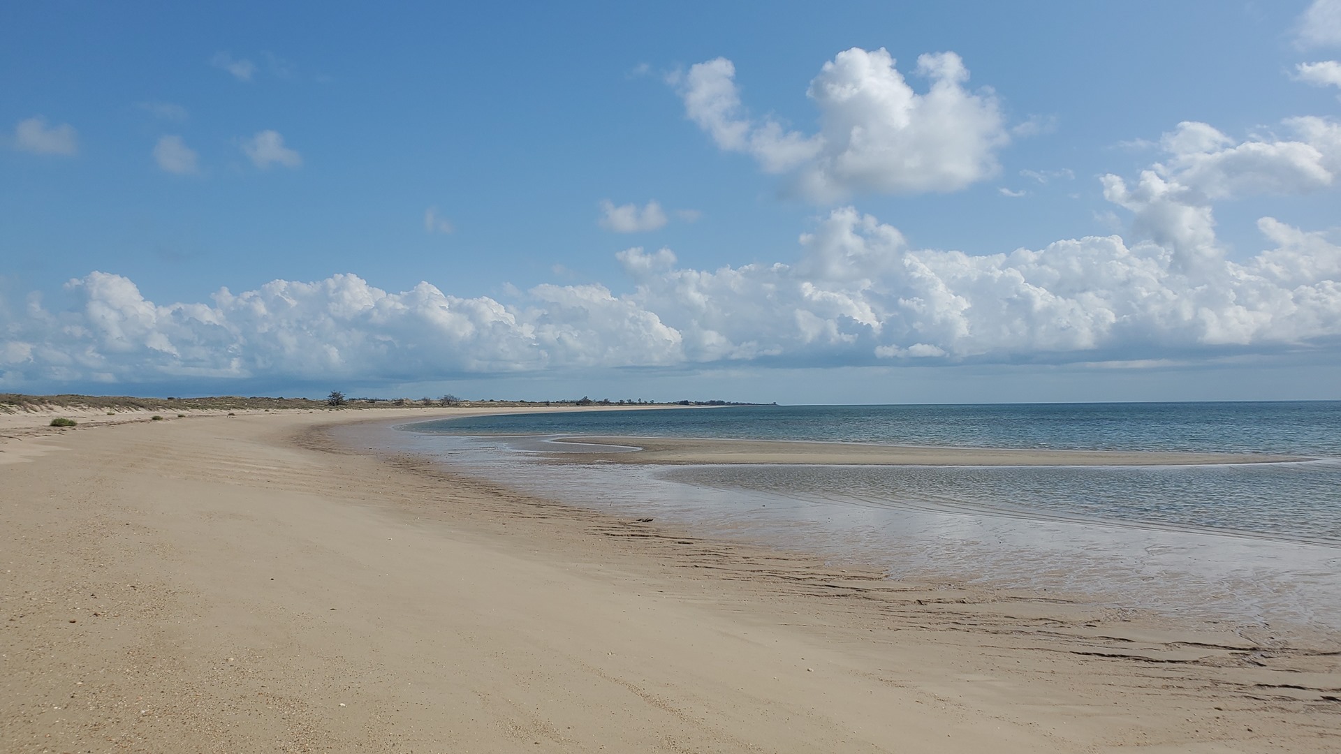
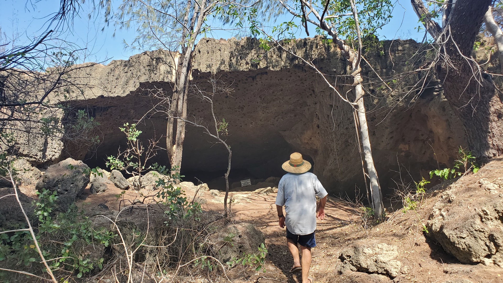
The camp had already closed down operations for the season, but the caretakers had answered the phone and invited me to drop in for a visit. Two men met me on arrival, one in a pick-up truck and one on a quad bike, and welcomed me to the island. I hopped into the pick-up, and we set off for a tour around the island. We started off at an old lime kiln, which still had old equipment scattered abandoned around it. It was dug out of a hill, and on climbing up to the top one could enjoy great views over the scrub-covered island. We returned to the truck and headed to the beach, driving along the waterfront to visit an old cave near the northern end of the island.


Sweers Island has a long history, having its western name bestowed in 1802 by explorer Matthew Flinders. Flinders was circumnavigating the continent in the sloop HMS Investigator to map the coastline and determine whether Australia was one large continent, or divided by a waterway between the Gulf of Carpentaria and the Great Australian Bight. In the late 1800s, the settlement of Burketown was relocated from the mainland to the island in an attempt to escape an epidemic, now suspected to be typhoid fever.


The old cave still bore graffiti carved into the walls by visitors in the 1800s. After checking this out we drove back along the beach to the fishing camp, where I met the wives and we enjoyed tea and biscuits before they drove me back to the airstrip.

I set off east across the Gulf of Carpentaria towards the shore, coasting in at Karumba where I carried out a touch and go. This town used to be a refueling and maintenance stop for the flying boats of Qantas Empire Airways. I followed this up by another at the nearby airport of Normanton and then turned north to follow the eastern shores of the Gulf, to the airport at Pormpuraaw.


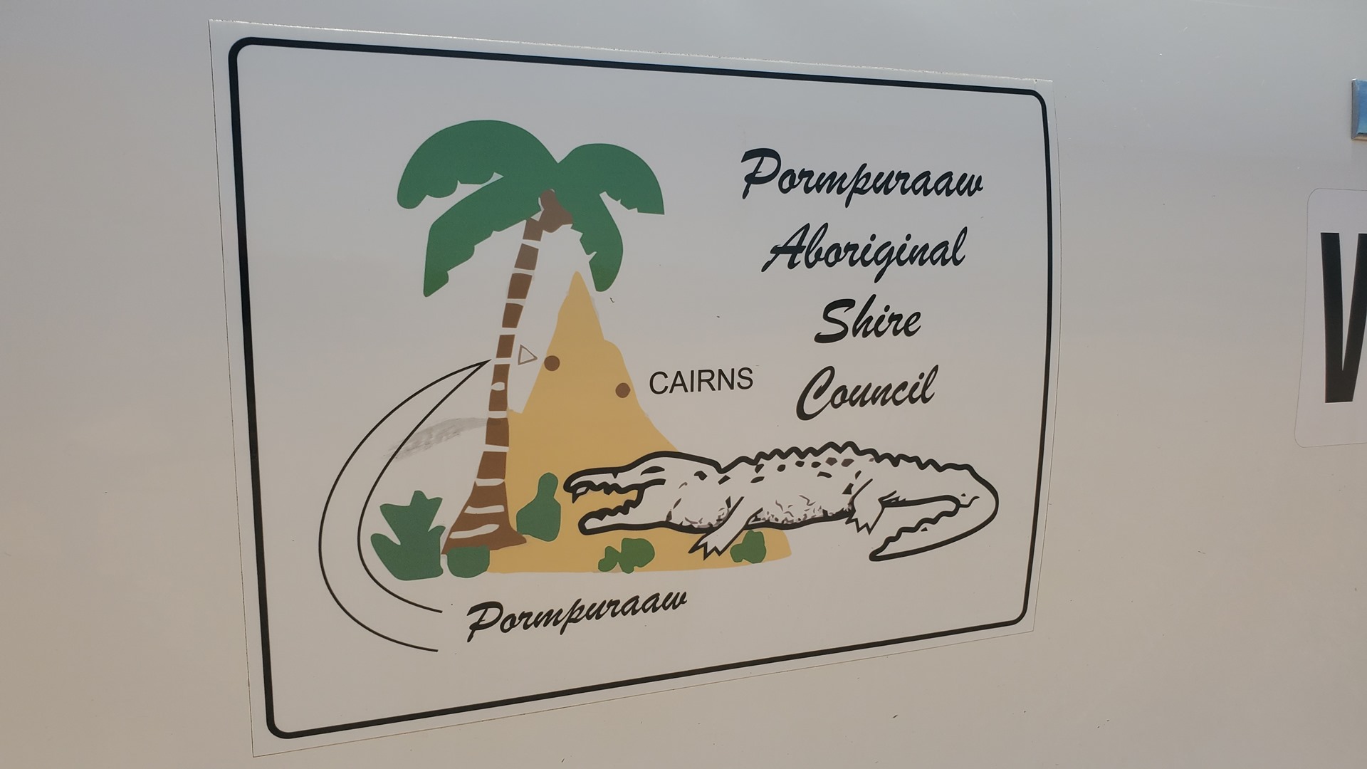
Pormpuraaw was originally set up in 1938 as the Edward River Mission. The Anglican Church managed the area for almost 30 years, until in 1967 the Department of Aboriginal and Islander Affairs took over the running of the community. The ERSA flight guide warns that only the airport itself counts as public property, and that permission from the Shire Council is required to access anywhere outside of it. This came across as pretty unwelcoming, so I kept within the fence to stretch my legs a bit, and was on my way again after a few minutes.


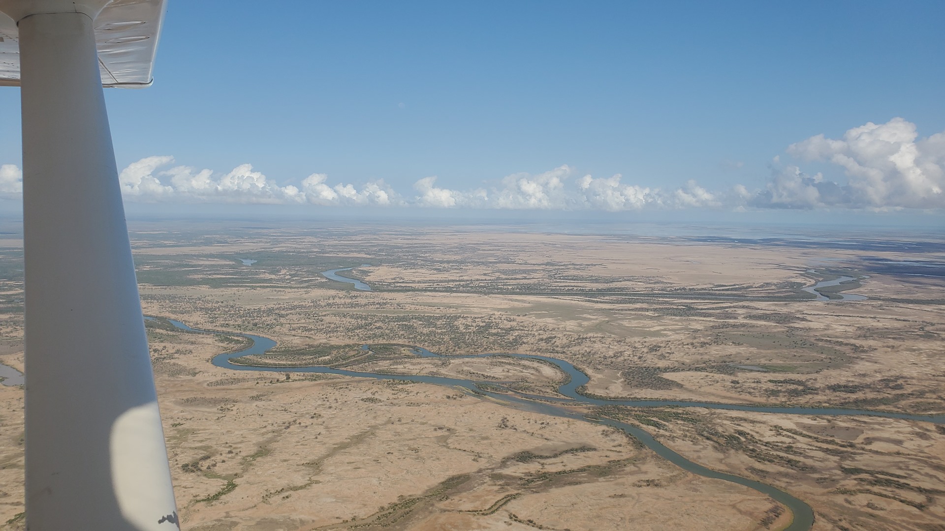
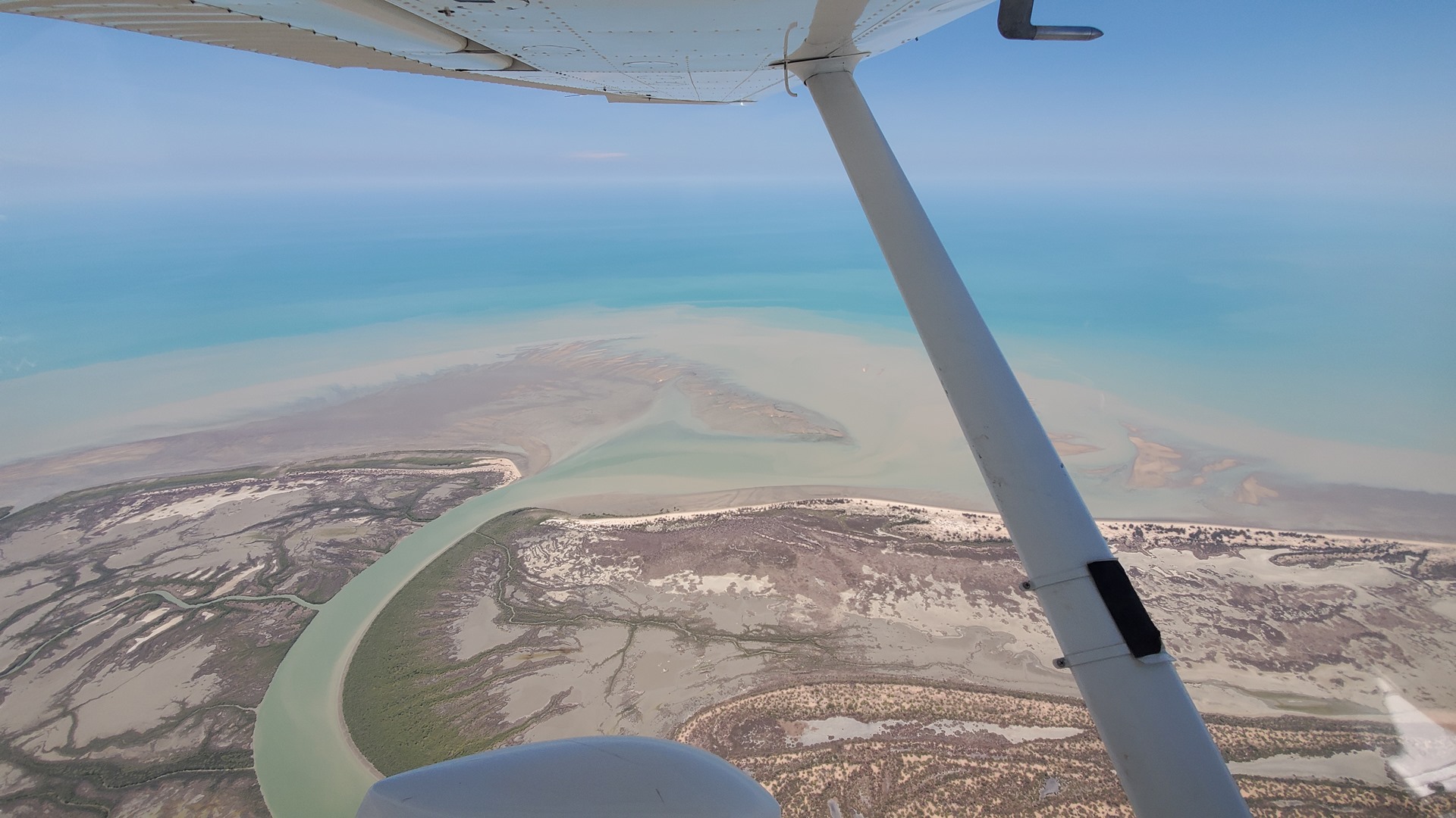
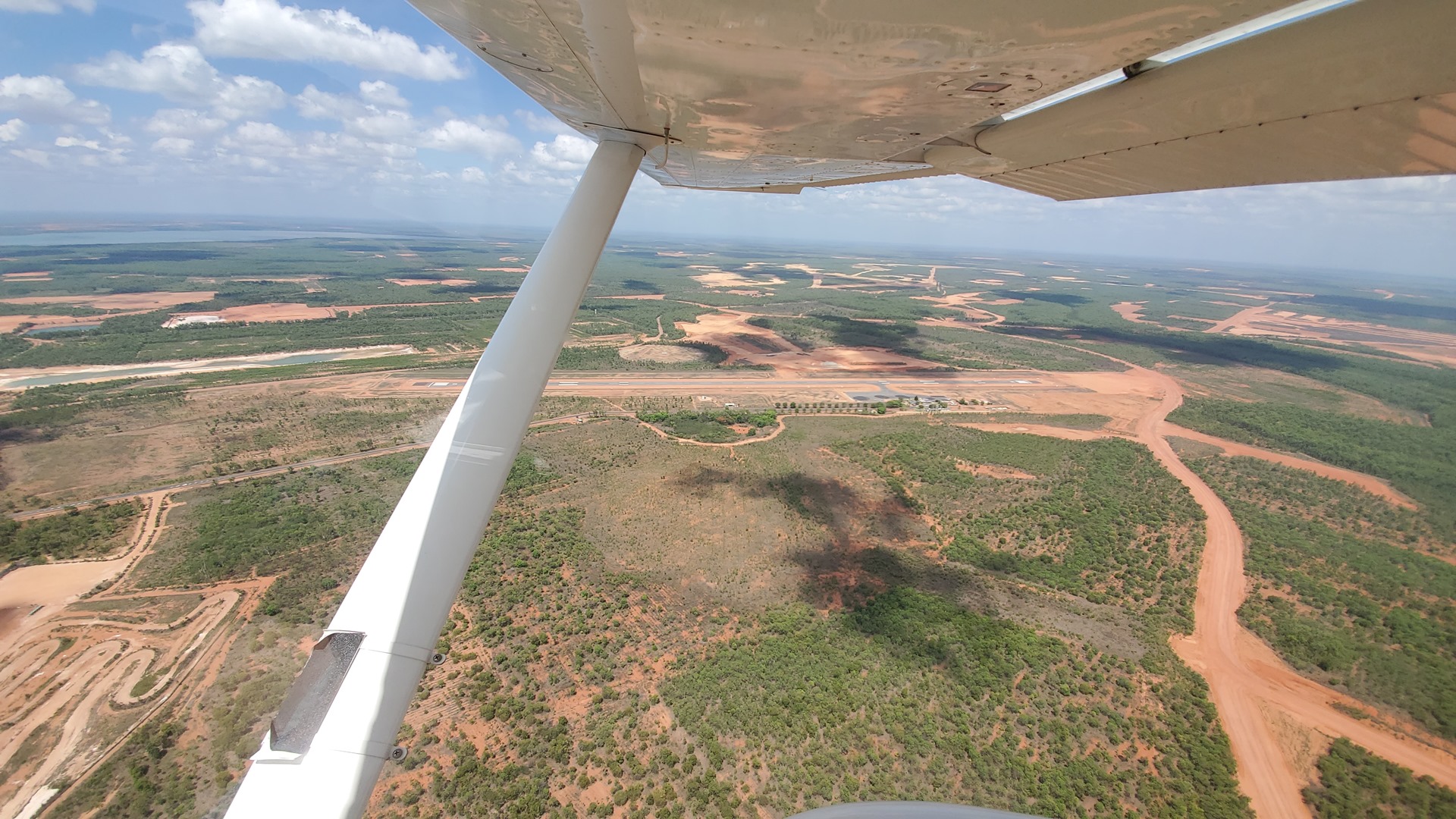
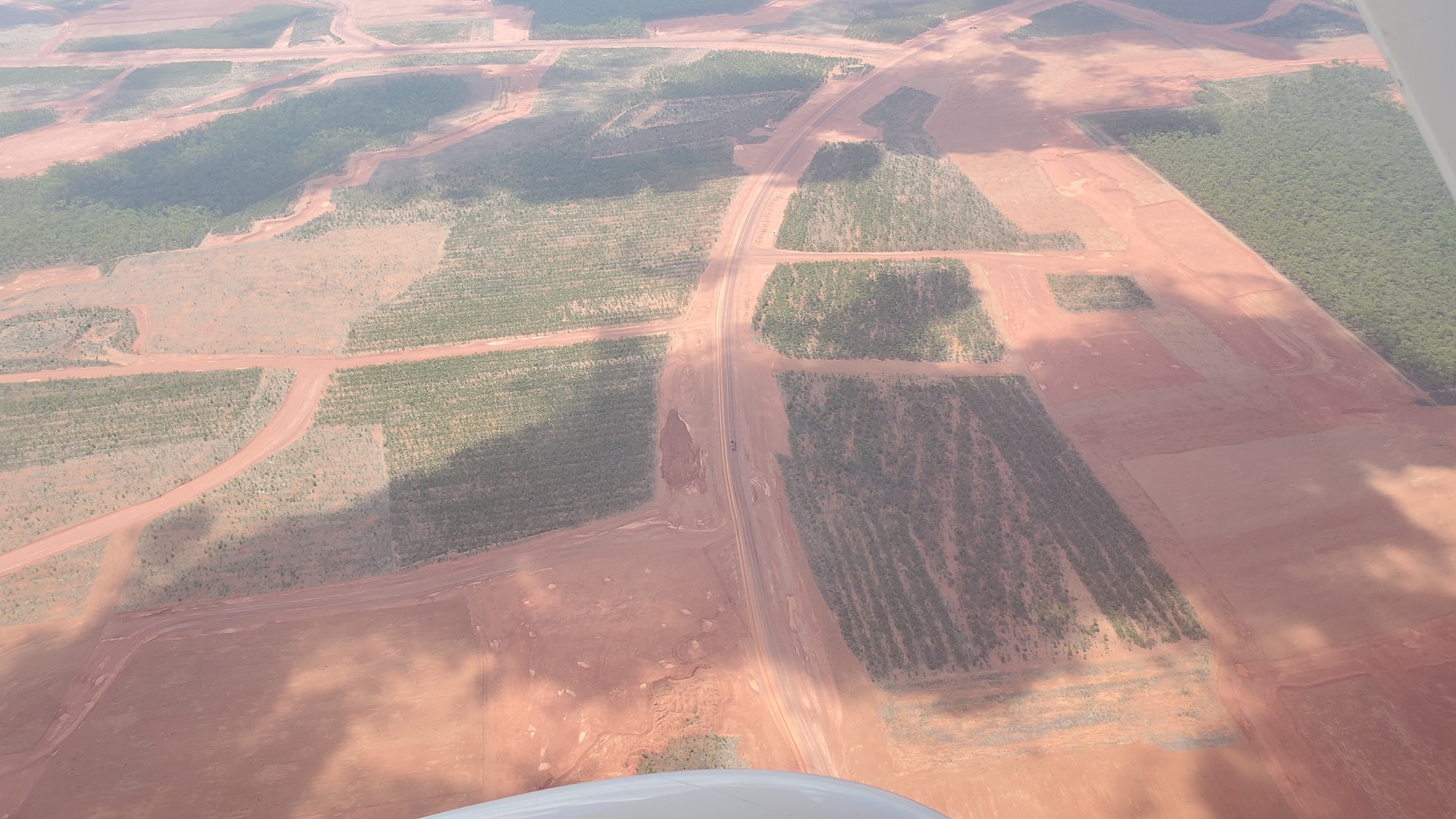
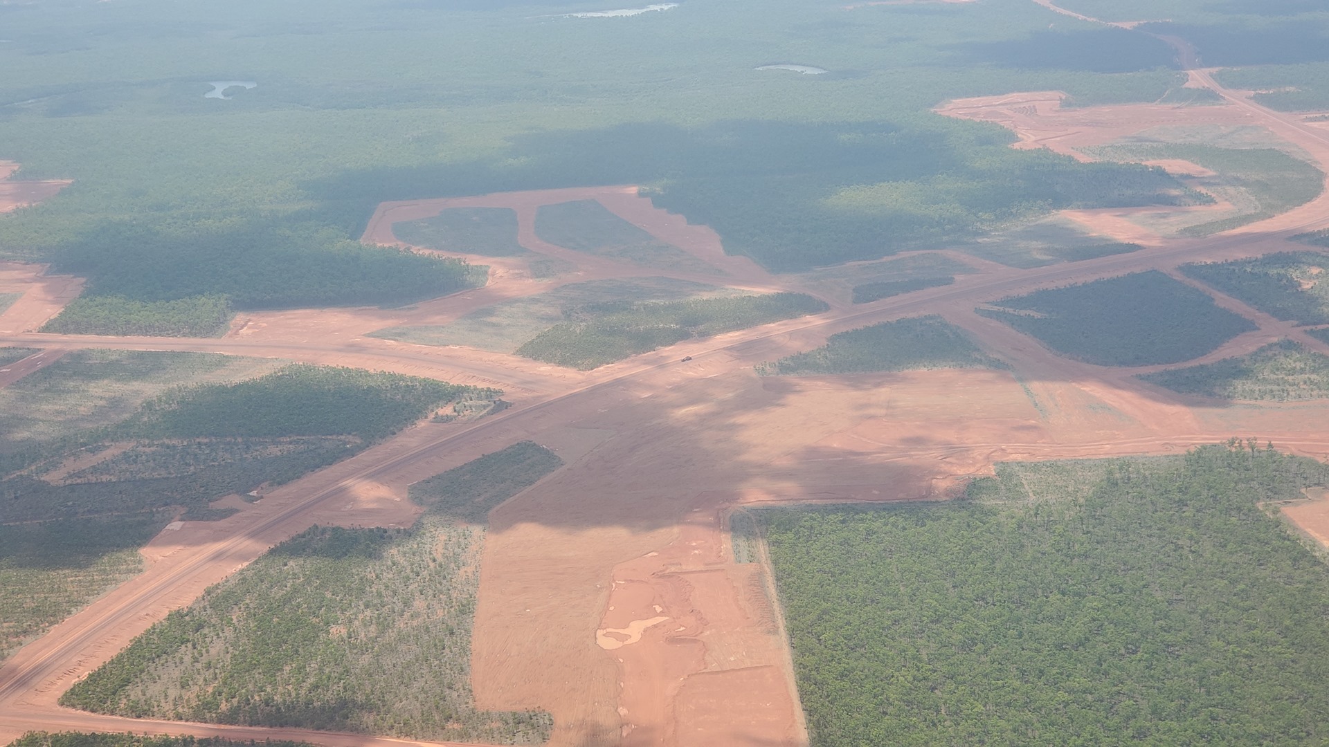
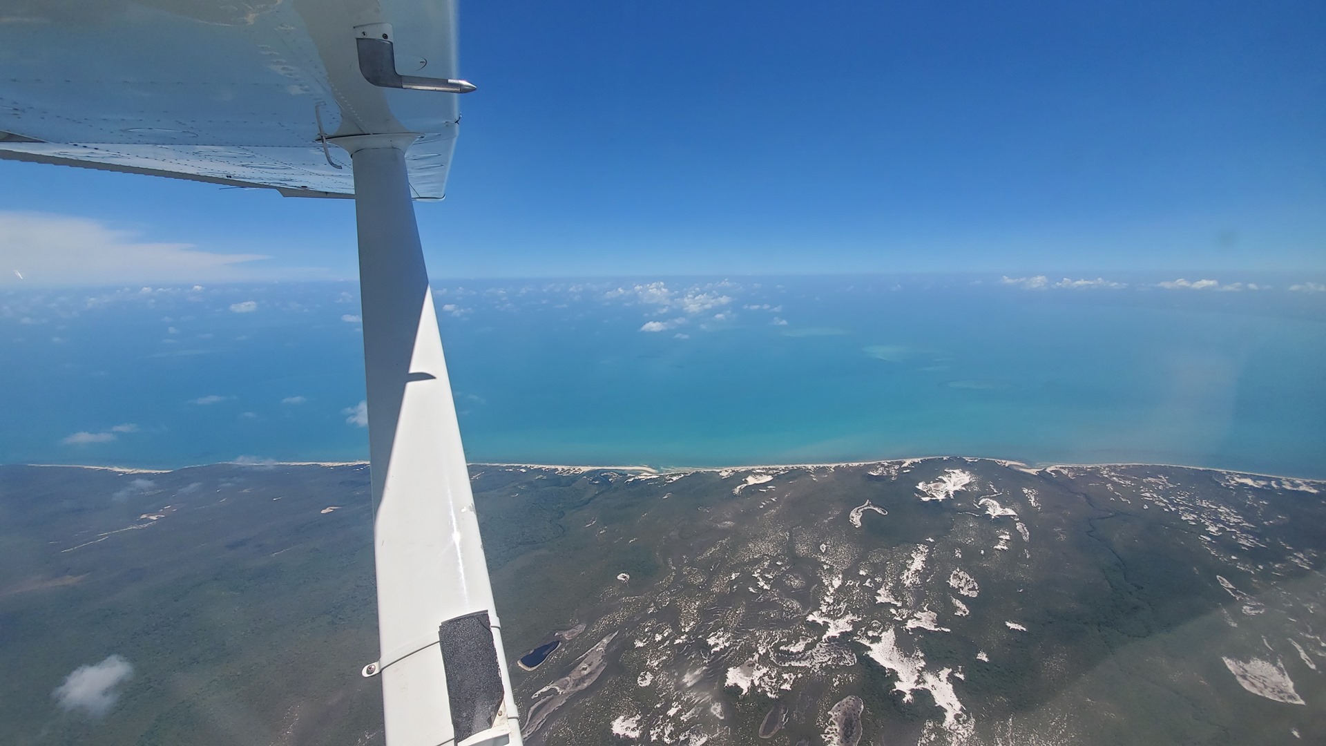
I continued up the beautiful Queensland coastline, flitting over the turquoise water and pondering the number of salt water crocodiles who were probably hanging out below me. Fortunately Planey’s engine kept running smoothly and I did not make their acquaintance. I performed a landing at the airport of Weipa, just for the fun of it, before carrying on to the north towards the tip of Queensland and the islands which lie beyond it. Departing Weipa I flew over an area of enormous dirt roads, with giant dump trucks and other machinery running back and forth along them. These appeared to be the Rio Tinto Bauxite mines; the company has rights to an astonishing 10,000 square km (4,000 square miles) in the area. They produce more than 15 million tonnes of ore a year from the sites.

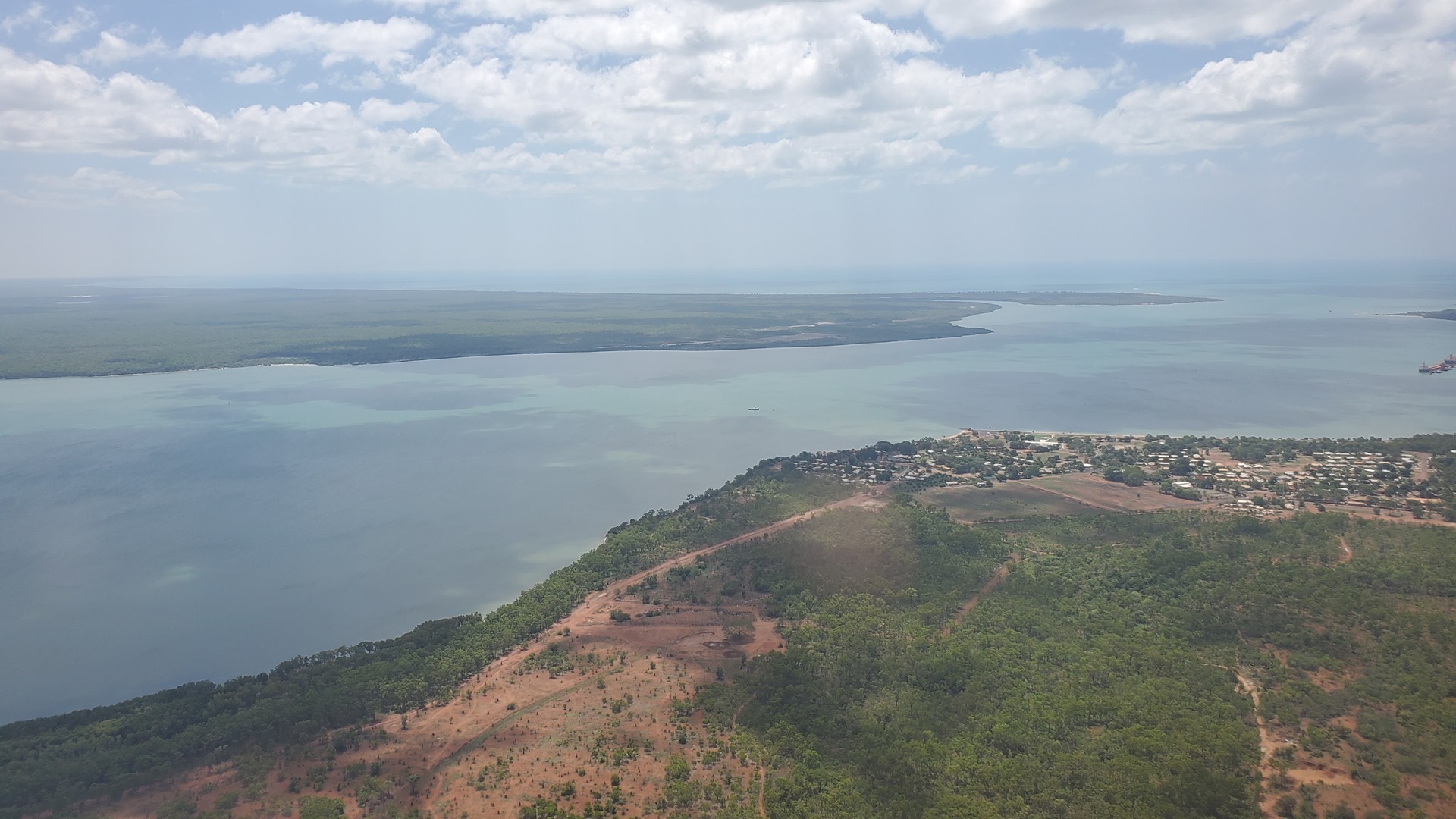

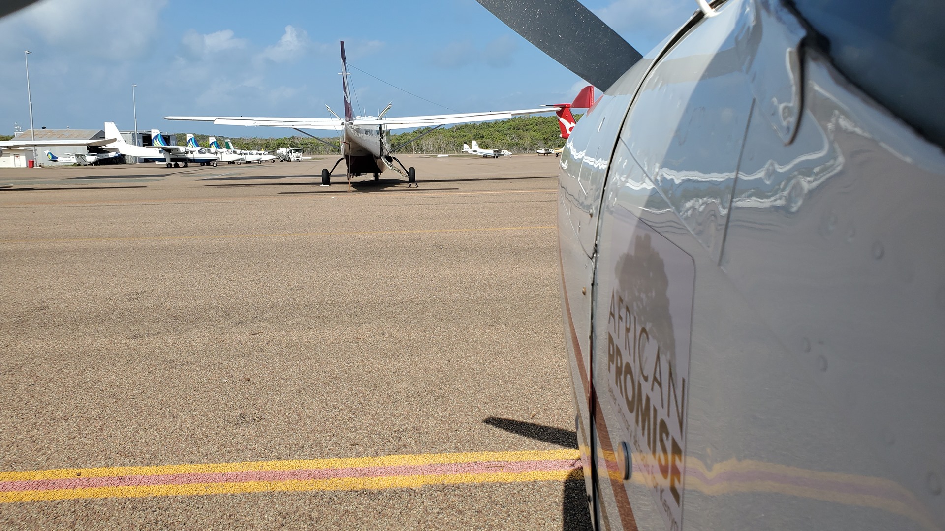
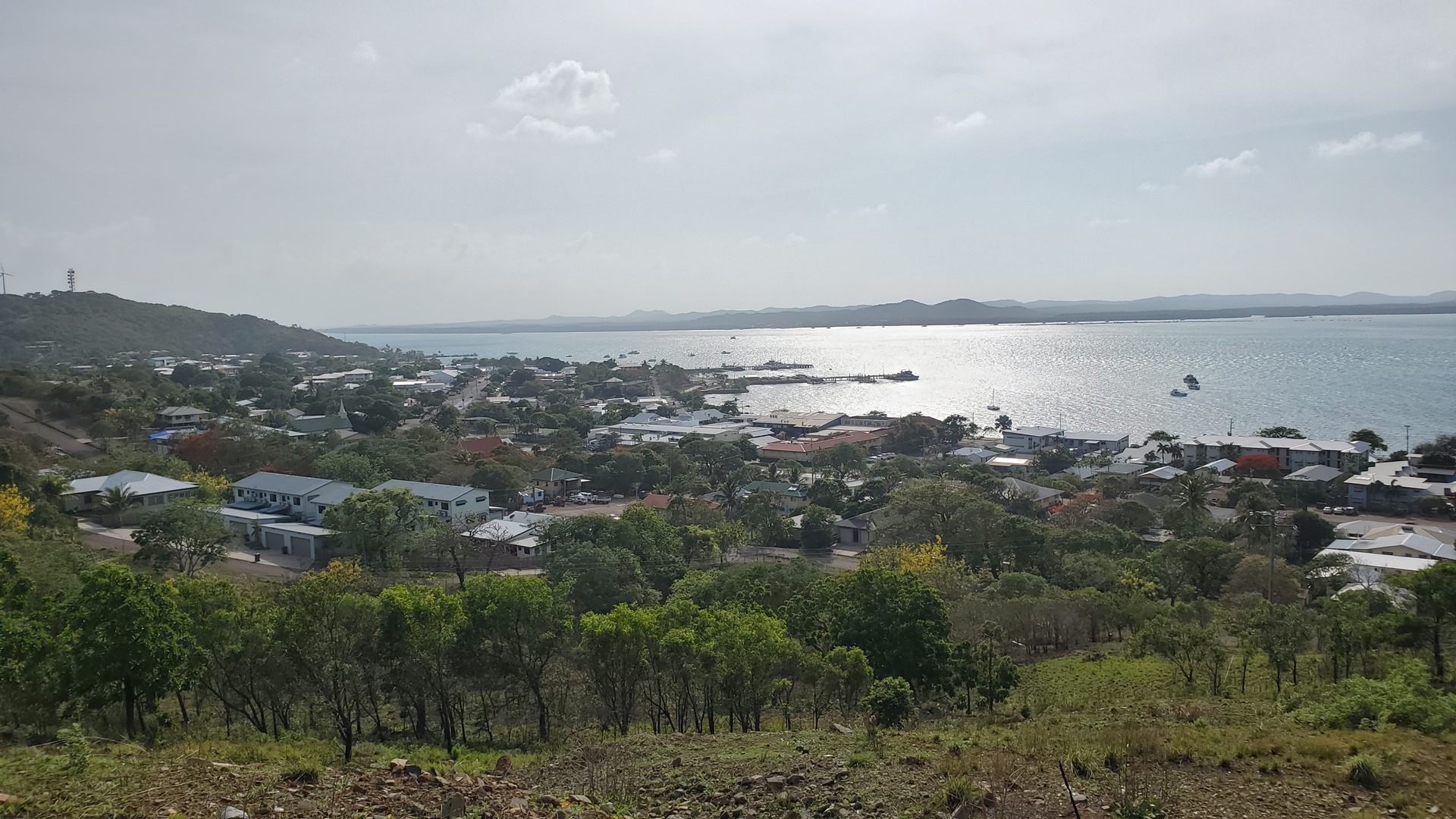
My final stop for the day was Horn Island. This island serves as the gateway to the Torres Strait islands, between Australia and Papua New Guinea. The population of Horn Island itself is just over 500, with most of the local residents basing themselves on the adjacent Thursday Island which has a population of around 3,000 and is a tourist destination. I had arrived at rush hour; a Qantas flight had just landed and multiple small commuter aircraft were buzzing in and out. I followed an Islander aircraft in to land and taxied to the ramp, pausing to give way to another Islander taxiing outbound. All the Torres Strait Islanders from the Qantas flight were dispersing to multiple Islanders scattered across the ramp, ready to give them heavily-subsidised rides (up to $4,800 per year per person) back to their villages. One Islander had just two people boarding it!


I had chosen a room at a small hotel on Horn Island, close to the ferry. They collected me from the airport and drove me the 20 minutes to town. I settled into my little cabin before going for a walk; there wasn’t much to see, apart from the supermarket, so I made my way back to the hotel for dinner and turned in.
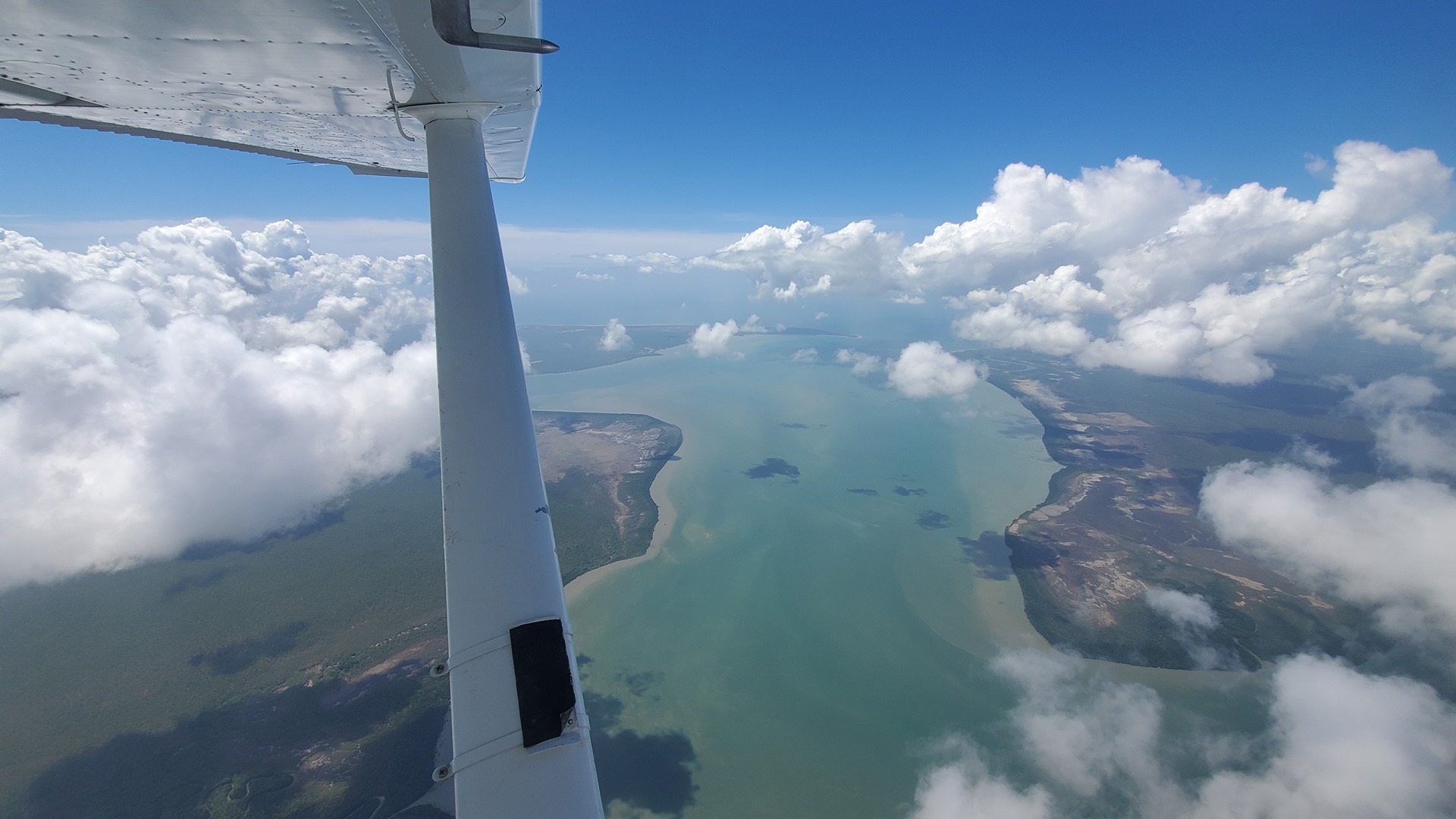
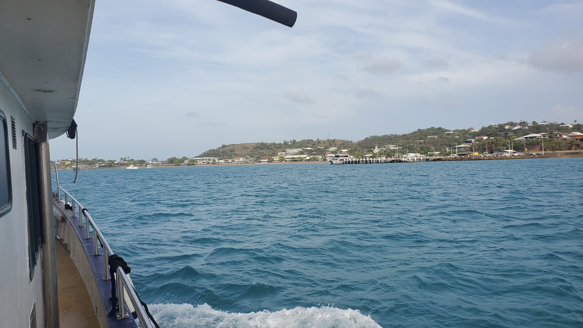
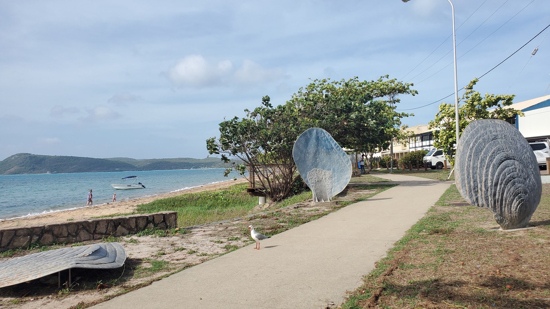
The next morning I woke early to get the first ferry of the day across to Thursday Island. It wasn’t busy; the only other passengers were an elderly man and a young mother with her child. The crossing was short and offered great views of both islands. Soon we were pulling into the pier at Thursday Island and I set out to explore.


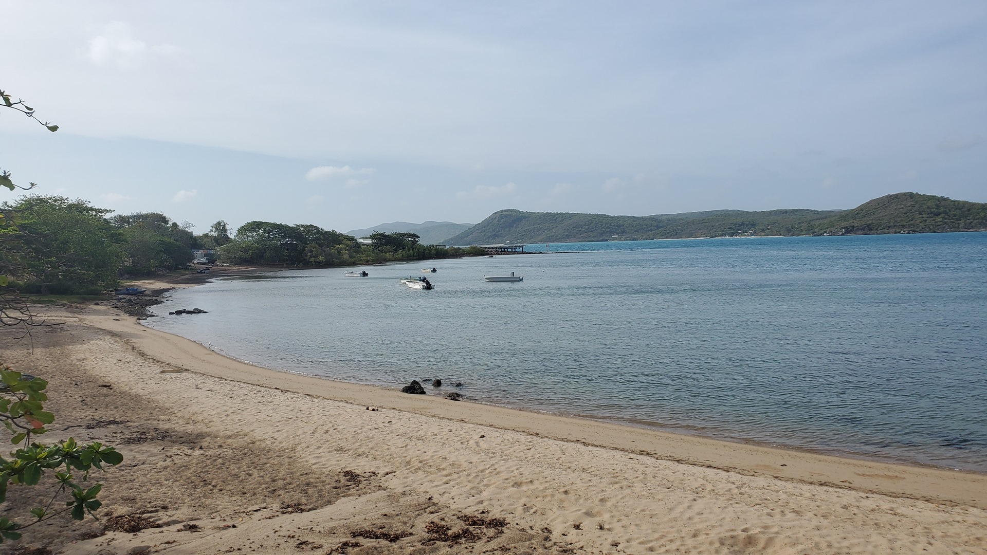
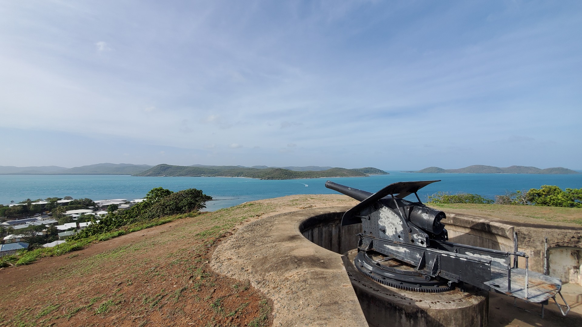
As well as a general look around, my main target was to visit the old fort on top of Green Hill (imaginatively named, “Green Hill Fort”). I set off down the street by the waterfront of this little island, past a young family with children playing on the beach, and admired the old timber colonial-style buildings as I walked. I followed the road around the waterfront past the island’s hospital and Bach Beach, circling Green Hill Fort but with no obvious way to get up to it. Eventually I decided to head cross-country and followed a concrete drainage ditch up the hill; it eventually intersected with a gravel road which led to the top of the hill and the fort located there.


The fort was constructed between 1891 and 1893 in response to the “Russian scare” of 1885 where Britain and Russia came close to war, as well as to colonial expansion in the region by other European powers. Most of the Australian states, and Great Britain, all contributed to the project. The garrison was withdrawn in 1926, with the fort being briefly reactivated as the headquarters for Allied forces in the Torres Strait from 1942 to 1945. It has not been used for military activities since, and is now managed by the Torres Strait Regional Authority as an historic site.

I walked back down the hill, with the route being much more obvious from the top. I had planned to visit the Gab Titui cultural center near the ferry pier, but despite the published hours they had apparently decided not to open today. Instead then I went to buy a smoothie, and then ran for the ferry as they’d taken a very long time to make the drink for me! After a short ferry ride back across to Horn Island I walked back to the hotel and collected my bags, before being given a lift back to the airport.


The airport was busy. A Qantas jet was being readied for departure and a flood of Torres Straits islanders had come in on the small commuter aircraft and were waiting at the sole gate for departure. Eventually I managed to get the attention of a member of staff and was allowed out of the door and back to Planey. I pre-flighted and started up, sneaking out ahead of the jet and turning south, keeping a keen eye out for the many commercial light aircraft buzzing around.


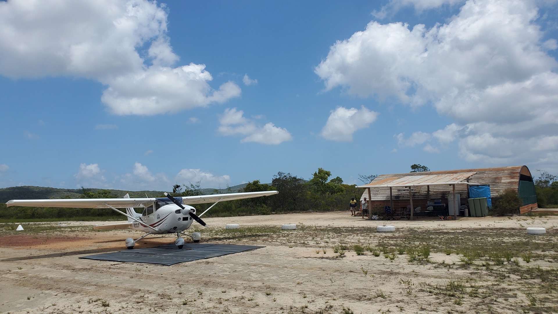
Before long I was back over the mainland, and mile upon mile of lush rainforest. This being Australia it was no doubt full of deadly creatures. I stopped briefly at the airport at Somerset, which serves the northern cape, before continuing south over the forest towards my first destination of Pascoe River. This is a fairly new private strip built by the landowner for the use of him and his neighbours and he’d extended an invitation to drop in and visit. He and a few others would be there performing some maintenance.
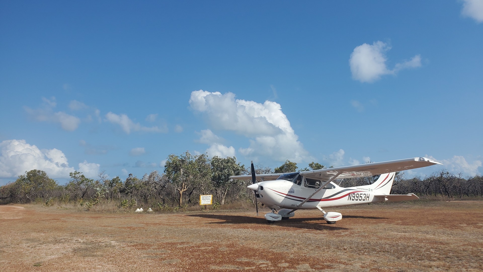
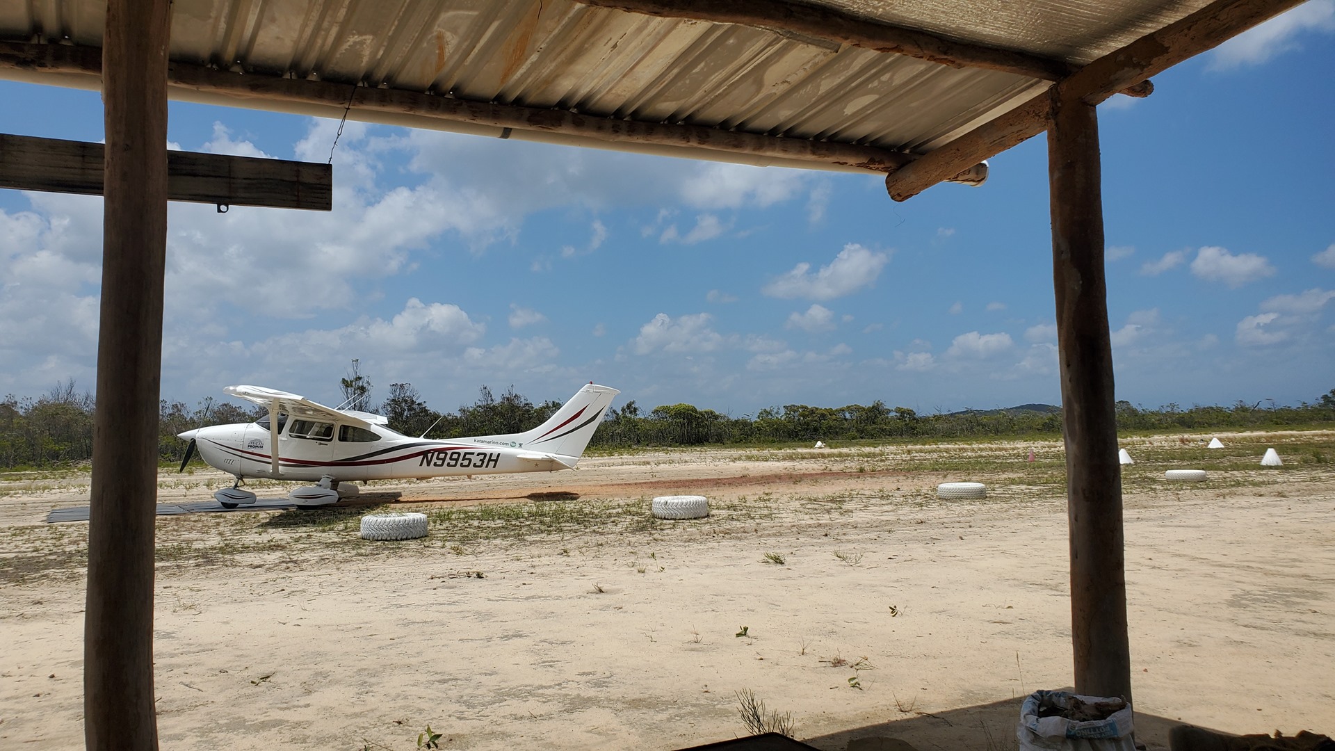
There were a few private strips in the area, but with the help of GPS and the distinctive cross-runway I found Pascoe River without trouble. Although not maintained for use, it gave the field an “X” shape and made it very easy to spot. I touched down on the northerly runway a little more firmly than desired; typical for when people are looking on! I taxied in and parked opposite the small hangar with attached lean-to and was warmly greeted by a bunch of disheveled looking Ozzies. They’d clearly been working hard in the morning heat.


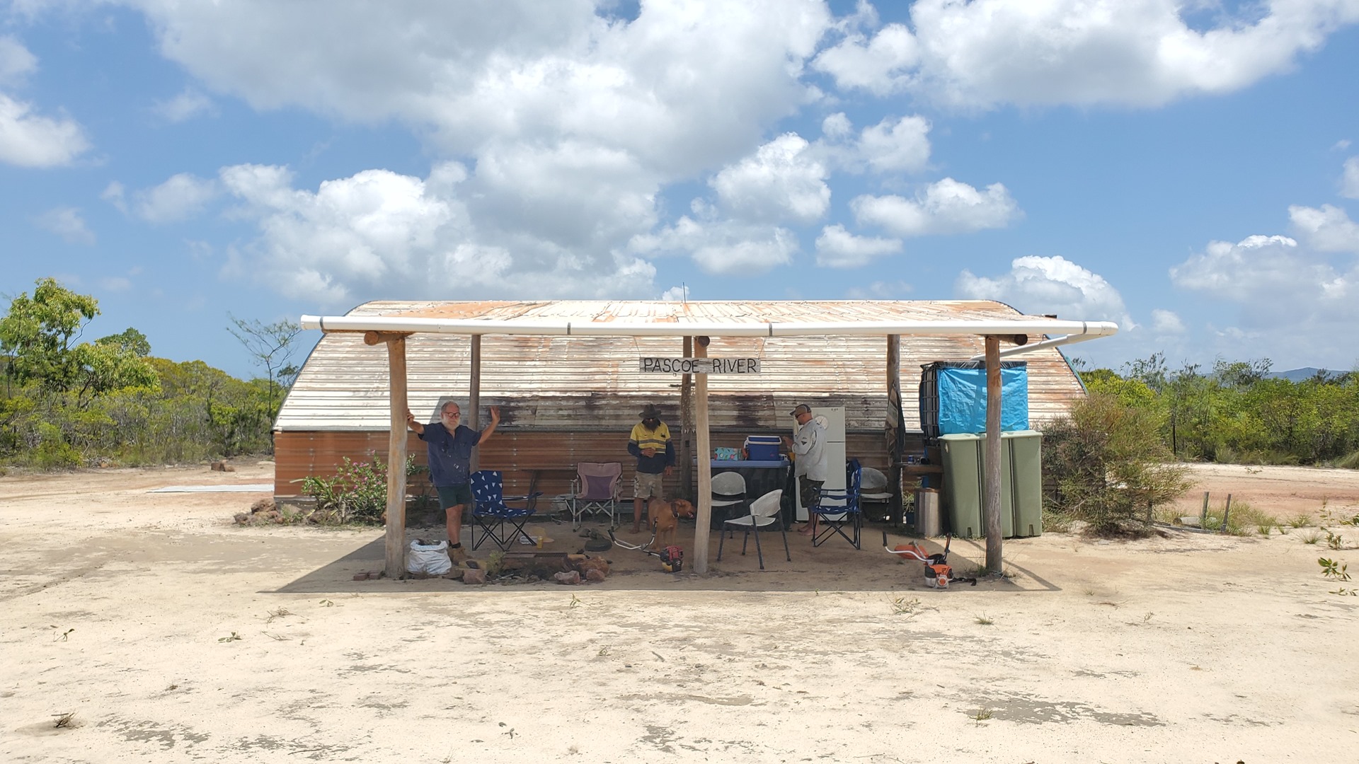
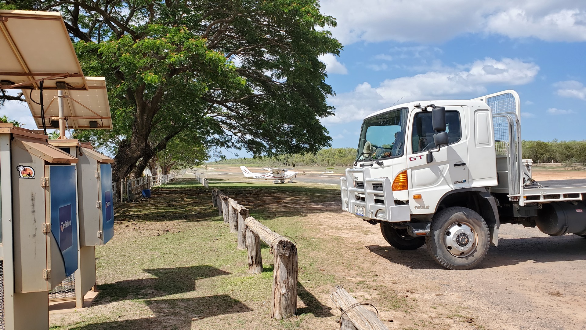
Living up to stereotypes, I was immediately offered a beer which I politely declined, but accepted a cold water instead. We sat in folding chairs in the shade of the lean-to, chatting about flying, the development of the strip, and life out here in the remote Queensland bush. A sleepy dog dozed at my feet. Soon it was time to be moving on.

I bumped over the runways sandy surface and lifted off as I passed the lean-to. My new friends waved goodbye as I turned south again and continued my way south. After a brief visit to the airstrip at Coen I made my way to the dirt strip at the Musgrave Roadhouse, in the rural locality of Yarraden; population 11. I parked the aircraft up next to a trip of 4x4s that were preparing to depart and, after a brief chat with the occupants, headed inside for a classic Australian light lunch of toasted sandwiches.


As I ate I spoke with a trio of indigenous ladies who were on their way to Cairns, the same destination as me that day. Travelling by land it would be a two day trip in each direction for them. I counted my lucky stars that I had the privilege of going by air! After my meal it was time to get going again, and after saying hello to a young family in a truck who were pulling in to the roadhouse I taxied out to the north end of the strip, turned around, and pushed the throttle in. 20 degrees of flap had me off the ground quickly, and heading for Cairns.
My route took me along highway 81, past the town of Laura, and through a quick landing at Lakeland Downs airport where, I had learned, one of the 4×4 drivers from the Musgrave Roadhouse had learned to fly ultralights. Here I punched Cairns airport into the GPS and set out on a direct course, having first checked the airport website to ensure I wouldn’t be arriving at a time when the $300 landing fee surcharge was in effect. Out to one side I could see a curtain of smoke slowly rising into the air from distant bushfires. Thankfully they were not nearly as intense as they had been down in New South Wales the previous year.


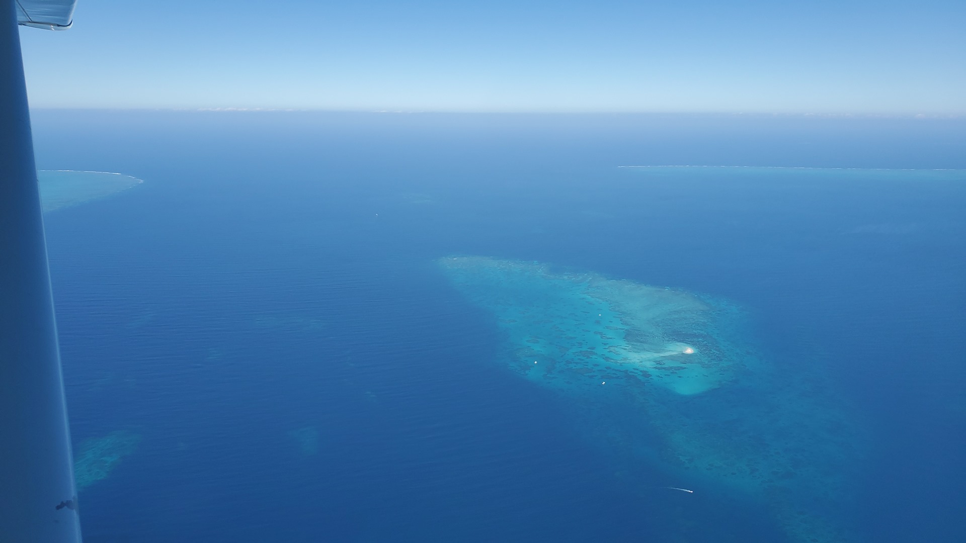
As I neared the coast north of Cairns the air traffic controller directed me out to sea. The airport was not terribly busy, but apparently they needed to send me out on a circuitous route anyway. This turned out to be something of a blessing however as the controller proceeded to give me an excellent tour of that section of the Great Barrier Reef, pointing out specific shoals and islands as I passed them. He took me around the eastern side of Cairns and then circled me in from the southeast, passing the city center as I made my way onto final approach.


I parked up with the rest of the General Aviation fleet on the western side of the field and secured the aircraft while waiting for the fuel truck to arrive. They topped off my main tanks for me so I’d be ready for an early departure the following morning. The general aviation terminal was unimpressive, and I bypassed it and made straight for my Uber and a ride into town where I’d be staying at the Cairns YHA.
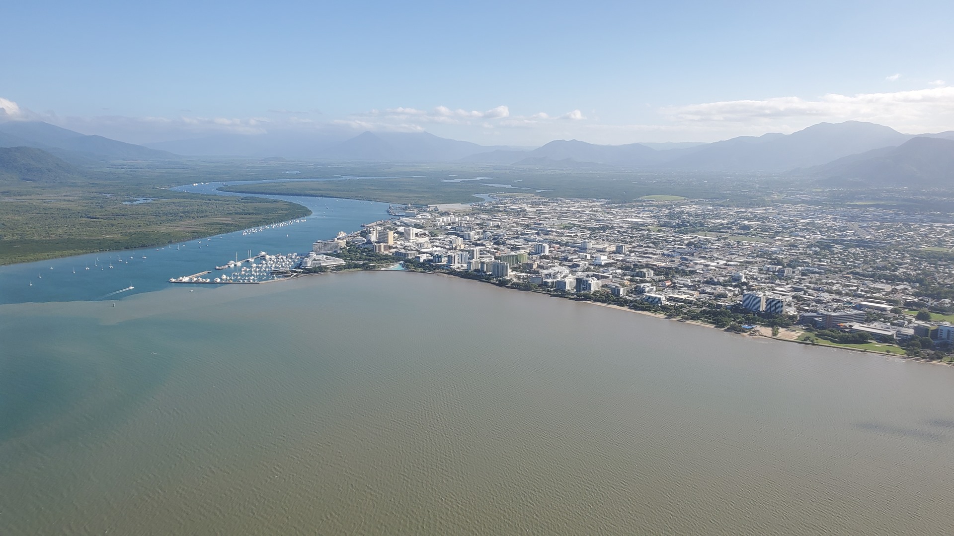


Cairns is a relatively small city of 150,000 people but this still makes it the 15th most populous city in Australia. The downtown seemed fairly compact and it was clear that everywhere would be within easy walking distance of my accommodation. I settled into my compact downstairs room, grateful for the strong air conditioning, and worked a little on flight planning for the following day as well as a load of laundry. Chores taken care of, I went out for a walk around and some dinner.


It was a shame that I didn’t have time to see more of Cairns, as it seemed like a lovely place to explore. I made a note that I would have to return in future, just like so many of the wonderful places which I had discovered on this trip. One downside to the adventure was the realisation that one lifetime was not nearly enough to see all that the world has to offer, not by a long shot. I counted myself very lucky to have seen as much as I have. After dinner and a drink or two I walked back to the YHA and settled down to sleep, with another early morning and big day of flying to come.
Click here to read the next part of the story.