Round the World – Australia 2, Part 7
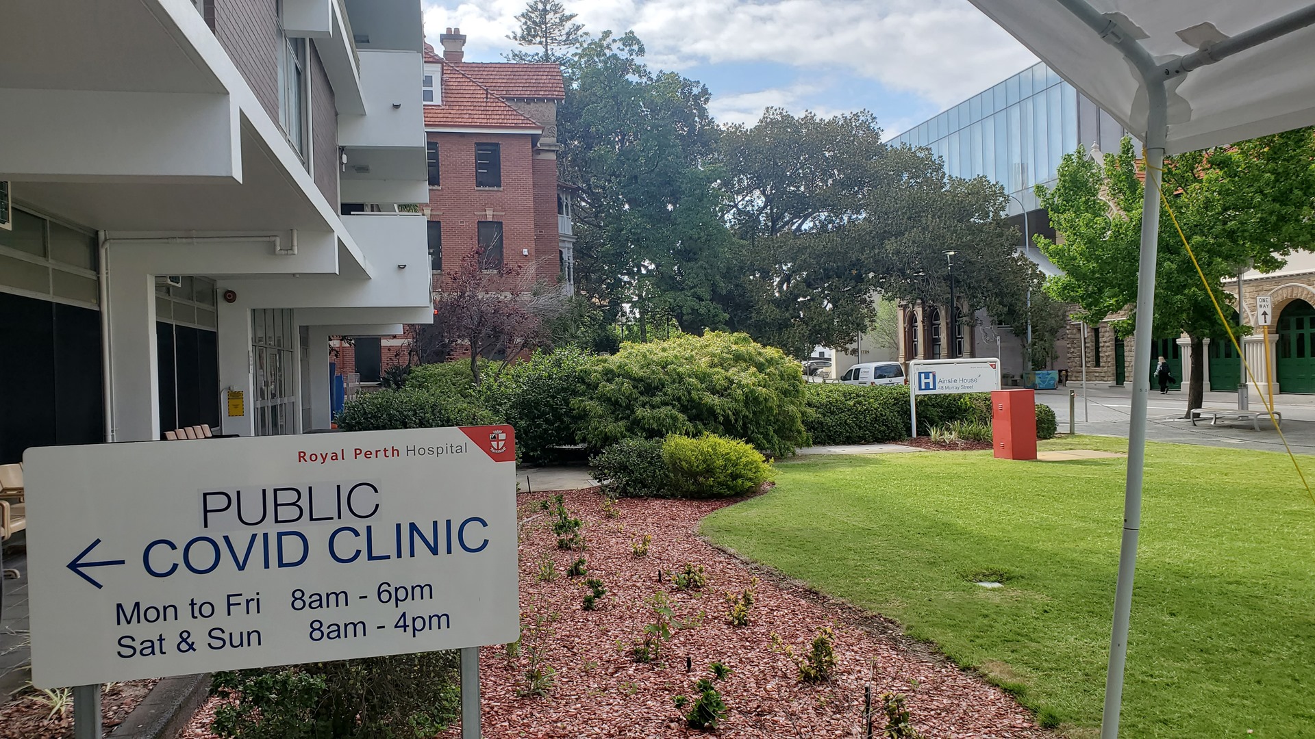
Ten days and one negative COVID test (my only allowed outing) later, I was free to go. Not a single traveler from South Australia had tested positive, underscoring the massive waste of time that the Western Australian government had forced on all of us. I was awake at dawn and on my way to the airport, keen to restart my adventure. I’d used the time in isolation to plan much of the rest of the trip around Australia; today I’d be flying up much of the west coast, stopping at many little airfields along the way.


I performed a careful pre-flight inspection, finding everything just as I had left it. My first stop would be Perth International, just for the fun of it, and I had phoned their control tower in advance to check that this would be OK. Just like Adelaide, things were very quiet at Perth and they were happy for me to come in. I took off from Jandakot and switched the radio straight over to Perth; they directed me for a straight-in approach.

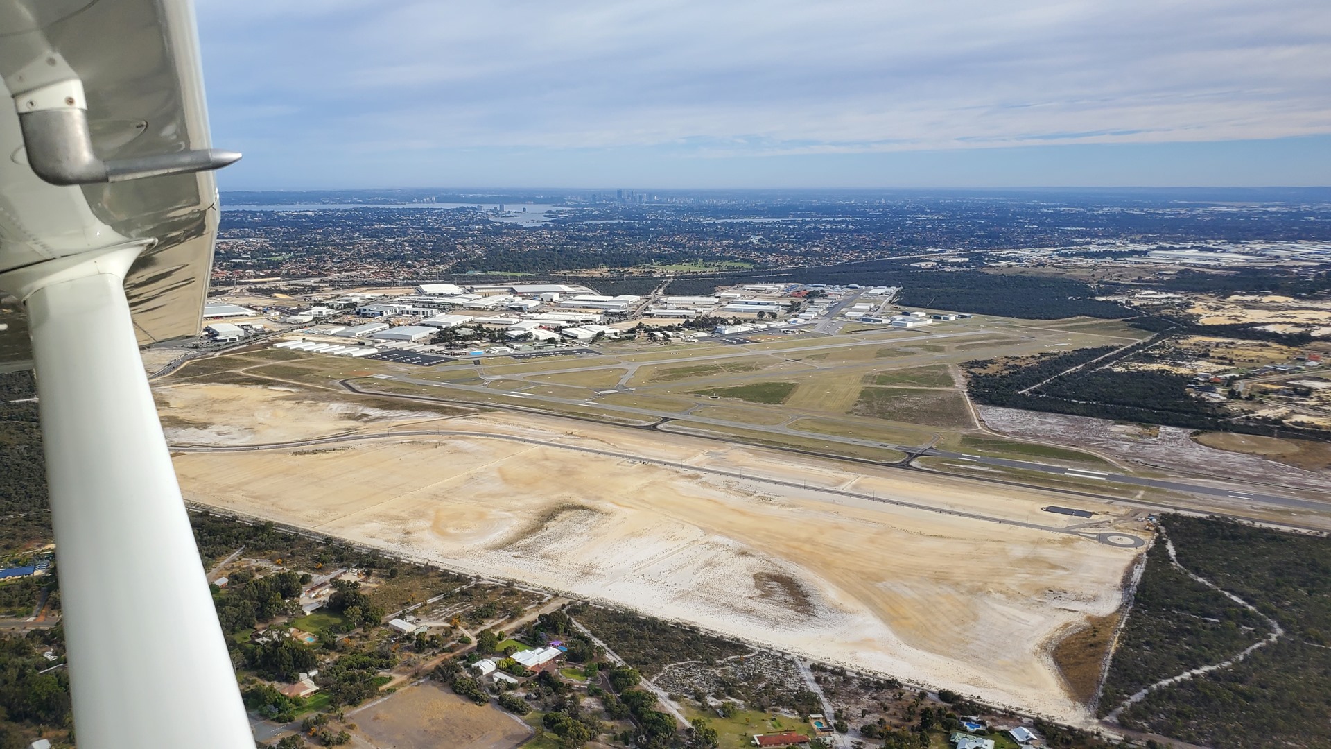
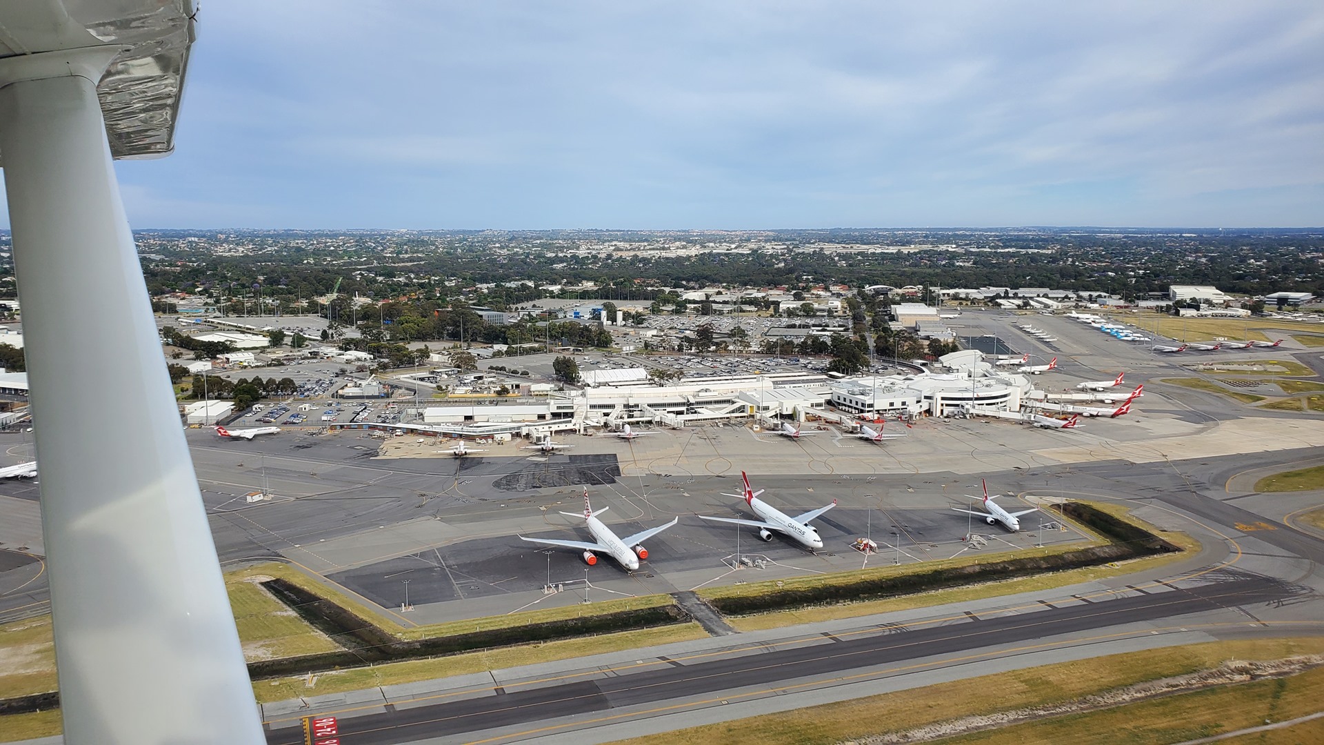
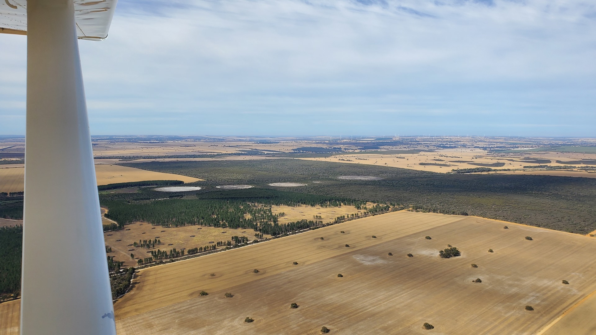
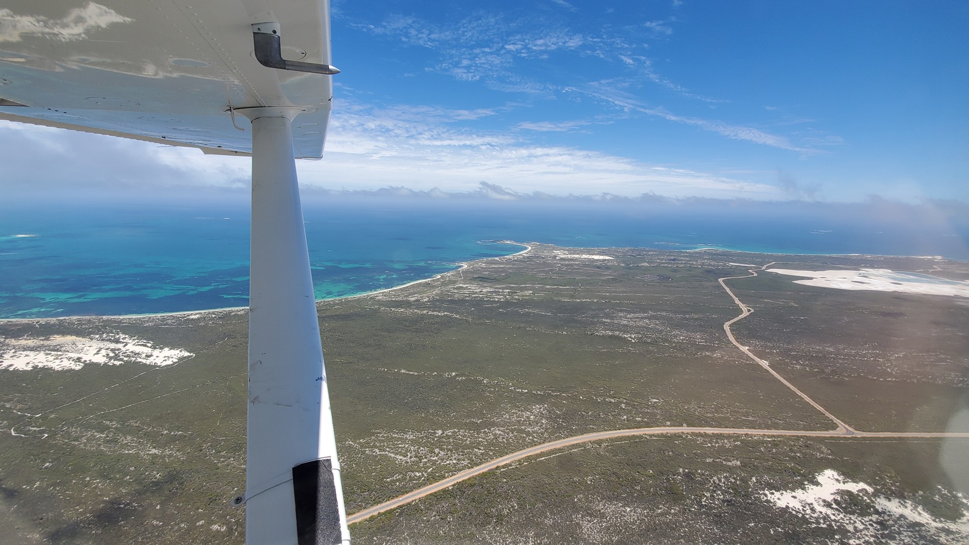
Unlike Adelaide, there was no delay in departure this time and I was quickly cleared to taxi back and depart to the west following one of the standard departure routes. After passing close to the center of the city I was cleared to turn north and follow the coast. Once clear of Perth airspace I was able to turn further east on course for my first destination, the airfield at Moora. The city suburbs very quickly gave way once again to the sprawling, dry fields of grain.


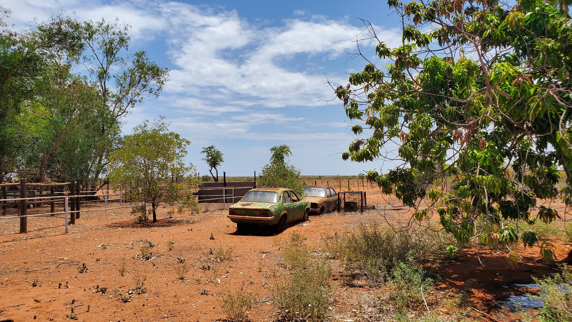
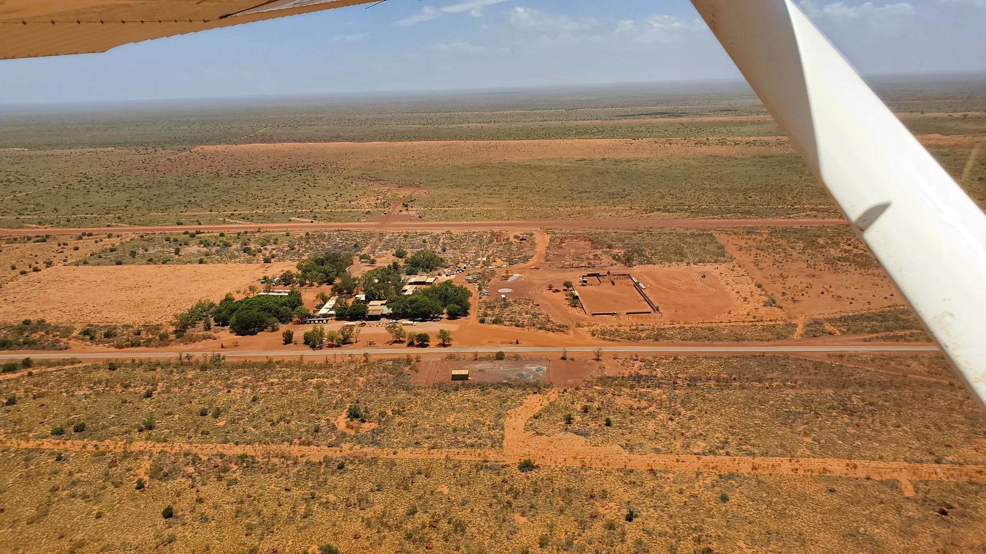
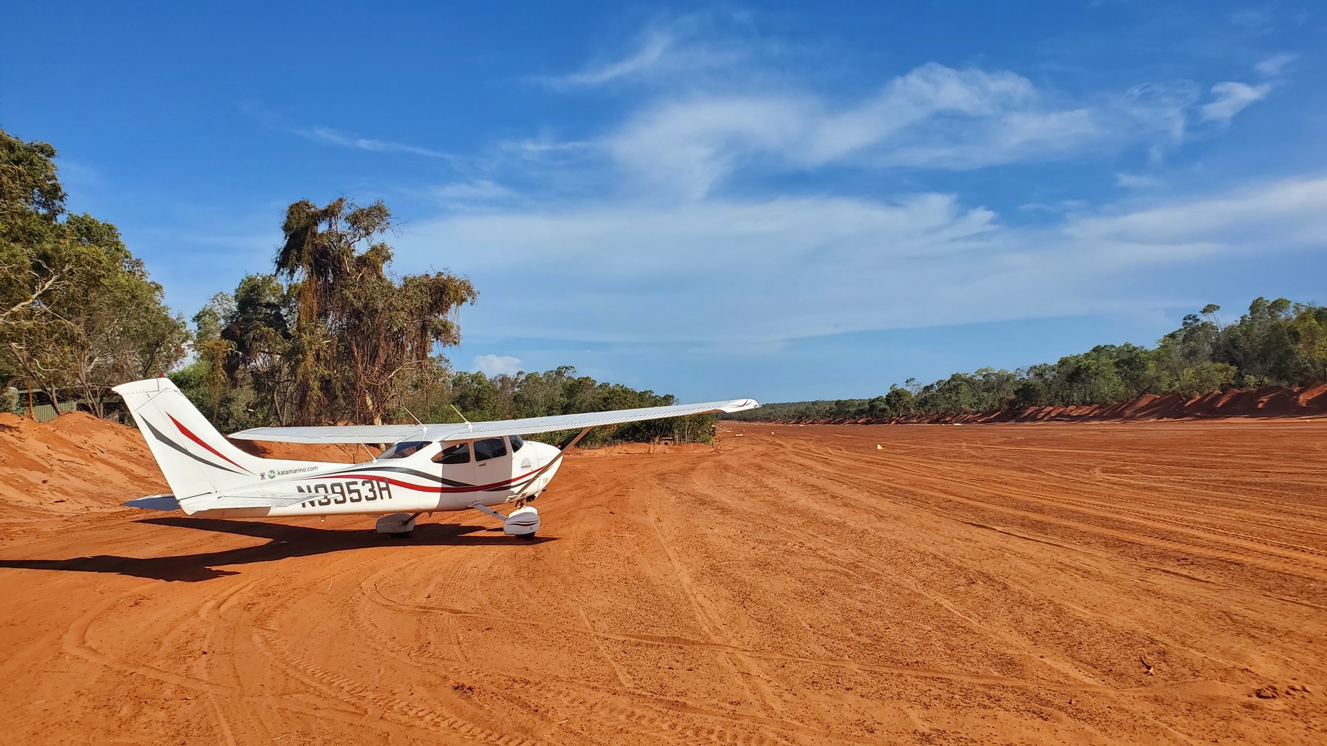
I set my wheels down briefly at Moora airfield for a touch and go, departing again to continue northwest and land at the dirt airstrip of Badgingarra. This strip services the Waddi Bush Resort, and the Country Airstrip Guide advertises it as open for visits by passing pilots. That was good enough for me! I performed a strip inspection and noted a truck parked on the crosswind runway, before touching down and taxiing to park at the end of the runway. The truck soon drove up, and the man inside greeted me; he wasn’t the owner, but would take me to see the man who was.
The owner, Michael, was very welcoming and drove me to the main house to meet his wife Noor and have a cup of tea. The resort was not currently open for tourists, and in fact they were only present because it was the weekend and they had driven up from the city for some time away. They offered to sell me some fuel from their AVGAS tank, and I took them up on the offer; this would simplify my fuel planning for the rest of the day. We all made our way back to the tank, via the barn to pick up the hose and the pump. It was a bit of a struggle to get the aircraft close enough to the tank, eventually involving a Bobcat excavator to remove a large bush for access.


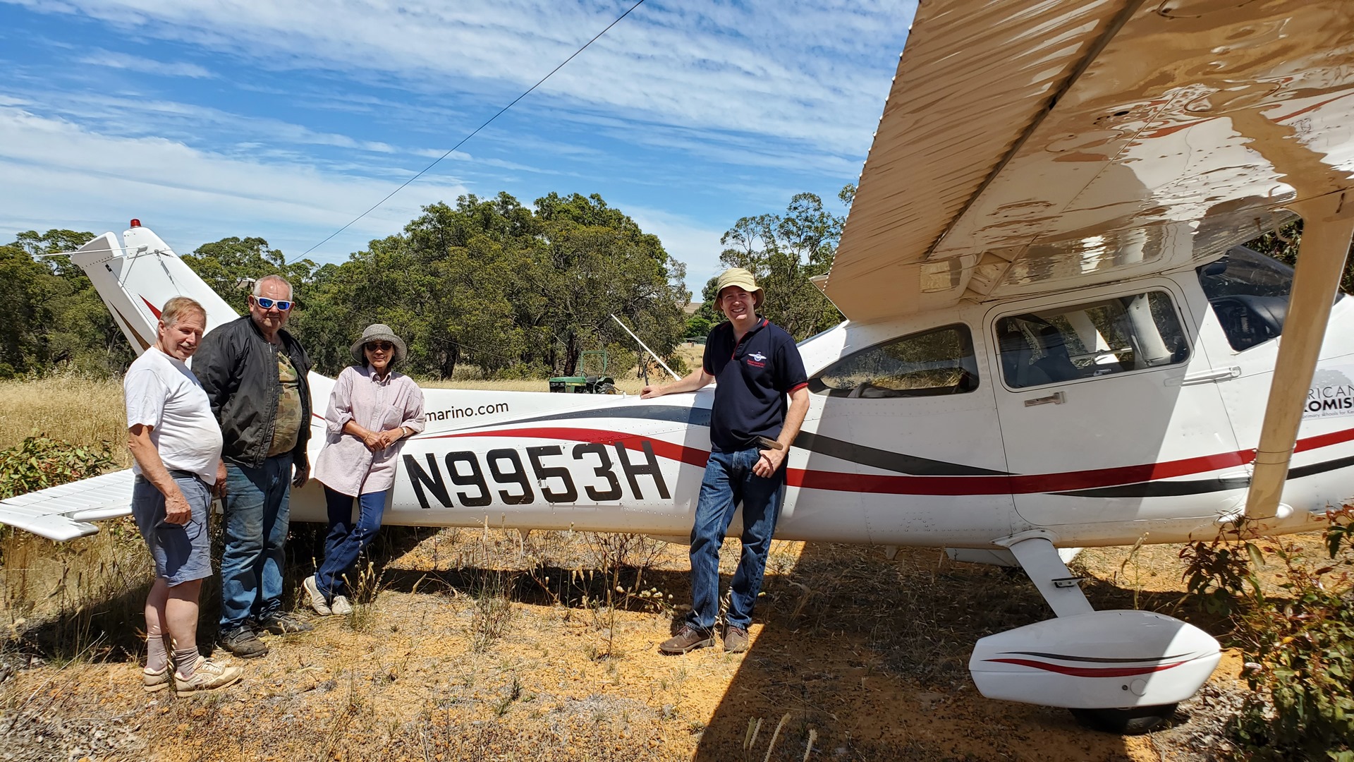

It turned out that the fuel level was too low for the pump, but we eventually figured out a solution. We removed the drain bung from the bottom of the tank and let the flow fill a jerry can. The owner’s friend, Charlie, stopped up the hole with his finger in between can fillings! Soon I had plenty of fuel for my subsequent stops. Michael and Noor would only take 50% payment and asked me to donate the rest to African Promise, which I was more than happy to do. I thanked them for their hospitality and continued on my way.

I struck out west, back to the coast, and made brief stops at the airports at Cervantes and Jurien Bay. At Jurien Bay there were parachute operations in effect despite the stiff breeze. I landed in between drops and enjoyed a croissant for breakfast as I watched the next lot of jumpers load up into the jump operator’s Cessna Caravan.
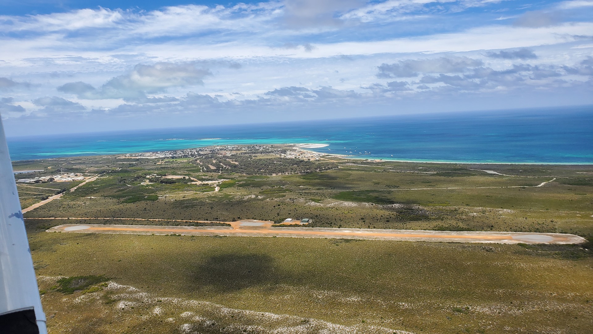
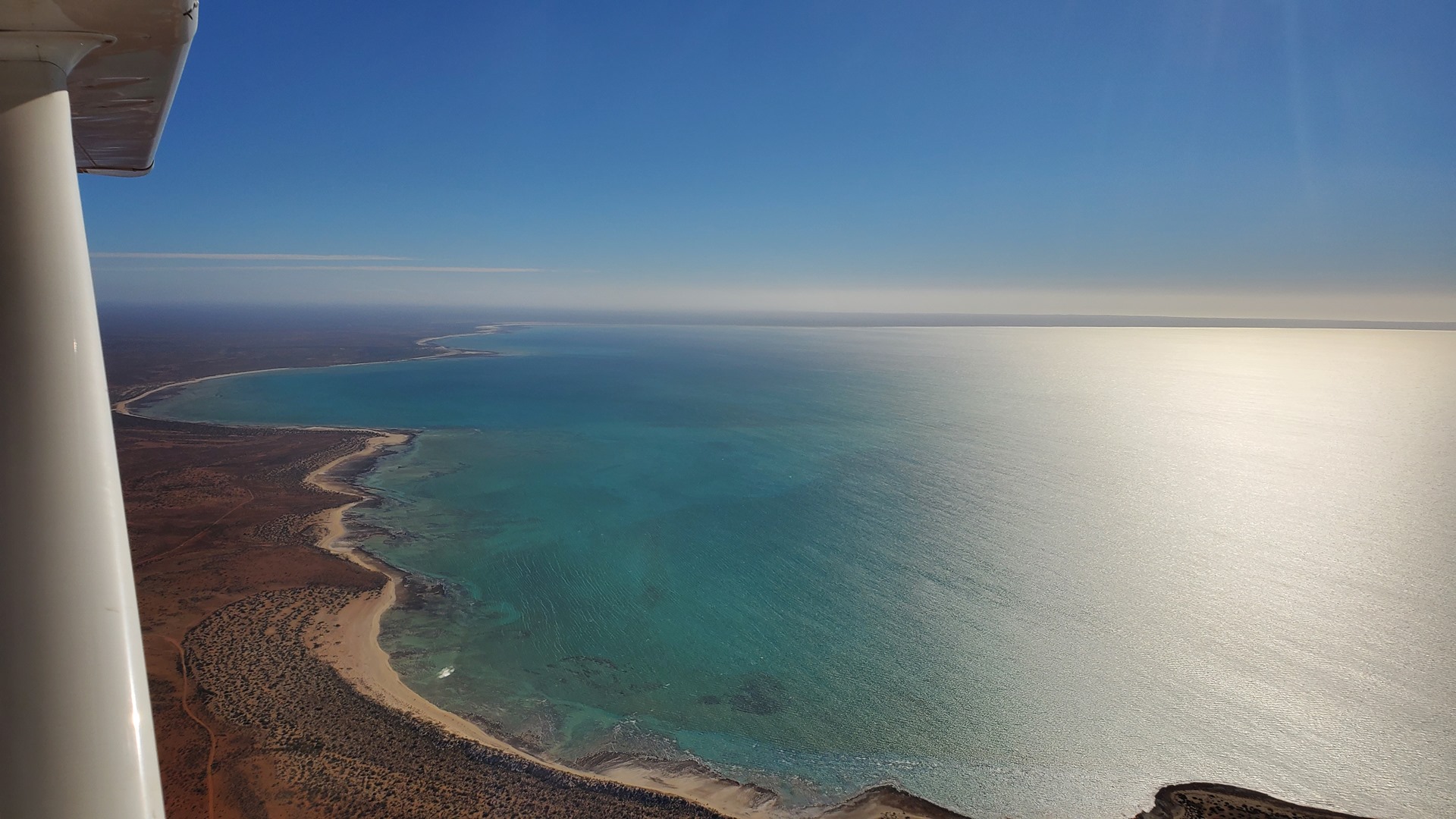
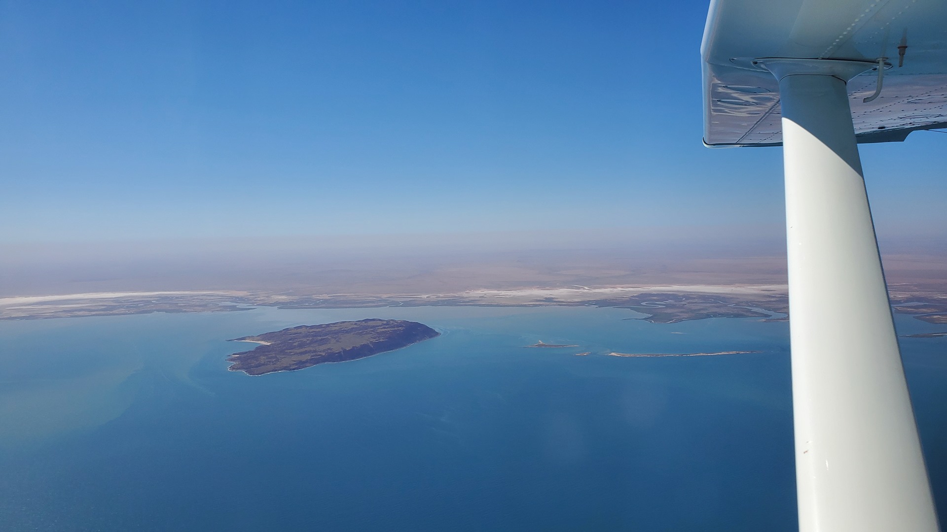
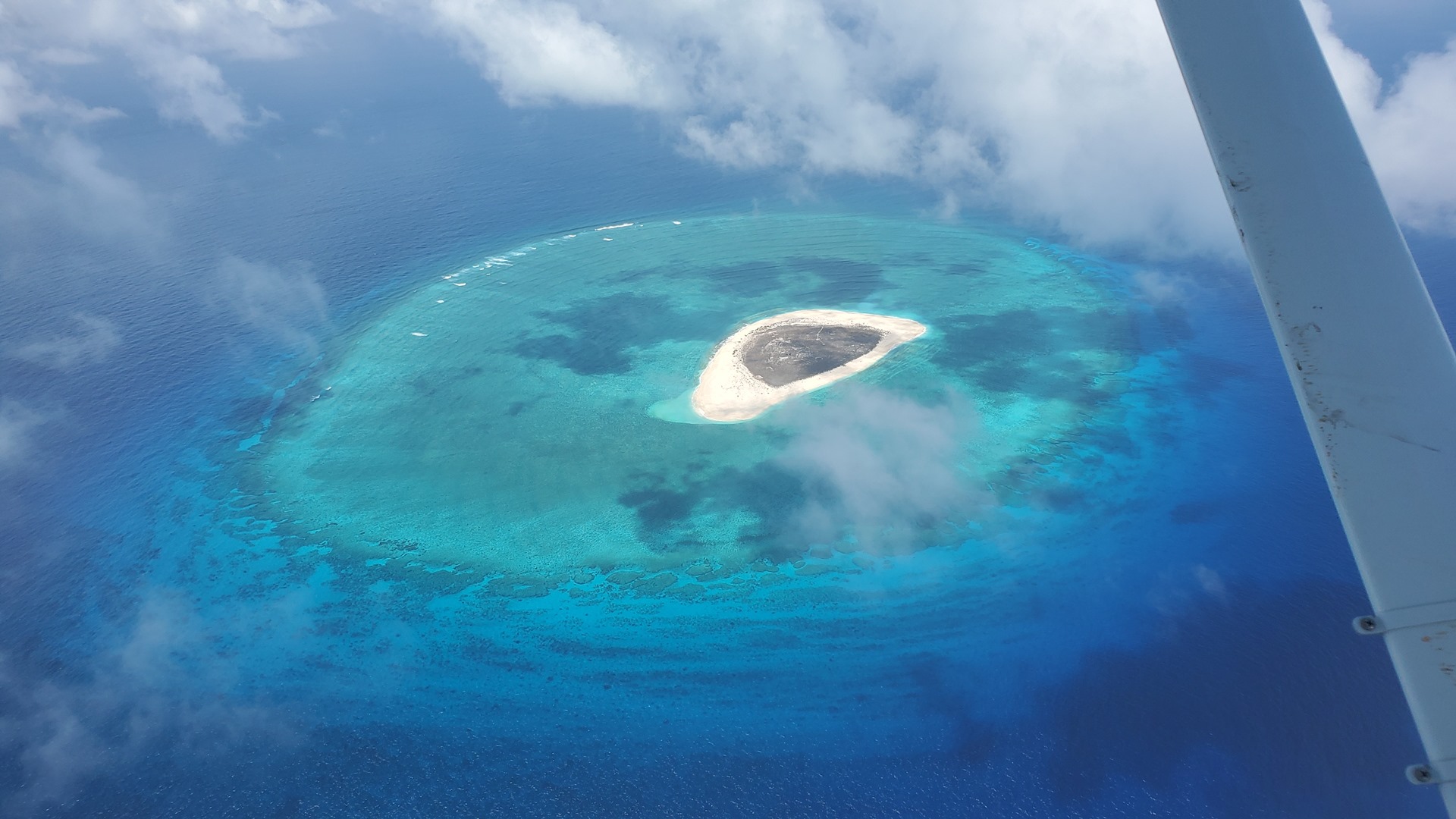
Slotting in between drops again, I taxied out and headed off north along the coast. The clarity of the water was incredible! I stopped off at Leeman, Dongara, and Geraldton for touch and goes or brief halts, taking the opportunity at Geraldton to don my life jacket for the next leg; this was the crossing to East Wallabi Island.


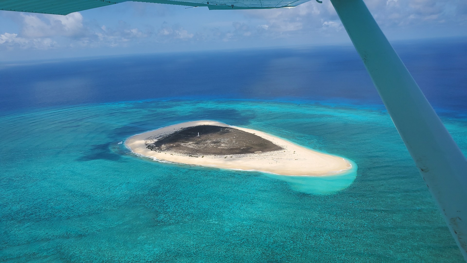
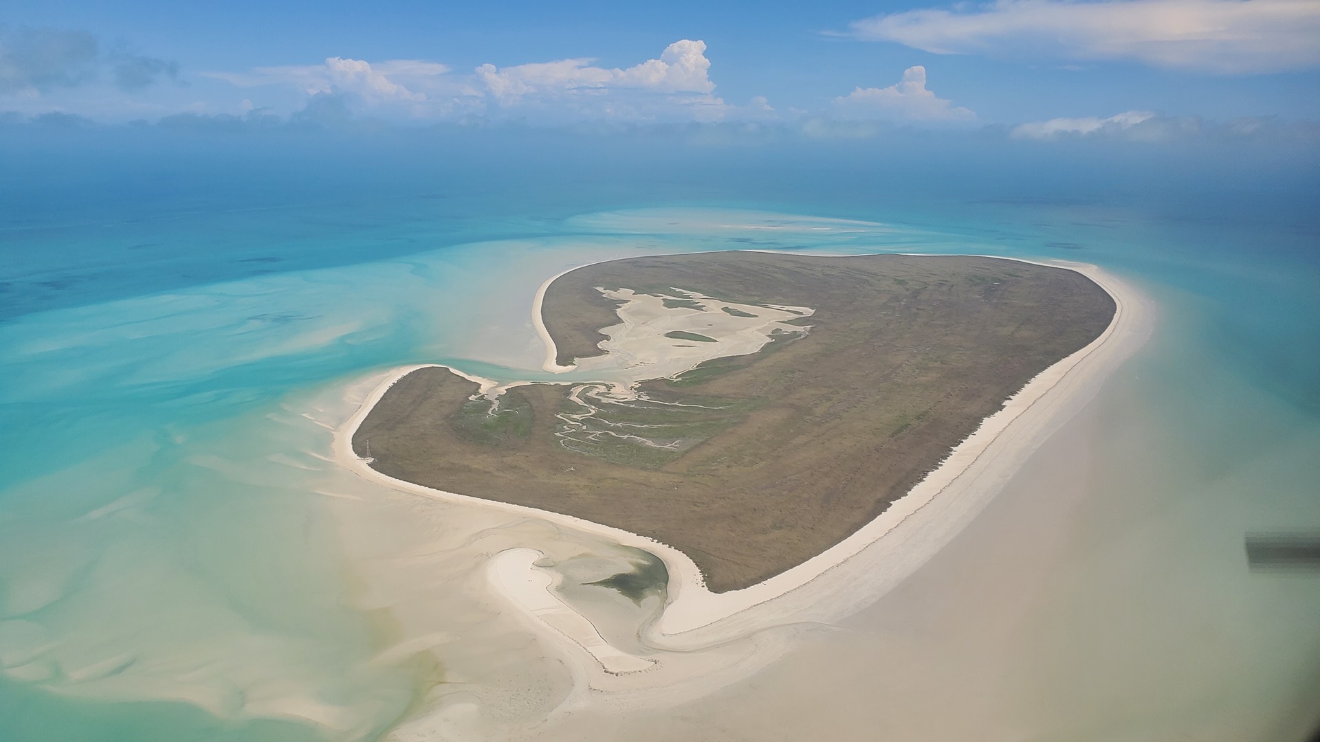
East Wallabi Island is protected, and permission is needed for landing. I had received this while in isolation, along with a few tips about visiting; apparently a work crew was out there performing maintenance to the runway. The island played a large part in the wreck of the Batavia, mentioned in the previous section of this write-up; it was the island which the soldiers ended up on after being evicted by the mutineers, and turned out to provide just enough food and water for them to survive. The water crossing to the island was short, and the ocean below looked warm and inviting!


The work crew could be seen down one end of the runway, and were well clear of my landing. I taxied into the parking area that is situated halfway down the strip, parking next to a Cessna 172 from a commercial operator which was the only other aircraft present. Signposts pointed the way along a short trail to the beach which I had passed on landing and I followed these eagerly to Turtle Bay, hiking along the sand and arriving at the little pavilion at the northern end just as the pilot and passengers from the C172 were leaving. I had the place all to myself, and took advantage of this to have a short swim and revel in the solitude. The midday sun was fierce, so I decided not to stay out in it for too long, and made my way back to Planey after an hour.


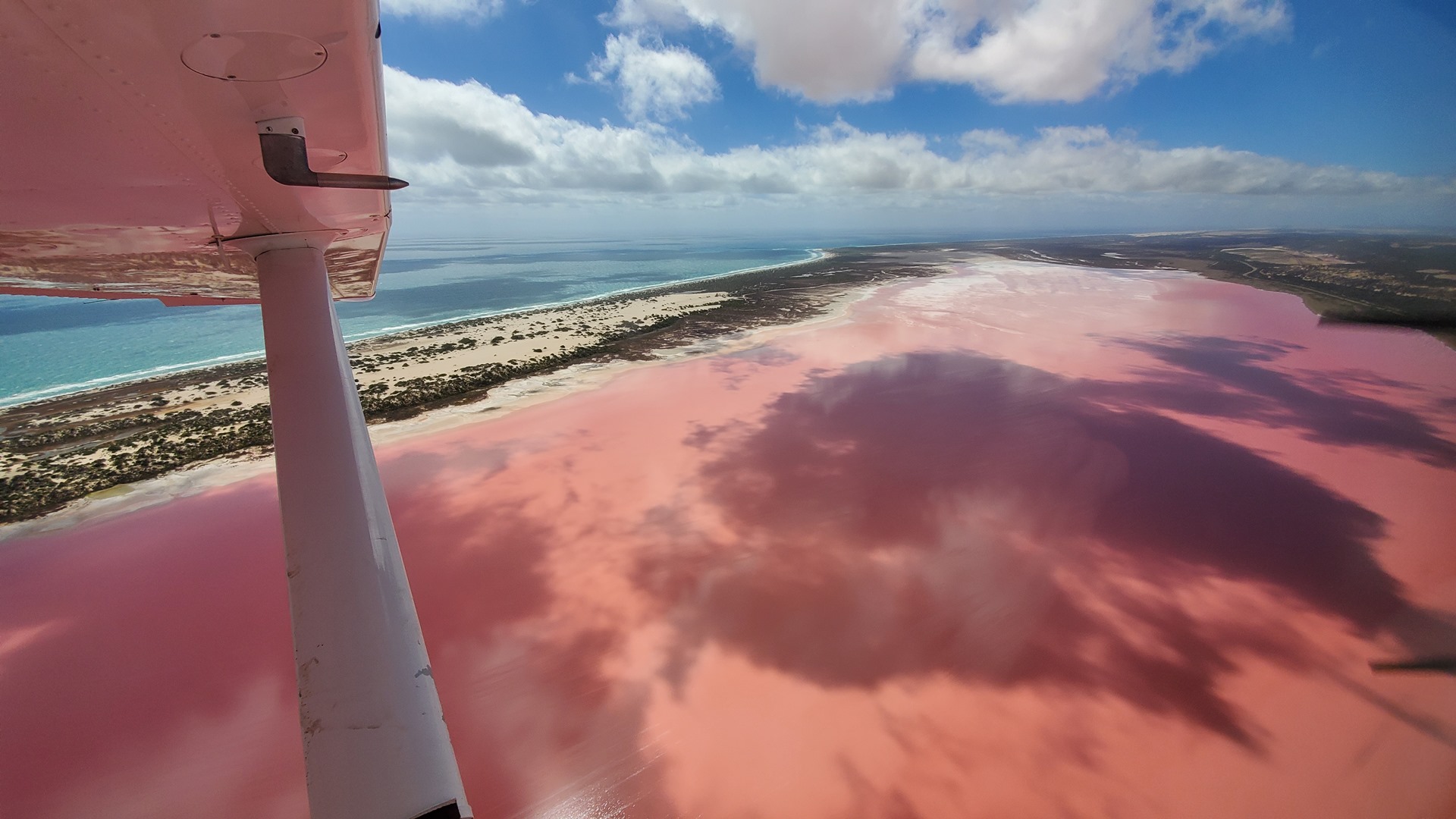
Three light aircraft arrived as I was waiting for departure, parking up at the southern end of the strip to load up the maintenance crew and ferry them home. I took off after they were all clear of the runway and departed over Pigeon Island; unlike East Wallabi this island did not seem to be protected, and was covered in shacks. The pilot of the C172 had told me about a worthwhile sight to see back on the mainland, the pink lake at Hutt Lagoon. This came into view after my crossing back to the mainland, and was much more pink than the rather disappointing example of a pink lake which I’d overflown back in Esperance!


I continued up the coast, pausing at Kalbarri airport for a touch-and-go before turning inland and making for the Overlander Roadhouse. It was becoming clear by now that one roadhouse is quite similar to another (this didn’t stop me visiting every one that I passed, however). It was tempting to land on the long straight highway in front of the roadhouse and taxi right up to the shop, but I behaved myself and used the dirt strip a five minute walk away. The temperature in this part of the state was really heating up, and an ice-cream at the road house was just what was called for.


The Overlander Roadhouse is located at the turn-off to Shark Bay, or Gutharraguda as it’s known in the local language. The area is designated by UNESCO as a World Heritage site, described thus:
Shark Bay’s waters, islands and peninsulas….have a number of exceptional natural features, including one of the largest and most diverse seagrass beds in the world. However it is for its stromatolites (colonies of microbial mats that form hard, dome-shaped deposits which are said to be the oldest life forms on earth), that the property is most renowned. The property is also famous for its rich marine life including a large population of dugongs (similar to manatees), and provides a refuge for a number of other globally threatened species.
The area is the second earliest part of Australia known to have been visited by Europeans, in the year 1616 (the only recorded earlier visit was by William Janzoon at Cape York in 1606). I flew up the central peninsula of the Shark Bay area and coasted out into the bay.


I crossed the waters of Shark Bay with a little tension in the back of my mind, given the name. Happily I reached the far side without incident, and landed at Carnarvon airport to refuel. I had phoned the fueler in advance, and he’d given me the code to a lockbox on the side of the pump which contained a fuel card to activate the equipment. After fueling I texted him the amount of fuel taken, and he let me know how much money to transfer! Very simple and convenient.
As I flew north towards my night-stop I passed the Minilya Roadhouse. This business was one of the few roadhouses without an airstrip. I circled the area to assess whether a landing on the road might allow a stop for a cold drink but it didn’t look like a good option so I carried on towards the dirt strip at Coral Bay, touching down as the sun was getting low on the horizon.


It was about a 15 minute walk to the backpacker’s accommodation I had booked a room at. Along the way I encountered a little collection of kangaroos grazing in the twilight. They didn’t pay me much attention. I dropped off my baggage and walked down the street for dinner; this was a resort town, all company owned, so it felt a little artificial. Not that I minded; I’d be up again before dawn to be on my way!
It was still dark as my alarm rang and dragged me out of my sleep. I needed to be at today’s night stop in time for a boat trip at 3pm, and there was a long way to go. I trudged back over the hill as the eastern horizon lit up. After stowing my luggage and performing a pre-flight inspection I roared off the dirt runway, probably waking up half of Coral Bay, and set off up the coast.


I flew north across the Northwest Cape as the sun rose steadily under my starboard wing, landing for a short visit at the airport of Exmouth. The town of Exmouth originally sprang up to support the nearby military base and solar observatory, but these days is primarily supported by tourism. The airport hosts a popular microlight school but at this time of day nobody was around. I put on my life jacket, and set out across the Exmouth Gulf towards Onslow.


Onslow town was founded in 1885 to serve the port at Ashburton Roads. The primary industry for the subsequent 80 years was wool. The port at Old Onslow silted up quote quickly, and in 1924 the town was moved to its new, present location. These days the town’s primary business is tourism, as well as support of the local industries such as salt production. I performed a touch and go at the Onslow airport before heading offshore towards Thevenard Island.


The flight guide labels Thevenard Island as a good fly-in destination for tourism, with visiting pilots being welcome. It boasts accommodation, a general store, barbeques and boat moorings in addition to a 1km brick-paved airfield. The Saladin oil field was discovered just offshore from Thevenard Island in 1985, with facilities being constructed on the island and production commencing in 1989. These facilities, including three large storage tanks, are currently being decommissioned. The runway was built by the oil operator, and was made of brick to facilitate its removal at the end of the project.

A pick-up truck pulled in shortly after I parked up. This turned out to be the manager of the tourist resort. Apparently the resort facilities had been closed this season thanks to COVID. He mentioned that the oil operator, Chevron, were very strict about airfield access and would probably start an investigation about my landing! This was strange given that the flight guides advertise the strip as being freely available for visitors. I never heard anything further. There was nothing to do here, so I set off again to the northeast.


I made the water crossing to Barrow Island. The airport here is strictly permission-only, but I wasn’t planning to land; I wanted to fly over the Gorgon Liquified Natural Gas (LNG) project. This enormous natural gas development takes gas from multiple fields, including the Gorgon field, off the coast of northwest Australia. Carbon dioxide is stripped from the gas and injected back into the ground, with the natural gas then being liquefied and exported by tanker along with other liquid products. The facilities on the island, including man camp, LNG facility, and export jetty were impressive in scale! Turning east from Barrow Island, I made my way back to the mainland and to the airport at Karratha.


Karratha is a pretty new city, being established in 1968 to accommodate the processing and exportation workforce of the Hamersley Iron mining company. It expanded in the 1980s as the oil and gas industry in the area developed. A little under 17,000 people live there and the population is on the decline. The major industries currently supporting the city are iron ore, ammonia, salt production, and the natural gas industry. Each year in August various companies including Pilbara Iron, Dampier Salt, and Woodside Petroleum sponsor one of the largest festivals in the North West, over two days. The “FeNaClNG” Festival’s name is derived from Fe (iron), NaCl (salt) and NG (natural gas) which, I think, is a bit corny. I parked up next to a brand new Cirrus SR22 with three on board, which started up and taxied out as I shut down to wait for the fuel truck. Before 9am I was back in the air and headed along the coast once again.


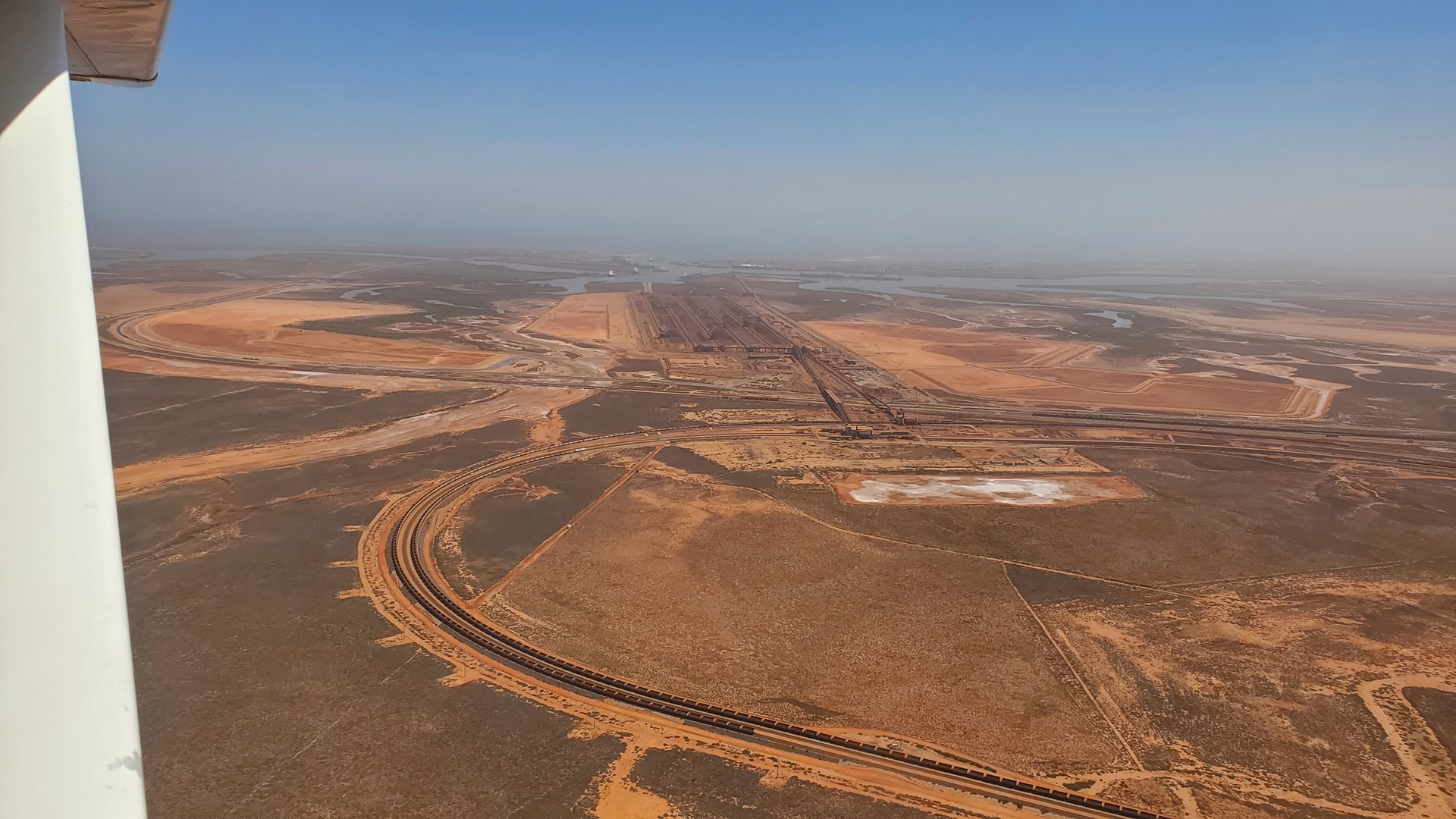

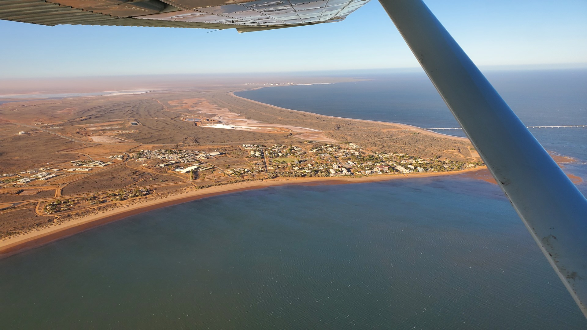
I flew a straight line along the coast to the city of Port Hedland. Port Hedland has a natural deep anchorage harbour which, as well as being the main fuel and container receival point for the region, is perfect for shipment of the iron ore being mined in the ranges located inland from the town. The ore is moved by railway from four major iron ore deposits to the east and south of the Port Hedland area. Iron ore shipments of as much as 500 million tonnes a year make this port the highest tonnage port in Australia. Other major resource activities supported by the town include the offshore natural gas fields, salt, manganese, lithium mining, and livestock.
Port Hedland is also the terminus of the unusual Blackrock Stakes race. This is a 122 km race from Goldsworthy to Port Hedland in which competitors push wheelbarrows weighed down with iron ore. It was first run in 1971 and since then the race has grown to raise more than $1 million for charity as a modified version where teams of 10, trios, duos and lone runners now push modified wheelbarrows containing 11 kg of iron ore over the distance. This does not sound like a good time, given the heat in this part of the world!


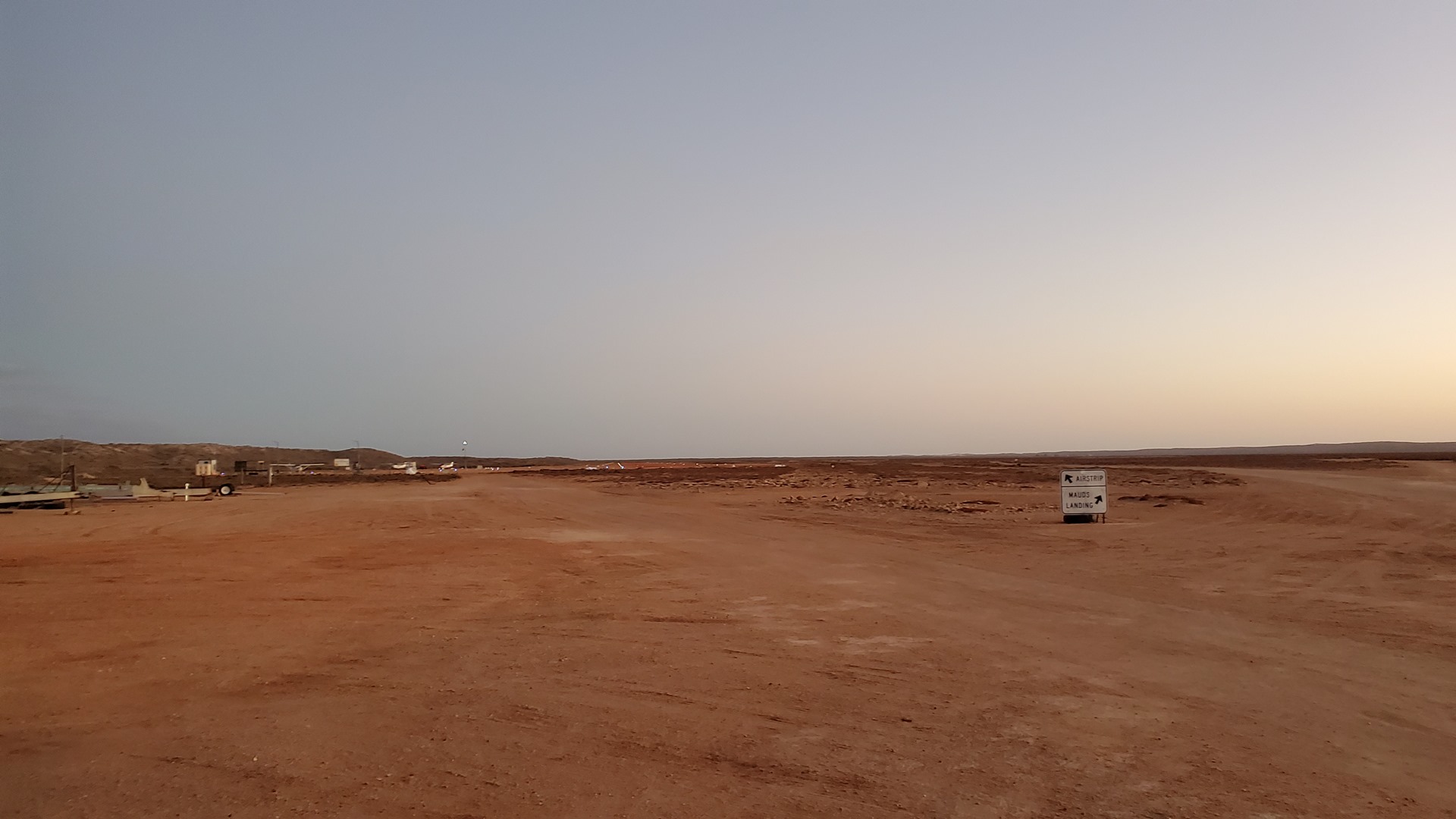
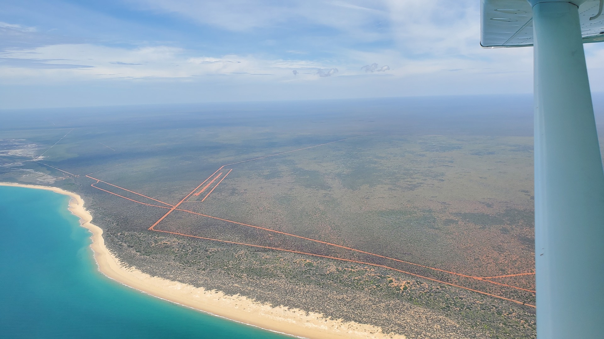
It was only a very brief stop at Port Hedland. I continued flying along the coast and highway 1 to the dirt strip at the Sandfire Roadhouse; a roadhouse much like any other which I’d visited. I took the opportunity to buy some simple food for my dinner the following evening, as I’d be staying at a property with no catering and nothing within walking (or indeed easy driving) distance.


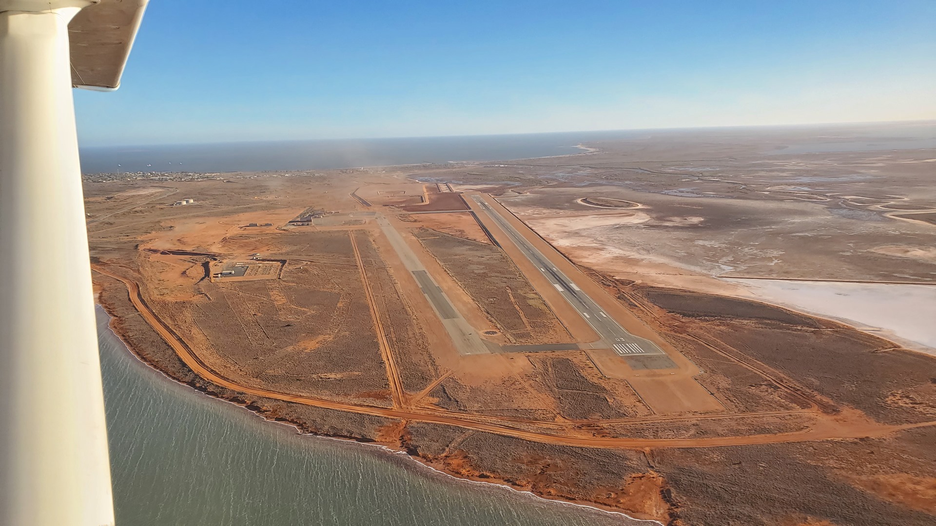
Another ice-cream saw me ready to move on. I had called ahead to Broome airport to check that they could fuel me up, and they confirmed that this would be ok despite the difficulties I’d faced there the previous year. I was planning a significant scenic flight the following day, and wanted to have plenty of fuel on board.
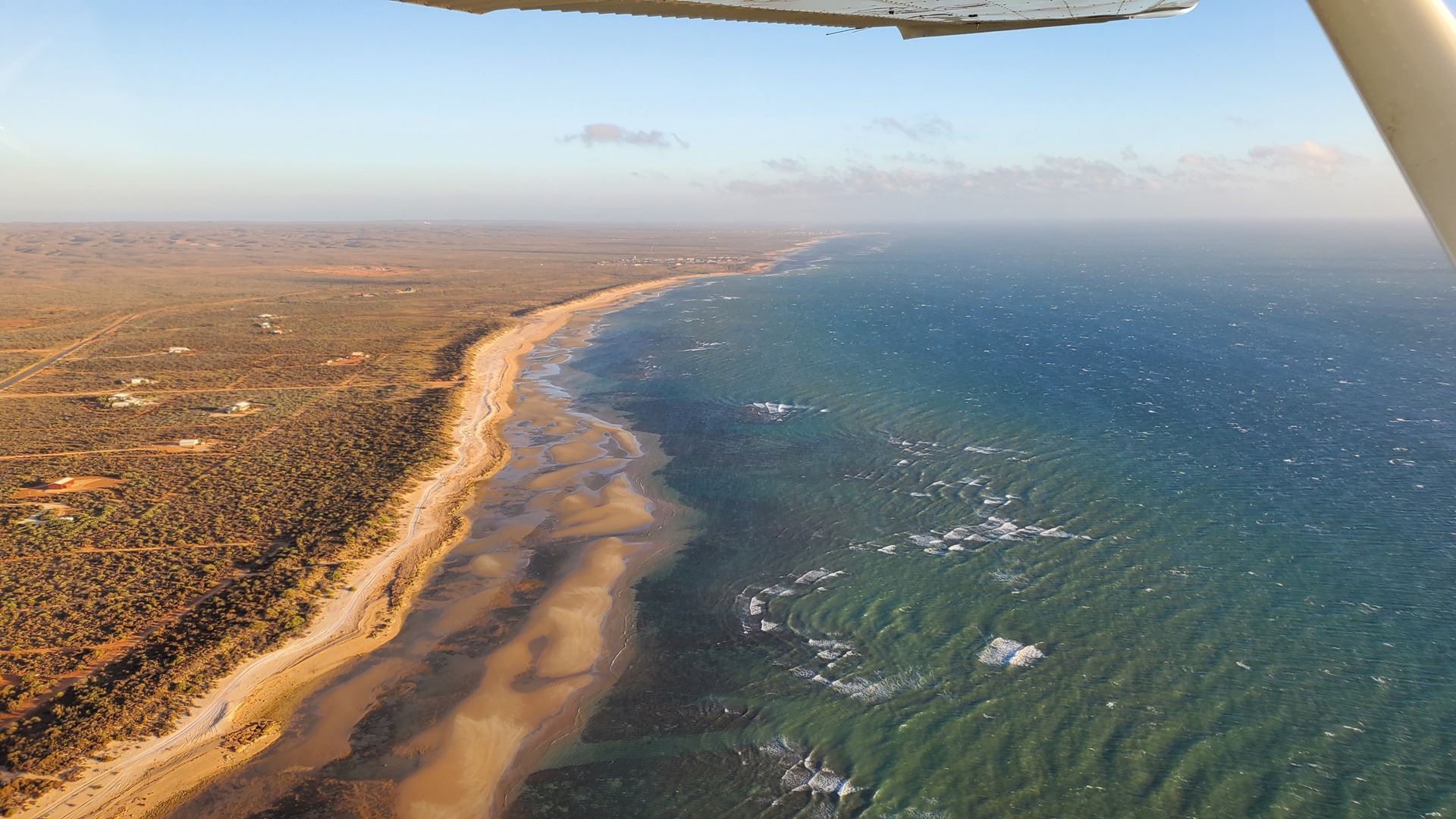
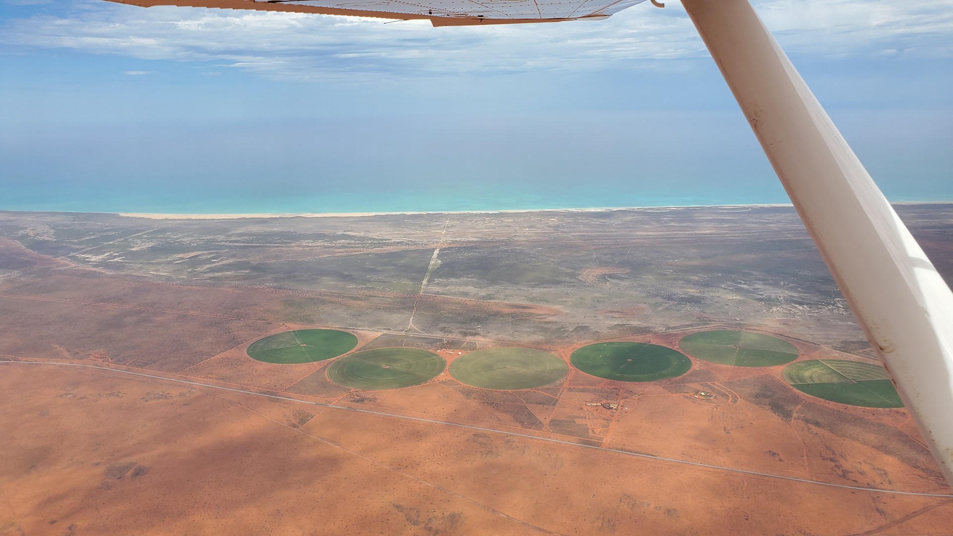
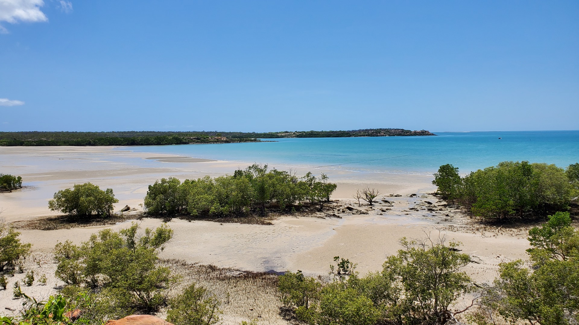
I flew up the coast along 80 mile beach, clearly somewhat inferior to New Zealand’s 90 mile beach. Curiously, it’s actually 140 miles long. I performed a touch and go at the Lagrange airport along the way. This small community seems best known for being in the area of the 1865 “Lagrange massacre”. Three white settlers were exploring the area, but were ambushed and murdered by local tribesmen in their sleep. A larger party sent to search for them was ambushed by natives, but fought them off with no losses.


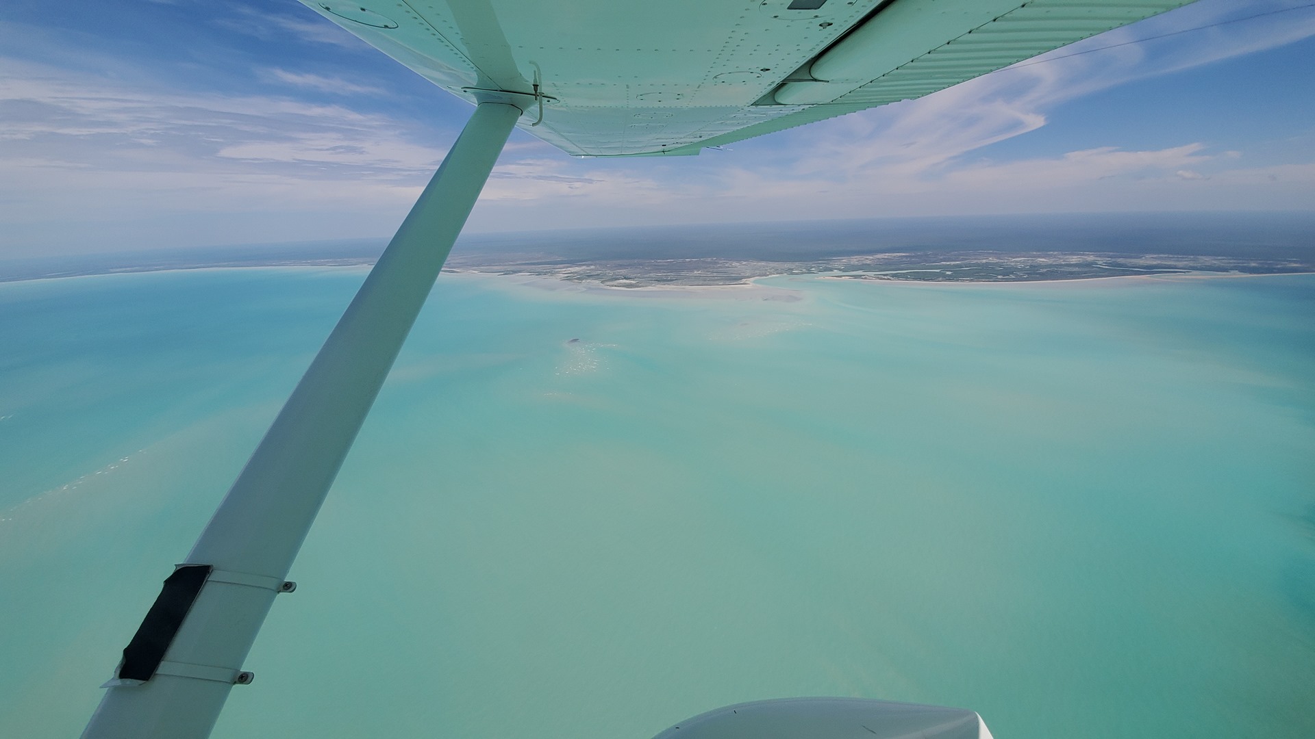
As I flew along the coast towards Broome I passed the Eco Beach Wilderness resort. I had originally wanted to stop here, as the charts and flight guides advertised an airstrip. On calling them however I discovered that they no longer maintained the strip and it was out of use; perhaps it hadn’t been worth the limited fly-in traffic. From Eco Beach I struck out across Roebuck Bay towards Broome. It felt a bit strange to be back here more than a year after I first passed through, imagining that my trip would be long finished by this time.
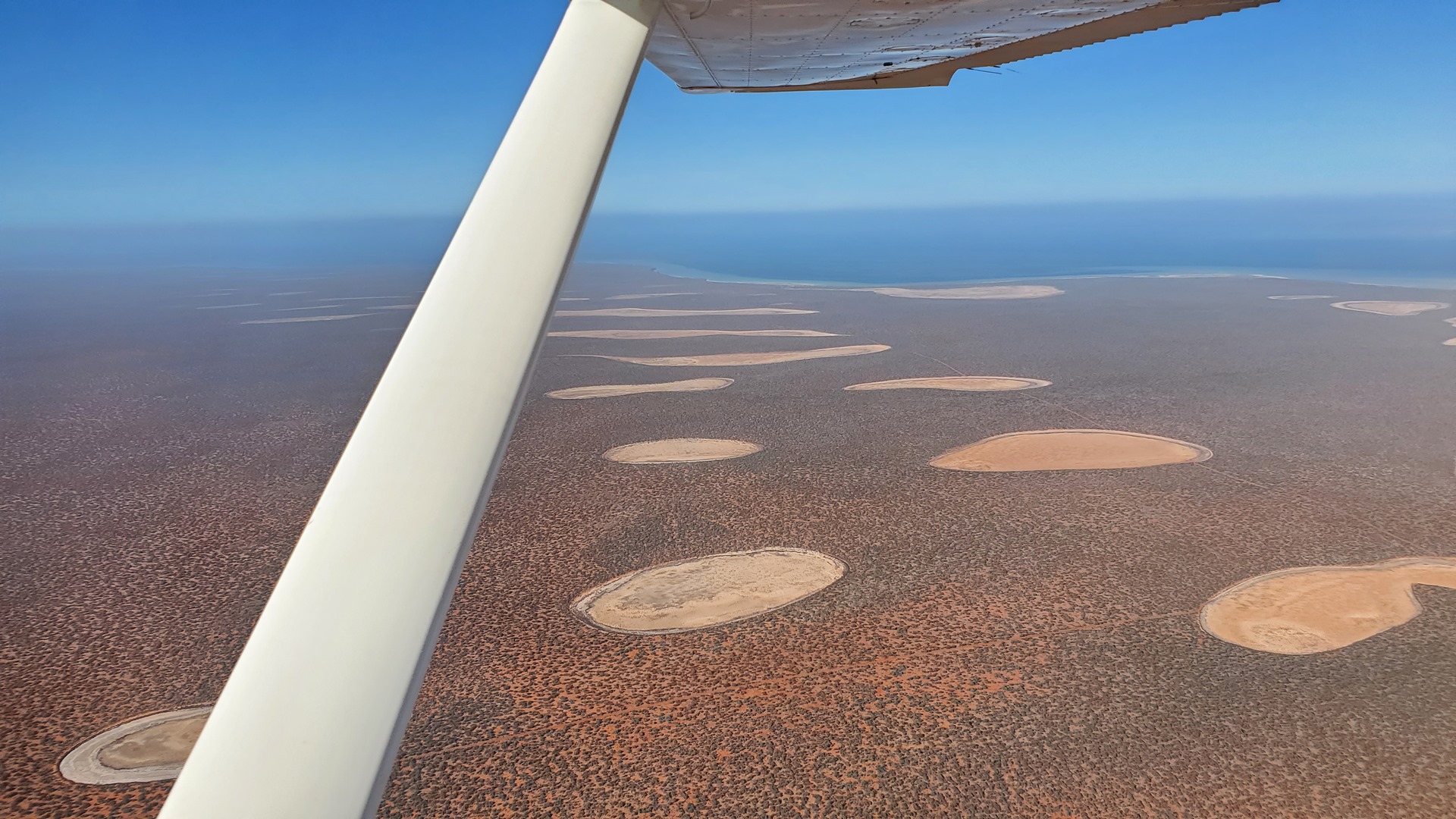
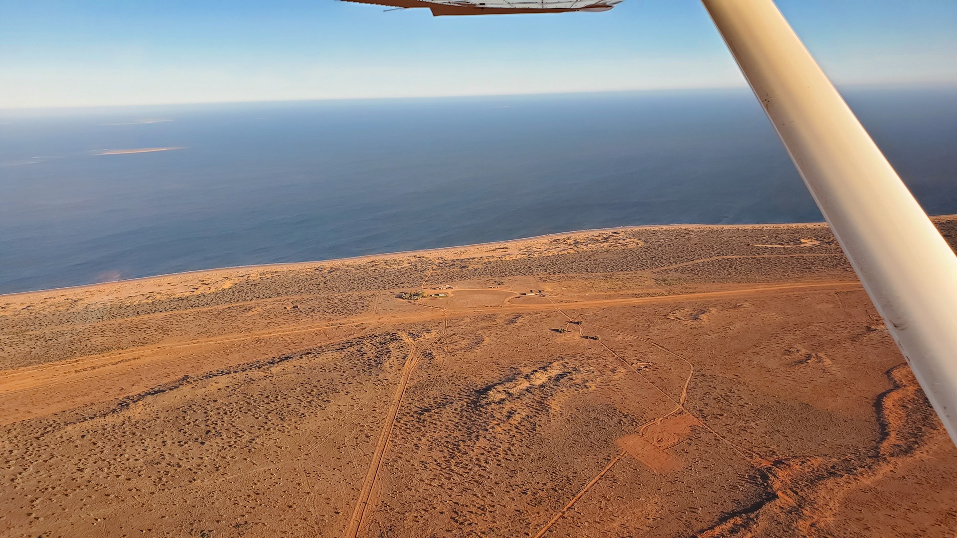
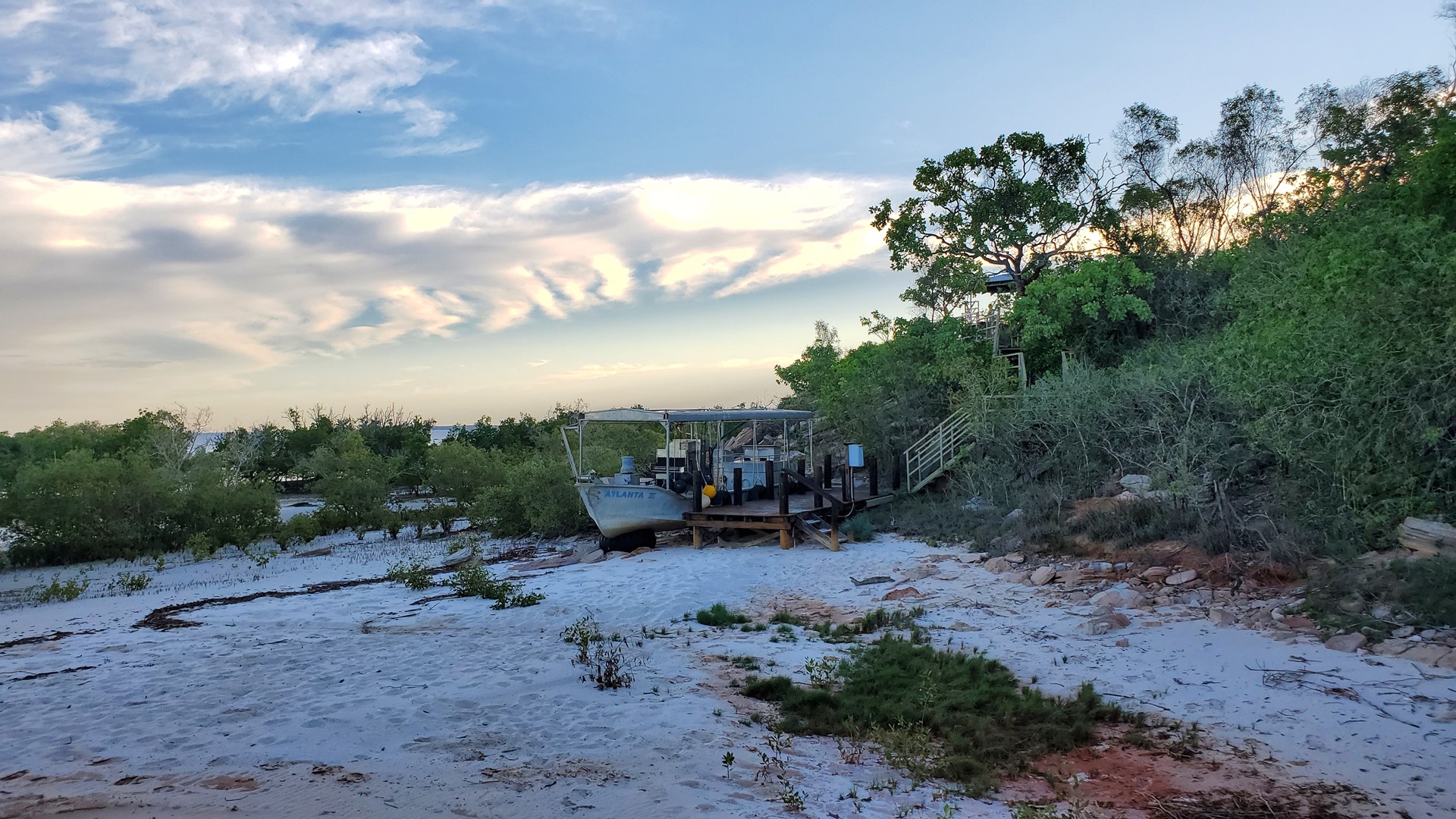
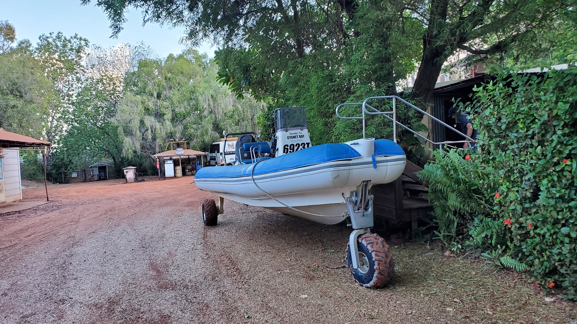
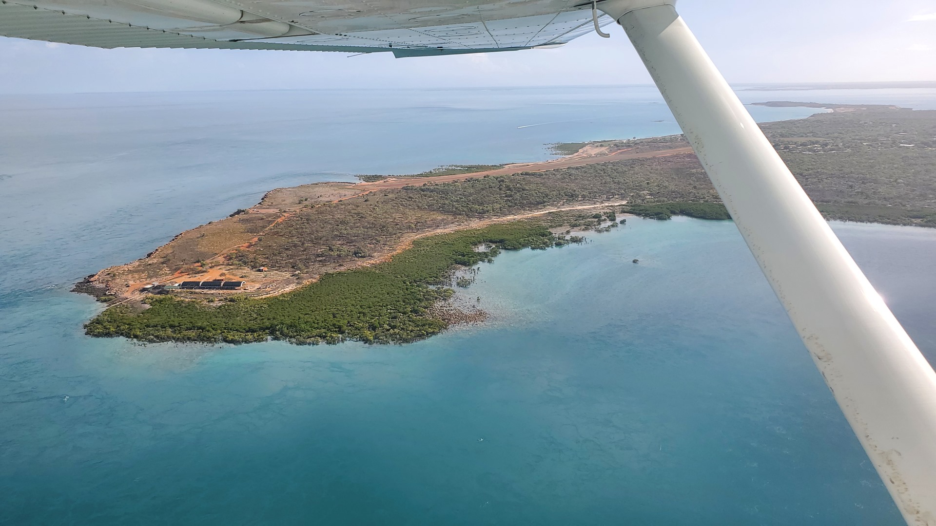
Refueling at Broome was relatively quick and I was soon on my way again. I flew over the arid sands up along the Dampier Peninsula. There are quite a number of airstrips up this way, both for private facilities and also to support the subsidized flights that are provided to native communities. I was bound for the airfield at Cygnet Bay, a pearl farm that also offered food, accommodation and tours. Their dirt strip was easily located, and the farm vehicle pulled up to collect me just as I was taxiing in.


It was a ten minute drive down a bumpy dirt track to the accommodation at Cygnet Bay. I’d managed to secure the last room, which was luckily just a short walk from reception; most were 1km away or more. I dropped off my baggage and quickly changed before making my way to reception to meet the guides for my afternoon boat trip to the beautiful Waterfall Reef.
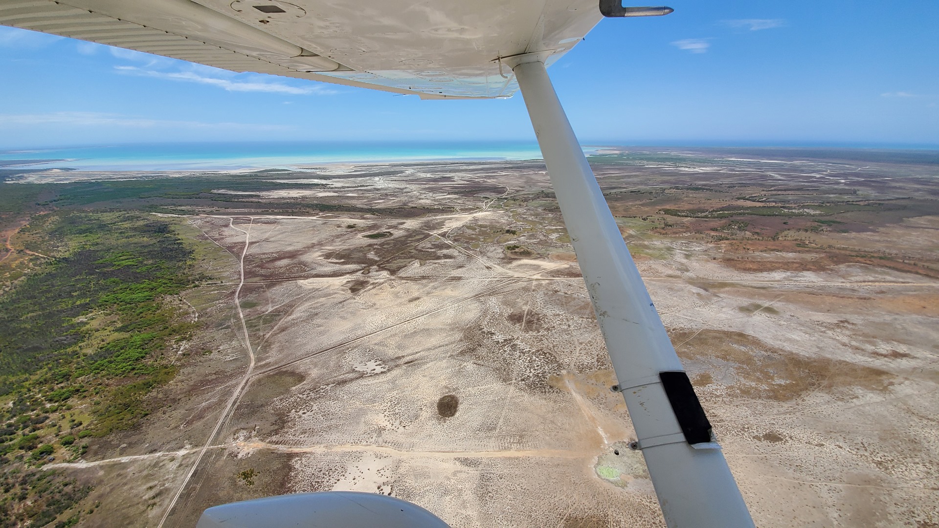
The waters off of the northwestern Australian coast line have an unusually massive continental shelf. This large, shallow shelf amplifies the tidal shifts and leads to tidal changes of over 10 meters between high and low points. Such an enormous movement of water on a regular basis causes some unusual phenomena. Waterfall Reef was the first of these which I would experience.
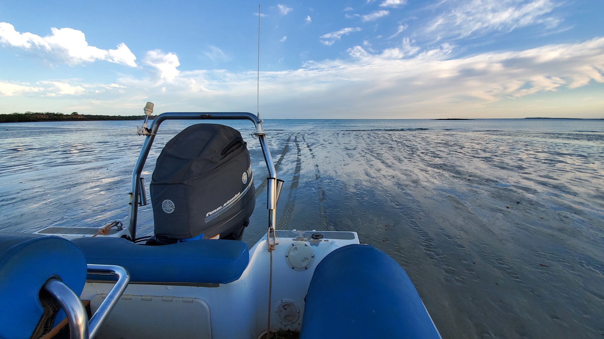
I and the other few tourists boarded the inflatable boat at reception, which is not terribly close to the water. This boat came with wheels however! We trundled down to the slipway and into the water, where the wheels were withdrawn and we turned into a true boat. This vessel did not take us far though, just to a slightly larger tour boat with an awning which was moored in the bay. We set off to explore the swirling tides created by the huge volume of water that flows in and out of King Sound.
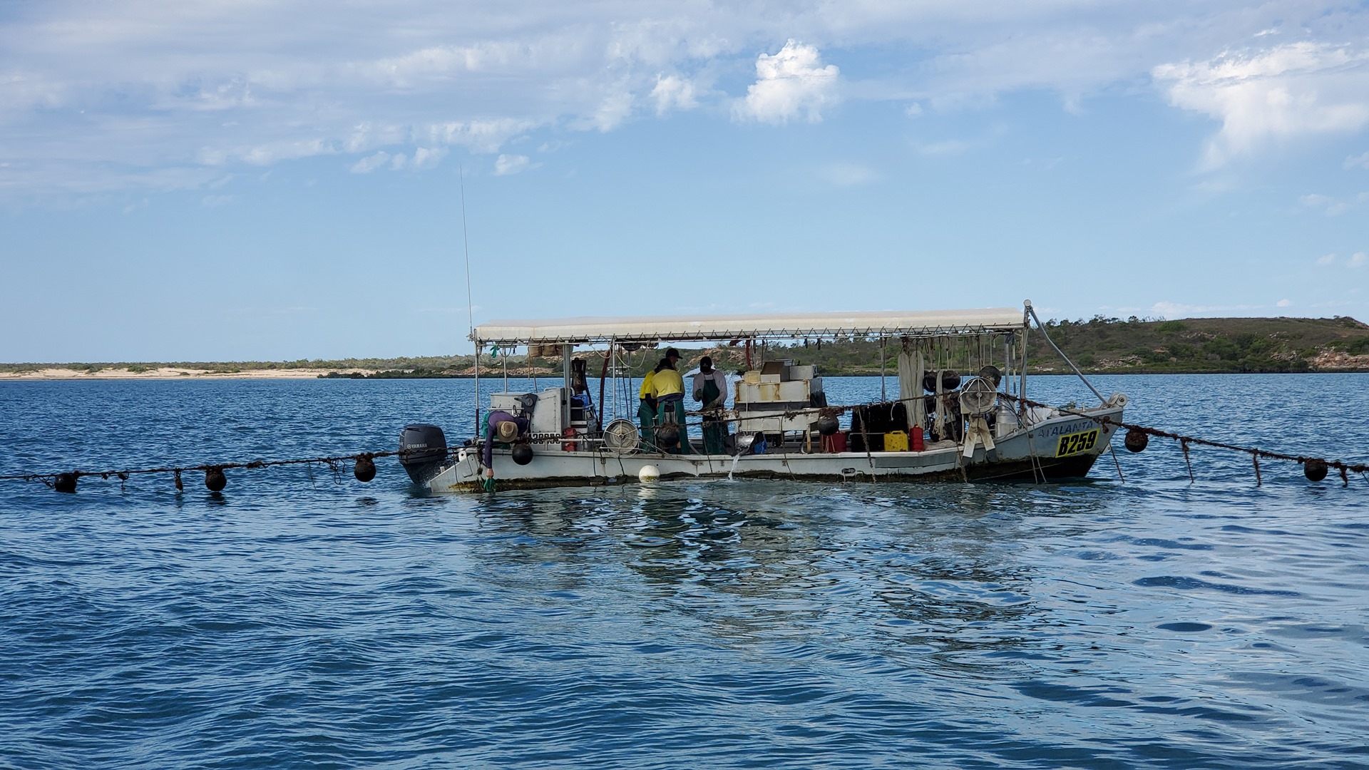
Our first stop was at one of the rows of oysters belonging to the farm. An oyster boat was servicing this row, which consisted of pulling up the line that holds the racks of oysters and cleaning the shells one by one to avoid hangers-on that might slow their growth. Apparently the huge tides that race through the area are excellent for the pearls, as they both help to clean the shellfish out and also bring abundant nutrients.

We next cruised round One Arm Point, allegedly named after an unfortunate pearl fisher who had an accident with some dynamite, checking out the whirlpools and rapids caused by the out-rushing tide. From here we pushed the throttles forward and made our way to Waterfall Reef. This reef is part of the much larger Montgomery Reef, the largest inshore reef in the world. This particular section of the reef is situated such that it is covered by the sea at high tide, but as the sea recedes the water flows off the wide, flat top of the reef in a long waterfall. The phenomenon is only apparent in the middle period of the receding tide, and luckily for me this was at about 4pm today.

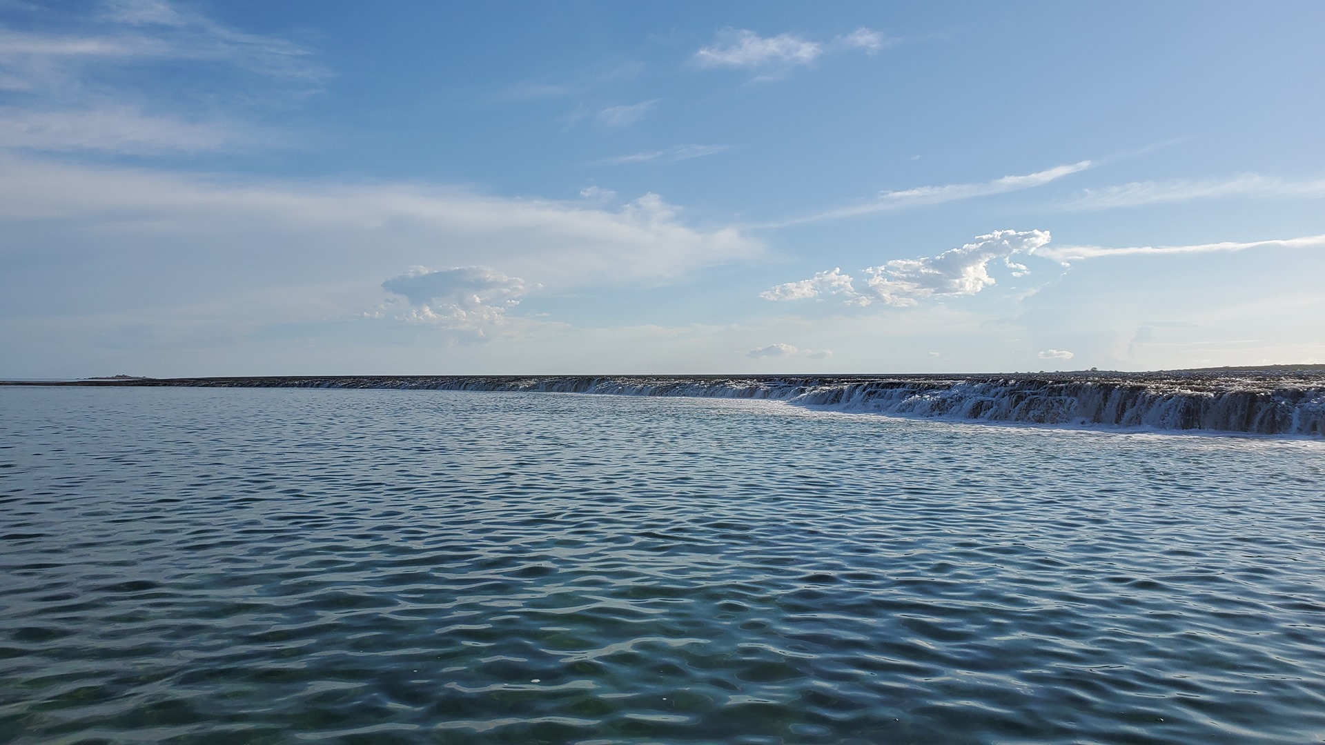
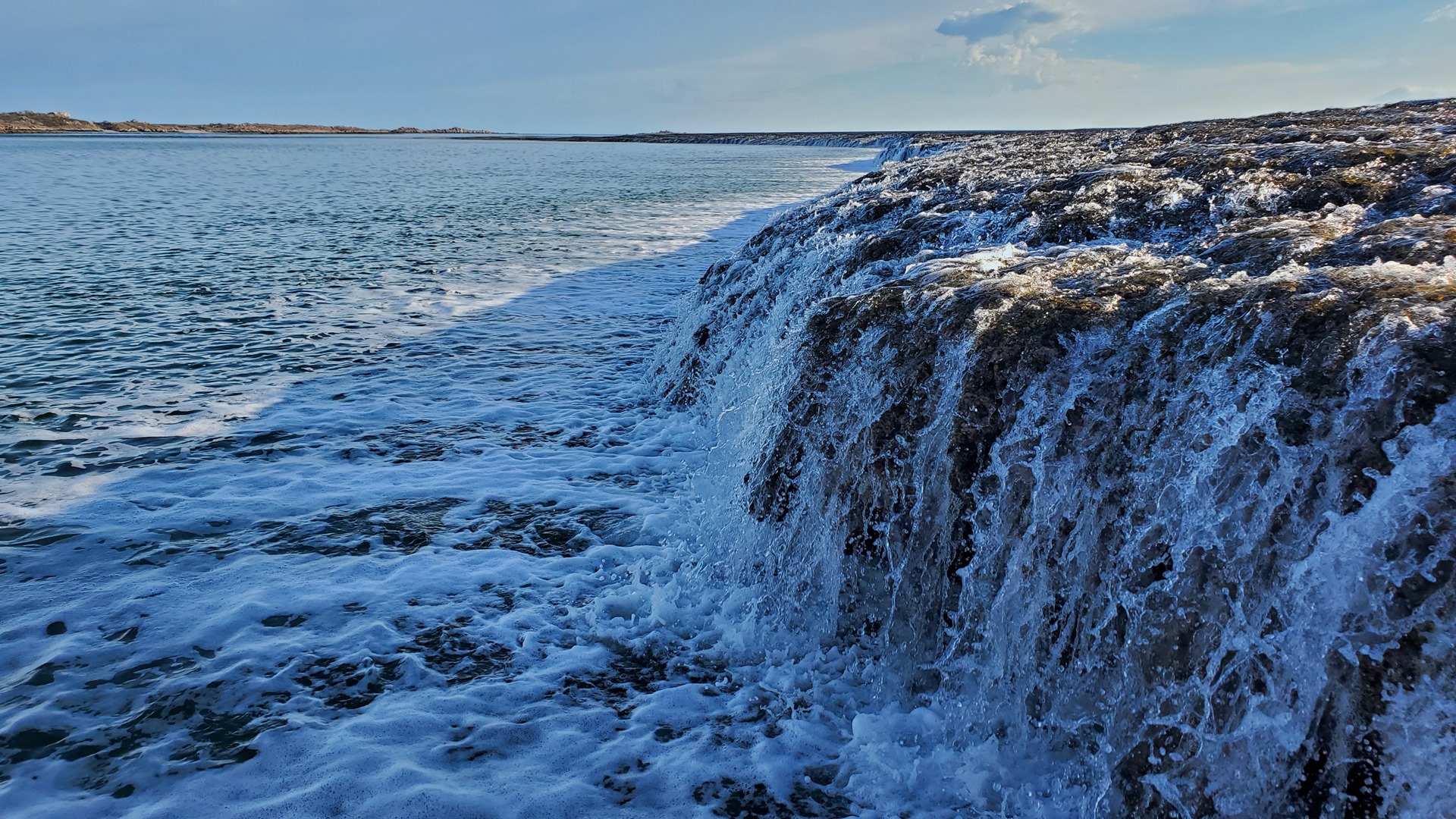
We sat for a while idling by the waterfall, watching as the tide dropped and the falls grew. The occasional fish could be seen darting around in the crystal clear waters below. After thirty minutes, it was time to turn the engines back on and make our way back to the bay, transferring back to the amphibious inflatable and returning to reception.

This was technically the first day of the “off-season” for the pearl farm, but happily they were still offering a buffet-style evening meal, topped off with unlimited chocolate brownies. A perfect end to the day.
I didn’t have far to go today, just 10 miles to the airstrip at the Kooljaman beach resort. I’d be putting in several hours flying, though! There were a couple of interesting sights, both natural and man-made, which I was keen to see. The first of these was another tidal phenomenon, and the tide timings were just right for a morning visit.


One of the staff drove me back to the airstrip, and I donned my life-jacket, took off and headed east. My first destination was the Horizontal Falls. The falls are formed when water pours horizontally through two narrow gorges in the coastal McLarty Ranges situated within Talbot Bay in the Buccaneer Archipelago. The falls occur after water backs up behind the range during tidal flows in each direction. The seaward gap is about 20 metres in width, while the landward one is about 10 metres. The natural phenomenon is created as seawater builds up faster on one side of the gaps than the other, creating a waterfall up to 4 metres (13 feet). With each change of the tide, the direction of the falls reverses. The Horizontal Falls have been described by naturalist Sir David Attenborough as “one of the greatest wonders of the natural world”. If he says so, they had to be good.


The first part of my flight took me over the entrance to King Sound, where the tides could be seen flowing hard. Before long the Horizontal Falls were in sight. There’s a common traffic frequency for the area where aircraft can coordinate for avoidance; one other aircraft was on frequency, a commercial sight-seeing flight. We agreed that I’d orbit at the lowest allowed altitude, with them 500ft above me.

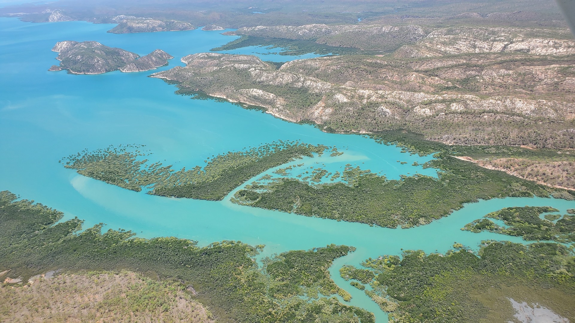
After passing over the Buccaneer Archipelago, at the northern end of King Sound, I began a descent to 1,500ft. The other aircraft soon came into sight above me, well clear vertically. The Horizontal Falls were clearly visible below, with tonnes of water rushing through the tiny gaps in the mountain ranges. Apparently certain boats can transition through the gaps when they’re in full flow, but it must be quite an exciting ride! I circled a few times to enjoy the dramatic views.


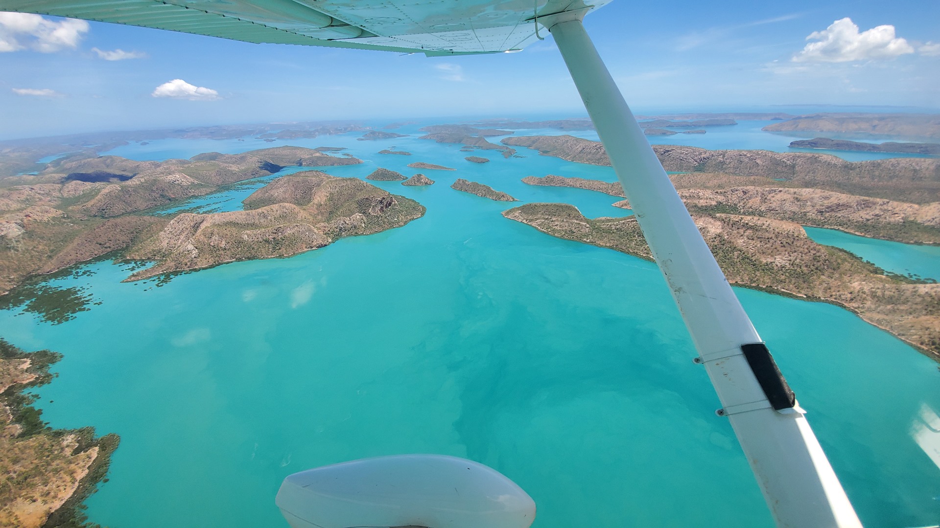
From the Horizontal Falls I set course out to sea into the Browse natural gas basin. My ultimate destination for sightseeing was almost 200 miles off-shore. Before getting there I reached Browse Island, a Western Australian Nature Reserve which is an important nesting site for green turtles as well as seabirds. Surrounded by rich coral reefs, there have been reports of humpbacked whales visiting to feed, although I didn’t see any as I circled overhead! The only sign of human activity was a lighthouse in the center of the island, built in 1945. There were rumours that the American Navy had used the island during the Second World War but no evidence is visible.

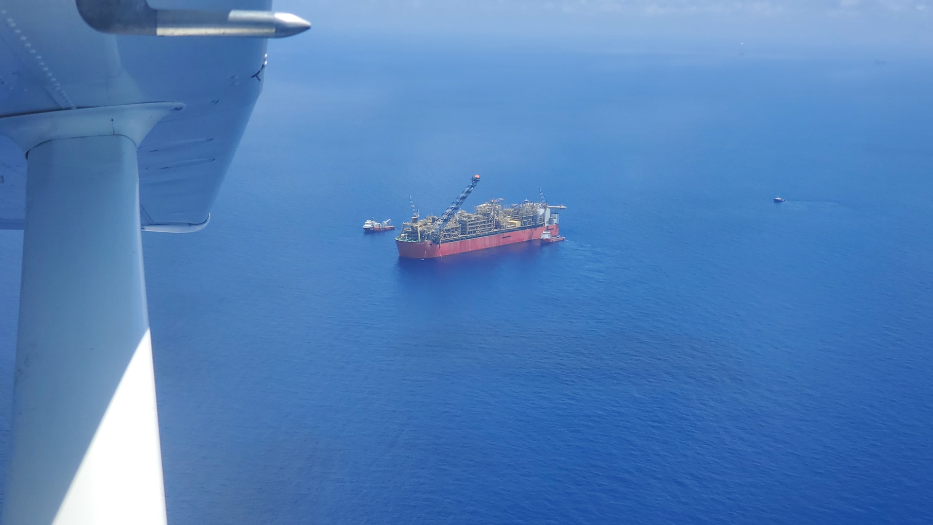
I flew on a few more miles from Browse Island, to the Prelude floating LNG ship. This is the largest floating structure ever constructed and weighs more than five times the weight of a Nimitz-class aircraft carrier. The facility was developed in order to exploit natural gas fields which are otherwise uneconomical to produce from, primarily due to large distances from shore. After being started up in 2018, Prelude was shut down in early 2020 due to technical issues, and was currently being started up again. I circled the ship once, not wanting to loiter for too long and cause concern to those on board, before setting course back towards the mainland. Along the way I chatted with an Australian Border Force patrol aircraft, who was clearly wondering what a single-engine Cessna was doing all the way out here!

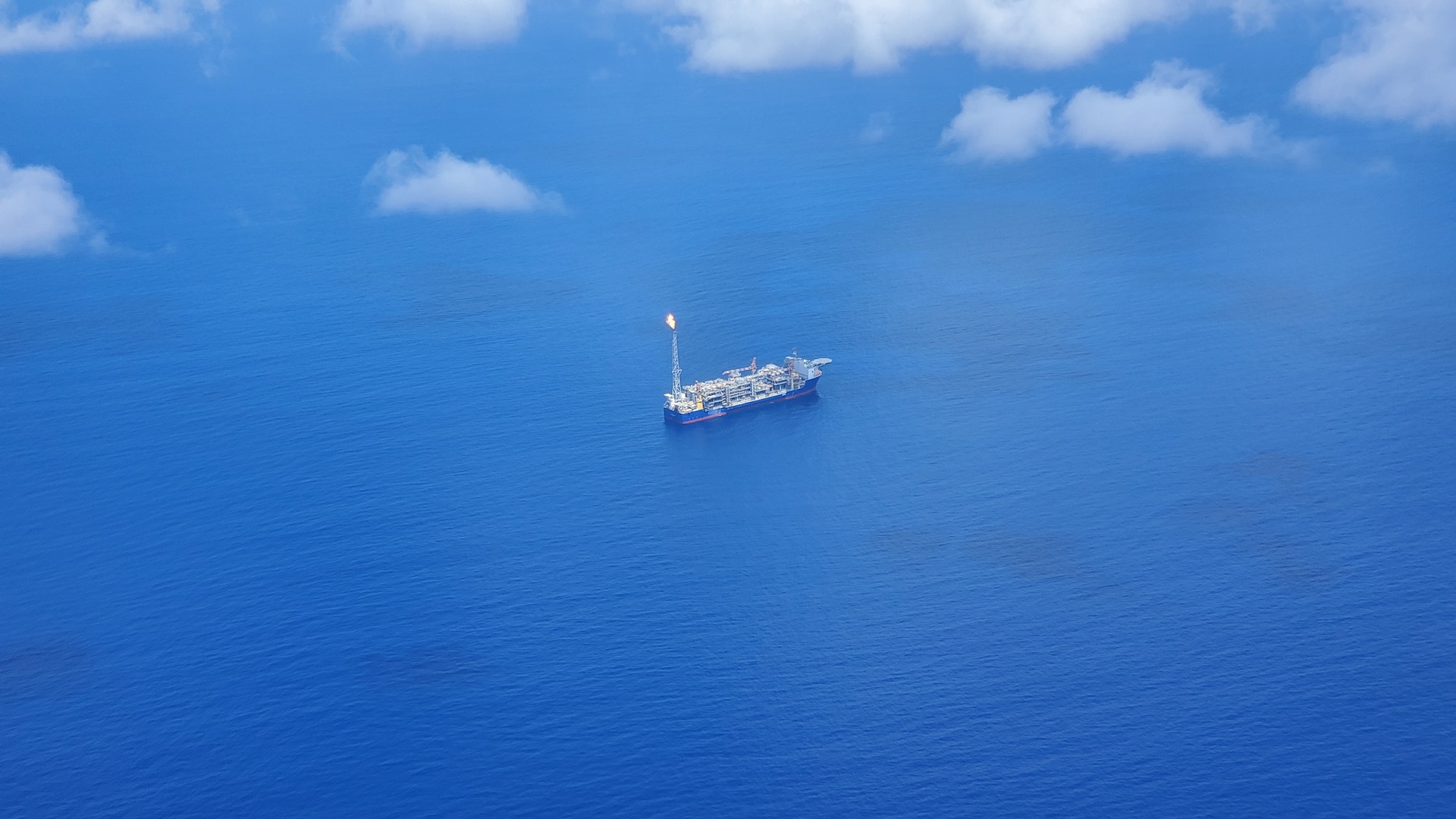

As I flew back I passed a helicopter heading the other way to service Prelude, and then the floating facilities that comprise the Ichthys natural gas development. This is made up of a semi-submersible production platform and a Floating Production, Storage and Offloading vessel. Liquids are collected from the facility by tanker, and gas is piped 900km through the longest subsea pipeline in the southern hemisphere. One wonders if the Prelude project might have been more straightforward if they’d worked out an agreement to share this pipeline!
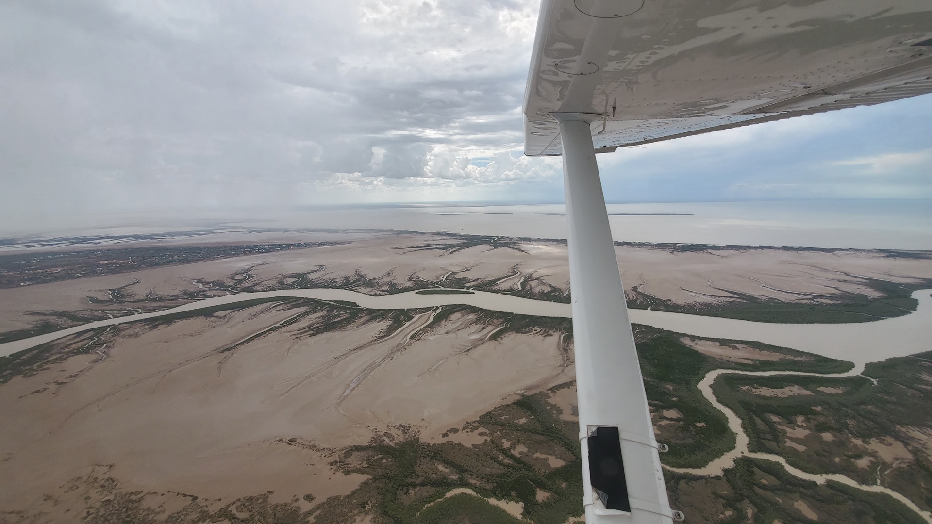

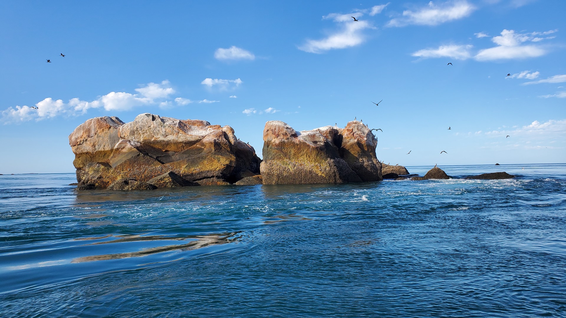
As I neared the shore I passed Adele Island. Aviation charts suggest that there is an allowed landing area on the island but there was no visible sign of this. The island is an important breeding area for cormorants and Australian pelicans, as well as globally important bird species such as the lesser frigatebird, brown booby, grey-tailed tattler, and red-necked stint. I stayed high enough to avoid disturbing any of these birds as I passed! I coasted in over the mudflats north of Derby, which looked like they’d contain plenty of crocodiles.
Derby was founded in 1883, and named after the British secretary of state for the colonies at the time, the 15th Earl of Derby. It was famous in aviation terms as the terminus of the first scheduled aviation service in Australia, in the 1920s, and at the time it was the world’s longest passenger airline route. Like many other towns in this remote part of Australia, the town is primarily supported by tourism, agriculture, and mining. The town also hosts a major Royal Flying Doctors base, as well as the Kimberley School of the Air. The school provides education to isolated Primary-aged children living on cattle stations and in remote Aboriginal communities and outstations scattered throughout the vast Kimberley region.
There were a number of storms in the area as I reached Derby, although none too close to the airport. The fueler met me as I pulled in. There was a 6-seat Cessna parked on the apron, not tied down, and he told me that earlier in the day it had been facing the opposite direction; a storm-burst had turned it completely around! The pilot had clearly been very lucky to escape without any visible damage.


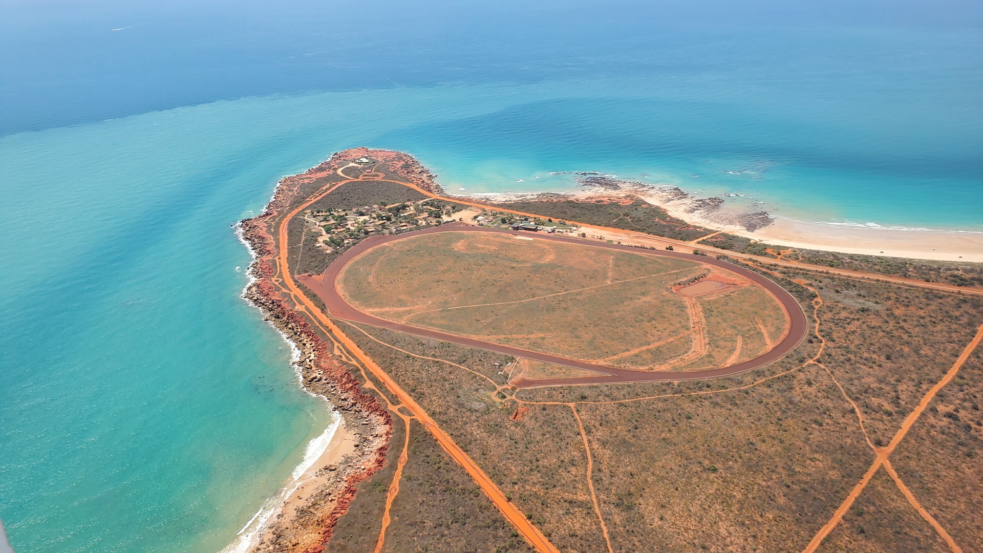
I flew back to Cape Leveque up the length of King Sound. I flew low around Cygnet Bay to have another look at the Pearl Farm and the places we’d visited on the boat tour, before joining the circuit at Kooljaman airfield. The Kooljaman resort is a pretty basic establishment on Cape Leveque; not much of it was open given that the high season had just ended, but I’d managed to secure a little shack for the night. I parked up at the north end of the dirt strip, managing to just avoid getting bogged in the soft sand between runway and parking area, and took a walk towards reception. Along the way a couple of workers stopped me and offered me an old Landcruiser to ride around in! I checked in, grabbed an ice-cream, and went to check out my accommodation.
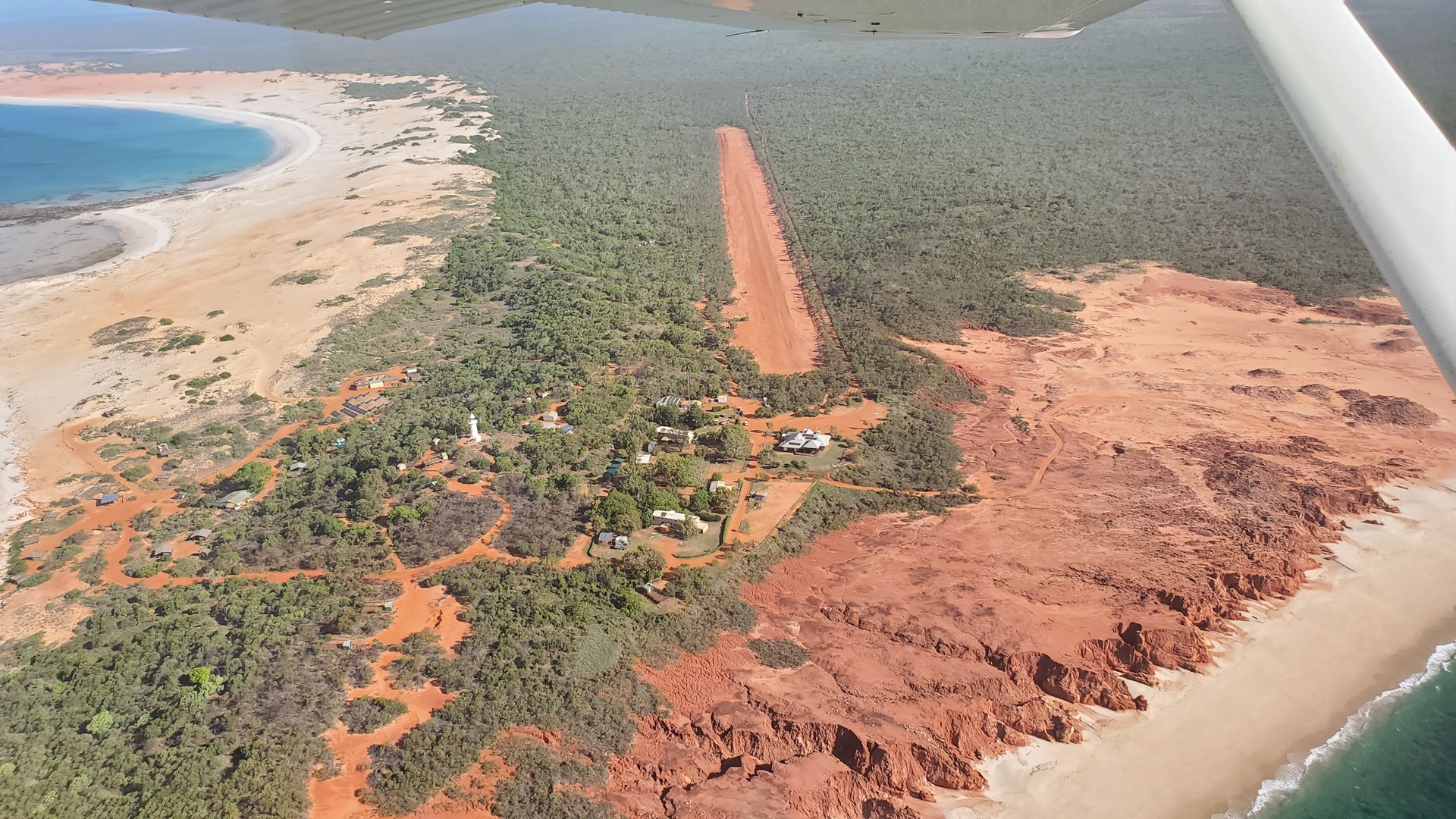
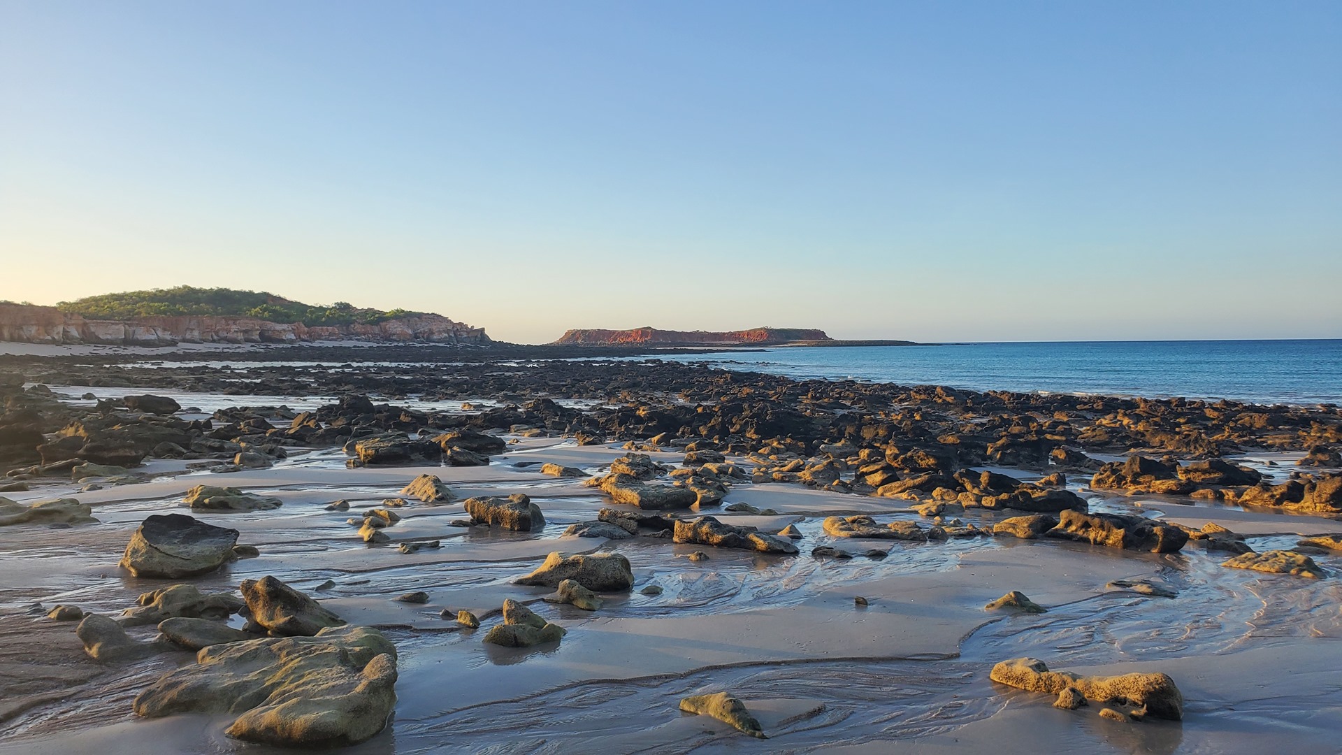

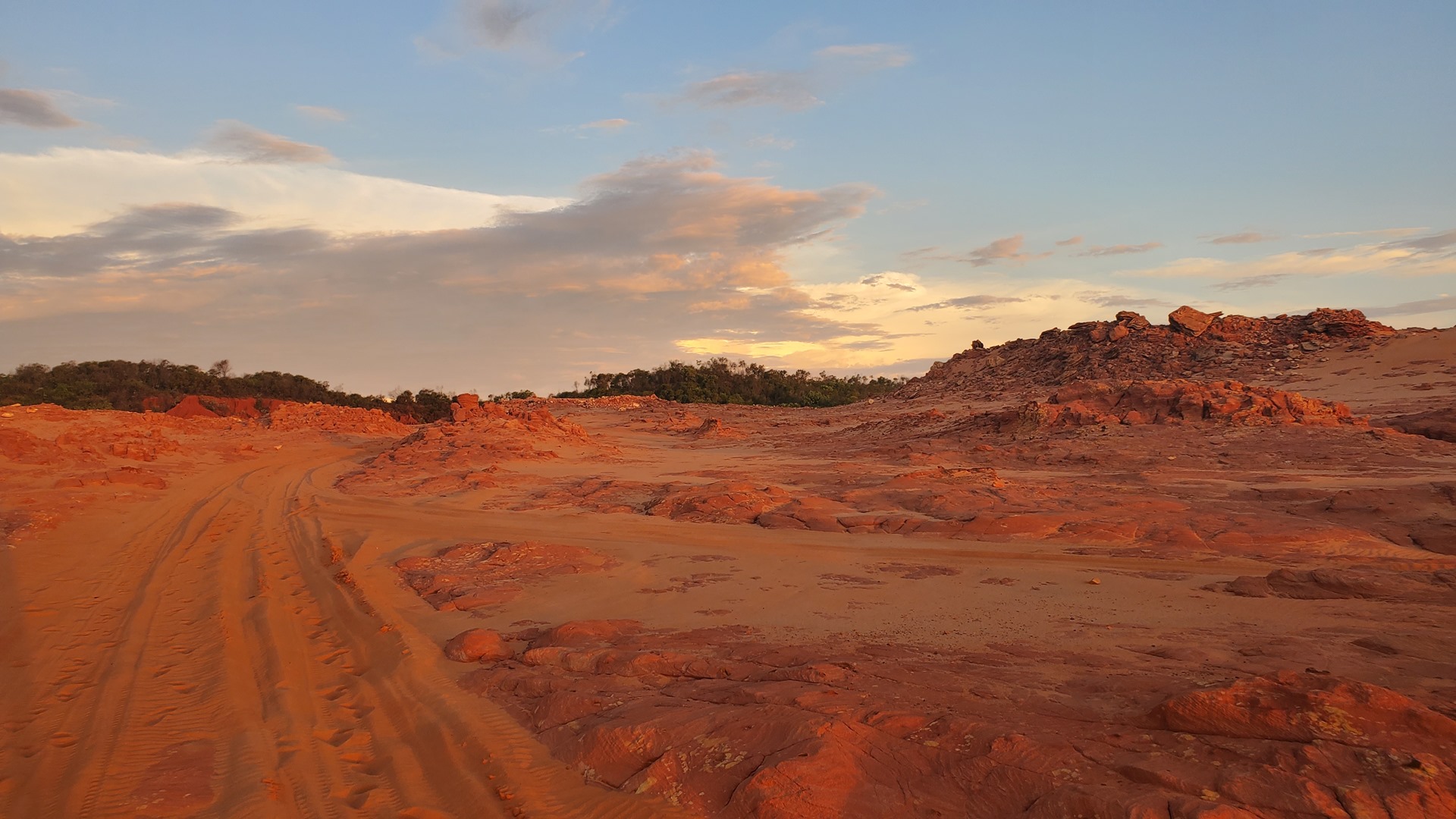

The shack was basic, with drafty walls and no glass in the windows. There were 4 beds inside, all equipped with mosquito nets. There was a rattling air conditioning wall unit that struggled to reduce the heat; thankfully once things cooled down a little later that night, it brought the temperature under control! I took my Landcruiser to the western beach and sat peacefully as I watched the sun sink below the horizon.
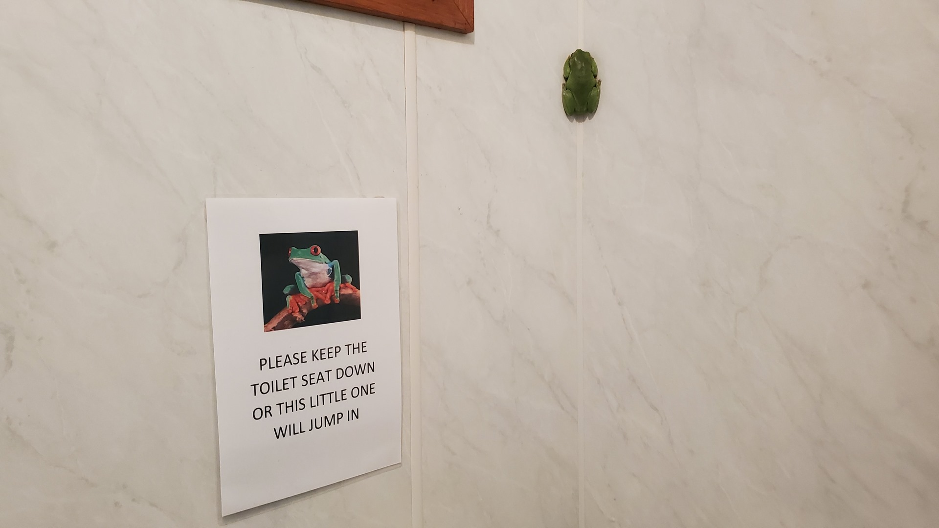

That evening, several frogs and I enjoyed a refreshing shower before I turned in. The next day I was to be up early again, bound for the Northern Territory.
Click here to read the next part of the story.