Round the World – New Zealand Days 19 and 20
We woke up in Hokitika to greatly improved weather. The ground team dropped Elsa and I in the town center to have breakfast and kill some time while they drove down towards Franz Josef Glacier. We lingered over bacon sandwiches and an absurdly large slice of chocolate cake, and were about to start a leisurely walk to the airport when the rain began. We waited for a while but things didn’t improve. The temperature had dropped ten degrees as well, so we elected to give up on the walking idea and took a taxi to the airport.
We took off “IFR” once again and turned south. The west coast peeked out at us every now and then through the clouds as we headed towards our first destination, Franz Josef Airfield. There was a large area of low cloud over the field, so we flew a little east towards a hole in the cloud. This ended up giving us great views of the glacier before we circled down through it and made our way to the airstrip.
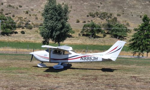
The runway, home of the Air Safaris flight-seeing company, had been partially washed away in recent weeks and reinstated in gravel. We taxied to the gravel parking area and shut down next to the Air Safaris air van. With the weather the way it was, they weren’t operating any flights, and the airfield was deserted; we waited for a short while inside the unlocked tour office before the ground team arrived to pick us up.
It was about a twenty minute drive to the car park near the base of the glacier. Along the way we stopped to watch an enormous bulldozer working in the river, using giant mounds of gravel to redirect the entire main flow away from the bank holding the road. As well as washing away part of the airfield runway, the heavy rains of recent weeks had cut numerous roads across the west coast of the South Island, including the highway to Milford Sound.
We soon arrived at the Franz Josef glacier car park. The very base of the glacier was just visible, peeking around the corner of the valley. Janet decided that she’d stay in the car and read her book, so Elsa borrowed her jacket and the three of us set off in the drizzle up the path to the glacier. Despite conditions there were plenty of other tourists around. The end of the trail is adjusted by the parks service based on conditions, and today it was set about 2km back from the foot of the glacier due to unstable river conditions. It turned out that Janet had chosen the best viewpoint; from the end of the path the glacier was 100% invisible behind low cloud. We spent a while waiting to see if it would clear, which it did not, and eventually headed back down to the car.
The ground crew dropped us back off at the airfield and we went our separate ways for a night. They set off for Haast, while we would be making our way across the Southern Alps to Wanaka. We departed to the west and flew out towards the coastline to get into clear air, before starting a steady climb up to 9,500ft. As soon as we had safe clearance from terrain, we turned on course towards Wanaka.

The flight route would take us fairly close to New Zealand’s highest mountain, Mt Cook. Unfortunately the cloud was shrouding the mountain completely, and we didn’t get any views of it as we passed to the south. What we did manage to see of the mountains, however, was still beautiful and offered tantalising glimpses of what we might enjoy on future flights when the weather was better. As we continued, the cloud started to break up and we were treated to the sight of the eastern part of the Southern Alps; we were not disappointed.
We headed down Lake Hawea as we descended. Wanaka is one of the busiest airports in New Zealand and has specific VFR arrivals published to help keep traffic separated; we followed the Maungawera corner arrival to fly a right downwind for runway 29, touching down behind a couple of flight-seeing Cessnas. We taxied in and parked in front of Southern Alps Air, which seemed to have the largest number of light aircraft in front of it. Wanaka, like most NZ airports, did not have transient parking marked on the airport chart and so it was usually necessary to ask someone!
Southern Alps Air directed us to the visitor parking, which was entirely unintuitive and involved taxiing all the way down to the end of the runway, round the end of the hangars on the grass, and then all the way down to a grass area near where we’d started. Elsa decided to walk rather than ride along, and ended up lost so after I had shut down I went off and found her. We asked at the counter of a local helicopter business about the best way to find a ride to town, and a young guy standing nearby overheard and offered us a lift. He turned out to have just successfully been checked out in a new helicopter model, and also worked as a helicopter mechanic. A man of many talents!
He dropped us off at our motel in Wanaka, where we were met by a very friendly proprietor and given a room upgrade. Lovely! After a bit of time spent resting at the motel we took advantage of the motel manager’s offer of a lift into town, and ate at a well-reviewed Asian fusion restaurant that sat overlooking the lake. The waiter turned out to be quite the local tour guide as well and gave us some excellent tips of what to do the following morning. Sitting enjoying dinner, overlooking the beautiful lake views in the sunshine, was a far cry and a welcome change from the rain and fog of just a few hours area.
After breakfasting, we packed our bags and called a taxi to take us to our morning’s activity, the Lavender Farm. This had been a top tip from the friendly waiter the night before, and appealed to us primarily due to the fact that they had alpacas. We entered the farm through the quaint gift and tea shop, and discovered that when our waiter had said the farm was heavily lavender themed, he had certainly not been exaggerating.
We had never seen so much lavender in one place. It’s a good thing we quite like it. The property is set up as an active lavender producing farm, with numerous lavender products available for sale in the gift shop, and even for consumption in the cafe! The whole place (including working farm part) is incredibly picturesque and attractive. We enjoyed a couple of hours wandering around and taking pictures, and even bumped into a British recreational pilot who was interested to chat about our respective flying experiences.
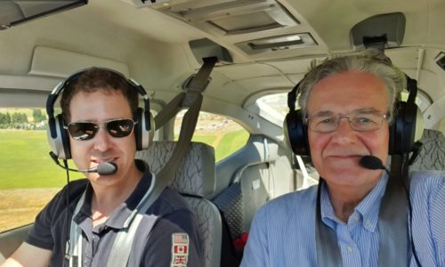
We had a snack at the cafe while waiting for the ground team to arrive, and once they did we threw the luggage into the car and headed out to the airport again. Given that we were so close to the beautiful Southern Alps here, we’d decided to do some scenic flying; I’d take Dad and my aunt for flights one at a time, as the aircraft only had 2 seats fitted. The rear seats had been removed before departure to make way for the ferry fuel tank.
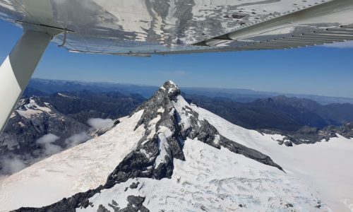
I flew a flight with each of them, taking off from Wanaka and heading north along the lakes and around the beautiful Mt Aspiring. It was interesting to see the colour of the snow fields; ash from the fires in Australia had made it all the way across the Tasman Sea and coated the glaciers, making them a beige colour rather than their usual brilliant white.
Other remarkable features were the many stunning waterfalls to be seen, a number of them emerging directly from the base of glaciers and tumbling down the cliffs below. It was a real pleasure to fly around the mountain and glaciers twice and enjoy a slightly different view and experience each time!
While I was flying, those who were on the ground spent some time in town. They also picked up some food for me to eat after the flying which was greatly appreciated. Scenic flights complete, I fully refilled the wing tanks with a loaned fuel card from the “U-Fly” company on the field; unfortunately, he failed to tell me about the 15% mark-up he was intending to charge until it was too late! At least we now had full tanks, and could continue on our way; and he did give some good tips on routing for the next flight.
Elsa and I took off out of Wanaka and headed once again for Mt Aspiring so that she could enjoy the dramatic views that we’d had on the scenic flights during the morning. From Mt Aspiring we continued west past another renowned ice field before arriving at the seaward end of the famous Milford Sound. The sound is situated in Fiordland National Park, and in 2008 was even voted the world’s most popular international tourist destination. Formed by glaciation, the sound is 15km long, and the sheer sides rise to heights of 4,000ft or more straight out of the water. It is renowned for the dramatic waterfalls that tumble from these towering cliffs.

The highway to Milford Sound had been seriously damaged in the recent rains. The only ground access was limited to buses, in two set time periods; they drove in as a large convoy in the morning, the road was then closed for the day for work to continue, and then the convoy was allowed back out in the late afternoon. Apart from these convoys the only way in was by air, and flights seemed very busy indeed. To land at the Milford Sound Airport a special permission from the government is needed, as well as an in-person briefing session in Queenstown, so we elected to just fly over this time and enjoy the views.
We flew up and down the sound down below the cliff tops, announcing our position and intentions on the mandatory broadcast frequency. It seemed we’d arrived at a busy time, with a string of about 7 light aircraft departing to head to Queenstown, so we made sure to stay out of their way and enjoy the views. Sightseeing completed, we tacked onto the end of the string of aircraft as they headed out to the southwest over Lake Ada, towards Lake Quill and the Sutherland Falls. These rivaled even the beauty of Milford Sound itself!
We followed the line of airplanes towards Queenstown, following the arrival procedure mentioned in the literature and being reassured by having preceding aircraft to copy and be sure we were on the right track. The ADS-B was handy for spotting other aircraft, although not every aircraft has it so you still need to keep a strict look-out. We passed overhead the airport and joined right downwind, touching down and following the tower’s direction to parking. We were pleased to even receive an unsolicited compliment, being told “great job for a transient” after managing to follow all the procedures accurately! The planes in front, which I had followed, deserved a large part of the credit. Once again it was not at all clear where to park. Luckily we had arrived not long after a pilot who’d seen my post online the night before, asking for tips on arriving at Queenstown. He saw us coming, and ran over to direct us to the appropriate spot.
It was only a short wait before my father arrived to collect us and we settled down in the hotel. After a couple of drinks in the bar we headed out to wander through the town, stopping in a souvenir store to browse, and then had dinner at a nearby Chinese restaurant.
On the way back Elsa was delighted to discover a newly opened milk-tea bar and managed to get a drink and a slice of cake moments before another customer bought out the shop’s entire remaining stock. We had an early night; the ground crew were departing on a 6am bus to Milford Sound, and we were heading out not much later to get to Manapouri and our next adventure!

Click here to read the next part of the story.


